Friday, June 29, 2018

Day 3 of 117 on our “Go West, Young Man” Two Lane Adventure – Friday 6/29/18


We departed A Stone’s Throw RV Park, after a very restful night and headed north on Route 19. It was a bit foggy, but burned off very quickly. If you are ever traveling this way, this is a great overnight stop.


Passing through the historic town of Monticello. Monticello is a pretty little town with giant oak trees forming canopy streets and a lot of old restored homes, many of them going back to before the Civil War. Many of these homes were restored during the Great Depression of the 1930's.

Main Street in Monticello is a Florida Main Street Community, and has historic sites such as the 1890 Perkins Opera House and the recently restored 1906 County Courthouse, in the middle of the roundabout. The opera house is still functional and puts on musical and theater performances, and the ground floor ballroom is a local gathering and meeting place.

The Christ Episcopal Church is also one of the prettiest Carpenter Gothic churches. It is located in the Monticello Historic District. I wish I could have captured the stain glass, they looked so exquisite and detailed.

Not historic, but just on the edge of town, I spied a cinderblock purple house … so, if you know me … I had to capture the purple house!

We crossed the FL / GA line, without much fanfare. But that is the last time we will be in Florida until October. That sounds like a long time away, but with all our planned adventures the time will go by quickly.

Thomasville Georgia is home to beautiful tree lined medians and at the corner of Crawford and Monroe Streets, there is the "Big Oak." 

It is a massive live oak tree that has a limb span of 162 feet, two feet wider than Niagara Falls is deep. It is 68 feet tall and has a trunk circumference of 24 feet. This massive Southern Live Oak grew from a tiny acorn and is now close to 400 years old!


Traveling on Route 19, the Georgia – Florida Highway, we cross over the Ochlocknee River. On the right of the new bridge is an old railroad truss bridge, that is abandoned and falling apart. We have traveled this route before, but I never noticed this old bridge.

We say this red sign and thought of Jack & Wayne right way! Want us to grab you a dozen?


We stopped at got gas at a Walmart market. Next to it, I saw this elephant. It is at the entrance to All American Fun Park in Albany GA. The Fun Park offers bowling, arcade, bumper boats, putt-putt, laser tag and laser challenge game, indoor virtual roller coaster, outdoor batting cage, and hover-car.


Leesburg GA is a small town, less than 5 square miles. It was originally known as Wooten Station and was founded in 1870 as the Central of Georgia Railway arrived into the area. In 1872, the town was renamed Wooten. In 1874, the town was incorporated and renamed again to its present form of Leesburg. The Central of Georgia Railway train depot has been given a facelift and is the central focus of the downtown area.


As we got closer to Americus, I kept telling Charlie we know someone in Americus. Al the way through the town, I kept racking my brain who it was … no luck … so, if you are a friend of ours and you live in Americus … remind me who lives here! LOL. We did find a unique sign for South Georgia Technical College. Northeast of Americus, you can visit the Andersonville National Historical Site. Andersonville National Historic Site is the only park in the National Park System to serve as a memorial to all American prisoners of war.

In Butler, we turned off 19 and headed west on Georgia 96. On the north side of the road is the Sandhills Wildlife Management Area. On the south side of the road are two of the largest solar farms we have ever seen. They seemed to go for miles and miles and miles. I took way too many pictures, but to see the magnitude of the solar farms, I had to get a satellite view … amazing, just amazing! 
Here is the skinny about it. It is a 900-acre solar farm, it was built by Southern Company, parent company to Georgia Power. What does 900-acres look like? Imagine 826 football fields, end to end and side to side.

Near the end of GA 96, there was a big trailer with a sign for Boondocks Mud Park. I had to take a picture of it, just for you Tammy Littlefield. Have you ever been there mudding?

The Georgia Mural Trail has some murals in Meriwether County. 


We were lucky enough to drive through a few towns that had the awesome murals. 


The Georgia Mural Trail was created by John Christian from Go Georgia Arts. The Georgia Mural trail started as a five years commitment to paint fifty murals in fifty cities, focusing on smaller cities with under 10,000 people.


We continued on Route 41 N and headed toward Warm Springs. Warm Springs is home to FDR’s Little White House. Franklin Delano Roosevelt built the Little White House in 1932 while governor of New York, prior to being inaugurated as president in 1933. He first came to Warm Springs in 1924 hoping to find a cure for the infantile paralysis (polio) that had struck him in 1921. Swimming in the 88-degree, buoyant spring waters brought him no miracle cure, but it did bring improvement. 

The Little White House provided a sanctuary for the President during the darkest days of the Great Depression. Many of his New Deal programs were conceived there as he looked with sympathy upon the desperate conditions suffered by his rural neighbors.


Downtown Newnan GA is a historic city. But, what attracted our attention today was a cornucopia of brightly colored and uniquely painted fiberglass farm animals around Court Square in downtown. 


The fun and vibrant pigs, mules, cows and roosters play an intricate part in the third installation project hosted by the Children Connect Museum and the Newnan-Coweta Art Association. 


The creative sculptures show the artistic style of the creators. There were many people having fun and interacting with the fiberglass statues, which are truly pieces of art.


A large sign in the center of a roundabout, announced we were in Carrollton. 


The Carroll County Veterans Memorial Park is a work in progress. To date they have completed 24 Walls of Honor containing 1,152 individual plaques showing name, rank, and service record. They are currently working on wall number 25, which they are in the process of raising funds for.


We arrived at Yogi Bear’s Jellystone Park. I was greeted by this talkative guy. We have stayed here before and it is a great place!

Thursday, June 28, 2018

Day 2 of 117 on our “Go West, Young Man” Two Lane Adventure – Thursday 6/28/18


We spent the night in Homosassa River Resort. It is our “go-to” camping spot in that area. We have friends close by and we get to use our Passport America discount … so camping for one night at a cost of less than $17, it is a no-brainer! However, we did learn that not all spots are created equal! I was first offered M-11 and I thought that was the un-level spot that Jack & Jackie were on, so I took M-08. It was very level, but not very wide! Oh well, Leigha was not working, so we missed our extra special treatment.


As the sun was starting to go down, we headed to McRae’s and enjoyed some shrimp, fish tacos and hamburgers. You can guess, who had the burger! The bugs were not out biting, so I was very happy. We did have a visit from this little guy! I said it was a grasshopper, Terry said a locust ... not sure who is right! 

We also watched a young boy fish … he was so excited, every time he hooked a fish … his father, no so happy, because he had to get the hook out. But the family certainly was having a blast!

Heading out of the resort, we take Yulee Road back onto US 19 & 98 north. We go through Homosassa and all the construction that never seems to end, into Crystal River. Crystal River is part of Central Florida’s “Nature Coast.” When the water temperature drops in the Gulf of Mexico, manatees move to the warmer waters of the Crystal River, followed closely by nature-loving tourists and other visitors. Crystal River is one of the few places where you can swim with manatees. The springs flow at a constant 72 degrees, making the waters attractive to all sorts of swimmers in the winter. Many summer visitors enjoy the 72 degrees of the springs too!

On the north end of Crystal River, you will find Willow Creek Secret Garden Store. It is so inviting from the exterior. The Secret Garden has a wonderful assortment of delightful finds, gifts for friends or perhaps items for your own home. The owners and their employees absolutely loves both their jobs and being with people. Items are displayed attractively and in thoughtful groupings. A fun place to visit whether you are buying or not. I bet, if we looked long enough, we might even be able to find an underwater Geek-E-Bird there!

Chiefland is a very unique southern community located in North Central Florida.  Community standards are set high in this family oriented society. Chiefland calls itself the "Gem of the Suwannee Valley.” Manatee Springs State Park is located west of town; the crystal-clear water is a "first-magnitude" spring that flows directly into the Suwannee River. We stopped at Wal-mart and met a lady in her RV that relocated to Cheifland from Westchester County, in New York. We talked for a while and then went into the store to get a little activity in the air conditioning!


We continued on US 19 & 98, it is a great road to travel on, you pass through towns occasionally, but the road is good and the speed limit is mostly 65. Fanning Springs, is labeled as "the Gateway to the Suwanee River." 


It is home to a unusual looking church, Bible Ministries Breakthrough Church. Don't let the outside appearance of the church hold you back; the building is covered in graffiti biblical scenes, but the inside is full of the Holy Spirit. 


It is also home to Fort Fanning Historical Park. Fort Fanning was named after Major Alexander Campbell Wilder Fanning. The original settlement of the town around Fort Fanning (now known as Fanning Springs) was named both “Palmetto” and “Sikesville”. A ferry service was setup, which connected one side of Suwannee to the other and remained until a wooden turn bridge and subsequently a modern steel bridge was built in 1935. Finally a four lane bridge made of concrete was added and remains there to this day.


In Perry, we left US 98 to heading west along the bottom of the panhandle of Florida and we continued on US 19 & 27. This portion of the highway was named in honor of Brandon Tyler Thorsen, a Chiefland High School graduate. He served in the US Army and was killed in Iraq in 2007.


We took a potty break at the Taylor County Rest Area on US-19 & US-27. I have always found this painted rock interesting. I was finally got a chance to get a picture of it, even if it was from the back side. We found this little town sign on the side of US 19 & 27, IDDO. Iddo is an unincorporated community in Taylor County. It was named, along with Eridu, by Atlantic Coast Line Railroad chief engineer JE Willoughby. The Atlantic Coast Line Railroad had two of the new stations on the Coast Line's Perry-Monticello division that had to be named. The first station north of Perry, was named "Secotan" while the one established near Pleasant Grove has been officially designated as "Iddo." The only evidence that a town once existed is a battered old service station. The service station property dates back to the 1800's.

In the very small hamlet of Capps, there is an old motel on the corner where we turn off US 27 and remain on US 19. I have seen it every time, we come this way and I can find no information on it. It peaked my curiosity again today. I searched the internet again and still no answers! But I took pictures anyway. I can see people in the 1950’s and 1960’s pulling up to these little cottages to spend the night, or longer to enjoy their vacations.


We arrived early at our overnight stop at A Stone’s Throw RV Park in Lamont. We have stayed here before, with member of our camping chapter, Carefree Sams. A few rain drops provided us with this spectacular view of a rainbow! 

Good night all!

Wednesday, June 27, 2018

Day 1 of 117 on our "Go West, Young Man" Two Lane Adventure - 6/27/18

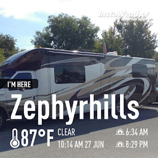
Today is Wednesday 6/27/18 and we departed home, passed by Zephyr Park on our way toward downtown Zephyrhills on CR 54, no SR 54. Yes, even to some that live here, it can be confusing … Zephyrhills is home to CR 54 and SR 54. Heading toward downtown, makes it sound like it is a real big city, it’s not … well, during the snowbird season it is a crowded place!  
Zephyrhills was first settled in 1882, home to a booming lumber and turpentine industry. It was originally called Abbott and later Abbot Station when the Seaboard Coastline Railroad established a depot there. In 1910 the town's name was formally changed to Zephyrhills when Howard Jeffries, a retired Union Army captain, established a retirement community for other veterans called the Zephyrhills Colony Company. It's said that the name was derived from the warm breezes, zephyrs, which blew across the rolling hills. 

The July 20, 1910 edition of the Tampa Morning Tribune reported that “Captain H. B. Jeffries, president of the Zephyrhills Colony Company, has engaged E. A. Nolan, of Tampa, to erect for him a house on the corner of Fifth Avenue and Eighth Street. The building will be two stories, with suitable porches.” This home was recently procured by the city and refurbished to its original glory. The 1950's and 1960's saw an influx of tourists, winter visitors and retirees, all lured by the warm winter weather, the low cost of living and the tranquil surroundings. Mobile home and RV Parks sprang up to accommodate these new residents. I guess that is how most of us ended up here! 

In 1961, Don Robinson took advantage of the areas good tasting water and established the Zephyrhills Water Corporation. The company started bottling the spring water and shipping it all over the state. The town soon became well-known as "The City of Pure Water." Zephyrhills Water is still bottled here, under the Nestle brand.


We turned onto US 301 and headed toward Dade City. Before there was Dade City, there was Fort Dade. The community of Dade City was established around 1884.
Outside of Dade City, along US 301, there is a new sidewalk. It follows US 301 from Dade City, until US 98 turns off toward Ridge Manor. There is a large amount of farm land and little business or residential in the area they built the sidewalk. Many locals call it the “sidewalk to nowhere.” The 5-mile sidewalk runs past a gun smithy, a Bar-B-Q joint, several pastures, a few ranches and a smattering of small houses. 

They feel it is a huge waste of taxpayer dollars. Whether a boondoggle or community resource, the miles-long sidewalk stirred debate in the tiny communities of Trilby and Lacoochee north of Dade City. It's supposed to connect Lacoochee to Dade City and Zephyrhills, but nobody's going to walk to Zephyrhills. The construction was part of a $6.9 million repaving of US 301. It was included in the project out of safety concerns and after the county balked at contributing $1 million toward a 12-foot-wide trail. Officials opted instead to add sidewalks to both sides of the highway. The cost was $625,000, paid for with state Department of Transportation funds.

Along US 98 in Ridge Manor, we ran into rain. Not an uncommon occurrence, this time of year in Florida, but it makes me chuckle when they sky is blue and beautiful and you are in a downpour!

At the intersection of US 98 and SR 50, we turned onto SR 50. At this intersection, you can enjoy some good southern BBQ, Bobo’s BBQ. It is owned by our friend, Buster. Hi Buster!


We crossed over the Withlacoochee River and under the Withlacoochee Trail. We had a friend that rode this trail for his 70th birthday. He actually rode it a bit more than twice, as he rode 100 miles in one day for his 70th birthday! The 46-mile Withlacoochee State Trail is a true Florida experience for any trail riding. The Withlacoochee's length, popularity and proximity to numerous communities have given rise to five trailheads, information kiosks, colorful murals and convenient parks. Although the trail makes for a long journey, food and drink are never too far off the trail. For much of its length, the trail parallels the Withlacoochee River, a state-designated paddling trail. The heavily used Ridge Manor trailhead, just off US 98 & SR 50 has a state-of-the-art overpass leads safely across the congested roadway.

On SR 50 at the overpass of I-75 there is still construction … it seems like this construction has been going on forever! There is new bridge construction for I-75 happening now. We got to watch one of the new concrete pillions being hammered into place with a crane.

We took the truck route to get around the center of Brooksville. We have taken this route before, but I never noticed this place. It is Live Oak Theater Company. It’s a not-for-profit company. It exists to enrich families, individuals and the community as a whole by providing positive artistic experiences in the Performing Arts. They want to provide excellent, affordable, and educational family friendly entertainment, performance, and educational opportunities for theater patrons and participants of all ages. 

I never noticed it before, because it is in a new location! In fact, the ribbon cutting is tonight! The theater began a capital campaign earlier this year and successfully raised $300,000. And now the theater company’s new home on Cortez Boulevard, which was formerly occupied by Hernando County Utilities, is officially a performing arts theater. Their 2017-18 season included a production of Annie and they are currently hosting their annual theater summer camps.

We ended the day at Homosassa River RV Resort. We were lucky enough to spend a few hours this evening with our goof friends, Terry & Bette. Long day traveling … 70 miles … but it got us on the road and Charlie was ready to hit the road! Let the adventure continue!

Monday, October 9, 2017

Sunday 9/17/17 - Bluegrass, Rallies and more Rallies, Our Trip South

We departed the Lebanon Expo Center and Fairgrounds and followed Route 72 to Route 322. There were many Amish farms here and the original stone work in the barns and homes are meticulously maintained.

The town of Campbelltown, Pennnsylvania was laid out in 1760 by John Campbell. At this period there were several buildings erected, all subject to ground rent. The town was no doubt "extensively laid out," and as was the custom at that time the lots were disposed of by lottery. The principal Scotch-Irish settlers in this locality were the Campbells, Semples, Pattersons, Mitchels, Sawyers, McCallens and Logans. The latter family was the last one left of the old Scotch Presbyterian element. The oldest house is still standing, and was the building where the earliest tavern and store were kept. The post-office was established in 1811, with John Wolfersberger as postmaster. The Salem Lutheran and Reformed Church was built in 1845 on the site of the old church erected over a century and a quarter ago. In this year the church was torn down and rebuilt on the same site, it is now a modern stone structure. The corner stone was laid in July, and it is now known as the Salem Reformed Church.

Today, we traveled all the way through Hershey. We passed the Penn State Milton S. Hershey Medical Center and the Ronald McDonald house. The Pennsylvania State Police Academy is located north along Hersheypark Drive. Hershey is also home to four world-class golf courses, a few museums, and an opulent spa. Hersheypark Stadium hosts concerts and sporting events, with a capacity of 30,000. It is also the venue of the annual Cocoa Bean Game between the Hershey High School and Milton S. Hershey High School football teams. Hershey is also home to the AACA Museum, operated by the Antique Automobile Club of America. The museum is dedicated to the preservation and presentation of vintage automobiles and their vast history. It is a proud affiliate of the Smithsonian Institution and offers a world-class automotive experience. You can explore numerous vintage vehicle displays and interactive exhibits featuring cars, buses, motorcycles, and other automobiles from the 1890s through the 1980s. It is a one-of-a-kind journey of discovery and entertainment for all visitors. As you make your way through the museum, you’ll discover a number of vintage automobiles in unique scenes and settings.

Indian Echo Caverns is a show cave near Hummelstown, Pennsylvania. The limestone caves are open for the public to visit via guided tour. The entrance to the caverns is located in a bluff along the Swatara Creek. A second entrance was sealed when the caverns were commercialized in the late 1920s. Given the large and accessible natural openings the caverns were likely utilized by Native Americans for storage and shelter, however no evidence of such use has survived. The location was previously known as Wilson Cave, Hummelstown Cave, Stoverdale Cave, Giant's Cave, and Indian Cave. When it was commercialized it was renamed Indian Echo Cave or Caverns. Rumors suggest that for nineteen years (1802–1821) the caverns were the home of William Wilson, known as the Pennsylvania Hermit. Wilson withdrew from society after his failure to halt the execution of his sister Elizabeth for the murder of her twin sons. Following her death in Chester, Pennsylvania in 1786, William wandered westward across southeastern Pennsylvania, settling in the caverns in 1802.

In Harrisburg, Pennsylvania while crossing the Susquehanna River, I shot a few pictures. I our picture, you can see a series of bridges. We are on the Capital Beltway Bridge the first bridge you see is the Cumberland Valley Railroad Bridge, Piers from the never completed South Pennsylvania Railroad Bridge, next is the Philadelphia & Reading Railroad Bridge, then the Market Street Bridge and if you look closely, you can see glimpses of the Harvey Taylor Bridge. I wish it was a sunnier time, this picture would have been awesome!

Outside of Harrisburg, we picked up US 15 South and into Gettysburg, Pennsylvania. Where you can visit the Gettysburg National Military Park. It protects and interprets the landscape of the 1863 Battle of Gettysburg during the American Civil War. Some call it the most decisive battles of the war. The size of the park has grown over time, thanks to land donations, land purchases, and federal eminent domain taking of other land. The park now totals, just shy of 4,000 acres. The properties include most of the Gettysburg Battlefield, many of the battle's support areas during the battle and several other areas associated with the battle's "aftermath and commemoration", including the Gettysburg National Cemetery.

I truly enjoy crossing from one state into another … on Route 15, we crossed from Pennsylvania into Maryland. The mile makers signs that say zero are amusing too, but I guess you have to start from 0 to go any higher!

On Route 15, we entered historic Emmitsburg, Maryland. Emmitsburg was named for its founder, William Emmit in 1785. However, settlement preceded the town, particularly since British authorities restricted colonists' expansion during and after the French and Indian War. Settlement began in the region during the 1730s, bringing Protestant Germans and Scotch-Irish from Pennsylvania, as well as English Catholics from Tidewater Maryland. The Union fortified Emmitsburg to stop the Confederate invasion of the Union territory in June 1863 during the American Civil War. Half the town was burned to the ground in a mysterious fire on the night of June 23. Folklore has it that 'The Great Fire,' as it was known, was started by a Union sympathizer to prevent advancing Confederates from taking supplies from the town. However fate spared the town a battle between the opposing forces, which instead took place north of it in Pennsylvania near the town of Gettysburg. The town was briefly held by the retreating Confederates on July 4. The Emmitsburg Historic District was added to the National Register of Historic Places in 1992

Mount St. Mary's is home to the National Shrine Grotto of Our Lady of Lourdes, a Catholic pilgrimage site devoted to the Blessed Virgin Mary that draws thousands of visitors annually. The Grotto is described as "a place of pastoral beauty and spiritual inspiration ... situated high on the mountainside where nature displays itself in all its wild and picturesque glory." The sixty acres of grounds include lush gardens, a pond, rosary paths, the Stations of the Cross, devotional areas, a scenic overlook, and St. Mary's Chapel on the Hill (also known as the Glass Chapel). Grotto water flows from taps located around a fountain pool, and chaplains are available to bless the water for visitors. Father John Watterson had the stone Grotto cave built in 1875 as a replica of the miraculous Our Lady of Lourdes in France.

The Grotto was first established on St. Mary's Mountain in 1805 by the university's founder, Father John DuBois. According to legend, Father DuBois was attracted to a light on the mountain and found a blessed spot and sat down at the foot of a large oak tree beside a stream. He made a cross of twigs and fixed it to the tree to be the symbol of the holy work he was undertaking. This was the original Grotto. Father Simon Bruté was an early steward of the Grotto. He created pathways throughout the grounds and attached crosses to the trees that now line the Stations of the Cross along the entrance. Saint Elizabeth Ann Seton attended Sunday Mass at the Grotto chapel. 

In 1958, the Grotto was refurbished and made more accessible to the public by Father Hugh J. Phillips, who became known as the "Restorer of the Grotto." The Grotto was proclaimed a Public Oratory on December 8, 1965, by Cardinal Lawrence Shehan, archbishop of Baltimore. On November 27, 2007, Bishop Jacques Perrier of the Diocese of Tarbes-et-Lourdes in France visited the Mount St. Mary's Grotto and gave the gift of a stone excavated from the original Grotto in Lourdes, France, in order to "spiritually connect" the two places.

US Route 15 is also known as America’s By-way, we also saw a sign that said “Hallowed Ground.” I wonder why? In October of 2009, an 180-mile long route of US Route 15 was designated as the Journey Through Hallowed Ground National Scenic Byway. This is one of the highest designations the Secretary of Transportation can bestow upon a public road and is a tribute to the local communities along the route. The Journey Through Hallowed Ground National Scenic Byway is the primary touring route where you can explore this scenic and historically rich landscape that has seen more of the blood, sweat, and tears of American history than any other part of the country. The Byway is an inspiring and relaxing travel experience highlighting the natural beauty and historic character of the corridor. The route has stayed largely rural interspersed by towns with vital and interesting Main Streets and beautiful views of the Blue Ridge and Piedmont landscapes.

We crossed the Potomac River, which is symbolically the Maryland and Virginia state line - The exact line where Maryland ends and Virginia begins is a question the likes of George Washington and King Charles have wrestled with. Is the border at the Potomac River’s edge? Maybe the low tide waterline? Or perhaps somewhere in between? Add Maryland’s Court of Special Appeals to the list of those who have weighed in on the issue. It took on a case that questioned whether river rafters were trespassing on a Maryland company’s property when swimmers exited the water on the Virginia banks. The court upheld the status quo, affirming Maryland’s ownership of the Potomac riverbed, while acknowledging that the border between the states follows the river’s edge despite fluctuations over time in its flow. It is amazing what ends up in our court systems!

In Leesburg, Virginia we found Oatlands Historic House. Oatlands is a National Historic Landmark, the highest designation given by the National Park Service. In 1798 a young bachelor named George Carter inherited almost 3,500 acres of prime Virginia farmland.  Carter was a descendant of one of Virginia’s first families.  Oatlands had based its plantation economy on wheat production, and eventually Carter branched out to grow other small grains; raise sheep for their wool; and build a mill complex on nearby Goose Creek.  The success of Oatlands depended upon a slave economy; by 1860, the enslaved community at Oatlands numbered 133 men, women, and children.  

George Carter designed and built Oatlands House and Garden. In the style of Tidewater Virginia and its English antecedents, Carter placed his formally organized garden near his house. The structure of the garden is comprised of terraces carved into the hillside to provide level areas for abundant plantings of fruit and vegetables along with trees, shrubs, and flowers. Even now, Carter’s steps and landings provide access to these same terraces. Cut from locally quarried stone, these steep steps are major axial walkways. He constructed and planted his garden with self-sufficiency and beauty intertwined. As one wanders through the garden, sweeping views of the surrounding hills and woods may still be seen even though the garden perimeter is enclosed by the Garden Dependencies together with the Garden Wall. Built with brick fired on the plantation and indigenous stone, the structures define the outer perimeter of the garden and shelter the garden plants.

In 1903 prominent Washingtonians, William Corcoran Eustis, and his wife Edith Morton Eustis purchased Oatlands as their country home.  Following Edith's passing in 1964, the family donated the property to the National Trust for Historic Preservation in 1965. In spite of the garden’s neglected state, Edith Eustis saw the garden ruin as a quiet, still, mysterious place harboring “old secrets” that inspired her to fill Carter’s terraces with boxwood-lined parterres full of fragrant and colorful flowers such as tulips, peonies, iris, and lilies. Romantic plant containers, statuary, and structures were added. The rose garden and a memorial to a daughter of Mrs. Eustis also became garden elements. Under her care, Carter’s terraces were revived with ornamental charm typical of the Colonial Revival Style popular in her time. Edith Eustis took pleasure in transforming Carter’s garden.


We arrived at Greenville Farm Family Campground in Haymarket, Virginia. This campground is celebrating its 50th anniversary! We assumed it would be near a farm. But we did not realize that it would be on the farm! With over 125 sites, we had plenty to choose from! There were ample pull thru sites, some had more tree cover than others.