Saturday, November 3, 2018

Day 4 Traveling to the Southernmost Point on a Two Lane Adventure – Thursday 11/01/18


We enjoyed a leisurely morning here at Boyd's Campground. We had coffee and breakfast on our patio. The neighbors were hanging around again, one Rooster even wanted breakfast at the neighbors table!

Day 1 of our Yankee RV Key West Fiesta Rally. Each caravan or rally begins with traditional root beer floats and introductions.

We have 12 rigs at the Key West Fiesta. There are several couples that have been on many Yankee Events and a few that are attending their first Yankee Rally. No matter, it will be a good time by all.

We enjoyed a Yankee dinner in Key West at Red Fish Blue Fish. It’s a seafood restaurant near Mallory Square in Key West. It is located just steps away from the cruise ship port, Duval Street, and Mallory Square. We are enjoying dinner before the sunset celebration!

We were offered three entrée choices: Jambalaya: Andouille sausage, chicken and shrimp sautéed with Cajun spices, bell peppers, onions, and tomatoes then served over rice. Chicken Carbonara: Chopped chicken breast sautéed with smoked bacon, mushrooms, and linguine noodles in our creamy Parmesan sauce. Seared Shrimp & Scallop Combo: Seared diver sea scallops and gulf shrimp presented with our lime cilantro sauce with island rice & vegetable of the day. I had the combo, looks good … and it was good!

Our dessert was homemade Key Lime Pie. They say it is some of the best on the island! It was sweet and tangy, topped with whipped cream and fresh lime. Yum, yum, yum!

Then it was time for buskers, vendors and sunset at Mallory Square. Mallory Square is the community's social and commercial hub. Sunset has a variety buskers appearing nightly including jugglers, escape artists, musicians, magicians, tight rope walkers and other colorful acts. These unique street performers ensure that Sunset Celebration ranks high on the list of Key West tourist attractions. The acts vary in professionalism and range from traveling buskers who seasonally attend a circuit of fairs and festivals throughout the world to Key West locals who entertain at Sunset nightly. All Sunset performers have one thing in common, they work only for the tips they earn while doing their show.

Sunset is an awesome time of the day, especially at Mallory Square. 


Every exceptional sunset here at Mallory Square ends with a round of applause by the locals and visitors.


These tall sailing ships add to the pirate lore of Key West!


Thursday, November 1, 2018

Day 3 Traveling to the Southernmost Point on a Two Lane Adventure – Wednesday 10/31/18


We had a leisurely morning at our overnight stop and departed the Boardwalk RV Resort a little before 10 am. We have been to Key West twice before, but it was on bus tours from Homestead and it was only for 1 day, each. There is way too much to see, for a 1 day visit.

Everyone thinks they want to embrace the laid-back Keys life... We do for a short time … so we decided to go on the Yankee RV Tours Rally to Key West. To begin the journey, we took the classic drive down the Florida Keys Overseas Highway, aka US 1. However, to embrace the true Key West lifestyle, you should drive it in a convertible, with the top down … we enjoyed it in our motorhome with the A/C off and the windows down!

The roughly 100 plus mile one-way route island-hops along the southern rim of the Everglades and Florida Bay from Key Largo south to Key West. Shops, stops and restaurants celebrate all things “Keys” … bright colors, boats, water sports, fresh-caught seafood, old-school roadside attractions, and unspoiled state and national parks.

Florida Keys Natural Marine Sanctuary. The first national marine sanctuary was established in 1975. Since then, the National Marine Sanctuary System has grown to include 13 sanctuaries and two marine national monuments. In 1990, Florida Keys National Marine Sanctuary became the ninth sanctuary to join the system, in response to concerns about the decline of the reef ecosystem in the area. Today, the sanctuary protects more than 2,900 square nautical miles of Florida Keys coastal and ocean waters. Warning signs about the fragile and finite nature of marine resources in the Florida Keys were present long before Florida Keys National Marine Sanctuary was established.

In 1960, to address the demise of coral reefs in the Keys, John Pennekamp Coral Reef State Park was established off Key Largo as the world’s first underwater park. Continued environmental degradation prompted the eventual designation of Key Largo National Marine Sanctuary in 1975 and Looe Key National Marine Sanctuary in 1981. Enjoy Key Largo’s natural beauty in the water at John Pennekamp Coral Reef State Park, the nation’s first undersea park. You can book a snorkeling tour to explore one of the park’s shallow, 15 feet deep, inner reefs. For deep water views without getting wet, take a glass-bottom boat tour to Molasses Reef.

Key Largo is the Gateway to the Florida Keys. "Sailin' away to Key Largo" might have been a little more difficult than the popular 1980's song suggested, especially prior to 1870. The island of Key Largo is one of the largest of the Florida Keys islands. Though originally inhabited by native tribes, Key Largo and the other islands were eventually overrun by Europeans. Though it is not known when Europeans first landed on any of the islands, explorer, Ponce de Leon made note of them in his logs. The name "keys" is believed to have originated from the Spanish word, cayo, meaning "small islands." Key Largo is also known as the diving capital of the world.

When you drive south across the Tavernier Creek Bridge you are officially in Islamorada.

Widely known among anglers as the “sportfishing capital of the world,” the village of Islamorada is made up of Plantation Key, Windley Key, Upper Matecumbe Key, Lower Matecumbe Key, and the offshore Indian Key and Lignumvitae Key state parks.

Try a slice of honest-to-goodness key lime pie at the Key Lime Pie Factory.

This guy reminded me of the big lobster we saw in Shediac, New Brunswick ... but this guy is much more scary!

The family-owned Theater of the Sea has been loving and caring for animals since 1946. It is a series of lagoons and lush, tropical gardens are home to dolphins, sea lions, sea turtles, fish, sharks, stingrays, alligators, and birds. Their mission is to provide a wonderful home for animals while sharing them with visitors in up close and personal shows and interaction programs.

On Upper Matecumbe Key, we pulled into a picnic area, for a short break. On the way out of the picnic area, I spotted this guy on the side of the road, a green iguana. It is believed that the first green iguanas to find themselves in the Florida Keys were stowaways on several ships bringing fruit over from South America. As time went on their population grew with some added members introduced by owners who tired of their pets and thus released them into the wild.

The Turtle Hospital was first opened in 1986 and works to rehabilitate injured turtles, educate the public, assist in research aiding sea turtles, and support environmental legislation that promotes clean and safe water and beaches. If you are interested, you can schedule a behind-the-scenes tour of the Turtle Hospital to help support the facility’s sea turtle rehabilitation efforts.

On the drive from Islamorada south to the city of Marathon, you can stop at Long Key State Park.

Until 1912, boats provided the only method of travel among the islands.  An entrepreneur named Henry Morrison Flagler changed that.  He extended the Florida East Coast Railway all the way from Homestead to Key West, spanning 29 islands along the way. Most everyone said the project was impossible.  The loss of life was immense for the engineers and laborers who designed and built the tracks.  Flagler pushed on and by hiring freight steams to haul materials, and searching northern cities for laborers willing to work in sweltering swamps, the railroad continued. 

Henry Flagler rode victoriously into Key West on the first train in 1912.  The train was greeted by cheering crowds and represented the signs of a new economic era for the Florida Keys. In 1935, the great Labor Day hurricane struck the islands, destroying much of the Florida Keys, and Flaglers railroad.  In a three year period following, the Overseas Highway replaced the tracks. 

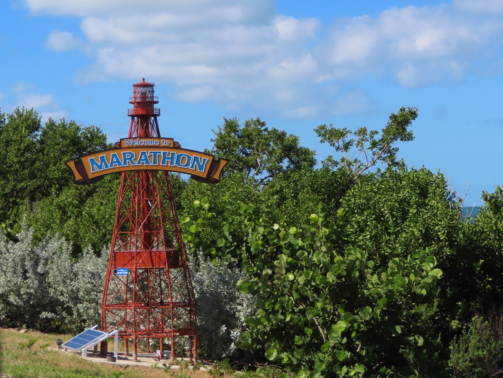
Seven Mile Bridge, the Keys’ most famous and longest bridge, links Marathon to the Lower Keys. Driving the east-west span delivers 360-degree water views. The Florida Strait to the east and Gulf of Mexico to the west. It’s a sight normally reserved for boaters.

The crystalline green-blue waters are just an amazing sight. It makes you want to jump right into the water, as you cross the bridge.

Approaching Big Pine Key, the largest of the Lower Keys, be sure to slow down and follow posted speed limits. This is to protect the Lower Keys’ endangered key deer. I searched for a key deer, but never saw one. If you are traveling in a car, stop at the National Key Deer Refuge visitor’s center. The best wildlife viewing areas such as the Blue Hole and Watson/Mannillo Trails.

Stop at a roadside pull off and look through the mangrove trails and see tropical birds and other wild things.

By some measures, the Florida Keys have rebounded remarkably since Hurricane Irma struck 13 months ago as a Category 4 storm. However, effects of Hurricane Irma are still being felt in the Keys. 

The 75-acre Sunshine Key RV Resort & Marina on Ohio Key has reopened 100 sites. They hope to have all 400 sites ready for the arrival of the snowbirds. But the KOA campground on Sugarloaf Key isn’t expected to reopen until 2019.

We arrived on Stock Island and the first thing I see are these purple houses … gotta love that! 

We arrived and set up our home for the next 6 nights at Boyd’s Campground. 


These are our neighbors! I hope they don't keep us up at night!

Wednesday, October 31, 2018

Day 2 Traveling to the Southernmost Point on a Two Lane Adventure – Tuesday 10/30/18


It is great to have friends all over the state and in other states! We were lucky enough to spend one night at Sandy & Paul’s house. Next time we head this way, we will have to spend a few day …. So, we can enjoy a boat ride! We departed Sun ‘N Lakes and headed south on US 27.

We came upon a bear crossing sign. However, this bear crossing sign looks like a polar bear, not a black bear. I doubt there are polar bears crossing US 27 south of Lake Placid, but we did not see any black bears in the next 12 miles either!

I know that the citrus greening disease, Huanglongbing, has had a fatal effect on the citrus groves in Florida. The disease is spread by a pest called the Asian citrus psyllid as it feeds on citrus tree leaves and there is no cure. It is nice to pass by orange groves that are being rebuilt by the growers.

We passed Gatorama, it was the first sign of life in miles. What is Gatorama? It was started in 1957 by an old colorful character named Cecil Clemons. When Gatorama began, US 27 was a two lane road. Cecil believed that when most Yankee’s came to Florida they wanted to see three things: the beach, an orange grove and an alligator. He was going to show them alligators! Cecil was quite the character and Gatorama used to have quite a different reputation than it does now.

Since 1987 they have worked very hard to build a reputation as an upright hard working law abiding farm and family attraction. Gatorama is one of 12 remaining of the original 72 attractions operating in the heyday of roadside tourist attractions in the 50s and 60s before the big mouse moved to Florida. This part of Glades County use to be referred to as Red Bug Ridge, it was a high sandy ridge running through the glades. Alligators were naturally found in this area. Cecil bought the land and fenced the alligators in. The large alligators in the front pond are some of the original stock and the biggest are well over 60 or 70 years old.

The crocodiles were brought into Gatorama in 1968 before they were an endangered species. Crocs natural range is from about Sanibel Island south. They are now mostly found in the Florida Keys. Gatorama has the only productive breeding colony of American Crocs in the US and we are one of the few facilities permitted to accept nuisance crocs from the wild. Nuisance crocs must be relocated….they cannot be harvested the same as nuisance alligators are.

David Thielen, was raised in Lakeport and for a time lived near Cecil. After a career as an army officer he retired and wanted to come back to his childhood home. His wife, Marietta, a Yankee, did not, but she soon relented. At about the same time it became legal to farm alligators in the state of Florida. Gatorama are pioneers in the alligator industry. They hold two of the original 30 permits. David’s interest was in developing the alligator farm, though he intended to keep his promise to Cecil and keep the attraction open and not sell off the valuable alligator and crocodile stock. By 2007 those original golden thirty permits have been consolidated and are now held by about 10 families’ who farm alligators commercially. 

Moore Haven Lock & Dam Recreation Area is a US Army Corps of Engineers area, located on the west side of Lake Okeechobee at the junction with the Caloosahatchee River. The Corps constructed and currently manages five locks along the 152-mile Okeechobee Waterway. Moore Haven Lock and Dam were constructed in 1935 for navigation and flood control purposes. Today it also serves as a recreational gateway to the second largest fresh water lake in the Continental United States, as well as one of the most bountiful fishing sites for sports fishing tournaments. Approximately 9,200 vessels lock through annually; of these about 95% are recreational vessels.

We crossed over the Caloosahatchee River. It is approximately 67 miles long. It drains rural areas on the northern edge of the Everglades, east of Fort Myers. An important link in the Okeechobee Waterway, a manmade inland waterway system of southern Florida, the river forms a tidal estuary along most of its course and has recently become the subject of efforts to restore and preserve the Everglades.

Clewiston is the town beside Lake Okeechobee. It was once used as a fishing camp by the Seminole Indians. The first permanent settlement began in 1920, when John O'Brien of Philadelphia and Alonzo Clewis of Tampa purchased a large tract of land to establish a town. Incorporated as a city in 1925, Clewiston would become noted for its sport fishing, particularly of largemouth bass. Large sugar plantations were established around Lake Okeechobee. By the 1950s and 1960s, the cultivation of citrus, vegetables and cattle were also important to the economy. US Sugar Corporation, however, remained the dominant manufacturer in Clewiston, which became known as "America's Sweetest Town."

Driving in this part of Florida, we can see tons of sugarcane fields. Sugarcane is a grass grown primarily for its sugar (sucrose) content. This field crop has been grown commercially in southern Florida since the 1920s and is one of the most economically important crops in the state. Approximately 450,000 acres are grown annually, mostly around the lower half of Lake Okeechobee.

Ever wonder why they burn the sugarcane? I always assumed it was burned after the harvest, to kill all the roots. No, it is burned before harvesting to remove the outer leaves around the stalks.

Another first on this Two Lane Adventure … we got to see some sugarcane being harvested!


When the processing plant is close ... they can daisy chain the carts loaded with sugarcane.


Those are some big harvesters!


When they have to truck the sugarcane, they can only haul an 18-wheeler at a time across the highway.


The Everglades Agricultural Area is along US 27. Before 1950 the “Central and South Florida Project for Flood Control and Other Purposes” designated a large area of the northern Everglades as the Everglades Agricultural Area. Completed in 1962, the project included 15 canals and 25 water control structures managed by the South Florida Water Management District to serve the EAA. The canals and structures were used to artificially control water depth in the historic sheet flow area, diverting water from Lake Okeechobee for farm irrigation. Today, the EAA spans 700,000 acres and encompasses 27% of the Everglades where sugarcane is the major crop. Nutrient runoff from the EAA, the result of fertilizers and the use of herbicides and pesticides, as well as the intensive use of water for sugar and other crops, are critical problems for south Florida. Restoring the EAA to its historic function of storage and treatment of water may be a key to the restoration of the Everglades. 

To protect and restore these ecosystems, the South Florida Water Management District (SFWMD) is working to remove excess nutrients and other pollutants, or prevent them from entering natural systems. One of these efforts is building Stormwater Treatment Areas (constructed wetlands.) This solution for improving water quality is a required element of federal/state legislation for restoring the Greater Everglades (which includes the Kissimmee, Okeechobee and Everglades watersheds). It is also mandated by separate state legislation for water quality improvements in Lake Okeechobee and the Caloosahatchee and St. Lucie estuaries, as well as in the Everglades systems south of Okeechobee. SFWMD is creating more than 6,500 acres of new stormwater treatment areas and 116,000 acre-feet of additional water storage through construction of flow equalization basins (FEBs). These impoundments capture runoff during storm events and provide a more steady flow of water to the STAs, helping to maintain desired water levels needed to achieve optimal performance. We witnessed this construction along US 27. We could not figure out what it was for a while. The construction created a ton of dust; it is a good thing that this area is void of residential areas.

In the heart of South Florida, two major roads, East-West SR 80 and North-South US 27 intersect. At this crossroads, near the southern bank of Lake Okeechobee, is the City of South Bay. Rich black soil and the lakes vast waters make South Bay a haven for agriculture and recreation. The settlement began at the North New River Canal, completed in 1912. Only 12 families lived at South Bay in 1917. During the 1920s, the town filled out along with Pahokee and Belle Glade to the north. 

As smaller settlements disappeared, these three became known as the Glades Communities. South Bay was incorporated in 1941. During the 1980s, South Bay was the third fastest growing major metropolitan area in the nation. Yesterday, it was a hot pink house ... today South Bay boasted a purple business. I loved the color!

We turned off US 27 and onto FL 997, aka Krome Ave. This is a 4 lane highway for a bit, but quickly becomes a two lane road with no passing. There are plastic cones in the center lines to discourage attempting to pass. They even have a couple of signs dedicated to sharing the number of deaths on this road. 


We turned onto US 1 in Homestead and quickly arrived at Boardwalk RV Resort, our home for the night. It was a bit tight to get into our site, but it was clean, pretty well maintained and the staff was helpful and friendly. It's a Passport America Park, so for $25 a night, I am not complaining!