Monday, July 26, 2021

July 23rd, 2021 … Summer of Fun continues!

Today, we moved from Van Buren State Park in Ohio to Eel River Bison Ranch in Whitley Indiana. 
We headed south toward Findlay. Findlay, Ohio is a town with a storied history. It started with Colonel James Findlay, who built a road and stockade in the area to transport and shelter his troops during the War of 1812. This stockade was later named Fort Findlay in his honor, with the town of the same name sprouting up after the war. Decades later, the town of Findlay was a stop for slaves traveling along the Underground Railroad. From the 1880s until the early 20th century, the area was a booming center of oil and gas production.

Findlay becoming designated Flag City, USA began in 1968 when John B. Cooke moved to Findlay. As a member of the Sons of the American Revolution, Cooke believed in the value of flying the American flag and went door-to-door in town asking residents and businesses alike to fly a flag on Flag Day, June 14, 1968. Cooke created a fund and purchased 14,000 small flags for the community. This project continued until 1974, when the Women’s Division of the Chamber of Commerce started a campaign to, once again, have flags fly and to have the city of Findlay become officially known as Flag City USA. The House of Representatives passed a resolution officially declaring Findlay Flag City, USA. Today, you may see a flag display in the Hancock Historical Museum, see the Flag City monument welcoming visitors to the town at I-75 and US 224, pass under the Flag City, USA distinction while driving on I-75 and pass by the mural on a Marathon Petroleum storage tank. Findlay is a place of great pride; both in its unique designation and patriotism.

We turned onto US 224 and headed west. US 224 eventually will cross US 30. These days, hundreds of cars a day drive past a solemn marker at the intersection of Ohio 637 and U.S. Route 224 in Van Wert County. A gentle summer breeze blows around the marker surrounded by an iron fence. The information on the marker details one of the worst murderous rampages in Ohio history. “One of Ohio’s greatest manhunts ended here on the morning of July 23, 1948,” states the sign. “Robert M. Daniels and John C. West, parolees from the state prison in Mansfield, had gone on a killing spree that had left six people dead. The victims were slain to their grave, including a family of three, before the killers were apprehended by Van Wert law enforcement.


We found a big steer along the road ... I hope he does not dart out into traffic!


We passed through Ottawa ... I thought we were in Ohio, not Canada! Residents named the town, which was founded in 1833, in honor of the Ottawa people, who once had a village at the site of modern-day Ottawa. 


We passed by a beautiful old armory and discovered it is home to a unique service that Ohio provides to all veterans! The Putnam County Veterans Service Commission is a county agency dedicated to providing assistance to Veterans, dependents and widows in time of need. We encourage all Veterans from every era to see what benefits they are entitled to. Some of the services that we provide are: financial assistance, burial benefits, widow benefits, Veterans ID cards, VA claims assistance, flag cases, and VA health care enrollment. Ohio is the only state that provides such comprehensive support and services to its veterans. Each of the 88 counties in Ohio has a board of five appointed commissioners who administer the program for their respective county​.


In Ottawa's downtown there was a set of murals that looked like store fronts, but they were all painted on!

Next town was Kalida, home to Pioneer Days. The festival is celebrating the 149th year in 2021, and still going strong! Pioneer Days is the oldest festival in Ohio. But, it’s more than just a festival that has been around awhile. It’s a time to visit with old friends and family in a relaxed and fun atmosphere. Not to mention, it’s a great opportunity to meet and make new friends, too! As summer draws to a close, with vacations over and school back in session, it’s the one last HOORAH at the end of summer.

Ottoville was the next small town we passed through. In 1837 the Miami-Erie Extension Canal between Loramie Summit and Junction was contracted out for completion and was divided into one mile sections. The Northern Division was numbered with Section One at Spencerville, Section Ten at Ten Mile Woods later Delphos and Section Sixteen, originally the town was called Sixteen, later named Otto and then Ottoville. 

The Miami-Erie Extension Canal was completed and the first boat traversed the entire length in June 1845. The Locks on the extension canal were numbered north from Loramie Summit and the Village of Ottoville grew between Locks 27 and 28. Lock 27 was just north of Fifth Street and Lock 28 was located just north of the present site of Odenweller’s Mill. Those two locks, as most locks on this section of the canal, were built of wood. The Canal Commission built a Lock Tenders’ house at Lock Number 28 and that structure still stands as a home and is the oldest structure in Ottoville. Lock Number 30 was a stone lock built further north near the Putnam/Paulding County Line. You can see a prime example of a stone lock at Delphos, Lock Number 24.


On our way to the intersection of 224 and US 30, we followed these slow moving military vehicles. They are actually military vehicles from days gone by. We remember some of these in our military units! Not the jeep, I am not old enough for that one! But Charlie remembers!


We got on US 30 and just before we came into Indiana, we found Uncle Sam watching over us!


I will tell you more about US 30, in the next blog as we are on it a lot longer tomorrow! But know that US 30 is also called the Lincoln Highway.


We arrived at the Eel River Bison Ranch! What a beautiful place! Let me tell you a bit about it. Our hosts were Eric and Tonya. This bison ranch is their retirement plan! They have really put their hearts and souls into it!


They have a herd of 12, with 5 calves born this year. A bison herd is led by a female, their female lead is Storm. She is the mother of the youngest calf.


Aside from the bisons, they have a barn that doubles as an events center. Where they host weddings, parties and other events. Their grounds are beautiful. Our “camping site” faced the pond that is lined with wild flowers. One of the bison fields was just above it.


The best part of the evening was the time we spent hanging out with Eric and Tonya. They shared their home, lives and dreams with us over craft beers and mixed drinks! It was almost 10pm before we even knew it! They enjoy hearing about all the travels of the campers that stay at their place as part of the Harvest Host program.


It was a great evening! Stay tuned as we move westward!

Saturday, July 24, 2021

July 21st & 22nd, 2021 … Summer of Fun continues!

We spent 2 nights at Van Buren State Park in Ohio. It’s a two looped camping area, away from the main part of the park, but it does not lack on WOW!

Here is some history … The Van Buren State Park region was originally inhabited by the Shawnee tribe. Banished from their homeland in south-central Ohio, this was the last stronghold of the tribe before they eventually departed for lands west of the Mississippi River. Native American artifacts and relics can still be found on what used to be Indian Island, located in the northwest section of the lake.

The land comprising Van Buren State Park was originally set aside as a wildlife preserve. In 1939, a dam was constructed over Rocky Ford Creek to provide additional fish and wildlife resources. In 1950, the area was turned over to Ohio State Parks. It has been maintained as a state park ever since. The park was named for Martin Van Buren, the eighth President of the United States.

Van Buren State Park lies in the rich agricultural plains of northwest Ohio. The plains, referred to as till plains, are named for the glacial debris, or till, which covers pre-glacial hills and valleys. Most hills in these areas are mounds of boulders and soil left by the retreating Wisconsinan glacier. Beneath the almost continuous cover of glacial deposits lies sedimentary bedrock which, in this region, is mostly limestone with a little shale. Much of this limestone is the magnesium-bearing form called dolomite.

Before settlement, the area was mostly woodland. Today, much of the vegetation consists of agricultural crops such as corn, soybeans and wheat. Today, a small remnant of the original woodland remains. Beech and sugar maple occupy a large portion of the park’s wooded area. Mammals found in the area include red fox, red squirrel, white-tailed deer, raccoon, skunk and opossum. Other animals found include eastern garter snake, spring peeper, eastern bluebird, eastern meadowlark, cowbird, woodcock and short-eared owl. Wildflowers abound in the fields and woodlands of the area. Dutchman’s breeches, spring beauty, thimbleweed, daisy fleabane and chicory are commonly found throughout the park.

What we found unique is one loop was for tents, campers and RV’s and the second loop was for equestrians. These sites either had a line to halter the horses to or a paddock or stall area to secure them in. There are ample riding and walking trails in the park and area.

The town of Van Buren is small, but holds lots of history! Located just north of the town of Findlay which was founded in 1821. In 1833, the Wyandot and Ottawa Indians roamed at will through this section, which was then an unbroken forest.  To the north was the great Black Swamp.  The only road was a trail cut out by Hull’s army on its march to the Maumee during the War of 1812.  This road was called “Hull’s Trace” and went directly through Van Buren.  It was merely a trail made by the cutting down of trees and brush to allow the gun carriages to go through.  Colonel Cass was sent to cut the trail to Maumee and it is said the engineers of this day could not have done a more complete job.  This trail hit Allen Township just south of Van Buren and passed through what was the Lewis Lyon farms on the west side of the Portage river then into Wood county.

The Village of Van Buren was laid out December 28, 1833, by John Trout and George Ensminger on the boundary of Portage and Cass Townships.  It was comprised of 53 lots surrounding a public square, and was named in honor of Martin Van Buren, a prominent national figure and the 8th President of the US. The village was incorporated in 1866 and Daniel Frick was elected the first mayor.  It was incorporated in June 1866.  Cyrus Hart located here in 1836 and Abraham Kempher, John Beeson and Samuel Huntington in 1837, Samuel Spitler in 1840 and Hugh McMurray in 1840.  The Overholt family came here in 1853 and John Cramer in 1859.  The May family came to Van Buren in 1842 and the Frick family came in 1856.  The Mummert family came in 1860. The first school was built in 1836, a log cabin one mile west of Van Buren. By 1870, the village had a population of 157.  The Toledo, Columbus, and Southern Railroad was completed through Van Buren in 1883. 

The development of the town was quite slow until the discovery of natural gas in the 1880s. A German physician named Charles Osterlen became convinced that an enormous reservoir of natural gas lay beneath the town of Findlay. He told of his belief and was scoffed at and regarded as a vain dreamer. But his patience and perseverance prevailed as he succeeded in organizing a stock company to drill for gas. The well was successful and spawned the growth of a great industry in Findlay. At one time, Findlay claimed the largest gas well in the world, with an output of 20 million cubic feet daily.

The first Post Office in Van Buren was established in 1837 when the mail was carried weekly on horseback between Bellefontaine and Maumee over the old Hull Trace.  Christopher Ensparger was appointed as the first Postmaster.  The present Post Office building was erected in 1927 with money left to the town by the will of Glenna Trout-Day, great- granddaughter of the founder of Van Buren. 

Among the lodges that spread friendship and goodwill are the Knights of Pythias, organized March 5, 1891.  The Pythian Sisters organized in 1907. These two were the only ones that had active memberships.  The Odd Fellows was a strong organization here for a number of years.  They then became affiliated with the Findlay Lodge.  The Rebekahs joined with the North Baltimore Lodge.  The modern Woodmen, the Maccabes and Lady Maccabees flourished for many years but are now extinct.


We enjoyed breakfast one morning at the Dark Horse restaurant in Findlay. Established in 2006, Dark Horse Restaurant is a family-oriented bar & grill in Findlay. They are open for breakfast, lunch, and dinner. They know how to do breakfast right! It was delicious and was priced fairly. Coffee was only ninety-nine dents! They have an extensive lunch and dinner menu featuring pasta, steak, burgers, and salad. Desserts and a full bar are also available.

Near the restaurant is the town of Findlay’s water tower. In 2016, the City of Findlay took to honoring their servicemen and women in a big way! The flag city's newly painted North Water Tower features a patriotic painting and the message "Findlay salutes veterans."


Between Van Buren and Findlay there is a large Whirlpool factory and tons of windmills. For more than 50 years, Whirlpool's Findlay Operation has been producing dishwashers for a number of brands. The plant holds the honor of being the first one built by Whirlpool Corporation, as well as the first plant to utilize wind power. With more than 2,600 employees, it’s the top employer in Hancock County.

Stay tuned as we travel further west!

July 20th & 21st, 2021 … Summer of Fun continues!

While in Pymatuning you must stop at the spillway and see the ducks and fish! The food is white bread, the fish are carp, and the venue is the Spillway on the Pymatuning Reservoir. Linesville, a small town with population of around 1,100, is affectionately known as the place “Where the Ducks Walk on the Fish,” and is home to The Pymatuning Spillway, which is a small part of the huge Pymatuning Dam.

Common carp were brought to the US in 1831. In the late 19th century, they were distributed widely throughout the country by the government as a food-fish, but they are now rarely eaten in the US. They live large in man-made and natural reservoirs and pools, and in slow or fast moving rivers. They prefer larger, slower-moving bodies of water with soft sediments. Common carp can live up to 20 years. The average size of the common carp is from 15 to 30 inches in length and weight from 4 to 30 pounds.


While we were out, we enjoyed a late lunch at the Crooked Paddle Pub. It is located less than a mile from the spillway. Charlie enjoyed a burger and I had a grilled chicken sandwich. Both were very good!


The next morning, we departed Pymatuning State Park after two days of visiting friends and exploring the area.

We needed gas, so we deviated from our planned route and headed into Ohio on Ohio Route 87. That route took us into the Gustavus Historic District. It is located at the intersection of State Routes 87 and 193. This national historic district area has 12 buildings listed on the National Historic Registry. The prominent architecture styles include both Greek Revival and Federal. Major buildings dating from 1832 to 1898 surround the village green, the geographic center of Gustavus Township.


Built in 1832 on the northwest quadrant, the George Hezlep House features Federal-Greek Revival architecture and has a closet reputedly used on the Underground Railroad. Built in 1840, the Farmers' Exchange Store was originally a double entrance Greek Revival structure. The Storekeeper's House, also a Greek Revival structure, was built next to the exchange store in 1840. South of this house is the Fraternal Hall, built in 1870.

There were once four churches in Gustavus including the Methodist Church, built in 1856 with a temple front and a belfry, and the Congregational Church, built east of the center in 1854. The eclectic Town Hall was built in 1890 and fronts the southeast quadrant. The Gustavus Centralized School, reported as the first centralized school in the United States, was built in 1898 and was replaced by the current building in 1928.

The next “big” town we came to was Mesopotamia, Ohio. This town is in the heart of Amish Country. One of the oldest general stores in Ohio, it has been in continuous operation since 1840, End of the Commons General Store. They stock over 1,000 bulk food products, hard to find housewares & kitchen gadgets, homemade fudge, hand dipped ice cream, over 150 varieties of old fashioned soda & penny candy. Steps away from the store entrance is a 15’ woodcarving featuring a frontiersman reminiscent of early settlers living in the area that was carved from a 350-year-old oak tree stump. 

Across from the store and adjacent to the Commons sits the world’s largest Amish horse and buggy which stands 14” high and 32’ long. Ken and Margaret Schaden and their 11 children run the End of the Commons General Store. After many years in corporate sales planning, Ken & Margaret found what the family was looking for in Mesopotamia; the family, living in Mesopotamia, visited the very store they own today to buy milk, groceries, and penny candy for their large family. When the store was for sale the Schadens believed that it would be a great way for their family to work together while serving the needs of their own neighborhood. Familiar with shopping in bulk for their own large family, the Schadens decided they could best serve the Amish community with bulk products at reasonable prices. The old grocery store had to be cleared out of its back rooms to make room for the bulk products.  As the cleaning process began, it soon became clear that what was thrown into back rooms and into the basement and attic, was not junk, but store history! They found hundreds of items: old store products, supplies, furniture, and fixtures. Cash registers, scales, needle boxes, dry goods, and actual food products in cans, tins, and boxes dating from the late 19th century! Penny candy still lines the shelves by the checkout counter, where slots and boxes of the old post office remain. People actually ask "How much is the penny candy?" but around here it still is a penny! 

We turned onto US 224, a generally east – west route. It is a rural arterial highway, mostly two lanes, across Ohio. It runs roughly parallel to the former Baltimore and Ohio Railroad from its westerly US 42 junction to Tiffin, a city around which it sweeps to the south with intersections at various state highways that radiate out from downtown.

US 224 took us through Newton Falls. Newton Falls would be “famous” for a waterfalls, right? No … home to the famous 44444 ZIP code, the only US zip code in the contiguous US where all five numbers are the same. The town's namesake falls feed into different branches of the Mahoning River.


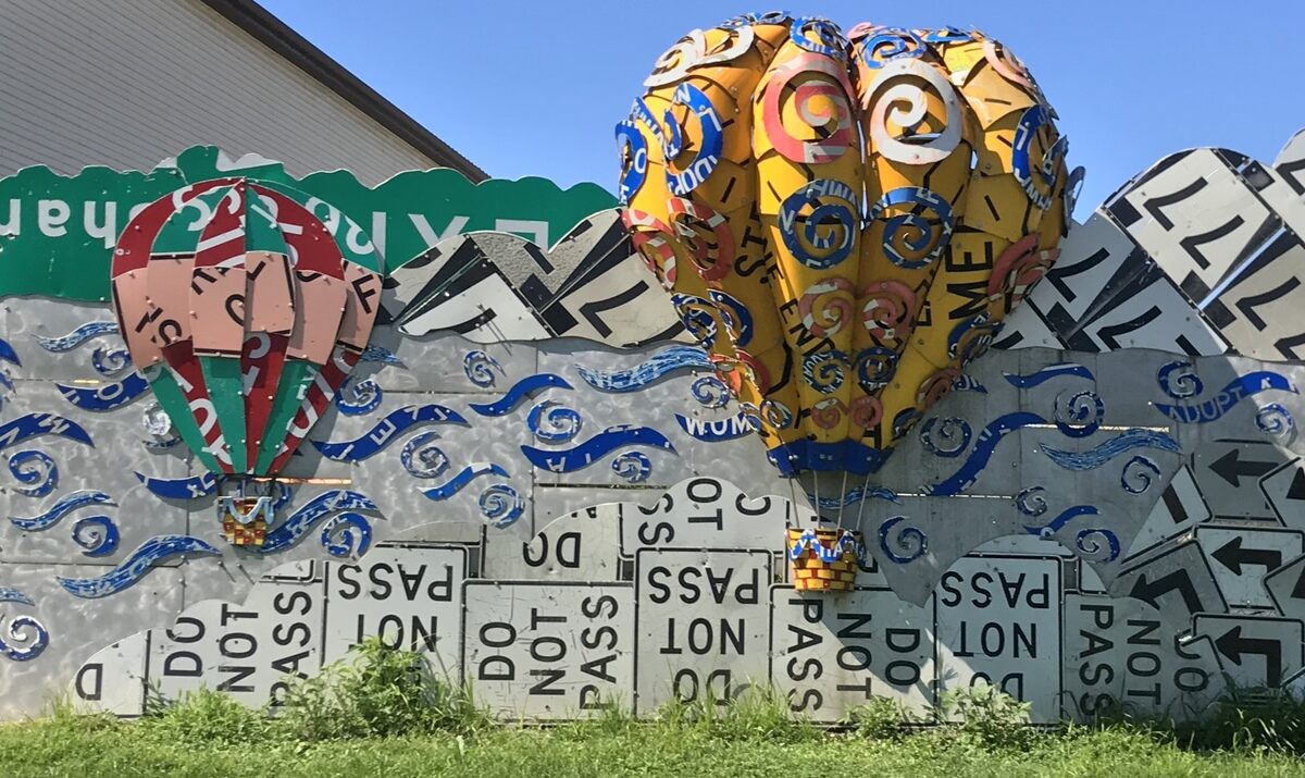
We found an old time store, Field View Mercantile, a local family run business specializing in selling old advertising, vintage toys, antiques, primitives, specialty treats, artisanal products, and seasonal decor. They would love to buy your old advertising signs!

We passed between Lake Milton and Lake Berlin and wondered why two lakes that were connected had different names? Lake Milton was built as a water supply for Youngstown. Within 10 years, however, the city found other water sources, and the lake largely became recreational. The downstream mills of US Steel and Youngtown Sheet and Tube used the lake to cool the waters of the Mahoning River, which they used to cool ingots. If the river water got too warm in the summer, the steel was too brittle. The mills would then ask the city to open the Lake Milton spillway and let some of the reservoir’s cooler water flow into the river. 

A very interesting part of Lake Milton's history ....Meanwhile, a number of small cottages started to crop up along the lake’s east bank. Although the city of Youngstown owned the lake and most of the property around it, fishermen began to erect tents, then lean-tos and finally cottages to spend weekends fishing. The city turned a blind eye at first but eventually began to collect a small rent from the cottage owners. They were squatters, essentially, living on city land. They had electric, none of which would have passed standards today. There were a lot of outhouses, a lot of which flowed right into the lake. By the mid-1980s, some of those cottages began turning into houses. A few were nice houses, including one owned by the Cafaro family, which made millions of dollars developing malls across the country. But Youngstown was hurting. The mills had closed. Just before the corps released its report on the Lake Milton dam, Youngstown had let its liability insurance lapse and had closed all its parks and recreation facilities. The residents rallied, getting the ear of their local politicians, led by then-state Sen. Harry Meshel. A deal was struck in which the state agreed to divert $4.3 million from another project to fix the dam. In exchange, the state would take over Lake Milton as a state park. As part of the deal, the cottage owners would get to buy their property. A lake cottage in 1995 was valued at $44,500, according to the Mahoning Valley auditor. The next year, a house was built on the site, valued at $228,500. Now, this 10-room, 4,700-square-foot home with a dock just outside the back door on the lake is valued at nearly $600,000. Property along N. East River Road, where Gardner lives, now easily commands more than $500,000, according to local Realtor Howard Vayner.

Ohio's Mahoning River is Berlin Lake. The Mahoning River has long done double-duty safeguarding the water levels downstream in Warren and Youngstown and providing a water source for citizens and industry. Berlin Lake actually began as the back-up reservoir for nearby Lake Milton a few miles downstream. Approved by the legislature early in the 20th century, the dam was completed in 1942 and Berlin Lake began its job of flood control, water level stabilization and water supply shortly afterward. The 18-mile long reservoir has a surface area of 3,590 acres during the normal summer, but can expand to 5,500 acres when heavy rainfall occurs. The lake is the fifth-largest inland lake in Ohio. Most visitors to Berlin Lake are interested in the recreational opportunities the large lake provides. The US Army Corps of Engineers maintains the Mill Creek Recreation Area around the lake which offers four public boat launch sites. Many bays and meandering arms make Berlin Lake ideal for paddle-craft such as canoes and kayaks, and pontoon boating on the lake is a favorite activity.


We saw lots of barns repainted with the "chew mail pouch" advertising!


We also spotted a Wrestlemania trailer, while we were getting gas!


Established in 1854, Fostoria is best known for its famous glass production years and for its abundant rail traffic and business that continues today. Fostoria was also the home for over a dozen glass factories during the end of the 19th century. The glass factories were established in Fostoria because of the discovery of natural gas in the area. As the gas supply became depleted, many of the factories closed or moved—including the Fostoria Glass Company.


Hundreds of 100 trains pass through the city each day. The city is often visited by rail fans, and a railroad viewing park, constructed to facilitate the viewings. The Fostoria Rail Preservation Society is dedicated to preserving railroad history and public education. They are the caretakers of the former Lake Erie and Western Depot, as well as the Fostoria Iron Triangle Visitor Center and Viewing Area. The viewing platform is open 24/7, 365 days a year, the 5.6 acre rail park provides a unique 360 degree unobstructed view of trains passing by on any of the surrounding rails. Three mainline double tracks cross each other and form a triangle around the rail park, hence the name “Iron Triangle.”


After Fosoria, we arrived in Van Buren at the State Park. Our home for the next two nights. Stay tuned as we make our way westward!

Wednesday, July 21, 2021

July 18th, 19th and 20th, 2021 … Summer of Fun continues!

We spent three soggy days at Ontario County Park at Gannett Hill with Rob & Sheila. Even though Mother Nature rained on our parade, we had a great time! We left there to head to Tompkins COE in Lawrenceville, PA for one last night with camping friends, Royce & Karen, from New York. Tompkins was just an overnight, because Pymatuning State Park is too far for a one day drive.

We enjoyed some sausages over the open fire and fellowship with Royce & Karen. This is our second time at Tompkins COE this season. We love this place, because the sights are partially wooded and quiet. The weather cleared up for the evening, but the morning we left was foggy again!

Most of our day driving on Monday July 19th will be on Route 6. Route 6 in Pennsylvania enjoys a storied past. The route can be traced back to 1807 when state officials mandated a road be cut through the Moosic Mountains to enable easier travel to the western parts of the state. As the state and nation grew, so too did the road. Carved out of hundreds of miles of wilderness, the road eventually united all of the county seats in Pennsylvania’s northern tier. The fledgling highway quickly became a vital link between the industry of the west and the railroads in the east. Along its length sprung charming villages, plentiful farming communities and thriving towns.

This 70 mile stretch of PA’s US Route 6 takes you back to the kind of vacation you might have experienced in your childhood. Drive through rolling, emerald hills, very much like those of the Blue Ridge Parkway. Each twist and turn offers stunning views, dotted with villages with pieces of small town life. You will see signs of a family recreation areas, like river outfitters, mom and pop motels and campgrounds.

We took you on our tour of the Grand Canyon of Pennsylvania back in late May. It’s about 15 miles to Galeton, PA. This town is almost at the center of Route 6. We passed through little towns like Ansonia, Rexford, and Gaines. In Galeton, we wound our way through the old downtown. Galeton was a booming lumber town in the 1800s, sporting an opera house, a hospital, railroads, breweries, and (of course) taverns. Surrounded by forests, today the town attracts tourists, hunters, and fisherfolk who enjoy the abundant wildlife and lush scenery. Every year, Galeton celebrates firefighters on Red Suspender Weekend, a festival of food, contests, and entertainment.

The Pennsylvania Lumber Museum was closed, but it looks like it would be a fun and educational experience for everyone. Nestled in the wooded mountains of Potter County, the museum invites visitors to discover the courageous yet reckless spirit of Pennsylvania’s lumbering past while learning to care for the forests of the future. Interactive exhibits simulate activities such as swinging an ax, sawing a tree, piloting a log raft and racing locomotives for a hands-on experience with history. Outdoor exhibits located across the 10-acre campus include a re-created early 20th-century lumber camp, a 70-ton Shay geared-locomotive, and Barnhart log loader, and a log cabin built by the CCC. In the past they have operated their steam-powered sawmill at three annual events, Spring Show, Bark Peelers’ Festival, and Fall Show, but that is up in the air as COVID has cancelled these festivals for a second year in a row.

The Denton Hill Summit on Route 6 in Pennsylvania has an elevation of 2,424 feet. Situated on the northern slope of Denton Hill, the steep grade of the park facilitated the establishment of a downhill ski area and lodge when the site was developed in the 1950s and 1960s. Throughout the remainder of the year, Denton Hill State Park serves as a unique setting for a variety recreational events. Additionally, hikers can find year-round access to the Susquehannock State Forest. The ski area was operated by the state until 1979, when it became a concession run by a private contractor. The park was closed to downhill skiing in late 2014, when the concession contract expired and remains closed today.

Motor through one-blink towns like Mina, Roulette, Burtville and the larger Port Allegany, named because it was a landing site for Native American canoes. Then you will arrive in Smethport. The Capital Seat of the County, Smethport was once a bastion of oil and lumber tycoons. At the turn of last century, this town had serious money. The evidence still lines Main Street, the Smethport Mansion District, a village of 30 opulent properties boasting history and architecture and showcasing the luxurious life of Smethport's past.

Smethport also claims it is “the birthplace of Magnetic Toys.” Wooly Willy was invented by James Herzog while he worked at the Smethport Specialty Company in Smethport, Pennsylvania. In the 1950s, the company produced a variety of magnetic and metal toys. In 1955, Herzog found that the powder created from grinding magnets made a perfect drawing tool. His brother Donald suggested using a clear, vacuum-formed plastic bubble to contain the magnetite powder, and Leonard Mackowski, a local artist, was commissioned to design the display card. After being rejected by numerous buyers, the 29-cent toy was eventually picked up and went on to enjoy great popularity.

The Alleghany National Forest is all around us! No wonder, it encompasses 513,257 acres! Over 600 miles of trails crisscross the ridges and valleys of the Allegheny National Forest. It provides opportunities for hunting, fishing, swimming, hiking, camping, cross-country skiing, snowmobiling, boating, mountain biking, riding ATV’s, boat/camping and more.

The Allegheny Reservoir spans the border between Pennsylvania and New York. In Pennsylvania, the reservoir is completely surrounded by the Allegheny National Forest; and in New York State by Allegany State Park and the Allegany Indian Reservation of the Seneca Nation.

West of Bradford on Route 59, we found the Kinzua Dam. This important flood control dam has created a vast waterway known as the Allegheny Reservoir. Completed in 1965 by the US Army Corps of Engineers, the 25-Mile elongated lake fills nearly 100 miles of forested shoreline. Day-to-Day operations of the flood control dam take place on the site.

Meadville, Pennsylvania, along a drab stretch of strip malls, the north side of the road is lined by a colorful pattern of repurposed road signs that stretches for nearly a quarter mile. Located on the property of the Pennsylvania Department of Transportation building, the PennDOT Road Sign Sculpture Garden is the most perplexing set of driving instructions you’ll ever see.

Alternatively known as “Read Between the Signs,” the road sign sculpture garden was created when art students from the nearby Allegheny College teamed up with DoT employees who had a few extra road signs on their hands. The result was both bizarre and ingenious, portraying the Pennsylvania landscape with a recycled metal homage.

We found our way back to Pymatuning State Park and our friends, Judi & Harry. It's a huge park facility, covering portions of two states! It has nearly 16,000 acres of land! Pymatuning is one of the largest parks in the state. The 14,000-acre lake is, too, the largest lake in the state. Of course, that makes the lake one of the best places to spend some time. We were tired and enjoyed a dinner out and a campfire! Stay tuned for more travel tomorrow!