Saturday, May 27, 2017

Day 1 of travel on our Pre-Canadian Maritime Two Lane Adventure

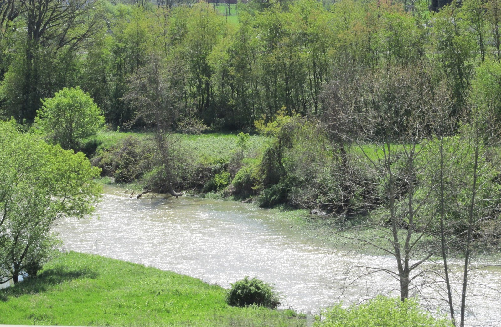
We departed Donny & Donna’s house, our home away from home and headed north on Route 415. We headed North on Route 15 through Wayland, into Springwater and onto Route 15A north into Hemlock. Hemlock was where we lived to raise our family.

We took a left onto Route 20A, and entered Livonia, the town where some of our kids graduated from high school. We went to Leisure’s, a restaurant we used to frequent quite a bit. 
We met some of our “fair friends” (Debbie, Jim, Dick and Jackie.) We ran into Shea, another “fair friend”, who was eating breakfast with co-workers. We also had breakfast with our son, Tony and our grandson, Connor. Connor just go a kitten and that was all he could talk about! He added animation to the breakfast table! After breakfast, Charlie, Tony and Connor all had haircuts scheduled at Dan’s Place.

Coming into Lima, there is a Veterinarians’ office that has resurrected a barn that sits close to the road. This barn used to be an eyesore, now it offers a silhouette montage of animal outlines. The Vet’s office has created a unique storage facility for its practice.

In Lima we turned left off Route 15A, which is also known as Plank Road, onto Routes 5 & 20. On Routes 5 & 20 East, between Lima and Bloomfield, we passed Rochester Rigging and Erectors. That is where our daughter-in-law, Margo, works. Hi Margo!

The greatest ice cream shop in New York is along Routes 5 & 20, just outside of Bloomfield … Sharks Ice Cream. Their homemade flavors are so rich and indulgent, you will be coming back for more … or maybe not! The small is more like a medium or large … so, one cone maybe enough! The flavors vary from Almond Joy, to Banana, Toffee Bar, and Vanilla Peanut Butter Cup! Too bad we went by early in the morning, otherwise we might have stopped!

As a kid, growing up in the late 60's and early 70's, it was a treat to go to Roseland Park! Roseland Park is a now defunct amusement park previously located along the north shore of Canandaigua Lake. Roseland started operation in 1925 and continued to operate for 60 years until its closure on Labor Day in 1985. Roseland originally opened up under the name "Lakeside Park" with little more than a dance hall and a few rides. The dance hall itself was named "Roseland" after the Roseland Ballroom in New York City. After three years it had become such an integral component to the park's identity, that the park itself was renamed from Lakeside to Roseland. Over the years as the park changed and grew, it saw many rides come and go, for a period of time there was even a live circus act. Following the park closure, an auction was held to sell off all of the park's remains. Two of the park's most notable rides can still be found in operation. Philadelphia Toboggan Company's carousel No. 18, was purchased by the Pyramid Companies of Syracuse. It was refurbished and restored to its original colors, and then installed at the Carousel Center mall in Syracuse in 1990. Carousel No. 18 was originally built in 1909. The other ride still in operation is the Skyliner, a wooden roller coaster. This ride was also built by the Philadelphia Toboggan Company. It was built at Roseland and opened in 1960, where it operated until the park closed. It was then moved to Lakemont Park in Altoona, Pennsylvania reopening in 1987 under the same name. It was designed by John C. Allen who later went on to design the Blue Streak at Cedar Point. It is a double out and back coaster with a track length of 2400 feet, and a maximum height of 60 feet. A housing development now sits on the property where Roseland Park once was. Though the park has long since shut down, its name still exists today in the form of Roseland Waterpark, which is also located in Canandaigua.

In Flint, there is an old railroad bridge over Routes 5 & 20 that has become part of the "connector" for the Ontario Pathways Trail. It is a 23-mile rails-to-trails project. The "path" is a cleared 12 foot wide trail with 10 of the 12 bridges already rebuilt. The Trail is composed of "legs" that connect Canandaigua, Stanley, Seneca Castle, Orleans and Phelps/Clifton Springs. The trail is open to the public year round for hiking, bicycling, horseback riding, and cross-country skiing. I would love to take our bikes on the pathway one of these days! 

Between Flint and Stanley, there is an awesome Antique Shop, it is located in an old carriage factory, hence the name "The Carriage Factory." It has been there since I can remember. I used to come here often, because my friend Stephanie, used to love in Stanley New York.


Just before you enter the town of Geneva, you come to the Red Jacket Farm Store. Three generations of the Nicholson Family have mastered the art of harvesting and pressing premium fruits and juices. Continuing a long tradition of selling farm fresh fruits and juices direct to the public, their farm store is stocked full of Red Jacket Orchard products along with a curated selection of local and regional fruits, vegetables, cheeses, meats, and other specialty pantry and sundry items.

The Cobblestone Restaurant located in Geneva New York is a restored 1825 farm house. Originally built as a Tavern and Stage Coach Stop in the 1700's, the second floor was added on in the mid-1800's for living quarters. Soon after, the building was purchased by the Fordon Family, known throughout the area as large landowners and farmers. The restaurant is at the crossroad of General LaFayette's encampment, on the former Massachusetts border, in this historically rich region.

Geneva is rich in history, famous for its beauty and unique in spirit. Along historic South Main Street you will find the scenic campuses of Hobart and William Smith Colleges. Located on 320 acres in the heart of Geneva, Hobart and William Smith are independent liberal arts colleges. The Colleges enjoy a rich heritage based on a two-college system rooted in teaching and research. Originally founded as two separate colleges (Hobart for men in 1822 and William Smith for women in 1908). Hobart William Smith now operates under a coordinate college system. All students share the same campus, faculty, administration and curriculum. Each college maintains its own traditions, deans, student government and athletic department, giving students additional leadership opportunities.

There is a full-sized mural located on the side of a building in downtown Geneva that depicts the steamship afloat on Seneca Lake. I could not find out anything about the artist, but it is well maintained and beautiful!

Seneca Lake is the largest of the glacial Finger Lakes (with a surface area of 42,800 acres) and the deepest lake entirely within the state. It is promoted as being the lake trout capital of the world, and is host of the National Lake Trout Derby. 
Because of its depth and relative ease of access, the US Navy uses Seneca Lake to perform test and evaluation of equipment ranging from single element transducers to complex sonar arrays and systems. The lake takes its name from the Seneca nation of Native Americans. At the north end of Seneca Lake is the city of Geneva. At the south end of the lake is the village of Watkins Glen, famed for auto racing and waterfalls. Seneca Lake’s natural combination of deep water (at 632 feet it is the deepest of the Finger Lakes) and sloping hillsides provides the ideal climate for grape growing. Its unique geology and topography protect the growth of hardy native grapes and premium hybrids as well as more delicate varieties.


In 1986 the Seneca Lake Wine Trail was formed in the heart of New York State’s Finger Lakes Wine Country to attract more visitors to experience its rich history, beauty and production of world-class wines. Today, Seneca Lake Wine Trail is the largest and most active wine trail in New York State with a community of 34 wineries, a distillery, two breweries and a meadery. The rich wine history of Seneca Lake can be traced back to 1866, when the Seneca Lake Grape Wine Company opened a winery on the western shores. However, with the passage of Prohibition in 1919, the bottom of the grape market fell out and many of Seneca Lake’s vineyards either closed or were replanted to produce grape varieties for the juice or fruit market.

Waterloo was the next town we came to, it is the birthplace of Memorial Day and home to the Memorial Day Museum. The Civil War, which had torn our nation apart, had come to an end. In Waterloo, as in the rest of the nation, the great sacrifice of our most precious asset, our young men, weighed heavily on the minds of our citizens. During the fall of 1865, Henry C. Wells, a local Druggist, proposed that a commemoration be held to honor their sacrifice. Late in the winter of 1866, he enlisted the aid of General John B. Murray who immediately threw his support behind the proposal and on May 5, 1866 the first Memorial Day was held and Memorial Day has been celebrated for over 150 years.

On the east side of Waterloo, a large grassy field provides the perfect setting to display a field of honor of United States flags. They are posted together with the flags of the five military services and the Prisoner of War flag to honor our nation and the men and women who have sacrificed so much in the defense of freedom. A Field of Honor is hard to describe, but once experienced it is not to be forgotten. Seeing this Filed of Honor, in Waterloo, on Memorial Day weekend amplifies these feelings!

We drove through Seneca Falls, which is home to the Women's Rights National Historic Site. The First Women's Rights Convention held in 1848 marked the formal beginning of the women's rights movement. At the time of the convention, women were not allowed the freedoms assigned to men in the eyes of the law, the church, or the government. Women did not vote, hold elective office, attend college, or earn a living. If married, they could not make legal contracts, divorce an abusive husband, or gain custody of their children. Five women organized the First Women's Rights Convention. 


When Elizabeth Cady Stanton, a Seneca Falls housewife and mother of three sons, sat down with the Quaker and abolitionist women, and decided that these wrongs should be made into rights. They called for a Convention, open to the public, to be held in Seneca Falls at the Wesleyan Methodist Chapel, July 1848. There they presented a Declaration of Sentiments, based on the language and content of the Declaration of Independence. Stating that "all men and women are created equal," they demanded equal rights for women, including - a radical idea - the right to vote. An estimate 300 people attended the Convention; the document was ratified and was signed by 68 women and 32 men. The First Women's Rights Convention and the Declaration of Sentiments have earned the Village of Seneca Falls a large place in the hearts of people all over the world. There is no major part of our lives today which has not been affected by this revolutionary document.

Whether you are traveling on Route 5 & 20 or on the NYS Thruway, you see portions of the Montezuma National Wildlife Management Area. Montezuma was designated a National Natural Landmark in 1973; the citation notes that "A small, 100-acre area within the site is one of the best examples of undisturbed swamp woodlands in New York or New England." The New York Northern Montezuma Wildlife Management Area borders the national wildlife refuge and protects additional parts of the Montezuma Swamp. A significant spot along the Atlantic Flyway, the Refuge provides crucial habitat for migratory waterfowl and other birds. Keeping the refuge a productive place for wildlife is all about the water. Grasslands provide critical habitat to migratory birds and other wildlife. Whether providing a place to nest for mallards and bobolink, or feeding grounds for hawks and fox, grasslands are critical to Montezuma. The short-eared owl, endangered in New York State, depends on Montezuma grasslands and marshes for wintering habitat, using these open areas to hunt their prey. The refuge boasts two types of forest, upland and bottomland hardwood. Upland forested sites are mostly successional forests dominated by black walnut, black willow, and green ash occurring on former agricultural fields. Most of the mature forested sites on the refuge are wetlands. Major plant life includes red and silver maple, American elm, green ash, and swamp white oak. In Florida, Osprey roost on the tall poles, in Montezuma is is the American Bald Eagles that nest there!

Routes 5 & 20, skirt along the top of the Finger Lakes. The Finger Lakes is a group of 11 long, narrow, roughly north-south lakes in a region called the Finger Lakes region in Central New York. The shape of the lakes reminded early map-makers of human fingers, and the name stuck.  The 11 Finger Lakes, from west to east are: Conesus Lake (where we started the morning,) Hemlock Lake, Canadice Lake, Honeoye Lake, Canandaigua Lake, Keuka Lake, Seneca Lake, Cayuga Lake, Owasco Lake, Skaneateles Lake and Otisco Lake. Cazenovia Lake to the east, although smaller, is sometimes called "the 12th Finger Lake", because it is similar in shape. The lakes, developed by glaciers, have been crucial to the development of this area. The lakes, particularly Seneca Lake, the largest of the Finger Lakes, have created microclimates for the area surrounding the lake and have made them perfect for growing grapes. These microclimates have led to the production of some amazing, top-notch wines from the Finger Lakes. Although there are a number of wines for every pallet, the Rieslings and other white wines are what the Finger Lakes are most famous for. Receding glaciers did more than just create the lakes; they also created a landscape that is absolutely breathtaking.

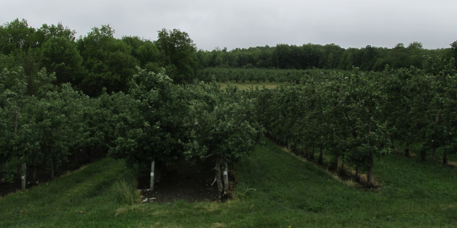
This area, like the Route 104 corridor to the north is dotted with apple orchards. Being from NY, I love everything apple, from the orchards, to the juice, and any spirits derived from them! 

1911 Established is a unique name, don't you wonder where it came from? In 1911 George Skiff and Andrew Beak founded Beak & Skiff Apple Orchards in the rolling hills of Lafayette. They use the same personal touch to every bottle of their small batch premium spirits that they have used to grow their apples, for more than 100 years. Their motto is “Tree to Bottle.” Their processes and ingredients for all of their products are controlled in-house, just like they were in 1911.


With over 350,000 trees in their orchards, they have ample supplies to to produce handcrafted, small batch spirits and artisan hard ciders and some left to share with the families that enjoy a day of "you pick" apple harvesting. Picking an apple off the tree and getting that first juicy bite, is one thing I do miss about New York. There is not a better, fresher taste of an apple than that!


In Lafayette we saw our first signs for Route 20 a Scenic By-way. It is an 108-mile stretch of Route 20 from Lafayette east to Duanesburg. 

It was designated as a New York State Scenic Byway because of its spectacular beauty and unique history to the westward migration of the state. It offers picturesque rolling hills, spectacular views, working farms, rich history and tranquil communities. Did you know that Route 20, is the longest highway in the US? It stretches over 3,360 miles from Kenmore Square in Boston, Massachusetts to the junction of US 101 in Newport, Oregon. Route 20 is also New York State's longest highway at 372 miles from the border with Massachusetts to the border of Pennsylvania. We have learned how to slow down, traveling on our Two Lane Adventures, but traveling on the Route 20 Scenic Byway helps us believe that the world is not racing by so quickly. After all, it is about the journey ... not just the destination!

Photo Credit - Jim McKeever, Irish Investigations.
"Stacks" is an outdoor sculpture by David Harper at the Stone Quarry Hill Art Park in Cazenovia, NY. I love Art Parks, but have never heard of this one! Here is the history of it, on a summer day in the late 1950s Dorothy and Bob Riester packed a picnic and drove from their home in Syracuse to Cazenovia to look at a plot of land, 23 acres in size located just off Route 20 on Stone Quarry Road. They decided to purchase the land and spent the next year building a summer home on the hilltop, taking advantage of views to Cazenovia and Oneida lakes. Over the years they continued to purchase surrounding acreage when it became available. In 1965 the Riesters made their summer hilltop home their permanent residence, adding a library and front entrance and expanding the small A-frame studio Dorothy used as work space for her various sculptures. Officially, it was a private residence, but as an active artist and community member, Dorothy’s home, studio, and land were always open for the enjoyment of others. 
Photo Credit: Heather & Jake, Nothing Mundane
By the mid-1980s, they owned over 80 acres of beautiful land. They built trails, gardens, and buildings, and many people came to enjoy the magnificent views, attend special events, and walk the trails. In 1991 in an effort to ensure the land would always be available to those that had come to enjoy its offerings Dorothy incorporated Stone Quarry Hill Art Park as a non-profit art park. A conservation easement protects the now 104 acres of land from future development and maintains the aesthetics of Stone Quarry Hill's history, first as a quarry and then in the late 1800s as a working farm. In 2011, during its 20th anniversary year, Stone Quarry Hill Art Park was recognized as #2 in National Geographic’s “Top Ten Sculpture Parks and Trails” in Secret Journeys of a Lifetime: 500 of the World’s Best Hidden Travel Gems. In 2014 the Hilltop House and Dorothy's studio were place on the National Register of Historic Places listed as "The Dorothy Riester House and Studio."  The Stone Quarry Hill Art Park offers visitors an unparalleled experience that is peaceful yet stimulating, self-directed yet suggestive, and familiar yet thought-provoking. On our way back, we are going to stop here and explore more!

Wind Turbines (windmills) are sitting atop the hillside east of Madison. I know there are people that will vigorously argue for and against these giants. But, whichever “side” you are on … I find them to be an awesome sight!


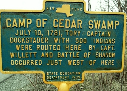
On July 9, 1781 scouts out of Fort Rensselaer reported to Colonel Marinus Willett that the British were burning Currytown, NY. A force of nearly 500 Indians and Loyalists under Lieutenant John Dockstader had surprised the settlement burning most of the homes and killing many of the residents. Col Willett marched a small force of 140 Levies and Militia to New Dorlach, now called Sharon Springs, where he ambushed the British raiding party gaining a complete American victory over the enemy. 

There was a set of three NY State historical markers along the roadside, as we turned off Route 20 in Duanesburg, heading to the campsite. I love history, but won't bore you with the details of the two men that are buried here and the history of the name of the town of Duanesburg.


We have traveled in light rain for most of the day, it finally seemed like it was going to let up, but no ... just as we were arriving at Frosty Acres Campground, the drizzle started again. The campground is on top of a steep climb, but we made it here safely, now time to rest for a few days!


Friday, May 12, 2017

Day 8 of Traveling North via the Blue Ridge Parkway 2017

Wednesday May 10th, 2017

We left Jack & Jackie in Fantasy Island Campground in Sunbury. We will see them in less than 3 weeks! Getting out of Sunbury was very busy … We had to travel south on 11 to be able to cross the Susquehanna River and go north on 15.

We crossed a body of water and saw a historical marker for the Pennsylvania Canal. We had to learn more about that. The Susquehanna Canal division created a mule-towed navigable channel 41 miles along the west bank of the main stem of the Susquehanna River between a lock near the mouth of the Juniata Tributary River and the canal basin at Northumberland. 

Meeting the West Branch Canal and the North Branch Canal at Northumberland, it formed a link between the public and private canals up river and the main east–west Pennsylvania Canal route known as the Main Line of Public Works which was devised to connect Philadelphia to Pittsburgh, southern New York, northern Pennsylvania and Lake Erie using most of the far reaches of the Susquehanna's tributaries.

In Lewisburg Pennsylvania, you can enjoy a hike on the Buffalo Valley Rail Trail. It is the result of investment by the Lewisburg Area Recreation Authority, Union County, Pennsylvania Department of Conservation and Natural Resources and the Federal Highway Department. The trail had a quick start thanks to the support of the PA Department of Conservation and Natural Resources, who awarded a matching grant for the acquisition of the 60-foot-wide abandoned corridor and an additional $3.7 million in federal monies made available through the Federal Highway Transportation Enhancements Program. These grants, along with contributions from local citizens and Union County, have made the Buffalo Valley Trail a reality for all to appreciate. Lewisburg Area Recreation Authority acquired the right of way from the West Shore Rail Road for the rail line from Northumberland County to Mifflinburg in 2009. The rails were salvaged in 2010. Construction began in the spring of 2011, including 9 miles of finished trail, trailheads, facilities and parking areas at both ends, and interpretive signage along the route. Phase II included the creation of a formal trailhead at Vicksburg on the one-time site of the train station, as well as extending the trail from its eastern terminus to Route 15 and creating a segment in the Borough, connecting along the North South rail line down to Market St. The trail is mostly paved at both ends but the middle section has a gravel surface. Lewisburg is home to Bucknell University and supports a vibrant and quaint downtown area, with eateries, bike shops and other boutique retail popular with trail users.

Also in Lewisburg, you can visit the Slifer House Museum. Eli Slifer commissioned a mansion to be built circa 1860 for his family’s estate on 188 acre farm known as the “Delta Place.” The Italianate mansion was designed by the famous architect, Samuel Sloan, and the family moved in when Slifer became the secretary of the Commonwealth of Pennsylvania. He was named an honorary colonel by Governor Andrew Curtain for his role in gaining troops and ammunition for the Civil War. 
stock photo
A physician, Dr. Lamont Ross, purchased the home and land in 1908, and established his medical practice there to serve the needs of the community. The mansion was sold in 1915 to trustees of the United Evangelical Home, a board assembled by the Central Pennsylvania Conference of the Evangelical Association. In 1916, the house opened as the United Evangelical Home, a home for seniors in need of care and housing. The house later became the administration building for the Evangelical Home, later called The United Methodist Home, and first community hospital, which had been located in one of the two dormitory buildings built behind the mansion. The house was listed on the National Registry of Historic Places and opened to the public as a museum in 1976. With the hard work the Slifer House Museum was restored and furnished with artifacts of the Victorian era and Civil War. Some heirlooms were returned to the museum by descendants and friends of the Slifer and Ross families. Original items from the Evangelical Home, Orphanage and Hospital are also stored there and on display. The house tells the visual history of the people who once lived there, as well as what life was like for people of different social classes in Pennsylvania during the Civil War and through the turn of the century.

In Allenwood, Pennsylvania there lives a neighbor in a purple house. I had to capture a picture of it for all my purple loving friends! I am sure when it was first painted the colors were much more vibrant!

North of Allenwood, a ½ mile off Route 15 you can enjoy the Four Friends Vineyard and Winery. It started out as a small vineyard, with help from good friends they planted 50 Delaware vines, and 50 Cayuga vines, by hand, using shovels and picks. Since then they have modernized somewhat, and added more vines each year, with the help of more good friends. That is how the "Four Friends Vineyard" namesake was created. Owners, Ken & Tina Day have enjoyed producing a wide array of wines from extra dry, to sweet table wines. Their goal is to have a wine to please everyone’s unique taste.

In Montgomery, Pennsylvania during the fair weather months, you can enjoy an outdoor movie at the Pike Drive-In Theater. It opened in 1953 during the “golden age” of the drive in. Built as a single screen theater, it was expanded to a 3 screen in the 1990’s. It is the last open air drive-in in the county. Current ownership purchased the business in 2006, and over the past 8 years, they have made numerous improvements to this drive in theater. Here is a little history about Drive-Ins. The First Drive-In Theater was invented by Richard M. Hollingshead. He worked out the details of designing a drive-in theater by mounting a 1928 Kodak projector on the hood of his car and hanging a sheet for a screen in his backyard in New Jersey. Richard placed a radio behind the screen for sound, then started to test his idea. One main problem that became apparent was that with cars parked behind each other, the cars at the rear would not be able to see the whole picture, due to the car in front. Richard lined up cars in his driveway spacing them at various distances and placing blocks under their front wheels he was able to find the correct spacing and the correct angles to build ramps for the car’s front tires to park on. Shortly afterwards Hollingshead was granted a patent on the design. Hollingshead opens the first Drive-In Theater Tuesday June 6, 1933 on Admiral Wilson Boulevard at the Airport Circle in Pennsauken NJ, a short distance from Cooper River Park. It offered 500 slots and a 40 by 50 feet screen. He advertised his drive-in theater with the slogan, "The whole family is welcome, regardless of how noisy the children are". The first film shown was "Wife Beware". The facility only operated three years, but during that time the concept caught on in other states, and later parts of the world.

Buckhorn Mountain is located along Route 15 and shares a popular legend throughout the Allegheny Mountains, The White Lady. The folk legend begins with newlyweds getting in a deadly accident on the mountain's treacherous roads. Both Wopsy Mountain and the Buckhorn Mountain have several dangerous curves. The dangerous curve has caused many experienced drivers to lose control, especially when the mountain is snow-covered and the roads are slick. The husband dying instantly. The wife regains consciousness only to find her beloved husband's decapitated body. Legend says the woman disappears into the woods, wandering around Wopsononock Mountain. She heads west towards Buckhorn Mountain. Yet, she always disappears around the deadly curves. She's been seen there many times by people traveling down the steep mountain road. Most sightings only last a second when you suddenly see someone in white on the side of the road ahead but once you approach the area there is no one in sight. The creation of the interstate has taken us off some of the back woods ... but do you believe in ghosts? Take a drive and find out!

Tioga State Forest derives its name from the Seneca phrase "meeting of two rivers." It covers over 160,000 acres in Bradford and Tioga counties. The forest hosts the Pine Creek Gorge, also known as the "Grand Canyon of Pennsylvania." Tioga features awe-inspiring views and miles of clean, cool streams, like Cedar Run and Babbs Creek and is one of eight state forests located in the PA Wilds region.

We crossed the Pennsylvania / New York state line and noticed some new New York State tourism signs. Of course, it has been a few years, since we have traveled north this way, so they might not be too new!


Nothing says “Welcome to New York State” more than the greeting you get when you cross the state line … bump, thump, bump, thump …. From the terrible roads! There are many things I miss, but the roads are not one of them!

Old Route 15 runs along the new Route 15, soon to be the Interstate 99 corridor. It is sad to look over and see the small towns along the old Route 15 dying slowly, with all the traffic rerouted. It is another testament to the status of today’s society … they are in a hurry to get everywhere. The days of a slow Sunday drive are gone. Perhaps the next generation can slow it down and stop and smell the roses!

From Route 15, we got onto I-390 for several miles. Just before we got off the highway, we came across the signs of the longest season in NYS … Construction season!


When you say New York State, most people think this!


When I say New York State, I think this!


We arrived in Cohocton, New York ... our temporary home for the next 18 days. Then onto our next Two Lane Adventure!

Thursday, May 11, 2017

Day 7 of Traveling North via the Blue Ridge Parkway 2017

Tuesday May 9th, 2017

We departed the Shenandoah Valley Campground in Mount Jackson, after a restful night of sleep. This campground is only 4 years old and an awesome family owned campground. During the height of the camping season, there is food served in the café.

Just at the end of the Industrial Park Road we found quite a sight. There was a business that looked like an old fashioned barn, and in front of it was a huge frog! That is one frog that I might like! According to Google maps, this building is listed as “The Yellow Barn.” It is part of the Shenandoah Caverns complex.

The Yellow Barn is one of the most unique Shenandoah Valley, Virginia wedding venues. You are surrounded by pieces of history, from antique carriages and farm equipment to props from Rose Bowl Parade floats, all in a beautiful barn setting. They offer an outdoor ceremony area under our gorgeous metal and stonework gazebo.

We got back onto Route 11 N.

On the west side of the Route 11, there is a Soldier’s Cemetery. It was established in 1861 across the road from the Mount Jackson General Hospital, which was operated by the Confederate Medical Department. During the war graves of the soldiers were marked with their names, units, and death dates. But after the war the graves were neglected, and by the time the United Daughters of the Confederacy erected the Monument to All Confederates in 1908, 112 head stones had been lost. Today only three of the original 359 still remain.

The Virginia Civil War Trails are five regional programs that fill in the gaps between the National Parks and highlight some of the less-known but no less interesting stories Virginia Civil War history has to offer. These trails give visitors the chance to explore Virginia's back roads, learning some history while driving and walking through some of the most beautiful landscapes anywhere. Most of what we traveled on in Virginia, after we exited the Blue Ridge Parkway, was part of the Shenandoah Valley, Avenue of Invasion Trail. It helps to uncover the often desperate action in the great breadbasket, the Valley of Virginia. Highlights are Stonewall Jackson's famous 1862 Valley Campaign and the final Union campaigns in 1864, just to mention a few.

This monument was erected in 1929. It is one of a total of 59 monuments commemorating Virginia Civil War battlefields. All were created during the 1920's by the Battlefield Markers Association. They were the first highway markers in the State of Virginia. After his defeat in September of 1864 at the Third Battle of Winchester by Major General Philip H Sheridan. Lieutenant General Jubal A. Early led his 9,500-man army here to Fisher's Hill, a favorite Confederate stronghold. Sheridan pursued and on 22 September attacked Early with most of his 30,000-man force. Brigadier General George Crook, with two divisions, struck Early's weak left flank about three miles west near Little North Mountain while Sheridan launched a general assault here on Early's center and right. The Confederates fled under the onslaught to Rockfish Gap. Early lost some 1,200 men, Sheridan about 530. This was the Battle of Fisher’s Hill.

The Belle Grove Plantation, north of Middletown, Virginia is hosting the 22nd annual “Of Ale and History” Beer Festival. This year's musical performers will be The Robbie Limon Band and The Reflex! As always 60+ craft and imported beers and ciders to taste, plus local food and merchandise vendors! New this year will be speakers on beer history and brewing.

In Middletown, I captured a picture of a couple of awesome murals on the side of a building. Too bad, I don’t know anything about the artist or what is housed in this building.

Stephens City is a small town in the lower Shenandoah Valley. Stephens City was founded October 12, 1758 as the second oldest town in the Shenandoah Valley and was originally settled by individuals of Scottish, Irish, and German ancestry. In the late eighteenth century and early nineteenth centuries, Stephens City, then known as Newtown, became prosperous as a crossroads village with a variety of small scale crafts and industries, featuring production of the renowned Newtown wagon. This prosperity peaked in the 1840s.

The town history would have ended in 1864, if not for the heroic efforts of Major Joseph Steans. He stopped General David Hunter from burning the town down. With ravages and disruptions brought on by the town’s location in the midst of conflict during the Civil War, Stephens City suffered. Old industries declined and disappeared. By the late nineteenth century, however, regional prosperity reemerged, and Stephens City found its place.

On the south side of Stephens City, is an old neon sign for a motel, the Redwood Budget Motel. I love the old neon signs and I was excited to see that the motel had been updated and was still in use! So many times, people bypass these roadside gems for the luxury of the chain hotels.

After the Battle of Brandy Station, June 9, 1863, Confederate General Robert E Lee ordered his Second Corps, Army of Northern Virginia, under General Ewell, to clear the northern Shenandoah Valley of Federal opposition. Ewell’s columns converged on Winchester’s garrison commanded by General Milroy. Instead of retreating in the face of superior numbers, Milroy determined to make a stand in the supposedly strong fortifications west and north of town. There was fighting on the afternoon of June 13, but the next day the Confederate Louisiana Brigade captured the West Fort leaving Milroy in an indefensible position. After dark, Milroy abandoned his remaining postitons in an attempt to retreat to Charles Town. Confederate General Edward “Allegheny” Johnson’s division marched at night and before daylight of the 15th cut off Milroy’s retreat just north of Winchester at Stephenson’s Depot. The 2nd Battle of Winchester marks the actions of Confederate General Jubal Early against Union General Robert Milroy in 1863. Milroy's force was completely destroyed, clearing the way for Lee's invasion of Pennsylvania. More than 2,500 Federal soldiers surrendered.

Virginia / West Virginia State line is marked by a small welcome to West Virginia sign.

The City of Martinsburg, West Virginia is recognized as the "fastest growing City in the State" is known as the "Gateway to the Shenandoah Valley." Located in the heart of the Eastern Panhandle, the City serves as the county seat to Berkeley County. Martinsburg was founded in 1778 by General Adam Stephen who named it in honor of Colonel Thomas Bryan Martin, a nephew of Thomas Fairfax, 6th Lord Fairfax of Cameron. The most prominent building in the downtown is the County Courthouse, thanks to its gold dome like structure and cupola.

Traveling on Route 11, the Potomac River, is the state line for West Virginia and Maryland and there is not a sign marking the crossing into a new state.

The Potomac stretches over 400 miles from start to its discharge into the Chesapeake Bay.

In Hagerstown Maryland, we traveled under a uniquely painted Western Maryland Railroad bridge.

Right after the bridge, there was an old train deport that now houses the Headquarters of the Hagerstown Police Department. It is nice to see an old building repurposed, instead of abandoned or torn down! Western Maryland Railway Station is a historic railway station. It was built in 1913 as a stop for railway. It is a 2 1⁄2-story hip roof brick building, reflecting the influence of the Commercial Style of the early 20th century. The building features over-scaled Classical detailing, a stone foundation, and a massive, modillion cornice with stone disks defining each bay. The building is also encircled by a one-story porch that has a cantilevered roof on three sides. The Western Maryland Railway ended passenger train service to the Hagerstown station in June 1957. We crossed the Maryland and Pennsylvania state line

We saw these pink cars and had to find out more! Jeff Fisher Insurance Agency has been around since 1967. About 14 years ago they decided it was time to start giving back to their community. At that time they selected Breast Cancer Awareness as their main project and have been raising money and awareness ever since. As of 2015 they have given over $140,000 to the local Breast Care group Cumberland Valley Breast Care Alliance. Since then they have been nicknamed “The Pink Insurance People”.

We saw one farmer in Pennsylvania already has his 1st cutting of hay down. As bear as the trees have looked, I am surprised. But, it looks very green and long!

Route 11 is home to portions of the Pennsylvania Civil War Trails. Pennsylvania has divided their trails into five groups, A Band of Brothers, News from the Home Front, Women and the War, The Battle Cry for Equality and When Johnny Comes Marching Home. Each looks at the war from a different outlook. A Brother's Bond: It explores the battlefields, artifacts and legends of the Civil War. These places tell the story of the soldiers who marched, fought, and died together. News from the Home Front: These places show that while the war waged on the field, life went on at home. You can “ride” along and experience daily life in the Civil War era. Women and the War: Soldiers weren't the only ones who played a role in the outcome of the war. Women were abolitionists, nurses, teachers, and business-owners. Ride along the trails and see where women laid rails, worked assembly lines, and served in the arsenals as they helped keep the wheels of progress turning. The Battle Cry For Equality: Journey along the trail of Underground Railroad stations, abolitionist freedom fighters, and African American soldiers. This is the road trip of freedom-seekers. When Johnny Comes Marching Home: When the war ended, Pennsylvania began the process of healing from the fighting and losses of loved ones in the battles. Go on a journey through Pennsylvania’s hallowed grounds and stories of sacrifice made by those who played a role in the Civil War.

Just outside of Harrisburg, in Camp Hill, Route 11 N meets up with Route 15 N. We picked up Route 15 N from here. This town is one place that always reminds me of the good things that come from Rochester New York, besides me! I am talking about the grocery store, Wegmans. At one time it was only in the greater Rochester area, now it has expanded into North Carolina. For the second year in a row, Wegmans has been voted the number 1 grocery chain. It pushed out Trader Joes!

Most of Route 15 in Pennsylvania travels along the Susquehanna. A few days ago, I told you about Lady Liberty in McRae Georgia … well along the Susquehanna River is a stretch called Dauphin Narrows. At this location, out in the river stands a brilliant white replica of the Statue of Liberty, proudly standing in all her scaled-down glory on an old stone bridge piling. Distance plays havoc with your sense of scale in this area: Although Dauphin’s Lady Liberty looks tiny, but she is actually 25 feet tall and quite sturdy. She’s also the second replica of the Statue of Liberty to stand in the fast-moving waters. The first one succumbed to the effects of the elements.

There was a place that sold yard ornaments, am I am sure that our Geek-E-birds relatives live there, but we did not stop to see ... Charlie thinks a family of 6 birds is enough! We crossed over the Susquehanna on Route 60 and followed the river on the east side along 147 into Sunbury Pennsylvania, arriving at our destination for the night at Fantasy Island Campground. We are meeting up with our friends, Jack and Jackie Laubach. Tomorrow will be the last leg of this Two Lane Adventure.


We enjoyed $5 Burgers at the Top Hat with Jack and Jackie and other couples from their campground. This was the first night the Top Hat was open again … no one knows why they were closed … should we be worried eating food from there? The burgers were delicious and the company was awesome. We will stop again, when we are in Sunbury!