Monday, August 27, 2018

Day 59 of 117 on our “Go West, Young Man” Two Lane Adventure – Friday 8/24/18


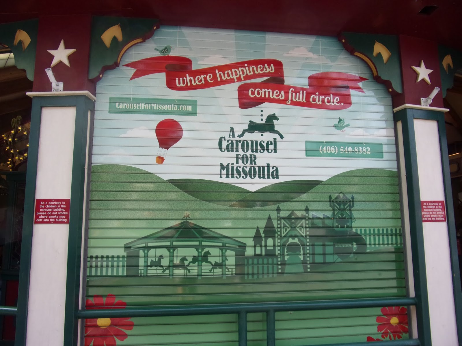
We departed Jellystone Campground in Missoula, it was a hazy morning.

Just 4 miles north of Missoula, we came into Evaro on the southern tip of the Flathead Indian Reservation. Evaro Hill on Highway 93 is a stretch of road that steadily climbs from the Missoula valley to Evaro and serves as a local landmark. The Flathead Indian Reservation is home to three tribes, the Bitterroot Salish, Upper Pend d'Oreille, and the Kootenai. "Confederated Salish" refers to both the Salish and Pend d'Oreille tribes and extends between Missoula and Kalispell, with fertile valleys and towering mountain peaks surrounding the 1.2 million acre reservation.

What is up with all the casinos in Montana? In the early 70s, the legislature approved Bingo as a form of legal gambling, and then video Keno as a form of live Bingo. Then, in the mid-80s, the legislature approved video poker machines to go along with the video keno machines, they allowed 5 video poker machines and unlimited video keno machines, per liquor license. In one year, the state issued just under 3,000 video poker licenses. Around the same time, Montana also approved the Montana State Lottery. Because of the fee revenue on these video poker machines, the legislature lifted the restriction in the early 90s on those video poker machines, to 20, per license.

The People's Way, otherwise known as US Highway 93 as it passes through the Flathead Indian Reservation, very much caters to critters, it appears. The most visible animal crossing is the animal bridge over US 93. The $1.88 million overpass north of Evaro is another story, a 26-foot-high and 200-foot-long tunnel was constructed where only air existed to let animals in these parts walk over the highway instead of under it. But, there are actually 41 wildlife crossings between Evaro and Polson. 40 of the crossings on this 56-mile stretch of US 93 run below the highway, mostly in the form of culverts, or under bridges designed to give animals room to pass without stepping on pavement. Drivers don't even notice the majority of the wildlife crossings. The goal of the crossings, of course, is to reduce the number of animal-vehicle collisions, which take a toll not only on the wildlife population, but cause more than $1 billion in automotive damages in the US each year.

The town of Arlee is named after the Salish chief "Alee" and sitting in the shadow of the Mission Mountains. Arlee serves as a trading center for residents of the Jocko Valley and Flathead Indian Reservation. Arlee is home to beloved local shops and galleries, and area highlights include the Garden of One Thousand Buddhas. Rounding out the town's offerings are annual events like the Let'R Buck PRCA Rodeo and the Arlee Celebration Pow Wow. You can tell that we are on the Indian Reservation, because all the signs are in two languages.

Just off US 93 in Arlee, in the Jocko Valley, is the Garden of One Thousand Buddhas. It is being created through the visionary guidance of Gochen Tulku Sang-ngag Rinpoche, an incarnate Tibetan Buddhist lama. Nestled in a peaceful valley in the land of the Confederated Salish and Kootenai Tribes of the Flathead Reservation, the Garden of One Thousand Buddhas aligns positive properties of the physical world in a sacred architectural arrangement based on the eight-spoked Dharma wheel. This symbol evokes the turning or awakening of the enlightened qualities of altruism and wisdom. The purpose of the Garden is to bring about positive transformation within those who visit, in response to the negativity that abounds in the world today. One thousand hand-cast Buddha statues are arrayed around the central figure of Yum Chenmo, or the Great Mother, the manifestation of the perfection of wisdom. One thousand stupas, representations of the enlightened mind, line the outer circle. Each enshrine an image of the female deity, Tara. Elegantly adorned with native trees and flowers, it is hoped that the Garden of One Thousand Buddhas will instill lasting impressions of peacefulness and compassion.

Ravalli is located at the junction of U.S. Route 93 and Montana Highway 200, at the bottom of a big hill near the National Bison Range. However … we did not see any buffalo. Year-round, the National Bison Range offers the opportunity to view 500 bison roaming on natural grassland, along with elk, bighorn sheep, antelope and deer on self-guided auto tours. At one time Charlie Allard, the country's leading expert on breeding bison, owned the country's largest herd of buffalo in Ravalli, Montana.

The smoke from the fires in the area is starting to be “seen” more, the mountain view should be clear this time of day, but all you can see is the “fog.” The United States Congress designated the Mission Mountains Wilderness in 1975, it is now has a total of almost 75,000 acres. All of this wilderness is located in Montana and is managed by the Forest Service. The Mission Mountains are a land of ragged peaks with snow on them most of the year, small active glaciers, alpine lakes, meadows, clear streams that run icy cold, slab-like boulders, vertical cliff faces, and talus slopes. The average elevation is 7,000 feet. In the northern portion you'll find the terrain less severe and more heavily timbered. The southern portion, however, receives more visitors, primarily around the alpine lakes (most of which do not thaw until mid-June). In summer high basins are painted with a sea of wildflowers. The first organized exploration of this area did not occur until 1922, after which part of the region was set aside as the Mission Mountains Primitive Area in 1931 and then expanded in 1939.

Rich in history and native culture, the small town of St. Ignatius on the Flathead Indian Reservation offers beautiful views of the Mission Valley. The St. Ignatius Mission was built in the early 1890's. This Catholic Church is unique because its walls and ceilings have 58 original paintings by Brother Joseph Carignano on them. The Mission Mountain Range is a beautiful backdrop of scenery behind the Mission Church. There are two very special paintings of the Salish Lord and Lord's mother (in Native American form) that are located in the back of the Mission. Next to the Mission, there are the log home which was the original Sisters' residence when they first arrived.

The 3,880 acres of the wildlife management area is located on the westside of the Ninepipe Reservoir National Wildlife Refuge, which is in the Flathead Indian Reservation. This exceptional wetland complex contains over 800 glacial potholes and a 1,770-acre reservoir. The rolling hills, open grasslands, lake, and numerous kettle ponds provide habitat for upland game birds, waterfowl, and other non-game species. About 200 bird species have been recorded, including nesting great blue herons and double-crested cormorants.  

Carrying a hearty legacy, Pablo was named for tribal member Michel Pablo, a rancher and stockman who played a role in saving the bison of Montana from extinction. Headquarters for the Flathead Indian Reservation, Pablo is home to Salish Kootenai College. It features a nine-hole golf course and a tribally operated museum that shares the history of the Confederated Salish and Kootenai Tribes. Established a bit later than most other towns in the region, Pablo came to life in 1917, with the coming of a branch line of the Northern Pacific Railway. Its location in an agricultural area is betrayed by the presence of a pair of grain elevators which still stand. Both now graffiti covered, they appear to have fallen into disuse. The other two most noticeable structures in the town would be the town water tower and the pedestrian bridge.

The bridge, a very long steel truss bridge, spans the four lane divided Highway 93 at the south end of the Salish Kootenai College, a tribal college with an enrollment of about 1,200 located on the Flathead Indian Reservation, as is Pablo itself. While the college is at the east end of the bridge, the headquarters of the Confederated Salish and Kootenai Tribes of the Flathead Reservation is off the west end. Officially opened in July of 2011, the $3 million dollar bridge was built in a single span of 265 feet in length, supported by stone faced concrete piers, with a pair of 60 foot tall steel tipi structures at each end.

We transitioned onto Montana Route 35. This route skirts around the east side of Flathead Lake, from Polson to Bigfork. Flathead Lake is the largest natural freshwater lake west of the Mississippi in the lower 48 states, with over 200 square miles of water and 185 miles of shoreline. The southern half of Flathead Lake is within the boundary of the Confederated Salish and Kootenai Tribes Flathead Reservation. Montana Fish Wildlife and Parks maintains thirteen public access sites around the lake.

One of Montana’s most unique roadside landscapes, the orchard stands that sell Flathead cherries during the summer months.  There isn’t really a Flathead cherry … the name comes from the lake region. Especially the east side of the lake that has proven perfect for growing the sweet treat. Harry Chapman started the first orchard here around the turn of the 20th century. There were ample orchards of cherries, apples and other fruits. The roadside stands along the east shore were open, but no room for 14 RVs to pull off!

We followed Montana Route 206 for a while, then we turned onto US 2E and followed the south Fork of Flathead River. The South Fork of the Flathead River begins deep in the heart of Bob Marshall Wilderness complex, one of the nation’s largest designated wilderness areas, more than 1.5 million acres. Due to the fact that the South Fork of the Flathead River starts deep in the wilderness area and flows for more than 40 miles through the heart of the complex. 

After traveling more than 40 miles, the South Fork finally leaves the protected wilderness area, and begins to follow the reservoir roads for another 20 miles until spilling into the Hungry Horse Reservoir. The reservoir is more than 50 miles long, created by the 460-foot Hungry Horse Dam. Below the dam, the South Fork flows for 5 miles before entering the Flathead River just downstream from the town of Hungry Horse. This is where we crossed the river.


We arrived at the West Glacier KOA, our home for the next three nights. Oh, what a beautiful campground!

We were able to sit out and visit for a bit!

The forest fires are on the other side of McDonald Lake, but we could see the helicopter water brigade dipping water from the lake.

The smoke from the fires have created a hazy sunset. Another excellent Yankee RV Caravan day!

Sunday, August 26, 2018

Day 58 of 117 on our “Go West, Young Man” Two Lane Adventure – Thursday 8/23/18


Free Day to explore and take care of daily needs that tend to be forgotten when you are on “vacation” every day! I’ll share a brief history of Missoula. The first inhabitants of the Missoula area were American Indians from the Salish tribe, actually the first inhabitants were probably relatives of these two guys! They called the area "Nemissoolatakoo," from which "Missoula" is derived. The word translates roughly to "river of ambush or surprise," a reflection of the inter-tribal fighting common to the area. The Indians' first encounter with whites came in 1805, when the Lewis and Clark expedition passed through the Missoula Valley.

The first white settlers were CP Higgins and Francis Worden, who opened a trading post called the Hellgate Village on the Blackfoot River near the eastern edge of the valley around 1860. It was followed by a sawmill and a flourmill, which the settlers called "Missoula Mills". The completion of the Mullan Road connecting Fort Benton, Montana with Walla Walla, Washington and passing through the Missoula Valley meant fast growth for the growing city, buoyed by the U.S. Army's establishment of Fort Missoula in 1877, and the arrival of the Northern Pacific Railroad in 1883. With this, Missoula became a trading center in earnest, distributing produce and grain grown in the agriculturally prosperous Bitterroot Valley. The Missoula Mercantile Company in the early 1880s.

The city's success was aided by two other factors. First was the opening of the University of Montana in September 1895, serving as the center of public higher education for Western Montana. Then, in 1908, Missoula became a regional headquarters for the Forest Service, which began training smokejumpers in 1942. The Aerial Fire Depot was built in 1954, and big industry came to Missoula in 1956, with the groundbreaking for the first pulp mill. Until the mid-1970s, logging was a mainstay industry with log yards throughout the city. The current site of Southgate Mall was once the location of the largest log-processing yard within several hundred miles. The saws could be heard over two miles away on a clear summer night. However, by the early 1990s, changes in the economic fortunes of the city had shut down all the Missoula log yards.

In 1995 “A Carousel for Missoula” opened. However, it began about four years before that. It all began with a few parts, ambition and a dream. It was almost a “build it and they will come” kind of thing. Chuck Kaparich said “If you will give it a home, and promise no one will ever take it apart, I will build A Carousel for Missoula.”  That was the promise the Missoula cabinet-maker made to the Missoula City Council in 1991. Kaparich, who had spent many childhood hours on the carousel at Columbia Gardens in Butte, Montana, had already carved four carousel ponies and had purchased an antique frame in thousands of pieces.  The Council agreed and Kaparich’s dream of A Carousel for Missoula became the dream of a community. A board of directors was formed to facilitate organization and fund raising, Kaparich taught others to carve, mechanics began the process of restoring 16,066 pieces of the antique frame and motor, painters were recruited, and Missoula began working together to create a treasure.

After four years of a huge volunteer effort, the Carousel for Missoula opened its doors to the young at heart. By Opening Day, May 27, 1995, over 100,000 hours of volunteer time had gone into the construction of 38 permanent ponies; three replacement ponies; two chariots; 14 gargoyles, gargoyle frames and mirror frames; and the largest band organ in continuous use in the United States, all within a jewel box building. Community members donated time, services, materials and encouragement.  School children collected over one-million pennies to adopt four ponies; stained glass artists constructed shimmering windows; mechanics poured Babbitt; majestic horses’ heads emerged from blocks of wood; and people found lasting friendships among the woodchips. 

Each horse has an adoptive family and a story. Here are a few of the stories from the carousel pictures I took. Silver has an adoptive family of Randy, Theresa, Jason, Jessica and Jamie Cox. His story includes … as a boy growing up on a ranch near Cascade, Montana, Randy had a horse named Silver. The pony looks like the real Silver in many ways, including its saddle. The flowers across the rump are sweet peas, flowers that grow wild in the spring in the Smith River and upper Missouri River country. When Randy and Theresa first met, he would bring her sweet peas. The three J’s on the stirrup are for the Cox children.

Behind Silver is Midnight Rose, her adoptive family is First Interstate Bank. Midnight Rose was the name given to this horse by her carvers from Calgary, Alberta, Canada. The community extended far beyond Missoula. The pony was a gift to the Carousel from the Midnight Rose Carvers. Midnight Rose is dedicated to the memory of Pat Davis, a bank employee who was killed in a horseback riding accident. 

Cannonball has an adoptive family of the Missoula Rotary Clubs. His story is that of an outside-row jumper, Cannonball was named for a beloved horse of world famous wilderness outfitter Smoke Elser, a Rotary member. The pony has gold armor, emblazoned with the Rotary emblem, and royal blue and maroon trappings.

The Eagle Chariot was adopted by the Missoula Building Industry Association. His story is that association members were anxious to provide a way for children and grownups of all abilities - especially those with disabilities and limited abilities - to enjoy the Carousel, and therefore decided to adopt a chariot that could be used by the very young, the very old and everyone in between. The seat can be lifted, and a wheelchair fastened into the chariot. The eagle and patriotic colors are symbols of the group’s umbrella organization, the National Association of Homebuilders.

Paint has an adoptive family of Irene and Larry Pirnie. As a world-renowned Missoula artist Larry Pirnie has always seen the running horse as an ever-changing array of electric colors. A favorite of Missoula children and visitors alike, Larry’s personal design and paint job represent Pirnie’s fantasy of jumping on the back of a wild horse “hanging on with great joy, as it leads him on endless adventures.”

Behind Paint is Red Ribbons, her adoptive family is the local newspaper, the Missoulian. Her story is told in the book “Red Ribbons” by John H. Toole, Missoula’s first printing press was hauled to town by horse and wagon in 1870. Just outside of town, the driver, Joe Magee, stopped and his men tied little red ribbons to the horse’s ears and mane. Thus adorned, the horse pulled the printing press into town and Missoula’s first newspaper was published. Red Ribbons, the Carousel pony, pays tribute to this little known anecdote in Missoula history.

Snapples has a pretty face. Her adoptive family is the Missoula school children. Her story is thanks to the efforts of the littlest volunteers. Sally Nelson’s fourth graders in Lolo designed Snapples, a shortening of “Sally Nelson’s Apples.” They won the rights to the design by collecting 19,039 pennies in the Pennies for Ponies fundraiser. The story of the Carousel includes wood and metal, concrete and colored glass, hearts and hands, and countless hours of loving labor. The spirit of giving which created the Carousel didn’t end when the building opened.  Volunteers carve ponies for other carousels and local not-for-profit organizations, and restore ponies for antique carousels.  The mechanical crew donates time to keep the machine in tip top condition, and many others help improve and maintain the Carousel as a gift to the community.

We entered the Lubrecht Experimental Forest, School of Forestry part of the University of Montana. In December of 1937, the Anaconda Copper Mining Company donated 19,058 acres to the Montana Forest and Conservation Experiment Station. Two years later the Northern Pacific donated an additional 1,210 acres. Over the years smaller tracts have been obtained from private individuals to bring the total acreage to its present figure. 

The forest was named for WC Lubrecht, who was the general manager of the Anaconda Company lumber operations at Bonner. According to newspaper reports at the time, the gift provided the school with "the most extensive holdings of any such school in the US.” The initial buildings at Lubrecht had been constructed from wood cut and sawed by the students from the property. For almost forty years, the camp at Lubrecht consisted of a collection of old buildings and temporary facilities. In 1982, the Castles Forestry Center was built to provide a permanent space for research. Many of the recreation facilities were constructed by students in the 1950s using lumber sawn on site. In 1996, the 32-bed lodge and one-bedroom apartments were added.

Lubrecht Experimental Forest is a 28,000 acre forest located 30 miles northeast of Missoula in the Blackfoot River drainage. The Montana Forest and Conservation Experiment Station, at the WA Franke College of Forestry and Conservation, owns and manages 21,000 acres. The other 7,000 are managed cooperatively with the State of Montana Department of Natural Resources. University of Montana students and faculty use Lubrecht for study and research. Members of the public use Lubrecht Forest for recreation, for conferences, weddings, and other special events. The forest even boasts nordic ski trails, that are groomed and maintained by Lubrecht staff with assistance from the Missoula Nordic Ski Club.

The forest has been actively managed over the years, with some commercial thinning done particularly for the mountain pine beetle in the 1970s and 80s. It is still possible to recognize remnants of the three earlier Anaconda Company cuts of the late 1800s, 1916, and 1925 to 1926 and associated railroad grades as well as two clearcut areas from the 1960s. Small amounts of timber are offered for sale annually, with the proceeds going to support further projects on the forest, as well as the maintenance and management of Lubrecht.

The Garnet Back Country Byway provides a 12-mile journey through the Garnet Mountain Range in western Montana. Garnet Ghost Town is a major point of interest along the Byway. The Byway begins 30 miles east of Missoula where the Garnet Range Road leaves MT Highway 200. As the Byway climbs 2,000 feet into the evergreen forest of the Garnet Mountains, outstanding panoramas of the Blackfoot River Valley, the Swan Range, the Mission Mountains, and the Bob Marshall Wilderness come into view. We took this scenic drive to the Garnet Ghost Town.

Garnet was named for the semi-precious ruby-colored stone found in the area and it was a good place to live. The surrounding mountains were rich in gold-bearing quartz. There was a school, the crime rate was low, and liquor flowed freely in the town’s many saloons. The bawdy houses did a brisk business and Missoula and Deer Lodge were close enough for necessary supplies.

In the 1800s miners migrated north from played-out placer mines in California and Colorado. Placer mining of gold or other minerals is done by washing the sand and gravel with running water, but by 1870 most area placer mining was no longer profitable. The Garnet Mountains attracted miners who collected the gold first by panning, then by using rockers and sluice boxes as the free-floating gold diminished. Although miners had located gold-bearing quartz veins, the lack of decent roads and refined extracting and smelting techniques, made further development unfeasible at that time. Silver mines elsewhere started to draw the miners out of the Garnet Mountains, but in 1893, the repeal of the Sherman Silver Purchase Act set off a panic throughout the region. Silver mines closed, and within weeks thousands of unemployed miners were on to gold mining in the Garnets. Miners began to trickle back.

At the head of First Chance Gulch in 1895, Dr. Armistead Mitchell erected a stamp mill to crush local ore. Around it grew the town, which was originally named Mitchell, but in 1897 became known as Garnet. Soon after Mitchell erected his mill, Sam Ritchey hit a rich vein of ore in his Nancy Hanks mine just west of the town. The "boom" began. By January 1898 nearly 1,000 people resided in Garnet. There were four stores, four hotels, three livery stables, two barber shops, a union hall, a school with 41 students, a butcher shop, a candy shop, a doctor’s office, an assay office, and thirteen saloons comprised the town. Eager miners and entrepreneurs built quickly and without planning. A haphazard community resulted. Most of the buildings stood on existing or future mining claims, and about twenty mines operated.

After 1900 many mine owners leased their mines out, the gold having become scarcer and harder to mine. The Nancy Hanks yielded about $300,000 worth of gold, and an estimated $950,000 was extracted from all the mines in Garnet by 1917, but by 1905, many of the mines were abandoned and the town’s population had shrunk to about 150. A fire in the town’s business district in 1912 destroyed may commercial buildings, most remaining residents moved away to defense-related jobs. By the 1940’s, Garnet was a ghost town. Cabins were abandoned, furnishings included, as though residents were merely vacationing. F.A. Davey still ran the store however, and the hotel stood intact.

In 1934 when President Roosevelt raised gold prices from $16 to $32 an ounce, Garnet revived. A new wave of miners moved into abandoned cabins and began re-working the mines and dumps. Then, World War II drew the population away again. The use of dynamite for domestic purposes was curtailed, making mining difficult. Garnet again became a ghost town. Once again FA Davey and a few others remained. Several new cabins were constructed following the war, and in 1948 an auction was held with items from the Davey store. Much remained however, and souvenir hunters soon stripped the town not only of loose items, but of doors, woodwork, wallpaper, and even the hotel stairway. The future of this historic town now depends on the work of volunteers and contributions from the public.

The jail was erected in 1897 but never received much use. During the early days, there were shootings and problems with claim jumpers, but people generally would work out these messes without using the jail. Supposedly the only person to be seen in the jail was Frank Kearn, a miner who got drunk and killed someone’s dog. It wasn’t unusual for rifles to be carried in town, but they were only used for hunting game. In the 1960s, a man known simply as Mr Stoddard lived in the jail while collecting weather data.

The post office was built between 1896 and 1900 as a miner’s cabin. In the 1930’s, Nels Seadin was the Postmaster when he moved into Adam’s house. After his death in 1939, Walter Moore took over.

Kelley’s Saloon is a two story frame building built before 1898. The owner at the time was Robert Moore and it was called the “Bob Moore Aloon.” On October 21, 1898. LP Kelley purchased the saloon from Moore for $1,500. Part interest in the business was sold to Thomas Fraser, and it became known as the “Kelley and Fraser Saloon.” In 1907, Nellie Fraser sold it to Ward Mulleneux who resold it to the Montana Liqour Company in 1908, but Kelley continued to operate the saloon. It was one of the thirteen bars in Garnet during the boom period that offered “Male-oriented” entertainment.

In Missoula, we traveled on Orange Street, going under the bridge. Technically, it’s a bridge that goes over the street, but because the bridge contains both train tracks and North First Street, it makes for a much wider overpass than a typical bridge. Hence, the underpass is literally a small tunnel. The art work that adorns the tunnel is awesome and awe-inspiring.


On our way back into town, I googled “barber near me” and we got off at the next exit and the barber shop was right there. Charlie walked in and got right into the chair and got his hair cut! We got back into camp and relaxed a bit, before we had huckleberry ice cream and our road log review for our travel the next day.

Day 57 of 117 on our “Go West, Young Man” Two Lane Adventure – Wednesday 8/22/18


Today was a travel day, we are going from North Fork Idaho to Missoula Montana. We departed Wagonhammer Campground at 9am and continued on 93, also known as the Salmon River Scenic Highway. The route follows the Salmon River through the Salmon-Challis National Forest into Montana. The river and its forks serve as important natural pathways into Idaho’s rugged back country. The deer, elk, and moose that often graze along the hills and meadows that line this road provide a glimpse of the wild country beyond.

Nestled in the Bitterroot Mountains, just about 11 miles north of North Fork, is the small community of Gibbonsville, Idaho. The first settlers made their homes here about 1872, at which time the tiny spot was referred to as Dahlongi. In 1877, after gold was discovered nearby, the small settlement officially became a town and was named Gibbonsville in honor of Colonel John Gibbon, who pursued the Nez Perce Indians and fought in the Battle of the Big Hole. Familiarly called Gibtown, the miners quickly set about building several mines, the largest of which was the AD&M Mine. Soon cabins dotted the hillsides and businesses were servicing the some 600 men employed in the mines. At the same time, the town served as a supply route between Utah and the Northern Railway terminal in Montana. At its peak, Gibbonsville boasted more than 100 buildings, including two saw mills, a roller mill, five stamp mills, a newspaper and eight saloons. The gold mines in Gibbonsville continued to be worked extensively, recovering some about $2 million in gold, about half of which came from the AD&M Mine. However, by the turn of the century, the ore was beginning to play out, and when a disastrous fire blazed in 1907, production ceased altogether.

To get out of Idaho on US 93, you must go up! We started the climb up at an elevation of 5,440. Elevations readings are thanks to our friend, Lyle, the pilot! He always wants to know how high he is!

We are still climbing, at an elevation of 6,500. Awesome views as we take the switchbacks!

We reached the top of the mountain, which is northern end of the Salmon River Scenic Byway. It also is the Idaho and Montana border in the Bitterroot Mountains at the Lost Trail Pass, elevation 7,021 feet. Lewis and Clark came this way in 1805 and the spectacular view from this vantage point has changed little since then.

We are in Montana and on the other side of the mountain and at 6,000 feet, we are still descending.

In 1877 the Nez Perce people were forced from their homelands while pursued by U.S. Army Generals Howard, Sturgis, and Miles, is one of the most fascinating and sorrowful events in Western US history. Chief Joseph, Chief Looking Glass, Chief White Bird, Chief Ollokot, Chief Lean Elk, and others led nearly 750 Nez Perce men, women, and children and twice that many horses over 1,170 miles through the mountains, on a trip that lasted from June to October of 1877. Forced to abandon hopes for a peaceful move to the Lapwai reservation, the Nez Perce chiefs saw flight to Canada as their last promise for peace. The flight of the Nez Perce began on June 15, 1877. Pursued by the Army, they intended initially to seek safety with their Crow allies on the plains to the east. Their desperate and circuitous route as they tried to escape the pursuing white forces is what we now call the Nez Perce National Historic Trail. This route was used in its entirety only once; however, component trails and roads that made up the route bore generations of use prior to and after the 1877 flight of the nontreaty Nez Perce.

We followed the Bitterroot River for a portion of our drive today.

Darby is a small town in Florida, north of Dade City … but it is also a small town at the southern end of the Bitterroot Valley in southwestern Montana, about thirty miles to the Idaho border. The Sapphire Mountains are to the East and the gorgeous Bitterroot Mountains are to the West. The Bitterroot Valley is known as Montana’s ‘Banana Belt’ for its slightly warmer temperatures than the surrounding mountains.

Darby’s overall architecture has a distinct western flair. Darby is also home to the Annual Darby Logger Days. It has been held here annually since 2001. The Bitterroot Valley of Western Montana comes alive the third weekend in July with serious timber sports events! There are seventeen traditional logging competitions including axe throwing, pole climbing, log roll and cross-cut sawing.

I have been capturing pictures of chickens, in every state we have been in. In an earlier blog, I reported that when we went into Montana to visit the Little Big Horn Battlefield, I never saw a chicken. Well, we are in Montana again, and my streak is back on track! This chicken statue has some strange friends, but it still counts!

We saw this sign heading out of Darby, I am not sure I understand the biggest little bull riding in the northwest. But Darby sure is proud of what they have!

In Hamilton Montana, I saw my first grizzly bear! Does it count, if it is a painted grizzly statue? Even if we have not seen a bear yet, we have learned a great deal about them. I know this is a grizzly, because he has the hump of muscle on his shoulders. They use that muscle to help them dig, with their long claws!

Lolo is home to Travelers' Rest State Park. The area was once used as a trading ground for Montana's First Nations and a campsite for Lewis and Clark, in 1805 and 1806. Travelers' Rest has an impressive history. It is the only archaeologically verified campsite of the Lewis and Clark Expedition in the nation.

We arrived in Missoula Montana. Missoula is located along the Clark Fork River near its meeting with the Bitterroot and Blackfoot Rivers and at the convergence of five mountain ranges, thus is often described as the "hub of five valleys". We will be in Missoula for a few days, so will share more about Missoula later. 
Today, I wanted to share the painted electric boxes. They are everywhere and beautiful!

We all arrived at Jellystone Campground, our home for the next two nights.

After we were settled, we car caravanned to the Missoula Smoke Jumpers School. We gathered at the Smokejumper Visitor Center for our tours. Missoula is home to the largest smokejumper base in the country. The Smokejumper Visitor Center provides static and interactive displays and opportunities to learn about this demanding and important occupation. There is also a gift shop to purchase any smoke jumper memorabilia.

Smokejumpers are a highly skilled, rapid response and operationally focused fire resource that provide initial attack suppression on emerging fires and fill a variety of roles on longer duration project fires and wildland-urban interface fires. Their training, versatility and agility enable them to provide leadership capable of establishing command structure, situational assessment and tactical and logistical support for extended fire and all-risk operations. Currently, 75 smokejumpers, including men and women from diverse backgrounds, work at the base. Ranging in age from early 20’s to 50’s, these are all dedicated and professional individuals who are highly trained and experienced firefighters.

Our tour of the facility was conducted by a smoke jumper, Dillon. He took us to see the sewing shop. Yes, they do repairs on their equipment and create specialty clothing they need. They even create specialty items for the Armed Forces. Our guide, never knew how to sew, until he came here … now he is a regular Betsy Ross!

Before we got to the Smokejumper loft, we passed through the room where they hang parachutes to dry. Every wall in the room was full of numbered lines. Each line had a corresponding pulley and they are used the hang parachutes to dry.

The Smokejumpers loft, is the room where they pack their parachutes. Each smoke jumper must pack chutes. There is a great deal of trust among this troop of smokejumpers.


When they jump, they have a ton of gear with them, but water and rations are usually dropped in later. Here is what they get. The SPAM is a smokejumper "thing." While at the base, they even have contests for new and original ideas for SPAM. Our guide, Dillon, loves to cook and once made SPAM with a fresh huckleberry reduction. Yuck ......

The ready room is like a big locker room. It is where all of their gear is ready to go. When they are called to a fire. They come here and gear up. From here, they can go right out to the tarmac and get on their plane. Like any other organization, they have a hierarchy and the “older guys” have more locker space and better positioning in the room.

During the summer, Smokejumper aircraft are also present. We got to tour one of them. There were several teams of smokejumpers out, but we did not get to see any Smokejumpers dispatched to a fire. The Missoula Smokejumper Base is located at the Aerial Fire Depot adjacent to the Missoula International Airport. They are collocated with the US Forest Service Northern Region Fire Cache, the Missoula Fire Sciences Laboratory, the Northern Region Training Center, and the Missoula Technology and Development Center.

It was another excellent adventure day with Yankee RV Tours!