First thing this morning, we had to drive one of the most
breathtaking stretches of road in the US … the Peter Norbeck Scenic Byway. It’s
a twisting, turning road trip through spiraling rocks and forests of the
southern Black Hills. This scenic byway has been called “the template for all
scenic byways.” It has been rated one of the top five scenic byways in the US.
The byway is names after the late South Dakota Senator Peter Norbeck, whose
idea it was to build this byway. Although scoffed at by the experts, with his
support and 150,000 pounds of dynamite, the Needles Highway became a reality.
The majority of the byway, which consists of the Needles
Highway and Iron Mountain Road, is located within the confines of Custer State
Park. The “Needles” Highway. It is a 14-mile stretch of South Dakota Highway 87
that leads to a group of granite spires, known as the Cathedral Spires, or the
Needles. The route is marked with narrow tunnels and sharp turns. Since it is
close to Sturgis, this road was loaded with motorcycles and a few hearty
bicycle riders.
The drive offers stunning views of granite spires above the
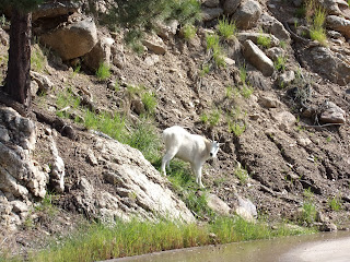
ponderosa pines and deep valleys that are home to abundant wildlife. We found
mountain goats waiting to enter a one-way tunnel and just munching grass along
the side of the road. Mountain goats were not found in South Dakota until 1924,
when they were introduced into the Black Hills. They can be found in in the
granite outcroppings and crags around Black Elk Peak (formerly Haney Peak,)
Needles and Mt Rushmore areas. They are an all-white mammal that feeds on
grasses, ferns, moss and lichen among other high-elevation plants. Both sexes
have sharp, slender, black horns.
Custer State Park is a 71,000 acre paradise. Besides
wildlife, the park is home to the Black Hills Playhouse, one of the oldest,
continually running summer stock theaters in the county. They produce four
productions, during June, July and August.
We made a rest stop at Legion Lake Lodge. It is named for
the American Legion Post that once leased the land, Legion Lake is a quiet
lakeside retreat.
The Custer State Park South Wildlife Loop travels 18-miles
through the open grasslands and pine-speckled hills that much of the park’s
wildlife call home. The park is defined by towering pines, gentile flowing
creeks and the massive granite outcroppings around every curve. However, taking
center stage in this transcendent landscape is one of the most powerful icons on
the American West, the bison, the unchallenged master of the Wild West.
We got to see the herd of 1,300 majestic Bison, we actually encountered
a roadblock of grazing Bison. These animals played a vital role in the lives of
Native Americans by providing food, clothing and shelter. These bison, more
commonly called buffalo, roam free in Custer State Park.
They can grow to
six-feet tall and weigh more than 2,000 pounds. They are considered the largest
native terrestrial mammals of North America. Bison have a short tail with a tassel,
a hump at the shoulders, curved black horns on the sides of their head and
dense shaggy dark brown and black hair around the head and neck, which tends to
look like a beard.
There were once millions of bison, but by 1900 it is estimated
that fewer than 1,000 bison remained on the entire continent. Peter Norbeck,
often known as the “Father of Custer State Park,” recognized the situation and
decided to take action to preserve this native beast. In 1914, the park, then
known as Custer State Game Sanctuary, purchased 36 bison to start its herd. By
the 1940s, the size of the herd swelled to over 2,500. The herds are on their
own to forage. The park does not supplement their food supply.
The herd soon began to overgraze the park’s rangeland and
the bison numbers were lowered. The park began to gather the herd in the 1960s
when the decision was made to reduce the herd and eradicate brucellosis from
the herd. The herd was certified brucellosis free in 1965, allowing the sale of
live animals.
Each year during the roundup, the size and the structure of the
bison herd is adjusted according to predicted availability of grassland forage.
Every spring the birthing season rejuvenates the herd size to around 1,300 or
1,400.
I saw some pronghorns in a field. They are commonly referred
to as antelope due to their similar appearances, live on the open grassland.
The name pronghorn comes from the buck’s large pronged horns. The horn sheaths
are shed each year. The fastest land animal in North America, pronghorns can
run 60 mph for great distances.
We saw some burros on the edge of Custer State Park. These
hoofed animals are not native to the Black Hills. They are descendants from the
herd that once hauled visitors to the top of Black Elk Peak. The rides were discontinued
years ago and the burros were released into the park. You can see, that they
are not afraid of people and people are not afraid of them!
The Iron Mountain Road (US 16a) portion is also home to the
tunnels blasted into the rock, that frame the faces of the Presidents on Mt
Rushmore. The drive also has the world-famous pigtails bridges, designed by CC
Gideon, a man with only an eight-grade education.
Iron Mountain Road is a very scenic drive, in only 17 miles
the road has 314 curves, 14 switchbacks, 3 tunnels and 3 pigtails, turns which
loop over their own road, allowing the road to climb rapidly. The road encompasses
miles of stunning views through twisty hair pin corners, high elevations and
steep grades. This scenic road winds round and round to the 5,445-foot summit.
It winds its way through Black Hills National Forest and Custer State Park and
past Mount Rushmore National Monument. The road is famous for its views,
horseshoe curves, and the three places it makes 360 degree turns (where the
road completely circles around and passes over itself) also known as the
world-famous pigtails.
A quick glance at the map, at its sheer drops and serpentine
twists and turns, confirms that this is no hype. It was designed to be slow
going – roll your window down, feel the wind in your hair, smell the pine trees
and enjoy. The other features of the road are two narrow one-lane tunnels on
the north side of Iron Mountain that are aligned with views of the Mount
Rushmore National Memorial.
Our first glimpse of Mt Rushmore was after we passed through
one of the tunnels on the Iron Mountain Road. It was amazing!
We drove to the
National Monument to see it up close, during the day. From 1927 to 1941 Gutzon
Borglum and 400 workers sculpted the colossal faces of Washington, Jefferson,
Roosevelt and Lincoln. He wanted to highlight the first 150 years of the great
experiment in democracy that is America. Mt Rushmore stands not only as a
rock-solid reminder of our national pride, but as a monument to the patriotism
and stubborn determination of a sculpture and the local crew of miners he
guided in carving a mountain into one of the wonders of the world.
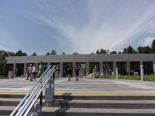
We took a stroll on the Avenue of the Flags. Flags are
powerful symbols, which remind people of their common heritage, history and
ideals. An aisle of 56 state flags and territories established in 1976 as part
of the celebration of America’s Bicentennial. It was at the request of a guest.
The flags are arranged in alphabetical order.
Then we got our up close view of the 60-foot faces of the four United States
Presidents are towering high above the treetops and share an impressive tribute
to the freedom and democracy in America. These giants measure 250 feet across. They
are scaled to a man who would stand 465 feet tall! An interesting fact, is
these four presidents faces would fit on the face of the Crazy Horse National
Monument.
The mountain was names after Charles Rushmore, a New York
lawyer investigating mining claims in the Black Hills in 1885. Borglum chose
this mountain due to its height (5,700’ above sea level,) the soft grainy
consistency of the granite and the fact that it catches the sun for the
greatest part of the day. The Presidents were selected on the basis of what
each symbolized: George Washington, the struggle of independence; Thomas
Jefferson, the idea of government by the people; Theodore Roosevelt, the twentieth century role of the US in world affairs; and Abraham Lincoln, ides on equality
and the permanent union of the states.
Following Horse Thief Lake Road (South Dakota 244) completes
the oval-shaped loop through the most rugged landscape in the Black Hills. We
have seen picturesque lakes, impressive granite formations, picture perfect
tunnels and a National Monument that left us speechless. And to think, we get
to go back to that monument tonight and regale in its beauty again.
We enjoyed an authentic Chuck Wagon Dinner Show. Everyone
that works in this show earns their living in the agriculture industry.
A
two-team horse drawn covered wagon picked us up and took us along rutted back
roads to reach the mountainside meadow encampment.
We enjoyed western music and
cowboy storytelling throughout the evening.
Our chuck wagon dinner included
fried potatoes, cowboy beans, and a choice sirloin steak.

The fried potatoes
and beans were cooked in huge dutch ovens, the steaks were cooked on a large
grate over the open fire. It all was delicious and plentiful!
We headed to Mt Rushmore, as a group, to see the majestic sight at night. We were amazed again at the view of the faces from the Grand
View Terrace, yes it is a grand view!
We took seats in the Amphitheater for the
evening performance. The lighting ceremony is the most spectacular program at
Mt Rushmore. We watched a 20-minute film about Mt Rushmore, then huge banks of
LED lights dramatically reveal the four Presidents faces, stark white against
the black South Dakota sky. That is when everyone’s hearts swelled with patriotism.
You could hear a pin drop. The military was honored on the Ampitheater stage as the
flag was retired. It was a moving tribute to the selfless service of all the
military men and women!
Another amazing day with the Yankee RV NW Expedition Caravan!


No comments:
Post a Comment