

We crossed the "Lion Bridge" and passed the Castillo de San Marcos. It is a 17th-century Spanish stone fortress with views of the St. Augustine Inlet.

This massive fortress was built to protect the city from foreign invasions during Spanish rule and is the oldest remaining European Fort in the USA. It is an amazing structure made of coquina stone.
We took 295 around Jacksonville and got onto Highway 17. We will travel on Highway 17 for most of the trip today. US 17 was one of the original routes of the US Numbered Highway System, which was established in 1926. Jacksonville is called The River City for good reason. The wide St Johns River bisects this sprawling city and runs into the Atlantic Ocean to the east while the whole of a large St Johns tributary, the Trout River, lies completely inside the Jacksonville city limits. Add a high water table and land that, at its highest point, is only 40 feet above sea level, and you have a very watery place that's prone to flooding, with more than 13 percent of the sprawling city's 875 square miles, the largest surface area of any US city in the lower 48, under water.

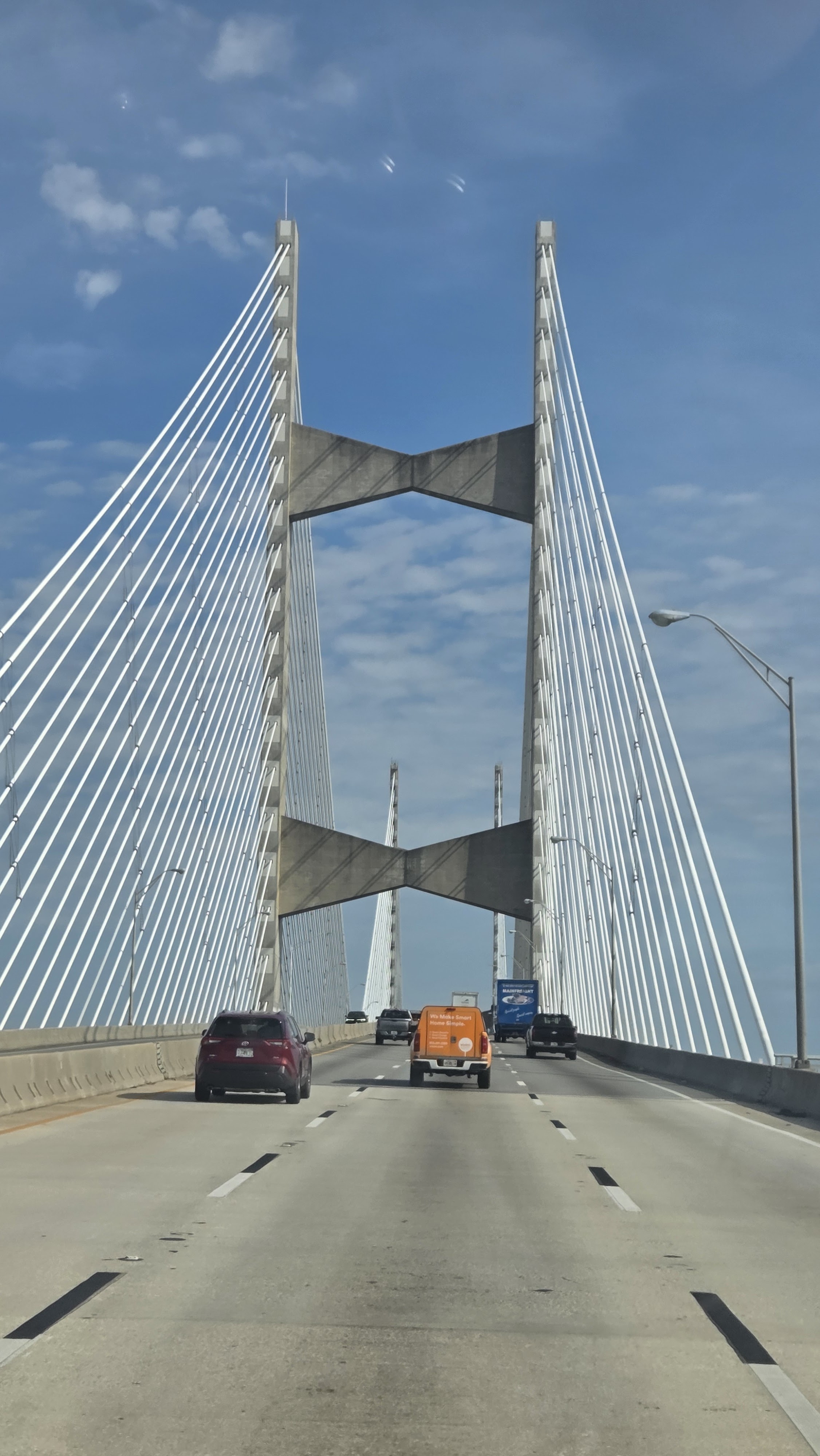
Jacksonville has seven major bridges over the St Johns River and one over the Trout River for a total of eight major bridges for road traffic in Jacksonville. We crossed the Napoleon Bonaparte Broward Bridge (or, the Dames Point Bridge) over the St John’s River. At two miles long, the Dames Point Bridge is the longest concrete cable bridge in the United States. It seems to be a popular place for ghosts. The 1988 structure is said to be haunted by an African-American woman whose apparition is seen walking along the bridge. Reports say she died when she was thrown over the bridge by an unknown attacker. Several others are rumored to have intentionally jumped from the bridge.


This route is also the Gullah Geechee Cultural Heritage Corridor. It is a federal National Heritage Area and it was established to recognize the unique culture of the Gullah Geechee people who have traditionally resided in the coastal areas and the sea islands of North Carolina, South Carolina, Georgia and Florida. Throughout the Gullah Geechee Cultural Heritage Corridor today there are vibrant and historic Gullah Geechee communities to visit.
Kingsland, Georgia, has a rich history, rooted in its location within Camden County, one of Georgia's oldest counties. The town's history includes significant roles in the War of 1812, the story of influential families like the Joseph family, and the legacy of the Kinlaw Rosenwald School. Kingsland was named after William Henry King. The town was founded in 1894 and incorporated in 1908.

All along these marshes we saw signs for shell recycling locations. Shucked oyster shell are needed to cultivate and restore oyster beds. Shells need to be returned to the estuary to provide a suitable surface to attract juvenile oysters. More often than not, the shell ends up in driveways and landfills. Recycling your shells will help restore, preserve, and enhance the state's inshore marine habitat. Oysters reefs provide habitat for fish, shrimp, crabs, and other animals.


Gary & Sheryl enjoyed the drive along this two lane road. Sheryl especially liked the tree canopies that we drove under several times along this trip.
No comments:
Post a Comment