
We stayed at Laurel Branch Campground a Corps of Engineer park on Rough River Lake.


The Rough River Lake is a Y-shaped reservoir. During the summer the lake is about 5,000 acres, has 220 miles of shoreline, is 39 miles long, and is 65 feet deep in the deepest portion of the lake, which includes the area around the dam. During the winter the lake decreases to 2,000 acres.

We departed Laurel Branch this morning on KY 259. It is a 95-mile-long state highway that traverses five counties in west-central Kentucky. We were on it for only about 10-miles, before it T'd and ended at US 60.
.jpg)
US 60 is the longest route in Kentucky, running 495 miles across the width of the state, passing through 22 of Kentucky's counties. Driving along US 60, we saw a ton of farm land and lots of grass, but no Kentucky Bluegrass, just green grass!
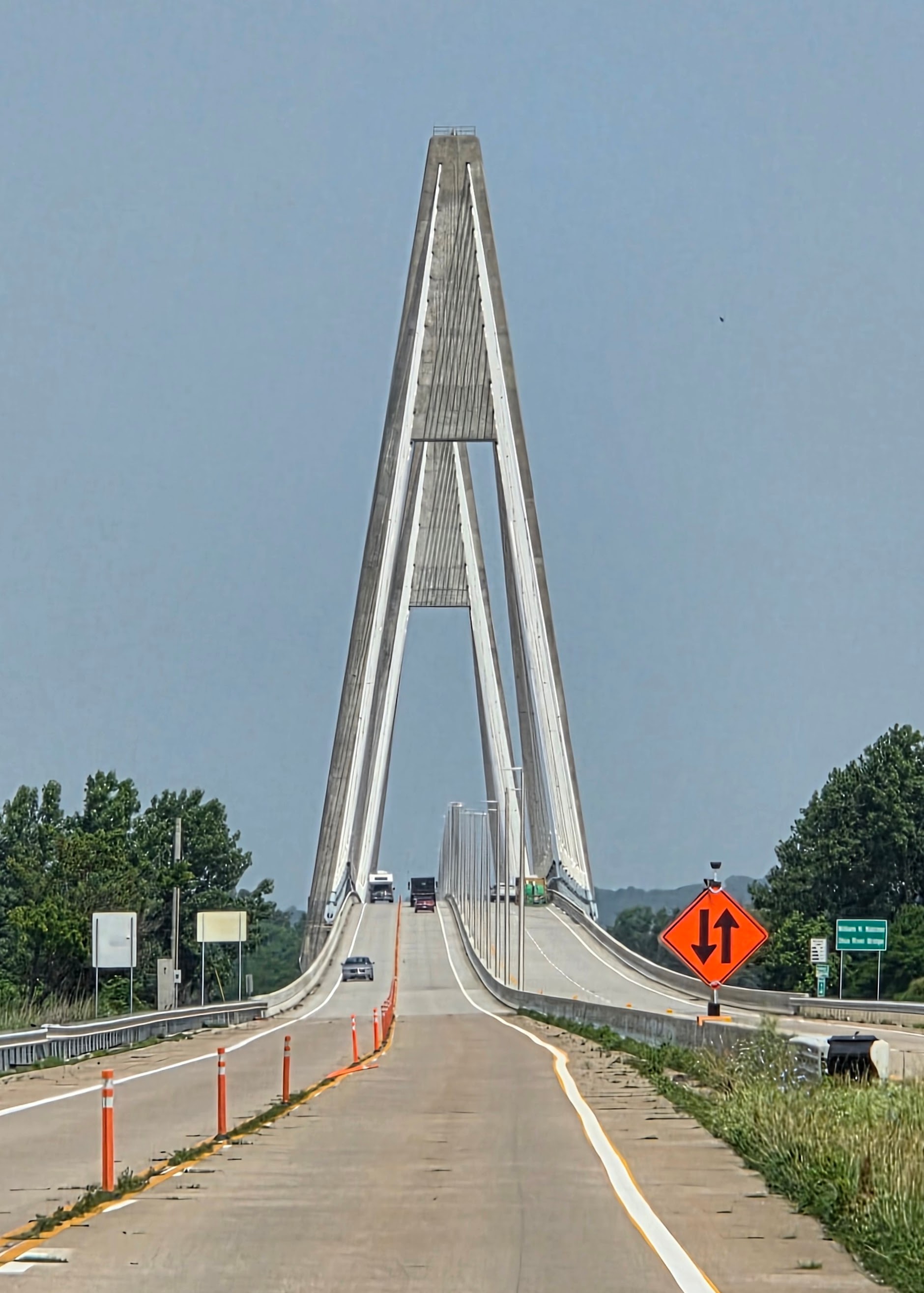

In Kentucky, US 231 was originally signed as Kentucky Route 71, one of many charter routes of Kentucky's statewide system of highways when it was established in 1929. US 231 enters Indiana on the William H. Natcher Bridge over the Ohio River from Kentucky. The road enters as a four–lane divided highway and immediately has a folded diamond interchange (also called a "parclo" interchange) with State Road 66.

Rockport Power Plant or the Rockport Generating Station is a coal-fired power plant, located along the Ohio River near Rockport, Indiana. The two identical non-cyclonic Babcock & Wilcox units were launched into service in December 1984 and December 1988. They are among the largest coal units built. The plant is connected to the grid by 765 kilovolt transmission lines (the highest rated voltage used in the US). The power plant features the tallest smokestack in Indiana, and is one of the tallest smokestacks in the world at 1,038 feet.

Traveling on Indiana State Route 66 it is part of the Ohio River Scenic Byway and the Lewis & Clark National Historic Trail.
The Ohio River Scenic Byway in Southern Indiana is your gateway to adventures, with 302 miles of scenic roadway to explore, you can take a journey along the river and into the Heartland.
In Indiana, the Lewis & Clark National Historic Trail follows the Ohio River from the Indiana/Ohio border, to Clarksville, then southwest towards Indiana's toe.

We headed into our home for the next few nights. We are staying at Miles Landing with Debbie and Jim.

Our night was complete, when we got the "Taco Tuesday" gang back together. We are just in Evansville Indiana instead of Zephyrhills Florida!

It is great to see Larry & Marcia! After they enjoyed margaritas and we all enjoyed chips & salsa and tacos we headed back to their place for more conversation. The company was awesome for our Taco Tuesday, but a bill for two people that was less than $15 was better yet!
Stay tuned for more Two Lane Adventures!
No comments:
Post a Comment