Monday, October 9, 2017

Sunday 9/17/17 - Bluegrass, Rallies and more Rallies, Our Trip South

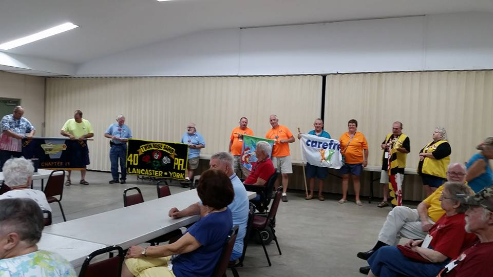
We departed the Lebanon Expo Center and Fairgrounds and 
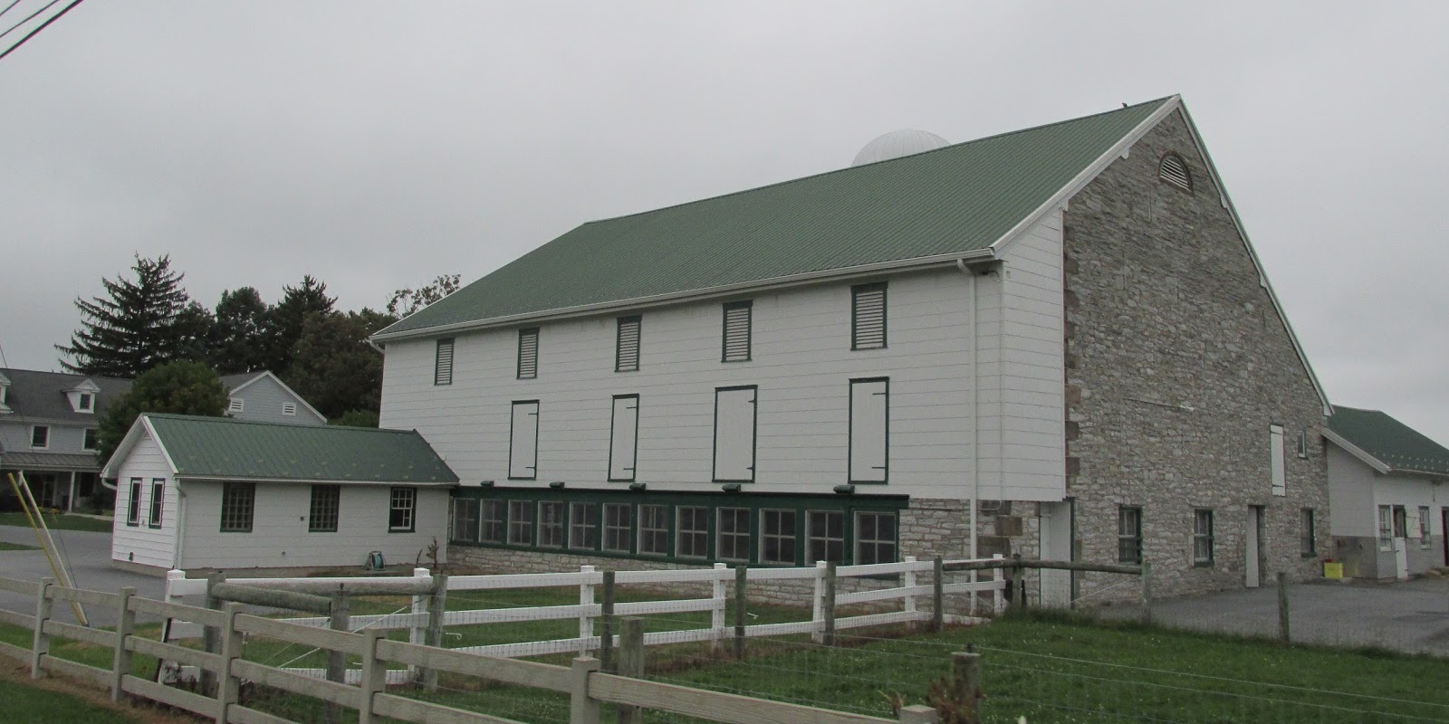
followed Route 72 to Route 322. There were many Amish farms here and the original stone work in the barns and homes are meticulously maintained.

The town of Campbelltown, Pennnsylvania was laid out in 1760 by John Campbell. At this period there were several buildings erected, all subject to ground rent. The town was no doubt "extensively laid out," and as was the custom at that time the lots were disposed of by lottery. The principal Scotch-Irish settlers in this locality were the Campbells, Semples, Pattersons, Mitchels, Sawyers, McCallens and Logans. The latter family was the last one left of the old Scotch Presbyterian element. The oldest house is still standing, and was the building where the earliest tavern and store were kept. The post-office was established in 1811, with John Wolfersberger as postmaster. The Salem Lutheran and Reformed Church was built in 1845 on the site of the old church erected over a century and a quarter ago. In this year the church was torn down and rebuilt on the same site, it is now a modern stone structure. The corner stone was laid in July, and it is now known as the Salem Reformed Church.

Today, we traveled all the way through Hershey. We passed the Penn State Milton S. Hershey Medical Center and the Ronald McDonald house. The Pennsylvania State Police Academy is located north along Hersheypark Drive. Hershey is also home to four world-class golf courses, a few museums, and an opulent spa. Hersheypark Stadium hosts concerts and sporting events, with a capacity of 30,000. It is also the venue of the annual Cocoa Bean Game between the Hershey High School and Milton S. Hershey High School football teams. Hershey is also home to the AACA Museum, operated by the Antique Automobile Club of America. The museum is dedicated to the preservation and presentation of vintage automobiles and their vast history. It is a proud affiliate of the Smithsonian Institution and offers a world-class automotive experience. You can explore numerous vintage vehicle displays and interactive exhibits featuring cars, buses, motorcycles, and other automobiles from the 1890s through the 1980s. It is a one-of-a-kind journey of discovery and entertainment for all visitors. As you make your way through the museum, you’ll discover a number of vintage automobiles in unique scenes and settings.

Indian Echo Caverns is a show cave near Hummelstown, Pennsylvania. The limestone caves are open for the public to visit via guided tour. The entrance to the caverns is located in a bluff along the Swatara Creek. A second entrance was sealed when the caverns were commercialized in the late 1920s. Given the large and accessible natural openings the caverns were likely utilized by Native Americans for storage and shelter, however no evidence of such use has survived. The location was previously known as Wilson Cave, Hummelstown Cave, Stoverdale Cave, Giant's Cave, and Indian Cave. When it was commercialized it was renamed Indian Echo Cave or Caverns. Rumors suggest that for nineteen years (1802–1821) the caverns were the home of William Wilson, known as the Pennsylvania Hermit. Wilson withdrew from society after his failure to halt the execution of his sister Elizabeth for the murder of her twin sons. Following her death in Chester, Pennsylvania in 1786, William wandered westward across southeastern Pennsylvania, settling in the caverns in 1802.

In Harrisburg, Pennsylvania while crossing the Susquehanna River, I shot a few pictures. I our picture, you can see a series of bridges. We are on the Capital Beltway Bridge the first bridge you see is the Cumberland Valley Railroad Bridge, Piers from the never completed South Pennsylvania Railroad Bridge, next is the Philadelphia & Reading Railroad Bridge, then the Market Street Bridge and if you look closely, you can see glimpses of the Harvey Taylor Bridge. I wish it was a sunnier time, this picture would have been awesome!

Outside of Harrisburg, we picked up US 15 South and into Gettysburg, Pennsylvania. Where you can visit the Gettysburg National Military Park. It protects and interprets the landscape of the 1863 Battle of Gettysburg during the American Civil War. Some call it the most decisive battles of the war. The size of the park has grown over time, thanks to land donations, land purchases, and federal eminent domain taking of other land. The park now totals, just shy of 4,000 acres. The properties include most of the Gettysburg Battlefield, many of the battle's support areas during the battle and several other areas associated with the battle's "aftermath and commemoration", including the Gettysburg National Cemetery.

I truly enjoy crossing from one state into another … on Route 15, we crossed from Pennsylvania into Maryland. The mile makers signs that say zero are amusing too, but I guess you have to start from 0 to go any higher!

On Route 15, we entered historic Emmitsburg, Maryland. Emmitsburg was named for its founder, William Emmit in 1785. However, settlement preceded the town, particularly since British authorities restricted colonists' expansion during and after the French and Indian War. Settlement began in the region during the 1730s, bringing Protestant Germans and Scotch-Irish from Pennsylvania, as well as English Catholics from Tidewater Maryland. The Union fortified Emmitsburg to stop the Confederate invasion of the Union territory in June 1863 during the American Civil War. Half the town was burned to the ground in a mysterious fire on the night of June 23. Folklore has it that 'The Great Fire,' as it was known, was started by a Union sympathizer to prevent advancing Confederates from taking supplies from the town. However fate spared the town a battle between the opposing forces, which instead took place north of it in Pennsylvania near the town of Gettysburg. The town was briefly held by the retreating Confederates on July 4. The Emmitsburg Historic District was added to the National Register of Historic Places in 1992

Mount St. Mary's is home to the National Shrine Grotto of Our Lady of Lourdes, a Catholic pilgrimage site devoted to the Blessed Virgin Mary that draws thousands of visitors annually. The Grotto is described as "a place of pastoral beauty and spiritual inspiration ... situated high on the mountainside where nature displays itself in all its wild and picturesque glory." The sixty acres of grounds include lush gardens, a pond, rosary paths, the Stations of the Cross, devotional areas, a scenic overlook, and St. Mary's Chapel on the Hill (also known as the Glass Chapel). Grotto water flows from taps located around a fountain pool, and chaplains are available to bless the water for visitors. Father John Watterson had the stone Grotto cave built in 1875 as a replica of the miraculous Our Lady of Lourdes in France.

The Grotto was first established on St. Mary's Mountain in 1805 by the university's founder, Father John DuBois. According to legend, Father DuBois was attracted to a light on the mountain and found a blessed spot and sat down at the foot of a large oak tree beside a stream. He made a cross of twigs and fixed it to the tree to be the symbol of the holy work he was undertaking. This was the original Grotto. Father Simon Bruté was an early steward of the Grotto. He created pathways throughout the grounds and attached crosses to the trees that now line the Stations of the Cross along the entrance. Saint Elizabeth Ann Seton attended Sunday Mass at the Grotto chapel. 

In 1958, the Grotto was refurbished and made more accessible to the public by Father Hugh J. Phillips, who became known as the "Restorer of the Grotto." The Grotto was proclaimed a Public Oratory on December 8, 1965, by Cardinal Lawrence Shehan, archbishop of Baltimore. On November 27, 2007, Bishop Jacques Perrier of the Diocese of Tarbes-et-Lourdes in France visited the Mount St. Mary's Grotto and gave the gift of a stone excavated from the original Grotto in Lourdes, France, in order to "spiritually connect" the two places.

US Route 15 is also known as America’s By-way, we also saw a sign that said “Hallowed Ground.” I wonder why? In October of 2009, an 180-mile long route of US Route 15 was designated as the Journey Through Hallowed Ground National Scenic Byway. This is one of the highest designations the Secretary of Transportation can bestow upon a public road and is a tribute to the local communities along the route. The Journey Through Hallowed Ground National Scenic Byway is the primary touring route where you can explore this scenic and historically rich landscape that has seen more of the blood, sweat, and tears of American history than any other part of the country. The Byway is an inspiring and relaxing travel experience highlighting the natural beauty and historic character of the corridor. The route has stayed largely rural interspersed by towns with vital and interesting Main Streets and beautiful views of the Blue Ridge and Piedmont landscapes.

We crossed the Potomac River, which is symbolically the Maryland and Virginia state line - The exact line where Maryland ends and Virginia begins is a question the likes of George Washington and King Charles have wrestled with. Is the border at the Potomac River’s edge? Maybe the low tide waterline? Or perhaps somewhere in between? Add Maryland’s Court of Special Appeals to the list of those who have weighed in on the issue. It took on a case that questioned whether river rafters were trespassing on a Maryland company’s property when swimmers exited the water on the Virginia banks. The court upheld the status quo, affirming Maryland’s ownership of the Potomac riverbed, while acknowledging that the border between the states follows the river’s edge despite fluctuations over time in its flow. It is amazing what ends up in our court systems!

In Leesburg, Virginia we found Oatlands Historic House. Oatlands is a National Historic Landmark, the highest designation given by the National Park Service. In 1798 a young bachelor named George Carter inherited almost 3,500 acres of prime Virginia farmland.  Carter was a descendant of one of Virginia’s first families.  Oatlands had based its plantation economy on wheat production, and eventually Carter branched out to grow other small grains; raise sheep for their wool; and build a mill complex on nearby Goose Creek.  The success of Oatlands depended upon a slave economy; by 1860, the enslaved community at Oatlands numbered 133 men, women, and children.  

George Carter designed and built Oatlands House and Garden. In the style of Tidewater Virginia and its English antecedents, Carter placed his formally organized garden near his house. The structure of the garden is comprised of terraces carved into the hillside to provide level areas for abundant plantings of fruit and vegetables along with trees, shrubs, and flowers. Even now, Carter’s steps and landings provide access to these same terraces. Cut from locally quarried stone, these steep steps are major axial walkways. He constructed and planted his garden with self-sufficiency and beauty intertwined. As one wanders through the garden, sweeping views of the surrounding hills and woods may still be seen even though the garden perimeter is enclosed by the Garden Dependencies together with the Garden Wall. Built with brick fired on the plantation and indigenous stone, the structures define the outer perimeter of the garden and shelter the garden plants.

In 1903 prominent Washingtonians, William Corcoran Eustis, and his wife Edith Morton Eustis purchased Oatlands as their country home.  Following Edith's passing in 1964, the family donated the property to the National Trust for Historic Preservation in 1965. In spite of the garden’s neglected state, Edith Eustis saw the garden ruin as a quiet, still, mysterious place harboring “old secrets” that inspired her to fill Carter’s terraces with boxwood-lined parterres full of fragrant and colorful flowers such as tulips, peonies, iris, and lilies. Romantic plant containers, statuary, and structures were added. The rose garden and a memorial to a daughter of Mrs. Eustis also became garden elements. Under her care, Carter’s terraces were revived with ornamental charm typical of the Colonial Revival Style popular in her time. Edith Eustis took pleasure in transforming Carter’s garden.


We arrived at Greenville Farm Family Campground in Haymarket, Virginia. This campground is celebrating its 50th anniversary! We assumed it would be near a farm. But we did not realize that it would be on the farm! With over 125 sites, we had plenty to choose from! There were ample pull thru sites, some had more tree cover than others. 

Friday, September 29, 2017

Wed 9/13 – Sun 9/17/17 - Bluegrass, Rallies and more Rallies, Our Trip South

Departed PA Dutch Country Campground, an Encore Thousand Trails park to make our way to the Pennsylvania State Good Sam Rally. It was a long commute … about 6 miles. Charlie and I had a debate … hook up and tow the jeep or not … no, not really! He said he would drive the jeep and I would drive the RV. I reminded him about the narrow bridge, because of bridge work and he agreed that maybe he should drive … no need for a new paint job! LOL

We came out of the campground onto Route 72 N and we took that road all the way to our turn onto Rocharty Road. I love this area, where we can see and marvel at the simple life of these neighbors! Arriving at the Lebanon Expo Center and Fairgrounds a quick 10 minutes after we left! Gotta love those long moves!

Since the move was so quick, we might as well talk about the Pennsylvania Good Sam Rally. After we never got notification that the Delaware State Good Sam Rally was cancelled, we were nervous about this one. But, we reached out to the State Director and verified that they were a go!

It was definitely the smallest state rally we have been to, with less than 40 rigs. They aligned their event with the largest RV show in the Northeast, the Hershey RV Show. But the alignment, did not help with the attendance at the Rally. We did have friends, that have been following us or we have been following them … since last spring at this Rally. 


Hello Joe & Debbie Trice!


We also had two visits from members of our Good Sam Chapter and residents at Majestic Oaks, Bill & Debbie Schaffer! They visited one day and then hit the RV show. Then they came back on Saturday for more fun at the Rally! We enjoyed simple breakfasts every morning at the Rally.

Everyone from Pennsylvania and surrounding states that attended the Rally were very nice and accommodating. We did learn a few new card games … we played a Horse Race Card Game and a Chicken Round-up Card game. I will have to look up the rules … I think both were played with dice as well! We played Euchre and they wanted to teach us 500, but too much to learn! Bill knew how to play 500, so he played and he won! Great job Bill!

There was one table for the Flea Market and one vendor, but the Chapter Raffles were plentiful! Most of them were a 50/50. 


Friday was the opening ceremonies. We marched in the parade to represent Carefree Sams, but spoke about the Florida Rallies! There were two Pennsylvania Chapters that marched, two out of state chapters and one state, Maryland.


There was one chapter raffle for a quilt, a member of the R&R Sams from Maryland won it. 


Anyone that has attended a Florida, Georgia, or Tennessee Rally knows that there should be so much more!  At the closing ceremonies it was discussed how to increase their chapter numbers and their rally attendance numbers

We had two pot luck meals and both we awesome, with an overabundance of food! They had adult crafts on Friday and Saturday, both sessions were well attended. I am not a crafty person, bit Debbie attended Saturday’s craft session and she was able to do Friday’s craft on Saturday! We did get to see someone launch a balloon from the parking lot at the Expo Center.


Saturday night, we enjoyed the 2nd Look Band, under the outdoor pavilion. 
They were good and played a variety of country and old time rock-n-roll! There was some dancing involved!

Sunday morning came quickly and there was a musical worship service, before the closing ceremonies. The closing ceremonies is when they gave out the door prizes.

If we were in the area at the time of another Pennsylvania Good Sam Rally, we would attend!

Monday, September 25, 2017

Mon 9/11 to Wed 9/13/17 - Bluegrass, Rallies and more Rallies, Our Trip South

We stayed at the PA Dutch Country Campground, it is an Encore Thousand Trails park, for 3 nights. During our stay we played tourist at a few area attractions around and in Hershey, Cornwall and Lebanon. Oh, it is some beautiful country ... but fall is fast approaching!

We went to downtown Hershey Pennsylvania. It is popularly called "Chocolatetown, USA" it is also referred to as "The Sweetest Place on Earth." The community is home to The Hershey Company, which makes the well-known Hershey Bar and Hershey's Kisses. Hershey Entertainment and Resorts Company owns and operates Hersheypark, Hersheypark Stadium, and other attractions such as ZooAmerica and Hershey Gardens, and is a major employer of the community and surrounding area. I heard that you can smell the chocolate in the air and yes you can ... but my bubble was burst when someone told me it was a scent in the light poles that gives off the scent!

Hershey's Chocolate World was built as a replacement of the Hershey chocolate plant tour, which had reached its capacity and was no longer able to handle the large numbers of visitors per year. The facility opened on June 30, 1973, and took inspiration from World's Fair pavilions. Through its first year of operations, Chocolate World had over 1.4 million visitors. By June of 1986, the visitor's center welcomed its 20 millionth visitor. The building features brownstone quarried out of Hummelstown, a neighboring town. 

Inside, we enjoyed reading about the history of Hershey. The walkway to get to the Chocolate Tour was long, and we could have zipped right through it. But we took our time reading everything chocolate! Well, not everything ... since Hershey does make Twizzlers! 

On the Hershey’s Chocolate Tour and followed cocoa beans on a delicious journey in an immersive chocolate making adventure. We could see, feel, hear and smell the transformation of cocoa beans to Hershey’s famous chocolate on this fun tour. We rode in a cart, like in an amusement ride and followed the cocoa bean through the process!
We walked through the largest candy store offering an abundance of Hershey’s favorites including a sweet array of seasonal treats, classic varieties and Hershey’s Chocolate World exclusives. The two things I wanted, we could not find … salt & pepper shakers and a sticker for the camper! It was much more commercialized than I had hoped for, but it was not crowed the day we went and I am glad we did it!

On our way to and back from Hershey, we passed through the Milton Hershey School, you know me … I had to learn more! The Milton Hershey School is a private philanthropic boarding school. Originally named the Hershey Industrial School, the institution was founded and funded by chocolate industrialist Milton Snavely Hershey and his wife, Catherine Sweeney Hershey. The school was originally established for impoverished male orphans, while today it serves students of various backgrounds. The school currently serves more than 2,000 students, it is the largest residential education program in the US.

The Milton Hershey School Trust, which funds the school, owns controlling interest in The Hershey Company and owns the Hershey Entertainment and Resorts Company. With over twelve billion dollars in assets, the Milton Hershey School is one of the wealthiest schools in the world. Hershey spends about $110,000 a year per student, according to its nonprofit IRS tax filing, more than the nation's most expensive and elite prep schools. On November 15, 1909, Hershey signed over the 486-acre farm where he had been born, complete with livestock, to start the school. In 1910, Nelson (age 6), and his brother Irvin (age 4) were the first to arrive. Their father, who had worked as a polisher in a Mount Joy foundry, had died after a long illness, and their mother couldn’t support six children by taking in laundry. Their brother William, 2, was too young to be admitted for two more years. Another pair of brothers, sons of an Evangelical church’s pastor, arrived a few days later. The first class consisted of 10 students, and by 1914, there were 40 boys enrolled in the school.

While Hershey consulted with experts on managing the school, he used three guiding principles to ensure the students had a good education, a sense of stability and security: every graduate should have a vocation, every student should learn love of God and man, and every student should benefit from wholesome responsibility. The vocational education program started with a woodworking shop, where the boys made their own beds and chests. Starting in March 1929, the boys got the responsibility of doing daily chores in the dairy barns. 

After Kitty’s death in 1915, Hershey gave his entire personal fortune - thousands of acres of land, and controlling interest in the company, worth US$60 million - to the school. He continued to be involved in the school’s operations until his death in 1945. The organizational papers were modified in 1933, allowing the school to accept older students, and again in 1951 to change the name of the school from the “Hershey Industrial School” to the “Milton Hershey School.” In 1968, the school was racially integrated, although it wasn’t until 1970 that the organizational papers allowed that, and another modification in 1976 allowed female students, who started arriving in 1977. In 1989, the school stopped requiring students to milk cows twice daily, reflecting a changed focus from vocational to college preparatory education, but students were still required to perform chores.

We also visited Cornwall Furnace in Lebanon, Charlie said it was too hot to go see a furnace! The Cornwall Iron Furnace is an amazing example of the furnaces that scattered the Pennsylvania countryside in the 18th and 19th centuries. Around them developed villages, artisans’ shops, stores, schools, churches, and the home of the wealthy ironmaster. All of the raw materials necessary for the smelting process — iron ore, limestone and wood for charcoal, were found in this self-contained iron plantation. Cornwall Iron Furnace, the only surviving intact charcoal cold blast furnace in the Western Hemisphere, attests to the once great iron industry that flourished in south central Pennsylvania.

In the 1730s, Peter Grubb, a stone mason, began mining nearby. In 1742, he established the furnace. He named the area Cornwall in honor of the area in England from where his father had emigrated. Although the British Parliament attempted in 1750 to restrict production of iron in the colonies, the output continued to rise. The American colonies, with Pennsylvania being the top producer, smelted one-seventh of the world’s iron. When Peter died in 1754, the property passed to his sons, Curtis and Peter. By 1798, Robert Coleman had gained control of the furnace operation. Robert was very successful and became one of Pennsylvania’s first millionaires. This furnace remained in operation until 1883, when newer furnace operations fueled by anthracite coal made it obsolete. The furnace was abandoned, leaving the building virtually untouched until it was given in 1932 to the Commonwealth of Pennsylvania by Margaret Coleman Freeman Buckingham, Robert’s great grand-daughter.

In the mid-nineteenth century, Cornwall’s iron plantation contained industrial, residential, and agricultural activities. Small villages were created for furnace workers and miners. These stone and brick structures were simple in style but sturdy in construction. Many other structures built during this time period use a Gothic Revival architectural style. The ore mine, which continued to operate until 1973, is located just south of the furnace property. Bethlehem Steel acquired ownership of the mine between 1917 and 1922. Both strip mining and underground mining were used to extract ore from the ground. The open pit mine began to flood in 1972, and today the open pit is filled with water.

Speaking of Robert Coleman, the Cornwall-Lebanon Railroad was built with $1.2 million in the 1880s by this rich socialite. The railroad was used to carry passengers from Mt. Gretna, an extremely popular resort community of the time. Later the railroad was used to transport the Pennsylvania National Guard from their camp near Mt. Gretna. As time went on the railroad service stopped, which resulted in the rail being purchased by the Pennsylvania Railroad. This group continued use of the rail up until the powerful Hurricane Agnes devastated Lebanon County. The hurricane destroyed sections of the track in 1972. But, until the purchase of the track in 1999 the rail was certain sections were unused. Other sections were purchased by private individuals or used on the original property in which the right of way was leased. The Lebanon Valley Rails to Trails, Inc., led by John Wengert Jr., purchased the rail line and began construction of the Lebanon Valley Rails to Trails. 

Too bad we did not bring the bikes this summer! The Lebanon Valley Rail Trail (LVRT) is a National Recreation Trail. The rail trail goes from the southwestern border of Lebanon County and goes through Colebrook, Mt. Gretna, Cornwall, and the city of Lebanon. At the southern border of Lebanon County, Pennsylvania the LVRT connects with the Conewago Trail and continues for another 5.5 miles. The trail is partly built on the old Cornwall–Lebanon Railroad. The trail runs 14.5 miles, and there are many phases in development that would extend the trail to northern Lebanon County and Jonestown. The trail features a packed stone path and paved path at many parts that traverses "Pennsylvania Dutch Country" and other scenic routes. Trail users see untouched woodlands of state game lands, forests, and views of area fields and farms. The trail is maintained by dedicated group of volunteers, and allows for running, walking, biking, horseback riding, and cross-country skiing. We drove under one of the old rail road tunnels on Burd Coleman Road. You can see the original brick arch, especially on the south end. It was built around the 1860's and is still open to traffic. Overhead the former railroad bed is now the Lebanon Valley Rail Trail.

There was an over-sized root beer barrel at one of the rest areas on the trail. It was closed while we were there, but it looked like it might be a refreshment center. We also enjoyed one meal out at the Quentin Diner. It is a Mom & Pop style diner that was awesome! Charlie had Turkey and gravy, imagine that! I had the Cobb Salad. Both were delicious!

Sunday, September 24, 2017

Sun 9/10/17 - Bluegrass, Rallies and more Rallies, Our Trip South

We departed Killens Pond State Park, after 6 relaxing days in Delaware and back tracked north toward Lebanon PA.

In Smyrna Delaware you can visit Belmont Hall, one of the most historic houses in Delaware. In 1684 William Penn granted a 600 acre parcel of land to Henry Pearman who named his property Pearman’s Choice. 

Thomas Collins purchased 91 ½ acres of the original grant in 1771 from John Moore. At that time there was a house on the property that was referred to as “The Manor House near Duck Creek”. Collins finished building the Georgian house, as it stands today, in 1773 and named it Belmont Hall. Although the brickwork appears to suggest that the entire house was constructed at the same time, family history and architectural evidence indicate that Collins enlarged the dwelling by building the large front of the house. He connected the old and new parts of the house after making extensive improvements to the two older rear wings – a kitchen and a dining room with bedrooms above.

Collins held almost every office in Kent County, including Sheriff, an Assemblyman in the Delaware General Assembly, and Councilman. From 1772 until the adoption of the Federal Constitution, Belmont Hall was the scene of many patriotic meetings. Collins garrisoned his property and built a stockade around the grounds. The tower on the top of the house were erected at his direction and used as an observation post by sentries. As a member of the Assembly, Collins agreed to raise a brigade of local militia which was maintained primarily at his own expense while the war lasted. The only person to be unanimously elected by the Assembly, Thomas Collins had the honor of serving as the 8th President/Governor of Delaware from 1786 until his death in 1789. When Delaware became the first state to ratify the Federal Constitution on December 7, 1787, Governor Collins was pleased to be able to certify and sign the document.  Collins resided at Belmont Hall until his death on Sunday, March 29, 1789. He was the first sitting governor of Delaware to die in office.

John Cloak purchased the estate in 1827 from his cousin, William Collins, Thomas Collins’ grandson. His daughter, Caroline Elizabeth Cloak Peterson, inherited the estate in 1867, and continued his work. Caroline Elizabeth Cloak married Howard Peterson in 1862. When he died in 1875, three of their four children had already died in early childhood. She married Gideon Speakman in 1876. Caroline and Gideon had one son, Cummins Elliot Stockley Speakman. Caroline began an extensive “modernization” of Belmont Hall to reflect the aesthetic of the Victorian era in the 1870’s. She painted the exterior brown, added porches, a Florida room to the dining room, and remodeled the floor plan. She also created twenty acres of gardens, installing the two boxwood formations at the front and rear of the house. Mrs. Speakman encouraged the people of Smyrna to visit the “Belmont Park and Gardens” for walks, picnics, and ice cream socials on Sunday afternoons. She also organized the Elizabeth Cook Chapter of the Daughters of the American Revolution.  It was named after her great grandmother and was the second chapter formed in Delaware. In 1916, Cummins and his wife, Marjorie, purchased Belmont Hall from his mother. After Caroline’s death in 1920 the couple began to restore the house to its Georgian origins. Unfortunately, the house endured a devastating fire in January 1, 1922 that damaged the top two stories.  Cummins and Marjorie set about the task of restoring the house with the help of friends in Wilmington, especially the DuPonts. Restoration included removing many of Caroline’s Victorian modernization. Cummins and Marjorie Speakman worked tirelessly to maintain Belmont Hall.  Even after Cummins’ death, Marjorie carried on their efforts.   

Belmont might have been sold many years earlier if it had not been for the two businesses she started in Wilmington. She treasured Belmont and its history and made sure that all of her grandchildren knew their family history and appreciated the special historic place where they grew up. She was an exceptional woman for her time. After her death in 1978, her son and daughter-in- law, Walter and Virginia Speakman resided in the house until it was sold to the State of Delaware in 1987.

Driving down the road, a 5th wheel passed us that had lobster or crab traps strapped on the back ladder. I wonder if their trapping was successful?


Odessa, Delaware is home to the Historic Houses of Odessa. Known in the 18th-century as Cantwell’s Bridge, Odessa played a vital role in commercial life along the Delaware River as a busy grain shipping port. Today, you can stroll along tree-lined streets and admire examples of 18th and 19th century architecture. Chief among these are the five properties that make up the Historic Odessa Foundation. The properties managed by the organization include the Corbit-Sharp house, the 1769 Wilson-Warner House, 1700 Collins-Sharp House, 1822 Cantwell's Tavern, and 1853 Odessa Bank. Local patron H. Rodney Sharp restored several buildings in Odessa in the middle of the last century, helping to preserve the community's unique legacy.

The Collins-Sharp House c.1700, one of Delaware’s oldest structures, is a center for educational programming. The Corbit-Sharp House, furnished for the late 18th century period, is a historic house museum that is owned and operated by the Foundation. In 1845, a runaway slave named Sam was hidden by Mary Corbit behind this tiny door in the attic of the Corbit-Sharp house. When local authorities came looking for Sam, they did not consider checking behind such a small door. Sam was able to continue his journey north to Pennsylvania and freedom.

We crossed back into Pennsylvania from Delaware. There is a historical marker indicating that William Penn founded Pennsylvania as the Quaker Commonwealth in 1681.


We came through town, on the last day of the Mushroom Festival in Kennett Square. It all began when a small group of mushroom enthusiasts decided to have a festival to celebrate their number one cash crop with the hope of raising funds to give as scholarships to local high school students. In 1986 that became a reality as Kennett Square hosted its first Mushroom Festival. It was a one day affair and just one block long. Thirty-two years later the Festival stretches a mile and features culinary events, growing exhibits, children’s entertainment, and 250 vendors with attendance calculated at up to 100,000 guests. The Mushroom Festival's Grant Program has given $805,000 in grants to local non-profits since 2000.

Driving along it is evident that mushrooms are their number one cash crop, as there are Mushroom Farms everywhere! Kennett Square is king of fresh, commercially-grown mushrooms. Not only is mushroom farming the leading agricultural pursuit in Chester County, the area is also the largest producer of fresh mushrooms in the United States. Chester County’s 61 mushroom farms account for 47 percent of total US mushroom production. This means over 400 million pounds of mushrooms are produced. 
The industry directly employs almost 10,000 workers, mostly from the area’s large Hispanic community. The landscape surrounding the region is dotted with single-level cinderblock buildings — variously called mushroom “barns,” “houses” and “doubles” — where the mushrooms are grown. The roads themselves are packed with flatbed trucks carrying baled hay for compost, dump trucks carting steaming compost to and from the barns and, of course, panel-bodied trucks racing to deliver just-picked mushrooms to nearby processing facilities. 
And when all that compost is being turned and is particularly ripe, winds carry that particular, rank aroma that says, “phew … you are in mushroom country.” Fresh-mushroom production is both labor-intensive and mechanized. Compost, once made from horse manure, now begins as hay spread on concrete slabs. Nitrogen is added, and the compost is turned for several days until it is a steamy, smelly mass. It is then transported to mushroom houses, spread on growing racks and pasteurized before the delicate, disease-prone spawn are planted and topped with peat moss, limestone and water. 
A few weeks later, tightly clustered mushrooms start to appear. About 10 weeks after a crop is sown, mushrooms are hand harvested over a period of several days. Crews start picking as early as 4 a.m., and the mushrooms are rushed to modern processing centers. Within about 30 minutes of arrival, the mushrooms are cooled to 34 degrees and by that evening they are cleaned, packaged and on their way in refrigerated trucks to markets across the country. Mushroom growing started regionally in the 1890s as an adjunct business for greenhouse owners who sold fresh flowers to Philadelphia. Nearby horse farms and race tracks supplied manure for compost. Mushrooms were an attractive crop to the thousands of Italian families who migrated to the area in the first quarter of the last century, a population used to foraging wild mushrooms, and today many mushroom companies are owned by second-to-fourth-generation Italians.

The Gap Town Clock, built in 1892, is a Lancaster County Historic Preservation Trust Site located in Gap, Pennsylvania. According to the Gap Clock Tower Association. Many traveling from Central PA to the beaches of Delaware have passed this clock along SR 41, just off SR 30. The Gap Clock Tower Association recently added a new flagpole and flag on the clock property thanks to Gap Veterans of Foreign Wars, J.P. Bair II Post No. 7418. John Hilton has tirelessly wound the clock twice a week since 1979. The Gap Clock Tower Association has been in existence since 1953, when the clock had to be moved due to the widening of Route 41. They currently have approximately 120 members who are faithful in supporting the cost of paying for insurance, electricity and ground repairs. In the future, the old Seth Thomas Clock, purchased in 1872, will need extensive cleaning and repairs. With support from the community and continued support from the faithful members, they will be able to preserve the history of our time-telling landmark for future generations.
The historical marker reads: THE GAP CLOCK TOWER. Unique on American Highways, was erected by the people of Gap in 1892. It was restored in 1953. The clock's face, long telling the time to passing multitudes on the Newport Road, Overlooks, at the Gap, William Penn's Entrance into Conestoga, now Lancaster County, in 1701. The Gap Clock Tower Association.


We turned onto Route 322 W and then onto Route 72 South, arriving at PA Dutch Country Campground, an Encore Thousand Trails park. This will be our home for the next three nights, as we play tourist in the Hershey area!