Monday, July 29, 2019

Two Lane Adventure in New York – Saturday, June 8th 2019


Some of the group (Dana, Dawn and Sheila) went to shoot skeet at Addison Fish and Game Club. Well Dana went to shoot. Dawn and Sheila went to visit with other shooters and spouses. Dana is shooting in preparation for their Memorial Open he will shoot in next weekend. Others, Randy, Karen and Royce, stayed and enjoyed the quite at the campgrounds! Rick and Lynn took a drive on their own to explore the area! Rob, Sheila, Charlie and myself took a 
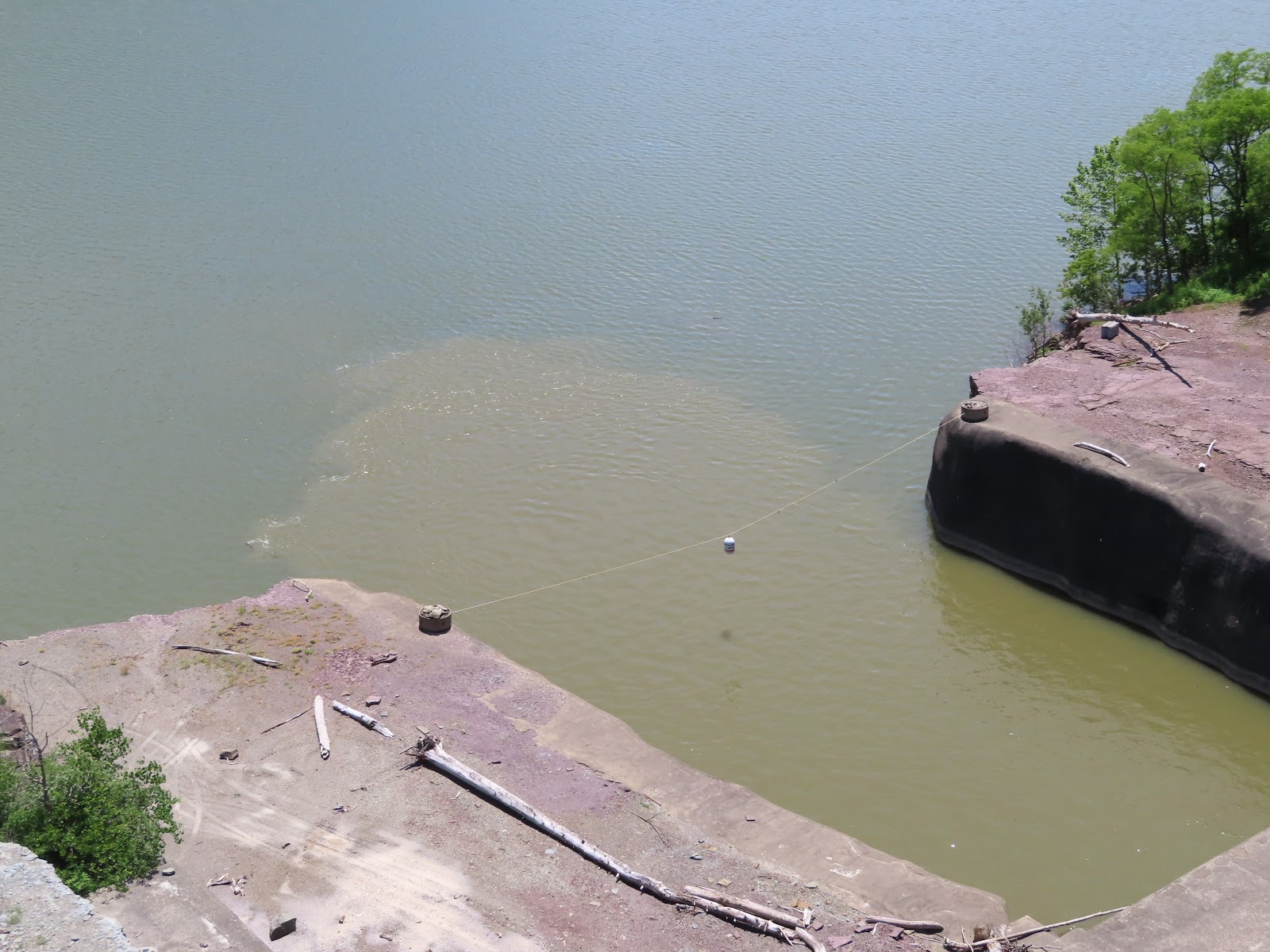
car ride with our cameras to the Tioga-Hammond Lakes and Dam. The beauty of north-central Pennsylvania is evident at Tioga-Hammond Lakes. They are surrounded by lush forested ridges, the lakes offers recreational opportunities for all.

The project is unique in that it consists of two separate dams, one on the Tioga River and the other along Crooked Creek.  The lakes formed by both dams are joined by a gated connecting channel. Why did they create the dam project? To answer that, we need some background.

The Upper Tioga River Watershed, which encompasses 280 square miles in northcentral Pennsylvania, is part of the Susquehanna River and Chesapeake Bay watersheds. The Tioga River Watershed makes up the greater portion of the county. The Tioga River proper begins in Bradford County and flows westward, near Blossburg it turns northward and flows that direction until it reached the Chemung River in New York State. The Cowanesque River Starts in Potter County, flowing eastward and joining the Tioga River near Lawrenceville. As recent as the 1970’s, the Tioga River supported Class A wild brook trout populations.  Today the Tioga River from the confluence of the Fall Brook tributary can no longer support aquatic life. Why?

In the early 1800’s, coal was discovered near Blossburg.  Deep and strip mining for coal were major industries in the region through the 1980s, with mining operations ending in 1990. When deep mining began in the watershed, entries into the mines were dug from below the groundwater table.  To keep the mines from filling with water, horizontal tunnels, known as drifts, were dug to allow water to drain by gravity out of the mines.  Water entering one mine could travel for many miles downhill collecting drainage from many other mine areas along the way before discharging in large amounts from a common opening.  Many coal seams are surrounded by pyrite-laden rock.  When pyrite is exposed to air and water in the deep mine, it reacts to form sulfuric acid that further dissolves metals in the surrounding rock.  The result is known as Acid Mine Drainage (AMD) pollution.  AMD has water quality characterized by low pH, high acidity, and high dissolved metals like iron and aluminum.

The devastation of the river’s water quality is the direct result of AMD pollution.  Some of the more heavily polluted tributaries have pH levels similar to battery acid. Remarkably, the tributaries entering the Tioga River north of Blossburg do not suffer from AMD pollution.  While these tributaries help to dilute the AMD polluted waters, the pollution emanating from the upper watershed is so severe that the river cannot recover and cannot support aquatic life. The Answer was the Tioga Hammond Dam Complex. The project was authorized by the Flood Control Act of 3 July 1958. Construction costs were more than $200,000,000. In nearly 40 years of operation the lakes have already paid for themselves in flood damage prevented. The two dams working together provide major flood control on the north branch of the Susquehanna River as far south as Wilkes-Barre, PA.

The Tioga Hammond Dam was constructed in 1978 and put into operation in 1981 as part of a flood control project.  The unnatural blue-green color that is frequently seen in Tioga Lake is due to the precipitation of aluminum which results when mine drainage begins to become neutralized by alkaline water.

The Dam complex provides some AMD remediation.  Hammond Lake impounds Crooked Creek and controls a drainage area of 122 square miles.  The water collected in Hammond Lake is alkaline and can be mixed with the polluted waters of Tioga Lake through a 2,700-foot connecting channel. Corps employees at the Tioga Hammond Dam monitor the chemistry and temperature of the lakes.  Using the connecting channel to control the amount of water released downstream from each lake, the Corps is able to control the quality of water north of the Dam thus permitting aquatic life to survive.

By the mid-60's, the Army Corps of Engineers had begun buying property in the areas that would be drowned by the new lakes, and began removing and relocating old cemeteries from the area. They also began condemning properties in the area, although in some cases, the owners were permitted to remain in their homes until a later time. It is reported that at least nine cemeteries that were moved. Most were small family cemeteries, but several were much larger, containing hundreds of graves. The Corps of Engineers recorded the names on the stone markers, and presented the list to the Wellsboro chapter of the DAR for inclusion in their records, and possible notification of next-of-kin. Just how the next-of-kin were chosen remains a mystery.

The Tioga River Watershed is home to three Army Corps of Engineers dam complexes. The Cowanesque River is home to the Cowanesque Lake. The Tioga River is home to the Tioga Dam, and Crooked Creek houses Hammond Lake. Hammond Lake has 685 surface acres of water. The project includes the Ives Run Recreation Area with a campground, boat launches and overnight mooring for campers. Fishing, picnicking, swimming, various sport fields, a volleyball court and a display garden with native trees, shrubs and flowers. Tioga Lake, with 498 surface acres of water, located just a few miles north of Mansfield, Pennsylvania. Its secluded location offers a boater's paradise and great water-skiing opportunities.

We took a drive into Ives Run on the east shores of Hammond Lake. It has a beautiful boat launch and overnight mooring for campers and tons of campsites. Personally, I don’t think they are as nice as the spots we have! The unique thing, is driving into Ives Run, we passed under a railroad overpass and a train went by. We learned later that it is Tioga Central Railroad. It operates scenic excursion trains over a right-of-way which in part dates to 1840. The section between Corning, New York and Lawrenceville, Pennsylvania, was part of the Tioga Railroad, opened in 1840 to connect Blossburg, Pennsylvania, with the Chemung Canal at Corning.

The Tioga Railroad was renamed the Blossburg and Corning Railroad in 1854. The section between Lawrenceville and Wellsboro Junction, Pennsylvania was completed in 1872. This line extended south from a connection with the Blossburg and Corning Railroad at Lawrenceville through Wellsboro to the coal mines at Antrim, Pennsylvania. In 1873, the Blossburg and Corning Railroad and the Wellsboro and Lawrenceville Railroad were merged to form the Corning, Cowanesque and Antrim Railway. Owned largely by the Fall Brook Coal Company. They offered through passenger service between Lyons, New York, and Williamsport, Pennsylvania. In 1899 the Fall Brook Railway was leased to the New York Central and Hudson River Railroad, which in turn reorganized in 1914 as the New York Central Railroad. The New York Central was succeeded in 1968 by the Penn Central Transportation Company, which was itself succeeded in 1976 by Conrail.

photo credit: Tioga Railroad
In 1988 Conrail ceased operation of its line between Wellsboro Junction and Jersey Shore, Pennsylvania, leaving only the line between Gang Mills, New York, and Wellsboro, and making the name “Wellsboro Junction” something of a relic. With this abandonment, the remaining line became and continues to be the only railroad in Pennsylvania’s Tioga County. At the end 1992, Conrail ceased operation between Gang Mills and Wellsboro. The line was purchased by Growth Resources of Wellsboro (GROW) and the Wellsboro & Corning Railroad began operations under the North Shore Railroad. Tioga Central began operating scenic passenger excursion trains in 1994. Today, the Tioga Central passenger service is operated by the Wellsboro and Corning Railroad which is a subsidiary of Genesee & Wyoming Railroad.

We ended our excursion in the small town of Tioga, our two choices for food were Mema’s or Jason’s Pub. We selected Jason’s Pub. It was clean and a typical local bar and eatery. We grabbed a high top table for 4. 

The bartender was the waitress, cook and dishwasher! But, the service was quick, the burgers were delicious and the atmosphere was fun! We watched some older guys play the video gambling machines. It a great end to our sightseeing trip. Sheila and Randy made dinner for all of us in the smoker, yum, yum … it was lasagna! How is it every time we are camping, everything revolves around food!

The sunset skies over the lake were a pretty pink.

We found a couple on the shore, up from us that needed to get a room!

We enjoyed another excellent fire, complements of Rick and Dana!

Someone needs to break it to Ruger, he is a bit too big to be a lap dog!

The moon tonight was spectacular! It is in the waxing crescent phase. What the heck is that … As the moon moves around Earth, the side we can see gradually becomes more illuminated by direct sunlight. It is between the first quarter and the new moon.

Sunday, July 28, 2019

Two Lane Adventure in New York – Friday, June 7th 2019


We have some early risers and some that like to sleep in! But, nothing beats coffee in your comfy clothes with friends!

This campground is awesome and it is full of wildlife! This morning’s visitor was a grey squirrel.

Rob and Sheila cooked us a dutch oven breakfast … yum, yum, yum! Nothing beats some of the foods that Rob can cook in the dutch oven! It is great to have a former boy scout with us! However, he did put a small burn mark in the table from his tortilla warmer set up … oopppss!

This is our first trip to Tompkins COE campground, our friends have been here before. When they were here last year, they were in a different loop. Dana and Ricky scoped out these sights on the water and they booked them as soon as the booking window. We booked in later and had to take a site in a different loop. But I checked often and when a site opened up close to them, we jumped on it.

Today is a relaxing day, waiting for the rest of the gang to arrive. Even Marley is relaxing … no, actually his is on high alert for the chipmunks, birds and squirrels!

This Blue Jay kept landing on Rob’s grill. She was a beauty, but Rob was afraid she was leaving him presents in his pots!

The leaves look like they are starting to change … perhaps, it is time to head south already?

The local animals certainly are not afraid of anything! They just kept hanging around all day!

Sheila and Randy arrived and so did Dana & Dawn … 

Hail, hail the gang is all here!

Royce spent some time fishing today, however his catches were not real big … but, he had a great time!

We enjoyed a group dinner, of pork loin and sides!

Dinner included Strawberry Shortcake with the cake mixes I picked up from Wal-Mart. Strawberry shortcake would not be perfect, without the can of whipped cream!

The sunset on the lake are excellent! You can’t see it … but the dam is in the void you see in the center of the pictures. The construction of Cowanesque Dam was completed in 1980. The dam embankment is rolled rock and earth fill. It is 3,100 feet in length and 151 feet above the lake bottom. Project purposes include flood risk management, water supply, low flow augmentation, and recreation.

The fire tonight was bigger than yesterday. To make it easier for everyone to get around the fire Dana and Rick moved the ring into the center of their seating area. Lynn added the sprinkles that makes the flames change color … ahhhhh, life is good!

Two Lane Adventure in New York – Thursday, June 6th 2019


Naturally, we took the two lane roads, as we made our way to Tompkins Corps of Engineers campground. From Donnie & Donna’s house, we took Route 415 to Route 21. Through the town of Fremont, past the Hornell Reservoir #1. Not sure why it is #1, there is not a #2! We came into North Hornell and made a quick stop at Walmart. I should have run into Wegmans, was looking for strawberry shortcake biscuits … had to settle for cake mixes.

The small town of Canisteo, boasts the World's Largest Living Sign. This term is a bit misleading, but it's precisely what it is: a "living" sign - the name of the town spelled out by 260 huge scotch pines on the side of a mountain. The sign is 300 feet long and 90 feet wide. However, age is starting to hurt the sign. In 2015, Experts presented options for restoring Canisteo Living Sign. Currently, it is an increasingly shabby historic grove of century-old trees on the village southern edge. The clump is the regionally famous Canisteo Living Sign, for more than 80 years a point of civic pride in the village and town of that name. Many village and town residents can tell visitors the sign was laid out in 1933 and added to the National Register of Historic Place in 2004.

We are happy to report that in the summer of 2019, the sign is “healthy” again. The tree replacements are taking root after difficult start, thanks to volunteers, creativity and changing weather, the Canisteo landmark “living sign” south of the village has recovered from an arid and potentially fatal replanting to a thriving reincarnation. The replacement of the 270 trees that make up the iconic 85-year-old landmark occurred in 2016, a year that featured a particularly devastating drought. The landmark was showing its age and letters were losing their form due to downed, dying or dead trees. All had lived past their expected life spans, everyone agreed. The family who in the early 1930's created the Canisteo Living Sign donated it and the surrounding 90 acres to the then-Canisteo Central School District and entrusted sign maintenance to the local school district.

When we passed thru downtown Canisteo, we encountered the first day of Crazee Daze. It is a Thursday, Friday and Saturday event which includes eating contests, a 5K & 10K races, a parade, vendors in the park and yard sales! You can find your treasure, looking for something rare, or just looking? The Wimodaughsian Library was running a book sale and silent basket auction and the Kanestio Historical Society running a “Yesterday’s Treasures” sale. The Methodist Church has a “Trash & Treasure” sale too.

Coming into Jasper, there are rolling hills with beautiful views! Until 1827, Jasper was part of the towns of Canisteo and Troupsburg. With the Phelps and Gorham purchase, they were separated into the town of Jasper, in honor of Sergeant Jasper, whose courageous conduct at the battle of Fort Moultrie, South Carolina in 1776, received public commendation. Geographically, Jasper is located in the southwest part of the county, and contains 31,300 acres of land. The surface is a hilly and broken upland, some of the elevations reaching more than 2,000 feet above tide water. The streams are small brooks and the soil is gravelly. The man of folk lore is Ebenezer Spencer. He was a pioneer, coming from Cayuga County, though a Connecticut Yankee by birth. He bought 400 acres of timbered land in Jasper at fourteen shillings an acre, and eighty four acres of cleared land at twenty shillings per acre. Mr. Spencer was a man of means and also of prominence in the new community; was a great hunter and trapper, and with his memory are associated many interesting stories.

Troupsburg is located in the southwestern part of Steuben county it was named in honor of Robert Troup, agent for the Pulteney Association. It was perhaps fortunate for Colonel Troup that this jurisdiction was created in 1808, for had that event been delayed twenty years it is doubtful whether the inhabitants would have been so well disposed to honor the former patron of their region. During the anti-rent conflict in 1830. Within its present boundaries Troupsburg contains 35,700 acres of land, being second in size in the county. As originally formed it came from the towns of Middletown and Canisteo. Among the earliest settlers in Troupsburg were Andrew Simpson and Andrew Craig, both raised families and were active and highly respected men in the region. Simpson did the blacksmith work for his few neighbors, while pioneer Craig was energetic in developing the early resources of the region. He made and marketed the first butter sent from the town, and it was his custom to take the season's products from the neighborhood and journey to Philadelphia to make his sales.

New York is a state which most people do not immediately connect with the Amish.  But today over 12,000 Amish live in New York, in at least 90 church districts. New York has the fastest-growing Amish population, and 5th-largest overall.

Starting about 2010 or so there has been an influx of Amish to the Steuben County area; mostly around Jasper, Troupsburg and Woodhull. They are usually quick to settle as a group, for the purpose of keeping their traditions.

Sometimes when we cross between states, there is not even a sign … we know it by the dotted line we see on the GPS. Pennsylvania is a bit more welcoming! There was a day when NYS residents would cross the border into Pennsylvania to get cheaper gas, sadly this is not the case anymore. Pennsylvania’s prices are higher.

The first town, actually they call them a borough, in Pennsylvania was Knoxville. The village of Knoxville was made a borough by William Freame Johnston, governor of the commonwealth, April 19th 1850. It was named Knoxville for Archibald Knox and William Knox, who established themselves in business in the place between 1815 and 1825. The former as a merchant, the latter as a hotel keeper. They were sons of William Knox, one of the pioneers of Deerfield. The Indian history of the borough does not differ from the common occurrences of the day. The only incident peculiar to Knoxville is that after a distillery was put in operation in 1815 the area was frequented by bands of Indians, who were rowdy after drinking "whusk," as they termed the product of the still.

PA Route 49 travels through a mix of farmland and woodland with a few homes to the south of the lake, forming the southern boundary of the Cowanesque Lake National Recreation Area and crossing into Lawrence Township and the town of Osceola. It was laid out in 1857 and was incorporated as a borough in 1864. On May 20, 1875, the town was almost wholly destroyed by fire. One and one-half million dollars’ worth of property was burned up and nearly all of the inhabitants were rendered homeless. With the aid of contributions by other, communities and their own energy, the people of Osceola soon recovered from the effects of this blaze and on the ruins left by the fire there sprang a new town more beautiful than the old one.

Oversize load … yes, it never fails when we are on a small town on a narrow street and oversize load comes in the other direction. This is a portion of a wind turbine base. We ran into him in the Township of Elkland.

Cowanesque Lake is located in Tioga County, Pennsylvania and lies on the Cowanesque River near Lawrenceville, PA. The Cowanesque Lake has 1,085 surface acres of water. Surrounded by lush forested ridges, the lake offers recreation for the entire family. Boating, fishing, hunting, water-skiing, camping, picnicking, nature walks, and amphitheater programs.

The Tompkins Recreation Area and Campground is located along the north shore of Cowanesque Lake, 3 miles west of Lawrenceville on Bliss Road. The campground has 83 campsites, including some full hook up sites and the Visitor Information Center are just some of the recreational opportunities available.

First day of camping with NY camping FRAmily and a few four-legged visitors! We came a day early and so did Sheila & Rob, Karen & Royce, Rick & Lynn. Charlie and I had dinner ready for all the working folks! We are waiting for Sheila & Randy and Dana & Dawn.

Camping is never complete, until there is a fire! Ahhh, a great day with friends!