Monday, June 27, 2016

Cross Country from New York to Arizona –Arizona, the final leg!

We spent the night at Distant Drums in Camp Verde Arizona. It is an RV park close to the Cliff Castle Casino. We did not venture to the Casino, I like my money too much to give it away! The park does have a shuttle to and from the Casino. The Casino and the park are both owned and operated by TheYavapai-Apache Nation. The RV park was a beautiful place for an overnight or a few days or longer! The area is home to Arizona Wineries, Sedona’s Red Rocks, the Ghost Town of Jerome, and a natural wonderland to explore on foot or by vehicle!

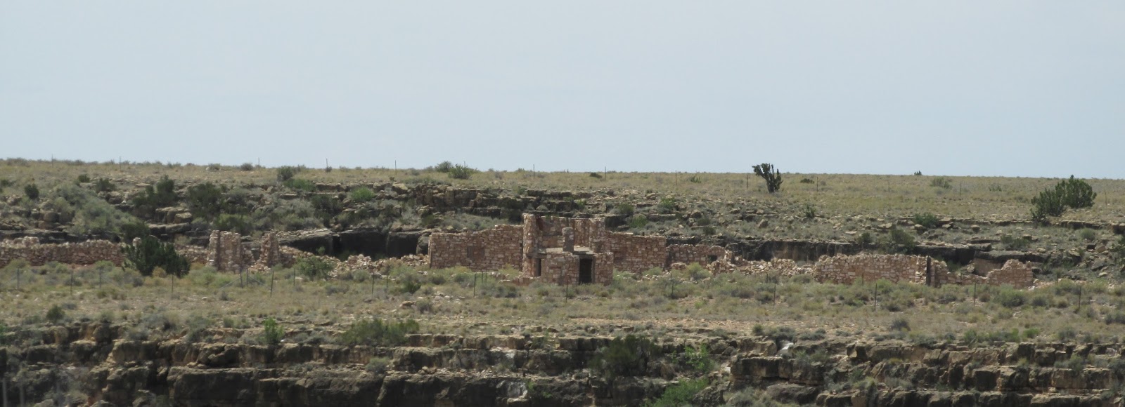
There is a vast Indian history in this area, Verde Valley has had human occupancy for nearly 10,000 years. There is a rich history to be told here, it begins with the nomadic cultures led by the Clovis, then came the Hohokam, followed by the Sinagua, the Yavapai and the Apachie people who continue to make this area their home. Fort Verde State Park is in the area, as well as the three stone ruins left in this area. Montezuma Castle, Montezuma Well and Tuzigot are all National Monuments managed by the National Park Services. There are three other archaeological areas, managed by the US Forest Services, the Petroglyph Walls at V Bar V Ranch, V Bar V Heritage Site and the Cliff Houses of Honanki and Wapatki.

When we checked in, we told them it was an overnight stop to get into Phoenix before it got too hot … both check-in assistants laughed and said “good luck with that.” Well we woke up a little before 5am and got up and closed up the camper and headed out … it was 68 degrees in Camp Verde when we left.
Once again, we went down below 4,000 feet elevation and then again back up above 4,000 feet elevation. Up and down, up and down … 

The AguaFria National Monument, which is a 70,000 acre area of high elevation desert around the boundary between the Sonoran cactus lands and the grass-chaparral belt. You can see the distinct differences in these lands. This area is hometo reptiles and amphibians including the Leopard frog, the Garter snake, the Desert tortoise, can be seen in the monument. Mammals such as the Pronghorn, Mule deer, White-tail deer and Javelina are relatively common. The elk (wapiti), black bears and
Mountain lions are also found in the monument, but are much less common. 
The centerpiece is the deep canyon of the Agua Fria River, which is bordered by two grassy mesas, split by various smaller valleys. As well as the protection of the abundant natural life sustained by the river corridor, the national monument was established to preserve hundreds of ancient sites - ruins, pictographs, petroglyphs - which are found dotted around the hills and along the river.

We passed a road that I had to research … Bloody Basin Road. Who could drive by a road name like that and not want to know how it got its name! I learned this while I was reading up on Bloody Basin, it has been a fairly bloody place over the years. There are several myths that have sprung up regarding the naming of that piece of land. One of the most fanciful suggests that seven Navajo virgins were sacrificed at that spot by the Apache Geronimo to bring freedom to his own wives and children. Another myth, that makes a little more sense, suggests that this land was pretty much cattle country. However, Basque sheepherders would drive their flocks to the area to graze, rotating between the valley and the mesa from the summer to winter. Now cattlemen did not appreciate this. Cows and horses eat foliage down to the ground so it will come back quickly, but sheep take the foliage down to the roots, which means nothing will grow back for several years. The cattlemen had enough and so they slaughtered all the flocks grazing in the area. The blood of the sheep covered the land, and hence … Bloody Basin. Some historical sites indicate that it was the site of more than one fight with Indians, especially the Yavapais and Apaches. I guess, we cannot get a definite answer … pick the version you like best!

After all of the up and down Interstate 17, we stopped at a rest area called Sunset Point. We were there at sunrise, but I am sure that sunset pictures would be awesome from this vantage point! 


Photo courtesy of Wheelchair Travel Adventures
There is a large sundial at this rest area, the light was not good in my picture, so I borrowed this picture from Wheelchair Travel Adventures. If you are traveling on I-17 and can be at the rest area near sunset, I think it would be pretty awesome!

Charlie has spent some time in Arizona and as we passed Black Rock Canyon, he told me there used to be a dog track there. So, I had to do my research! The Black Canyon Dog Track was opened in 1967 by the Funk family. With the newly built I-17, residents of Phoenix had easy access to the greyhound races. The Funk family ran the track until it was closed in 1982. A few years later the track would play host to a variety of Swap Meet events, and eventually became abandoned in the late 1980s. Charlie could point out the old track, but not much else was visible!

Along Interstate 17 we found a few unique crossing signs. Anyone that follows my blogs, knows what a fascination I have with crossing signs … we have found turtle crossing, panther crossings and many others. Well, we can add Elk to the list. This signs was seen a variety of times on I-17 outside of Flagstaff heading toward Phoenix. 


Outside of Phoenix and then again closer to the city, we found a jack ass crossing sign. I can understand the Elk, as it is great hunting area for those animals near Flagstaff … but do you really expect to see a jack ass crossing I-17? I am talking about the 4-legged kind of jack ass … not the 2-legged versions!

We headed into Phoenix and were amazed at the amount of traffic on Interstate 17 at 7am on a Saturday! Yikes, we won’t be doing much driving around here! 

We got to see a bit more of Phoenix than we planned before we got to Tim’s house … the GPS routed us from I-17S to I-10 and then onto 51N … however, it did not tell us 51N until it was too late for us to negotiate the lane change. So, we made a big loop back onto 17N to I-10S and this time we were in the correct lane to get onto 51N. Just a few minutes later we arrived at Tim’s house. It was over 100 degrees at 7:30am! Yikes! We are staying put for a few weeks enjoying time with our son and Granddaughter!

Watch for our next two lane adventure as we head north to Williams Arizona to meet up with our Yankee RV Tour Southwest Caravan group!

Here are our stats for our two lane adventure from New York to Arizona:

  • 2,563 miles from New York to Arizona, with an average of 256 miles traveled per day.
  • $2.26 was our average price per gallon for unleaded fuel. 
  • Highest prices was in Salem Illinois at $2.569. 
  • Best gas price was in Miami Oklahoma at $1.919.
  • We purchased just over 302 gallons of fuel at a total cost of $678.14. 
  • Our average MPG was 8.417.
  • We paid $306.04 for all our overnight accommodations. 

Saturday, June 25, 2016

Cross Country from New York to Arizona – New Mexico to Arizona

Here is the sunset from last night and the sunrise this morning, before we departed Grants New Mexico. The KOA we stayed at offered a Continential breakfast that was better than some high end hotels that we have stayed at! The place was packed when they opened at 7:30. It is really a great idea, they get to interact one last time with their guests, before they depart and it leaves a very positive vibe on the guest. Positive feelings, equal good reviews, equal more reservations! Pretty smart!


I do have to admit, I love the desert sunrises ans sunsets almost as much as I love the beach or ocean sunsets and sunrises!


We passed the Rodeo Arena, to locals it is known as the “Cow Palace!” It is a rodeo grounds, shouldn't it be called the "Horse Palace?" Downtown Grants has some good neon and there are some nice neon signs that are now dark. Since we are traveling during the day, we are not sure which is which! But they sure are pretty. I might consider hitting these towns again,but in a car ... Sleep during the day and travel at night to see all this impressive neon. Of course, sleeping all day and traveling at night sounds like something I should have done in my youth, not during retirement! I am not sure if either of us could stay up late enough to accomplish that goal!


After leaving Grant and passing through Milan, Bluewater and Prewitt we arrive in Thoreau. Along here is where Route 66 begins to parallel a long row of pink-tinged cliffs and hills. It is amazing how flat some of the tops are. One of the items I read, said these cliffs can be seen in many movies.

Past Thoreau is one of the best photo opportunities on Route 66. A historical Route 66 sign above a Dead End sign. Which is a true statement, there are many points on Route 66 in New Mexico that turn into dirt roads, or disappear entirely! I should have saved this picture for the last blog of our two lane adventure on Route 66, oh well ... this picture might be seen again!


Gallup New Mexico is a thriving southwest town full of galleries, trading posts and public art displays. I could have spent the day and then some in Gallup, just looking and taking pictures! I am including just a few of the very interesting items we saw!


A top the Chamber of Commerce building in downtown, is a great new neon “Here we are on Route 66, Gallup NM.” Plus there are many old neon signs on the main drags. I could fill a blog with the neon pictures ... maybe after our Route 66 two lane adventure is done and before I start the Yankee RV Tours Southwest Caravan Two Lane Adventure ... I will do a blog of just pictures with descriptions and locations of all the cool neon signs!
Photo courtesy of the Gallup Chamber of Commerce


This is how the downtown sign looks when it is illuminated.


The most historic hotel in Gallup, is the El Rancho Hotel with rooms named after movie stars. There was a second neon sign that was equally as pristine as the one in this picture.

Outside of Gallup is Red Rock Park, we did not tour the park, but Church Rock was visible from the road. I am sure that Red Rock Park is full of the beautiful red rock, we have been seeing n this part of the country!


We entered Arizona from New Mexico on Interstate 40. There was many times that Route 66 was in conjunction with I-40, because the roads were impassible for an RV or just dirt. Sometimes, we drove on a frontage road right next to the Interstate. This area did give us some great desert scenery!


At the state line, colorful gift shops gather near the base of some majestic brown cliffs, while a deteriorating painted mural and plenty of plastic animals perch precariously, including a giant TeePee!


In Lupton, the Geodesic Dome is now closed to and has been vandalized … as it seems many of the old iconic buildings that are abandoned are vandalized. Sad, sad state of affairs in our country.


 Stewarts Rock Shop has colorful and crazy folk art statues galore!


The most iconic place to overnight in Holbrook is the Wigwam Motel. These concrete wigwams have been owned by the same family since they were built in 1950. This is the next to the last set of Wigwams in a chain of seven built from 1933 to 1950. This location and the recently renovated set in San Bernardino are the only locations still open!


Winslow has a very nice “9/11 memorial park” at the entrance to town. The park includes two steel beams from one of the towers. Many small towns have petitions to get pieces of these buildings to build memorials. Have been down there the the Guard after it happened, I carry pieces of that terrorism with me everyday, no need to stop at a memorial to read about. I live it.


The biggest draw to Winslow is the “Standing on the Corner” statue, it is dedicated to the classic Eagles song “Take It Easy.” There is a mural painted behind the statue depicts a girls in a flatbed Ford, as if it is a reflection in a window. A huge Route 66 is painted on the road, fills the intersection.


Off of Route 66 is the Meteor Crater, we skipped it, because two different couples told us not to waste our money on seeing a big hole in the ground!

Two Guns is a storied tourist town of days gone by. The side of the road now is just stone ruins. They say they are of gas stations, two roadside zoos, hence the “mountain lions” spray painted on the ruins and a museum. I can not really see any of those in this rubble, we will just have to take their word for it! I am always dishearten when I see such pieces of our history that has been defaced by vandals, even if they think they are warning you of something.


Just before Flagstaff, we said good bye to our last “Historic Route 66” sign … as once we get to Flagstaff, we will be heading south on I-17. 


As we started traveling on Interstate 17, there was a 7,000 feet elevation … remember that! As we headed down from Flagstaff we watched the elevations decrease to 6,000 … 


going down to 5,000 feet elevation


and finally 4,000 feet of elevation. Actually we were still a bit under that, because we went down even further. This more than 3,000 foot drop was accomplished in an 18 mile grade of 4 percent to 8 percent. You want to be careful on your breaks in this area!


We are spending the night at Distant Drums in Camp Verde Arizona. It is a beautiful desert RV park of 158 concrete and racked rock sites. I would definitely stay here again!

Thursday, June 23, 2016

Cross Country from New York to Arizona – New Mexico to New Mexico

When we got up this morning, we knew we would not get out of New Mexico today. Route 66 in this part of New Mexico is spotty and requires time, patience and some travel on the Interstate. We took our time, we are still adjusting to the second time zone change we had! We were awake before 6am, at least it gave us an opportunity to see a great sun rise! 

We also enjoyed a couple of visitors, I think it was a momma and a baby. They seems to be a bit tame, but did move away the closer you got! We even fed one of them!


We departed Tucumcari KOA onto Route 66 and headed for downtown Tucumcari. 


It boasts a variety of neon, even though some have gone dim. The Blue Swallow Motel has been well maintained and is a great example of the neon on the old Route 66!

There are tons of murals in this town too and many are very well maintained! 


There was also a big sombrero on the roof of a Mexican restaurant. 


On your way out of town, there was and Edsel that Charlie really liked! They only made them for one or two years. I am sure that we could not tow that car for wheels down behind the RV!


Also there is the Tucumcari Trading Post … I am sure it holds tons of treasures! 


After Tucumcari … I just really like to say that name … Tucumcari … the road and railroad start to travel into a wide open valley, surrounded with steep bluffs in so many varying hues. We had to get onto I-40, as portions of Route 66 around Montoya are not recommended for RV travel.


The town of Cuervo was devastated by Interstate 40, as the interstate cut the town in half. There is many ruins on one side of the interstate and the other side has an active stone chapel. 


After Cuervo, we started to lose our red and orange hues on the bluffs; the colors have turned to browns, yellows and greens.

After Santa Rosa, you are forced to get back onto the Interstate, as Route 66 from here to Moriarty is buried deep under Interstate 40.


You go for miles and miles and miles without seeing much, then the billboards start to pop up and they keep coming. The first set is for the Flying C Ranch, a tourist trap along Interstate 40. However, don’t stop! There is a more famous stop along I-40. The famous Clines Corners has been assisting travelers since 1934, long before Route 66 came this way.


On the west side of Moriarty, the National DWI Memorial of Perpetual Tears is visible from I-40. The Field of Markers represents the total number of New Mexico alcohol related traffic fatalities on record for the last five years. Each marker signifies a death. They are more than numbers, they are our loved ones, families, and friends. Each marker, surrounded by the protective arms of the wall, symbolizes a loss of life that was completely preventable. These actions left behind tremendous pain and grief. 
The hope is to stop DWI and someday have an empty field! Everyone traveling through New Mexico on I-40 will witness this visual reality of the devastation caused by DWI!


Following Route 66 through Albequerque is not recommended for an RV, so we took in a few select sights and went on our way! 

The El Don Motel has a newly restored neon sign. If we did not hate to travel at night … some of these neon signs would be spectacular when it is really dark out! Heading out of town, the climb up the foothills of the Sandia Mountains was a tough pull … Charlie said Jack & Diana would have been really sloooooow! Here is where the cross winds got really stiff too!


At Rio Puerco, across the Interstate from the Route 66 Casino, is the well preserved 1933 “Parker Through-Truss” bridge. You can get out and walk the bridge, but in the 100 degree heat … that is not for me! From Mesita to Laguna, Route 66 traverses through Laguna Pueblo Land, and takes you on narrow winding roads, including a spot called “dead man’s curve” … that is nowhere we need to take an RV!


As we got closer to Grants, the rocks changed from a familiar looking rock, to a more volcanic rock. We are very close to the Bandera Volcano and Ice Caves.


We are spending the night at a KOA in Grants New Mexico. It is a gravel KOA, with a few trees and very level sites. The couple that owns it is very friendly and accommodating! Our rate for a 30 Amp pull through site with some shade was $45.00 with our KOA Value Card. It is a bit more than we normally pay, but the Good Sam Park, we were going to stay at was only $19.00 and by the look of it … you get what you pay for! The rate includes a continental breakfast and the cafĂ© makes dinners, they even deliver to your site! Tonight’s pies were apple, peach and mixed berry … can you guess which one Charlie had?