Wednesday, October 31, 2018

Day 2 Traveling to the Southernmost Point on a Two Lane Adventure – Tuesday 10/30/18


It is great to have friends all over the state and in other states! We were lucky enough to spend one night at Sandy & Paul’s house. Next time we head this way, we will have to spend a few day …. So, we can enjoy a boat ride! We departed Sun ‘N Lakes and headed south on US 27.

We came upon a bear crossing sign. However, this bear crossing sign looks like a polar bear, not a black bear. I doubt there are polar bears crossing US 27 south of Lake Placid, but we did not see any black bears in the next 12 miles either!

I know that the citrus greening disease, Huanglongbing, has had a fatal effect on the citrus groves in Florida. The disease is spread by a pest called the Asian citrus psyllid as it feeds on citrus tree leaves and there is no cure. It is nice to pass by orange groves that are being rebuilt by the growers.

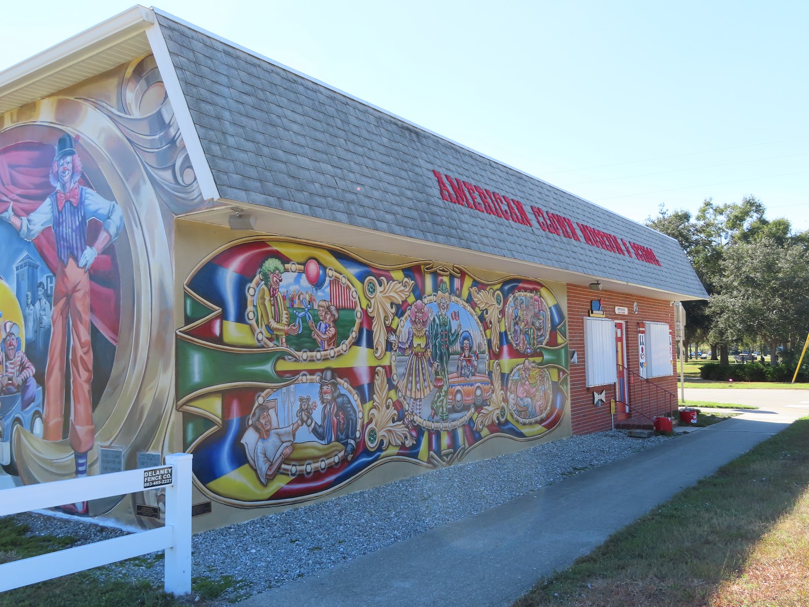
We passed Gatorama, it was the first sign of life in miles. What is Gatorama? It was started in 1957 by an old colorful character named Cecil Clemons. When Gatorama began, US 27 was a two lane road. Cecil believed that when most Yankee’s came to Florida they wanted to see three things: the beach, an orange grove and an alligator. He was going to show them alligators! Cecil was quite the character and Gatorama used to have quite a different reputation than it does now.

Since 1987 they have worked very hard to build a reputation as an upright hard working law abiding farm and family attraction. Gatorama is one of 12 remaining of the original 72 attractions operating in the heyday of roadside tourist attractions in the 50s and 60s before the big mouse moved to Florida. This part of Glades County use to be referred to as Red Bug Ridge, it was a high sandy ridge running through the glades. Alligators were naturally found in this area. Cecil bought the land and fenced the alligators in. The large alligators in the front pond are some of the original stock and the biggest are well over 60 or 70 years old.

The crocodiles were brought into Gatorama in 1968 before they were an endangered species. Crocs natural range is from about Sanibel Island south. They are now mostly found in the Florida Keys. Gatorama has the only productive breeding colony of American Crocs in the US and we are one of the few facilities permitted to accept nuisance crocs from the wild. Nuisance crocs must be relocated….they cannot be harvested the same as nuisance alligators are.

David Thielen, was raised in Lakeport and for a time lived near Cecil. After a career as an army officer he retired and wanted to come back to his childhood home. His wife, Marietta, a Yankee, did not, but she soon relented. At about the same time it became legal to farm alligators in the state of Florida. Gatorama are pioneers in the alligator industry. They hold two of the original 30 permits. David’s interest was in developing the alligator farm, though he intended to keep his promise to Cecil and keep the attraction open and not sell off the valuable alligator and crocodile stock. By 2007 those original golden thirty permits have been consolidated and are now held by about 10 families’ who farm alligators commercially. 

Moore Haven Lock & Dam Recreation Area is a US Army Corps of Engineers area, located on the west side of Lake Okeechobee at the junction with the Caloosahatchee River. The Corps constructed and currently manages five locks along the 152-mile Okeechobee Waterway. Moore Haven Lock and Dam were constructed in 1935 for navigation and flood control purposes. Today it also serves as a recreational gateway to the second largest fresh water lake in the Continental United States, as well as one of the most bountiful fishing sites for sports fishing tournaments. Approximately 9,200 vessels lock through annually; of these about 95% are recreational vessels.

We crossed over the Caloosahatchee River. It is approximately 67 miles long. It drains rural areas on the northern edge of the Everglades, east of Fort Myers. An important link in the Okeechobee Waterway, a manmade inland waterway system of southern Florida, the river forms a tidal estuary along most of its course and has recently become the subject of efforts to restore and preserve the Everglades.

Clewiston is the town beside Lake Okeechobee. It was once used as a fishing camp by the Seminole Indians. The first permanent settlement began in 1920, when John O'Brien of Philadelphia and Alonzo Clewis of Tampa purchased a large tract of land to establish a town. Incorporated as a city in 1925, Clewiston would become noted for its sport fishing, particularly of largemouth bass. Large sugar plantations were established around Lake Okeechobee. By the 1950s and 1960s, the cultivation of citrus, vegetables and cattle were also important to the economy. US Sugar Corporation, however, remained the dominant manufacturer in Clewiston, which became known as "America's Sweetest Town."

Driving in this part of Florida, we can see tons of sugarcane fields. Sugarcane is a grass grown primarily for its sugar (sucrose) content. This field crop has been grown commercially in southern Florida since the 1920s and is one of the most economically important crops in the state. Approximately 450,000 acres are grown annually, mostly around the lower half of Lake Okeechobee.

Ever wonder why they burn the sugarcane? I always assumed it was burned after the harvest, to kill all the roots. No, it is burned before harvesting to remove the outer leaves around the stalks.

Another first on this Two Lane Adventure … we got to see some sugarcane being harvested!


When the processing plant is close ... they can daisy chain the carts loaded with sugarcane.


Those are some big harvesters!


When they have to truck the sugarcane, they can only haul an 18-wheeler at a time across the highway.


The Everglades Agricultural Area is along US 27. Before 1950 the “Central and South Florida Project for Flood Control and Other Purposes” designated a large area of the northern Everglades as the Everglades Agricultural Area. Completed in 1962, the project included 15 canals and 25 water control structures managed by the South Florida Water Management District to serve the EAA. The canals and structures were used to artificially control water depth in the historic sheet flow area, diverting water from Lake Okeechobee for farm irrigation. Today, the EAA spans 700,000 acres and encompasses 27% of the Everglades where sugarcane is the major crop. Nutrient runoff from the EAA, the result of fertilizers and the use of herbicides and pesticides, as well as the intensive use of water for sugar and other crops, are critical problems for south Florida. Restoring the EAA to its historic function of storage and treatment of water may be a key to the restoration of the Everglades. 

To protect and restore these ecosystems, the South Florida Water Management District (SFWMD) is working to remove excess nutrients and other pollutants, or prevent them from entering natural systems. One of these efforts is building Stormwater Treatment Areas (constructed wetlands.) This solution for improving water quality is a required element of federal/state legislation for restoring the Greater Everglades (which includes the Kissimmee, Okeechobee and Everglades watersheds). It is also mandated by separate state legislation for water quality improvements in Lake Okeechobee and the Caloosahatchee and St. Lucie estuaries, as well as in the Everglades systems south of Okeechobee. SFWMD is creating more than 6,500 acres of new stormwater treatment areas and 116,000 acre-feet of additional water storage through construction of flow equalization basins (FEBs). These impoundments capture runoff during storm events and provide a more steady flow of water to the STAs, helping to maintain desired water levels needed to achieve optimal performance. We witnessed this construction along US 27. We could not figure out what it was for a while. The construction created a ton of dust; it is a good thing that this area is void of residential areas.

In the heart of South Florida, two major roads, East-West SR 80 and North-South US 27 intersect. At this crossroads, near the southern bank of Lake Okeechobee, is the City of South Bay. Rich black soil and the lakes vast waters make South Bay a haven for agriculture and recreation. The settlement began at the North New River Canal, completed in 1912. Only 12 families lived at South Bay in 1917. During the 1920s, the town filled out along with Pahokee and Belle Glade to the north. 

As smaller settlements disappeared, these three became known as the Glades Communities. South Bay was incorporated in 1941. During the 1980s, South Bay was the third fastest growing major metropolitan area in the nation. Yesterday, it was a hot pink house ... today South Bay boasted a purple business. I loved the color!

We turned off US 27 and onto FL 997, aka Krome Ave. This is a 4 lane highway for a bit, but quickly becomes a two lane road with no passing. There are plastic cones in the center lines to discourage attempting to pass. They even have a couple of signs dedicated to sharing the number of deaths on this road. 


We turned onto US 1 in Homestead and quickly arrived at Boardwalk RV Resort, our home for the night. It was a bit tight to get into our site, but it was clean, pretty well maintained and the staff was helpful and friendly. It's a Passport America Park, so for $25 a night, I am not complaining!

Tuesday, October 30, 2018

Day 1 Traveling to the Southernmost Point on a Two Lane Adventure – Monday 10/29/18


We departed our home in Zephyrhills, just 10 days after arriving home from our 114 day "Go West Young Man” Two Lane Adventure. We enjoyed our short time at home by sitting on our back patio and talking to our friend, Randy Fitzsimmons, best friend in Florida … Mr Ali Gator! We traveled east on SR 54 to SR 39 into Plant City.

On the north and south side of Plant City, we saw them planting the early season Strawberries. Researchers developed three new varieties of strawberries that are able to withstand the early fall heat. Farmers are planting a strawberry variety known as Sweet Sensation or Sweet Charlies. To stay competitive with California and Mexican strawberry growers, local strawberry growers must produce more fruit in November and December. Historically, going back for generations, Florida’s market window has been winter production, Thanksgiving to Easter. Strawberry farmers are changing that season by planting and harvesting earlier. Now you know how, the name Winter Strawberry Capital of the World was given years ago to Plant City.

We turned east onto SR 60 and our eyes were blinded by the hot pink house! State Road 60 is an east–west route crisscrossing Florida from the Gulf of Mexico to the Atlantic Ocean. Along the portion of SR 60, we traveled on has several different names, including Hopewell Road in Plant City, Canal Street in Mulberry, West Main Street west of Bartow city limits, Baker Street in Bartow and Hesperides Road in Lake Wales.

The City of Mulberry values art and is committed to making art accessible to all. With all the current art offerings happening here. The addition of the Mulberry Murals initiative was the natural next step. Prior to this initiative, the City already had two murals installed. One at City Hall and the other at the Mulberry Public Library.

The Mulberry Murals are a gateway into imagination and creativity featuring the work of established and up-and-coming artists within Central Florida. For the City of Mulberry, a mural is defined as a large-scale artwork, painting, mosaic, applied to an exterior surface of a building, construction fence or other structure and that is visible from the public right-of-way. Its primary intent is to be artistic in nature, rather than purely information, creative signage or commercial signage. Two more were completed in the summer of 2018, in Spence Park, marking the start of The Mulberry Murals.

The Peace River originates at the juncture of Saddle Creek and Peace Creek northeast of Bartow and flows south through Fort Meade, to Arcadia and then southwest into the Charlotte Harbor. It is 106 miles long and has a drainage basin of 1,367 square miles. US Hwy 17 runs near and somewhat parallel to the river for much of its course. The river was called Rio de la Paz (River of Peace) on 16th century Spanish charts. It appeared as Peas Creek or Pease Creek on later maps. The Creek (and later, Seminole) Indians call it Talakchopcohatchee, River of Long Peas. 

Fresh water from the Peace River is vital to maintain the delicate salinity of Charlotte Harbor that hosts several endangered species, as well as commercial and recreational harvests of shrimp, crabs, and fish. There were many Pleistocene and Miocene fossils found throughout the Peace River area, eventually leading to the discovery of phosphate deposits. Most of the northern watershed of the Peace River comprises an area known as the Bone Valley. The Peace River is a popular destination for fossil hunters who dig and sift the river gravel for fossilized shark teeth and prehistoric mammal bones. Several campgrounds and canoe rental operations cater to fossil hunters, with Wauchula, Zolfo Springs, and Arcadia being the main points of entry.

We had a “patrol” helicopter circling around, but when we looked for what they might be looking at, we just saw open fields.

Yes, we were still on FL 27, we passed of thing most would not even know it was there, the Avon Park Air Force Range. It is a 352 square mile bombing and gunnery range. Avon Park Air Force Range (APAFR) consists of an 8,000 foot main runway, an operational control tower, an aircraft rescue and firefighting facility, and limited ramp and hangar facilities. There are no published instrument approach procedures and the airfield is limited to Visual Flight Rule (VFR) operations only. It's the primary training range for Homestead Air Reserve Base, Patrick, MacDill, and Moody Air Force Bases.

Sebring is home to the 12 Hours Grand Prix. It is an annual motorsport endurance race for sports cars held at Sebring International Raceway, on the site of the former Hendricks Army Airfield World War II air base. The track opened in 1950 on an airfield and is a road racing course styled after those used in European Grand Prix motor racing. The first race was a six-hour race on New Year's Eve 1950, with the next race held 14 months later as the first 12 Hours of Sebring. The race is famous for the "once around the clock" action, starting during the day and finishing at night. The race in 2019 is its 67th annual event!

Continuing down US 27, we came to Lake Placid is the Caladium Capital of the World, holding an annual Caladium Festival, every July.

The caladium is the crown jewel of the jack-in-the pulpit family (Araceae). With all of its colors and leaf shapes, it is the bird of paradise in the drab crow family of arums. In South Florida, caladium cultivars can provide color and brighten dark, shady corners for 9 months or maybe longer.

As one goes north, they tend to have a dormant period with cooler weather and less moisture. To see 1500 acres of glowing caladium foliage ranks up there with seeing the flowering tulip fields in Holland (almost!).

Lake Placid is also known as “The City of Murals.” Founded by Bob & Harriet Porter in 1992, the Lake Placid Mural Society formed to beautify the town and tell its history. As you walk through the town, internationally known historic outdoor art gallery, with over 47 beautiful larger than life murals.  Some of these murals have sound, while most of them have hidden items.  Also, you will find 17 unique one-of-a-kind trash containers, all are companion pieces to the murals.

In 1992, Lake Placid had 15 empty stores and black mold and mildew was evident on many of the walls in town. The Porters knew several artists and selected Thomas Freeman for the first mural, which he painted on the side of the Caladium Arts and Crafts Cooperative, also a new business and the brain child of Bob and Harriet. Tea at Southwinds is Lake Placid’s first mural. It’s an impression lifted from a postcard found at the Lake Placid Historical Society. But it was enough to get the mural project started in 1993. Not long after Dr. Melvil Dewey passed away, his resort, Litl Loj, became known as Southwinds. By the standards of those times, Dewey’s southern resort rivaled his northern resort at Lake Placid, NY. These stylish ladies might have been a lot like Dewey’s guests—pretty, proper and primped. They were having tea on the luxurious patio of handmade Italian tiles. Their view from the patio was a long sweeping slope to the Lake Placid shoreline. It must have reminded them a little bit of home.

Since its beginning, the mural society placed 142 pieces of artwork in town, which includes over 33,000 square feet of murals. There are over 140 towns and cities across the US and Canada that have requested information to start their own mural project to help revitalize their towns. All the money for the murals is earned solely by fundraisers, sponsorships, and donations. During these years, tourism increased, which has had a positive economic impact. Lake Placid became known as the Town of Murals, and Florida’s Outstanding Rural Community.

In 2013, Lake Placid Florida won the coveted title of “America’s Most Interesting Town,” in a nation-wide search by Reader’s Digest. Ten towns were finalists in this contest, and in the end, Lake Placid stood out among the rest. It is truly a jewel in the crown of Highlands County. Lake Placid has the distinction of being known by many titles. Lake Placid is known as the Town of Murals, with 47 larger than life historic murals forming an outdoor art gallery and the Caladium Capital of the World, where 95% of the world’s caladiums are grown and shipped all over the world. The 27 beautiful pristine lakes that surround the town within seven miles give Lake Placid the title of Florida’s Lake Country. Lake Placid is also know for the Clown Museum and School, which graduated over 2500 clowns since its beginning in 1993.

The Lost Bear Club - Lake Placid was once one of the best bear hunting grounds in Southern Florida. The territory around Lake Istokpoga and south along the western edge of the sand hills was almost too thick to penetrate by man or dog. This presented a perfect haven for bears to raise their young. When settlers moved into the area they brought cattle and razorback hogs. Unfortunately, the bears liked fresh pork and beef, and, out of necessity the pioneers became bear hunters. During the first hunt 34 bear were killed: and some of the old timers boasted of killing over 200 bears during their lifetime.

The Cracker Trail Mural displays Cowmen drive a herd of cattle through the Lake Placid area on their way to market. It was a two to three week trip and full of danger. Only the strongest would survive. The life of the Florida cowmen was not easy as they battled the heat, insects and storms. The name “cracker” comes from the cracking of the whips the cowmen carried to keep the herd together. The registered brands you see all belong to Highlands County cattlemen.

Sandy also took me to the American Clown Museum and School. It was Monday and almost everything is closed on Monday in Lake Placid, according to Sandy. Since 1993, Toby's clowns have been bringing smiles to life in Lake Placid. Keith "Toby" Stokes began spending time in Lake Placid, but missed being a Shrine clown when he was down south. He organized the first class of clowns and graduated 6 clowns. Now we are proud to say more than 1500 clowns have graduated from the American Clown School.


His mission is to teach the art of clowning and to spread Smiles, Love and Laughter, but there's more to see at the clown house. First of all, on the exterior walls, you will discover two of Lake Placid's famous murals. One is "Toby's First Clown Class", by Keith Goodson. The other is "The Art of Clowning", by Monica Turner. But, I was able to snap some pictures and think of my Dad and smile. He was a clown, no … more than just the kind of guy that tells funny jokes. He was a Shrine Clown, too. It was a facet of his life that made him very happy … he loved to bring a smile to every face!


The jack-n-the-box, is a great example of the unique trash receptacles in Lake Placid.

We enjoyed a quiet night at our friend’s, Paul & Sandy’s, house. They were kind enough to share their cement pad with us! Plus, she fixed one of Charlie’s favorite meals … baked ziti and garlic bread! Delicious!

Thursday, October 18, 2018

Day 113 of 117 on our “Go West, Young Man” Two Lane Adventure – Wednesday 10/17/18


Our last town in Alabama was Eufaula. 
It is nestled high upon a bluff overlooking the beautiful 45,000-acre Lake Eufaula, along the Alabama-Georgia border. Eufalula Alabama is rich in history. On November 3, 1874, during statewide elections in Alabama, deadly riots occurred in the city of Eufaula, a result of social tensions brought about by Reconstruction Era societal changes. The immediate practical effect was that many black voters were turned away from the polls in Eufaula and had their ballots burned in Spring Hill. These events also drew national attention and a congressional investigation. In Eufaula, racial and political tensions were especially high during that election season. During this period, local Democrats felt threatened by blacks voting, particularly because they tended to vote Republican. These Eufaula Democrats had supported secession in the Civil War and frequently feared that freed blacks would rise up against them.

Voting began smoothly until an argument arose between a black Republican, and white Democrat over an underage black voter. The young man admitted being underage and was turned away before voting. White Democrats then took that same under-aged man into the alley, and the youth agreed to vote Democratic. Lawrence confronted the young man for his choice, and a white man stabbed Lawrence in the shoulder. Gunfire began almost immediately as Democrats took arms, possibly stored in anticipation of conflict, from a militia storage area above the polls and another location across the street in an organized fashion. Most of the shooting came from whites as blacks retreated before they were able to vote. Military records showed that either seven or eight black men were killed or died later from injuries, and 70 to 80 men were wounded. Fewer than a dozen were white. Aided by a lack of black voting in the aftermath of the Eufaula riot and the burned ballots at Spring Hill, Democrats swept the county.

As we drove down Hwy 82, this historic town’s gorgeous Seth Lore Historic District really showcases wonderful old homes. With over 700 historic and architecturally significant structures, the district includes Alabama's most coherent collection of intact mid-to-late 19th century small town commercial buildings, as well as the state's most extensive collection of domestic Italianate architecture. The period of architectural, commercial, industrial and political significance is from 1825 to 1949. Architectural styles include Craftsman, Late Victorian, Classical Revival, Gothic Revival, and Greek Revival. I could not find information on all of them, but I did find a few!

The Shorter Mansion is located in the Seth Lore Historic District. It is graced with bold Corinthian columns that support an entablature extending around three sides of the structure. It was originally built in 1884 by Eli Sims Shorter II, a wealthy cotton planter, and his wife, a Georgia-born heiress to the SSS Tonic fortune. When the mansion was put up for auction by the builder’s granddaughter in 1965, it was purchased by a group of civic-minded citizens who organized the Eufaula Heritage Association.

The Raney-Conner-Blackmon-Taylor House, which had construction begin in 1857, but underwent 19 months of restoration by Jimmy Willoughby, including new columns, masonry, a paint job, decorations, and artwork in the house’s foyer. Officially classified as an Antebellum home, construction was not completed until 1863 due to the interruption by the Civil War. Considered a Greek Revival Style, the home has endured many owners. In 1883, it was sold at a public auction for $3,000 to MB Wellborn. Eight years later, the home was inherited by Emma Wellborn, who sold it for $2,500 to Mildred Thweatt. Anna Crawford purchased the home, for $2,500, in 1909, but the home reverted back to Mildred and JM Thweatt before they sold it in 1911 to EP Thomas. HH Conner bought the home in 1918 for $10,000 after it had become rental property for two years. Bobby and Celia Taylor completed a large renovation of the home in 1972. The house stayed in the Conner, Blackmon and Taylor families for the better part of a century until Willoughby made his purchase in 2015.

Lake Eufaula, also known as Walter F George Lake, is located on the Chattahoocee River between the states of Alabama and Georgia. The lake is nationally known for its bass and crappie fishing. The lock, located at Ft. Gaines, Georgia, has the second highest drop east of the Mississippi River. Eufaula National Wildlife Refuge is located on the northern end of the lake offering excellent bird viewing all year. Lake Eufaula was formed with the construction of the Walter F George Dam in 1963.

The Corps of Engineers built the dam to provide flood control, produce hydroelectric power, create a navigable shipping channel and offer recreational opportunities. The COE manages the lake and its shoreline. Since the lake is a border water, part of it lies in Alabama and part in Georgia, a reciprocal agreement has been reached between the states which allows anyone with a valid fishing license in either state to fish the entire lake. This holds true when on the water but when shore fishing a valid license for the state you are in is required.

We thought we had picked a route that was far enough north, to miss the storm damage left by the path of Michael, but we were wrong.

Cuthbert is one of the most architecturally interesting towns in all of South Georgia. The city boasts a large collection of Victorian houses and is home to Fletcher Henderson Jr, an African-American leader in the jazz and swing movement.

Today, it is home to much devastation from Hurricane Mathew.

This home owner was very lucky.

More trees that missed a historic home.

In Shellman Georgia, the pecan orchards suffered damage too.

In Sasser, the cotton yet to be picked and the rolled cotton was not affected by the winds of Hurricane Michael.

But I wonder if it water logged?

In Albany Georgia, Hwy 82 and US 19 come tighter and create a bypass around the heart of Albany. It is here that we could see more storm damage and the strength of the wind.


Not sure if this was an old unused or new gas station, but you can see the force of the winds. It blew over all of the pumps and ripped apart the canopies.

The force of the wind, bent these road signs over … WOW.

The Pecan Orchards south of Albany GA saw damage too.

You can see the twist in the wind, by how this tree was damaged.

Heading further south, we reached Camilla Georgia. There is still heavy destruction as evident in the way the roof was rolled back on this gas station. But just a few feet away, the pumps and canopy are untouched.

In Pelham, there was more wind damage. 

This hotel had blue tarps all over the roof and this green house did not fare well.

The damage is decreasing as we arrived in Thomasville Georgia.

My reflection today is to be thankful for each day and cherish all that God has given us, because he can take it away in the blink of an eye, too.

We are almost home! We are back in the state we live in and love!

In Monticello Florida, I love this courthouse and the fact that it is literally the center of the town. It just screams old town, and it is one of my favorite places! I have blogged about this place a few times already ... so I won't bore you with it all again!

We arrived in Perry Florida. We are spending the night at the Perry KOA. We stayed here on our way out of Florida in June and we wanted to see how the new owners from New York, are making out. They just purchased the campground in April of 2018. I’ll let you know in tomorrows blog!