Sunday, September 30, 2018

Day 95 of 117 on our “Go West, Young Man” Two Lane Adventure – Saturday 9/29/18


We departed Sky Mountain RV Resort after a relaxing night of visiting with our camping neighbors from Albuquerque.

A picturesque lake set among the tall pines of northern New Mexico. It is part of Heron Lake State Park. The lake has been designated a “quiet lake” where boats operate at no-wake speeds, making it an excellent location for all types of paddle craft. Lake Heron is a fisherman's paradise with record-size trout and kokanee salmon. Actually, Heron Lake is a reservoir.

Written accounts of the town of Tierra Amarilla are from the Spanish friars in 1776. They described it as suitable for pastoral and agricultural use. The route taken by the friars from Santa Fe to California became the Spanish Trail. During the Californian Gold Rush the area became a staging point for westward fortune seekers. The Tierra Amarilla Grant was created in 1832 by the Mexican government for Manuel Martinez and settlers from Abiquiu. The land grant encompassed a more general area than the contemporary community known as Tierra Amarilla. The grant holders were unable to maintain a permanent settlement due to "raids by Utes, Navajos and Jicarilla Apaches" until early in the 1860s.

When Americans took to the road, many states devised ways to attract motorists off the highway, explore, and invest some time and money learning about local cultures and landmarks. In 1935, New Mexico—no stranger to promoting tourism with its history—began installing those signature big, brown, log-hewn signs to inform travelers about the landscapes and the people who inhabited them. Official Scenic Historic Markers explain land formations, public archaeological sites, important buildings, historic travel routes, places, and events. They mark locations of geologic, cultural, economic, political, scientific, and artistic significance to New Mexico, the Southwest, and the nation.

Over the past few decades, as cellphone networks have grown, thousands of antenna towers designed to look vaguely like trees have been built across the United States. Although these towers are intended to camouflage a tower's aesthetic impact on the landscape, they typically do the opposite. When we drove this road in 2016, there was only one “tree” here now there is two. Progress!

After the unique cell phone tower trees, look at these beautiful vistas!

There are several Mauri Andretti curves on this road!

The town of Cebolla was created by a farmer named Carlos Santistevan. Acting for himself and on behalf of five others, he appealed to Governor Manuel Armijo in December of 1845, soliciting a grant covering a tract of vacant agricultural land located between the Town of San Antonio del Rio Colorado and San Cristoval. Santistevan stated that he and the others were all poor and landless residents of the Town of Arroyo Hondo and needed the premises to support their families. The Governor granted them the land and the town of Cebolla was born.

The Carson National Forest is one of five National Forests in New Mexico. This National Forest contains some of the finest mountain scenery in the Southwest. It covers over 1.5 million acres. Elevations rise from 6,000 feet to 13,161 feet at Wheeler Peak, the highest in New Mexico. I love the natural beauty that these National Forests provide!

My folks had hundreds of these in their house, when my brother and I had to clean it out … I never gave any thought to the fact, that they might still be in use. They used to be atop all electric poles to protect junctions. When new, the glass was clear, but turned blue with age. But here we are, driving on US 84 and 64 and bam, we see mile after mile of insulators on poles and wires. It’s one of those things that makes you go, hmmmm.

We continued to descend, on our drive to Santa Fe.

I love the look of the sandstone cliffs and the dark green vegetation.

Located among the sandstone cliffs of New Mexico, the Echo Amphitheater is now known for its unique echoing auditory properties, but also supposedly carries the stains of Wild West killings. According to legend the curved stone cliff wall now known as Echo Amphitheater was the site where a group of Navajo executed a family of settlers. As the story goes, the victims were brought to the top of the cliff and killed, their blood running down the cliff wall and permanently staining it. Possibly in response to this legend another story says that years later a number of Navajo were in turn murdered in the same spot, once again staining the cliff wall with their draining blood. Now the natural echoing caused by the site’s geography is often ascribed to the voices of the unquiet dead.

There seems to be little truth to the tales, but the colorful sandstone itself may have inspired the myths. Running in red vertical stripes down the otherwise horizontally stratified cliff wall are streaks of mineral varnish that resemble blood. This colorful geological feature combined with its unusual auditory properties no doubt fed the myth associated with the Echo Amphitheater. Regardless of the legend, the Echo Amphitheater sees a steady stream of visitors coming to throw their voices off the cliff wall to listen to them bounce and fade like the voices of the long forgotten dead.

It is here that I found my flower and rock picture, just for Nancy Ragland!

Have I told you how much I like the sandstone cliffs and flowers!

Dinosaurs once walked the soggy wetlands that became the arid high desert of Ghost Ranch. Millions of years later Navajos and various other tribes roamed the valley. The Spaniards settled here and then came the cattle rustlers, the wranglers and the dudes. When the cattle rustlers were hiding their stolen goods in the box canyon alongside Kitchen Mesa, they discouraged their neighbors from looking around by spreading the rumor that the land was haunted by evil spirits. “Rancho de los Brujos” it was called, “Ranch of the Witches,” which naturally evolved into Ghost Ranch. The turn-off to Ghost Ranch was marked by an animal skull long before Arthur Pack bought the ranch in 1936. When Georgia O’Keeffe came looking for the Ranch she was told to watch for the skull on a fence post. O’Keeffe made a drawing of an ox skull and gave it to Arthur Pack; he promptly adopted the artwork as the logo for Ghost Ranch.

When Pack gave the Ranch to the Presbyterian Church they used a sketch of Chimney Rock as a logo. By 1971, partly as a result of O’Keeffe’s encouragement, the familiar skull design was firmly established as the official Ghost Ranch logo. For more than fifty-five years Ghost Ranch has been a national education and retreat center owned by the Presbyterian Church. At one time in history it had the largest number of employees in Rio Arriba County. From the beginning Ghost Ranch has been deeply involved in support of the surrounding communities and committed to the preservation and protection of the environment. Over 200 classes are offered each year in subjects ranging from Memoir Writing, Adobe Building and Paleontology to Plein Air Painting and Yoga. Groups reserve rooms and meeting spaces for their meetings; individuals and families come for the day or the week to hike, kayak or just to relax. All people of all ages, races, religions and cultural traditions are welcomed to Ghost Ranch.

Abiquiu Lake (pronounced Ab-Ba-Que), is the US Army Corps of Engineers northern most flood control reservoir in the state of New Mexico. Abiquiu Lake sits peacefully between the rugged Sangre de Cristo and San Juan Mountain ranges. At an elevation of 6,400 feet, the project rests comfortably within the Piñon Pine/Juniper life zone, and is possibly the highest reservoir in the Corps of Engineers. The 2,860 acre project is fed a diet of cold, clear, mountain water which is diverted from the San Juan Mountains in south-central Colorado, and piped under the continental divide into the Rio Chama approximately forty-seven pristine miles upstream from the project.

Here is the Chama River heading into the valley.

Nothing beats an American Flag flying … I’ll post a picture of that every blog!

Santa Rosa de Lima was an early 18th-century Spanish settlement in the Rio Chama valley, near the present-day town of Abiquiu, New Mexico. By the 1730s Spanish settlers were moving into the Chama River valley, and by 1744 at least 20 families were living in the present-day Abiquiú area, where they founded the Plaza de Santa Rosa de Lima. The church was built around 1744, and was in use until the 1930s. Repeated raids by Utes and Comanches caused the settlement to be abandoned in 1747. In 1750, the Spanish founded a new settlement at the present site of Abiquiú, about a mile from Santa Rosa de Lima. Today the site of Santa Rosa de Lima is a ghost town, with substantial adobe ruins of the church, and mounds where the settlers' adobe houses stood. The site is private property, belonging to the Archdiocese of Santa Fe.

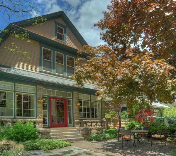
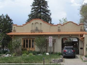
We have noticed that everything around here has the southwest architectural style … including Family Dollar

We crossed the Rio Grande, known as the Río Bravo. The river is the fourth longest river system in the United States, at 1,885 miles long. Since 1848, the river has marked the boundary between Mexico and the United States. Rio del Norte was the most common name for the upper Rio Grande , the use of the modern English name Rio Grande began with the early American settlers in south Texas. By the late 19th century, the name Rio Grande for the entire river, from Colorado to the sea, had become standard in the US. The Rio Grande was designated as one of the American Heritage Rivers in 1997. 

It is formed by the joining of several streams, just east of the continental divide. From there, it flows through the San Luis Valley, then south into New Mexico. The geology that created the 1,800-mile long Rio Grande River, was a millions-of-years-ago rift, or crack, between the Sangre de Cristo Mountains and the ranges to the west. Volcanic activity filled the crack with lava. About 3 million years ago, water draining from the San Juan Mountains of Colorado began carving the river that dissects New Mexico and, eventually, the west and southwest boundary of Texas and the Texas-Mexico border, before emptying into the Gulf of Mexico.

North of Santa Fe, Route 84&285 travel through the foothills of the Sangre de Cristo Mountains and a string of Eight Northern Indian Pueblos. Approaching the Tesuque Pueblo, one of New Mexico’s smallest pueblos, you will do a double-take. Seeing the distinctive Camel Rock, you'll find yourself turning around to get a closer look. Yep, this roadside oddity near Pojoaque is a natural attention getter. Pojoaque is the closest town to several Native America reservations in the area. To describe the Camel Rock … it's basically a rock that looks like a camel sitting down. There is a giant lower rock and a large rock which shoots upward forming a neck, which is crowned by a rock on top, the head.

We skirted around Santa Fe to arrive at Santa Fe Skies RV Resort, our home for the next 6 nights. I think this is the longest, we have stayed in one place since we started our Two Lane Adventure in mid-June. Wow, that says a lot!


We were here in 2016 and I do remember that the sunsets are spectacular.


I remembered correctly!

Saturday, September 29, 2018

Day 94 of 117 on our “Go West, Young Man” Two Lane Adventure – Friday 9/28/18


Today was our trip from Durango Colorado to Chama New Mexico. Since it is just over 100 miles, we relaxed at the campground in the morning … we have until 11 am to vacate. We departed Lightner Creek Campground, about 10:30 am. What a great stay we had here. We are going to share the information about the campground with Rod & Helen Coe, it is much closer to Durango than the park we stayed at in Bayfield on our SW Caravan.

We crossed over the Animas River. From Durango the Animas River flows south into New Mexico through the town of Aztec to its convergence with the San Juan River at Farmington. The only major tributary of the Animas River is the Florida River which joins just north of the Colorado–New Mexico border. Kind of a unique name, well, Spanish explorer Juan Maria de Rivera of Santa Fe recorded the name "Rio de las Animas" (River of Souls) in 1765. One theory is that the full name of the river was once "Rio de las Animas Perdidas" (River of Lost Souls), although this idea may indicate confusion with the Purgatoire River of southeastern Colorado.

We are traveling on US 160 E toward Pagosa Springs. Which is also park of Tracks Across Borders, Colorado’s newest Scenic Byway. This byway offers access to dramatic mountain scenery and layers of history. Including the storied pasts of our earliest American Indian inhabitants to the golden age of railroad travel and the rise of Wild West towns bustling with gold-seekers. The greatest significance of this corridor today, is the connection of the Durango & Silverton Narrow Gauge Railroad in Durango Colorado to the Cumbres & Toltec Scenic Railroad in Chama New Mexico and the fact that it connects the sovereign nations of the Jicarilla Apache in New Mexico and the Southern Ute in Colorado. 

The Utes are the oldest continuous residents of Colorado. Two of the seven original Ute bands, the Mouache and Capote, make up the present day Southern Ute Indian Tribe. They reside on approximately 800,000 acres in southern Colorado. The Jicarilla Tribe consists of two bands: the Llaneros, or plains people, and the Olleros, or mountain valley people. They once roamed a large part of northeastern New Mexico and southern Colorado. In 1887, they were given a permanent reservation in north central New Mexico, which now encompasses one million acres.

San Juan National Forest covers 1.8 million acres in the southwestern corner of Colorado. The San Juan National Forest abounds with natural and cultural treasures. Terrain ranges from high-desert mesas to alpine peaks, with thousands of miles of back roads and hundreds of miles of trails to explore. Five distinct life zones range from elevations near 5,000 feet to above 14,000 feet.

We passed by the entrance for Beaver Creek Ranch and Charlie made a comment that the house we could see was nothing special and they must have spent all their money on the entrance. Well, little did we know … it is the exclusive Beaver Creek Ranch, a private gated ranch community of minimum 35 acre lots. The ranch is gated, well maintained, and includes a homeowners association. They say it is the absolute best Colorado has to offer, 3 rivers, 2 lakes, private access to the 1.8 million acres of National Forest. Elk and mule deer over 200 inches are regular visitors to the property to take advantage of their private wildlife areas. The area is known for its abundant elk herd with over the counter tags, and mule deer that regularly make the record book.

Chimney Rock National Monument, is a must-see. The monument, known for its twin rock structures, was once home to the ancestors of the modern Pueblo Indians and boasts more than 200 ancient homes and ceremonial structures. Chimney Rock National Monument is a protected archaeological site with limited access through tours only.  Guests then drive in their own vehicles to the high mesa.  Only people on tours may drive to the mesa top.  The drive is 3 miles up a steep, winding gravel road to the upper parking lot at an elevation of 7,400 feet. This is where both Guided Tours and Kiva Audio-Guided Tours begin.  The ancient structures are not visible from the mesa top.  Tours do not climb Chimney Rock nor Companion Rock.

Navajo State Park is Colorado's Answer to Lake Powell. Navajo Reservoir Extends for 20 miles South into New Mexico. Resplendent Navajo Lake, the chief attraction in Navajo State Park, is nestled on the border between Colorado and New Mexico. The 15,000-acre reservoir’s sapphire waters hug flat-topped buttes and canyons, and the picturesque expanse is a prime fishing, boating, camping and wildlife-watching destination. The park facilities opened in 1964, two years after completion of Navajo dam in New Mexico by the federal Bureau of Reclamation. The dam, built on the San Juan River, backed the water up 35 miles into Colorado. The dam was constructed as part of the Colorado River Storage Project.

Located within the San Juan National Forest amid the majestic San Juan Mountains, Pagosa Springs offers visitors a rich geological and cultural history to explore. Known for its world-famous hot springs, "Pagosah" is the Southwestern Ute word for "healing waters".

We stopped at Wal-Mart so I could grab a few things and Charlie could listen to the Kavanaugh vote on the Sirius radio. There was an interesting chain saw carving across the street. Love those eagles!

After we got through the downtown portion of Pagosa Springs, we turned onto US 84 S. Driving on US 84, there is not much but ranches, farms, trees and a few watering holes.

We started to get out of the evergreens and into a bit more leaf changing color trees.

I love the way the scenery changes, every time we turn a corner. Love the cliffs and the lone tree!

Outside of Chromo, Colorado we found this unique home and a second home? It looks more like a space ship has landed.

We came to the Colorado and New Mexico State Line. I looked at my pictures from our caravan is 2016 and this is a different New Mexico welcome sign.

We are heading into the Chama Valley. Towering mountain peaks, scenic vistas and deep, colorful gorges grace every direction, Chama is a diverse valley region famous for its art treasures and natural beauty

While Tracks Across Borders Scenic Byway ends in Chama, your journey doesn’t have to. Ours does, as this is our overnight stop at Sky Mountain RV Resort.

See you tomorrow!

Day 93 of 117 on our “Go West, Young Man” Two Lane Adventure – Thursday 9/27/18


We took a tour of 3rd Street, which is home to many historical churches and homes of Durango. These homes are just a few examples of Durango's earliest and finest architecture. The character of these homes are as beautiful as the character of the people who built them and lived in them and formed the town, and the people who reside in them and care for them. Home. It's a simple word that conjures abundant and conflicting emotions. Home is an escape and a haunting, a refuge and a vacancy. Homes hold hidden spaces and host family dinners, sometimes too crowded. They contain the breathlessness of leaving, and the anticipation of returning.

On this shaded avenue stands Durango's historic St. Mark's Episcopal Church. St. Mark’s is as old as Durango. It is older, in a sense. As early as 1877, the founder, the storied Episcopal missionary C. Montgomery “Parson” Hogue, rode a San Juan Mountain circuit on horseback. In 1880, Parson Hogue held the new town’s first worship service the day after Christmas at the Delmonico Hotel. Fearless and persuasive, Hogue regularly visited Durango’s saloons and gambling houses, wearing cassock and six-shooter, to preach to the rough townsfolk. When the parson passed the plate, they dug deep, and these monies helped build St. Mark’s, Durango’s first church. In the summer of 1881, St. Mark’s opened its doors. St. Mark’s also doubled as the town’s first public school. Yet by 1883, when the bishop in Denver elevated St. Mark’s from mission to parish, the restless Parson Hogue had moved on to Silverton.

Just ten years later, the first recorded interest in Christian Science in Durango was noted. The list of people attending informal meetings included twenty two names. By December 1900 public services were being held and on January 6, 1901 the Durango Christian Science Society was formed.  The Society established a Sunday School and held all its services at 300 Newman Block. In 1905 Wednesday evening meetings were established and a Reading Room was opened to the public in 1906.  In January 1907 a Board of Directors was appointed and 15 charter members signed the bylaws, formally establishing the new Church organization.  Among those were the Mayor and his wife, a newspaperman, teachers, a banker, musician and store owners. In 1921 the present site on Third Avenue was purchased and construction began in the fall of 1922. The edifice was dedicated in 1924. At that time Durango was a bustling mining and ranching town of 6,000.

The Dwyer homestead originally consisted of 160 acres and a log cabin located south of Animas City on Junction Creek, including where the fairgrounds sit today. The brick home now standing at 2535 W 2nd Ave became the Dwyer residence in 1888, after his retirement. Placed on Durango's Registry of Historic Places in 1997, this landmark still boasts its original stained glass windows and gable ornaments. The illustrious Robert Dwyer served as Durango's first marshal, and later as La Plata County Sheriff. Dwyer is well-known for his role in taking down the Stockton Gang which was terrorizing Durango in the early 1880s.

Built in the Dutch Colonial Revival style in 1906 by Scottish stone mason David Ramsey. The gambrel roof is the distinguishing feature of the Dutch Colonial Revival.  Primarily a residential style, it was popular in Colorado between 1900 and 1925. This home became known as the Clark-Hatfield residence from its first owners. In 1926, it sold to Fred & Marguerite Clark. It is said that Hatfield was going to be a district attorney in town.

This Durango icon is now the home of Hood Mortuary, but it was once the residence of Ernest Amy and his bride, Isabelle. When Hood Mortuary first opened in 1902, it was on East Ninth Street next to what now is The Red Snapper. It moved to the Amy Mansion in 1932. Amy managed the San Juan and New York Smelter, a regional smelting center for ores coming out of the San Juan mines. He built the house in 1888 as a Shingle Style mansion to suit his wife's east coast upbringing. The smelters transformed the gold and silver ore from the nearby mines in the San Juans.

Known as the Perkins House, this residence was constructed in 1892 for Adair and Margaret Wilson. Adair Wilson was elected to the Colorado Senate in 1886, and also served as chief justice of the state court of appeals in 1897. The home, however, takes its name from Durango mayor Clayton Perkins who also resided here.

Built in 1912, this home belonged to George "Smoothie" West, a Colorado state senator. The American Foursquare structure also pays tribute to several other architectural styles, most notably the half-timbering of a Tudor. Half-timbering is a way of constructing wood frame structures with the structural timbers exposed.

This home is a Vernacular style home that's reminiscent of the American Foursquare. Vernacular architecture is an architectural style that is designed based on local needs, availability of construction materials and reflecting local traditions. At least originally, vernacular architecture did not use formally-schooled architects, but relied on the design skills and tradition of local builders. Built in 1912 for Robert Sloan, an associate of General William Jackson Palmer, co-founder of the Denver & Rio Grande Western Railway, and co-owner of Graden Mercantile, this home became known as the Sloan-Ayers home after Robert's daughter Mary Sloan-Ayers.

This is one of the few distinctly Mission Revival style homes in Durango. The defining characteristics include roof parapets and simple stucco or plaster siding. The Harry Jackson house, is a fine example. Built in 1929 for Harry Jackson, a local merchant, the home's stucco siding, roof parapets, arcaded entry porch, and flat roof are characteristic elements of the Mission home.

The Camp House is a fine example of a Folk Victorian. Next to the Craftsman Bungalow, this is the style most often associated today with being a historic home. It was built in 1883 for AP Camp, the founder of Bank of Durango, now First National Bank. The home maintains many of its original elements, both inside and out. The Folk Victorian is a simpler style of Victorian construction verses the Queen Anne, while still maintaining the decorative trim elements.

On the National Register of Historic Places in La Plata County, this brick Queen Anne sits on the corner so it’s splendor can be seen from two sides. The Queen Anne style represented the culmination of the picturesque, or romantic movement of the 19th century. It was built in 1898 by grocer Walter Weightman, the home contains classic Queen Anne brickwork, oculus windows, gable trim, and spindle designs on the porch. Several sources refer to the home as the Fields Home, named after a sheep man who owned it.

Tomorrow is our day to move. It has been a great few days to relax in an awesome town!