Monday, October 7, 2019

2019 Rally Route - Monday September 23rd, 2019 – Day 15


Today, we decided to drive to Congaree National Park in Hopkins South Carolina. Congaree National Park protects the largest remaining tract of old-growth bottomland hardwood forest in North America. As we walked, we discovered Congaree’s cultural history and its natural beauty.

Our first stop was the Harry Hampton Visitor Center. We learned that though known for its unique natural features such as magnificent stands of bald cypress and tremendous biodiversity, the landscape of Congaree has a rich cultural heritage as well. People have been using the floodplain for many purposes for over 13,000 years, long before it became a national park. While water has been an enduring force that has shaped this landscape, humans have left their mark as well. From prehistoric natives to Spanish explorers, Revolutionary War patriots to escaped slaves, loggers and conservationists, this forest landscape is rich in the stories of the people who have called it both a home and a refuge, and have helped to make it what it is today.

Astonishing biodiversity exists in Congaree National Park, the largest intact expanse of old growth bottomland hardwood forest remaining in the southeastern United States. Waters from the Congaree and Wateree Rivers sweep through the floodplain, carrying nutrients and sediments that nourish and rejuvenate this ecosystem and support the growth of national and state champion trees.

The boardwalk trail offers stations numbered 1 to 21. I will share some of these stations with you, as we walked along the boardwalk. At station #2, we looked at the ground on either side of the boardwalk and saw dark-colored mud, a mixture of clay and old leaves. This mud, called Dorovan muck, is eight-feet thick and plays an important role in the health of the floodplain. It filters water, traps pollution, and turns pollutants into harmless compounds. By filtering water, it helps keep the floodplain and the Congaree River clean.

The majestic bald cypress trees produce “knees” that rise up from the roots of the tree and can be seen throughout the forest floor. While their function is not entirely understood, it is believed that the knees provide the tree with extra structural support during floods and high winds. Bald Cypress trees can live to be 1,000 years old. Bald Cypress wood is rot and water resistant. Historically, the Catawba and Congaree tribes used these trees for canoes.

Water Tupelos dominate the landscape at Station #4 and are identified by their swollen trunks. These trees only grow where water is plentiful.


See the moss on the on the lower part of the tree trunk, this is an indicator of water levels from previous floods. Flooding is a natural occurrence in Congaree National Park and is important for bringing fresh nutrients into the floodplain.

At Station #6, we learned that standing dead trees are called snags. The tree itself may be dead, but snags are full of other life. Many species of insects, spiders and fungi make their home in and on the dead wood. At the base of this snag you will see the work of a pileated woodpecker. The woodpecker breaks off woodchip-sized pieces to reach the insects living inside.

  
See the many unique forms of fungi growing on snags throughout the forest.

The impressive height of Congaree’s forest is the result of the rich soil, frequent flooding, a long growing season and a history free of intensive logging.

Here the trees you see average over 130-feet in height, making Congaree one of the tallest deciduous forest in the world. The forest is rich in biodiversity, meaning it supports an abundance of many different kinds of living organisms.

At Station #9, the low area you see on both sides of the boardwalk is called a gut. Guts and sloughs are low channels in the forest that helps disperse water throughout the floodplain when the Congaree River floods. The guts fill with water prior to the entire forest floor flooding. During floods, silt and soil are deposited, replenishing the floodplain with nutrients.

The grand tree you see here is a loblolly pine. It is unusual to find pines growing in wetlands areas, however, loblollies can tolerate living in wet conditions better than other species.


Loblolly pines are the tallest trees in South Carolina. This tree is over 150-feet tall and is a former State Champion.

Once a bend in the Congaree River, Weston Lake is now an oxbow lake. Over 2,000 years ago the river gradually changed its course and meandered south, leaving behind Weston Lake. The lake is slowly filling with clay and organic debris.

We saw some yellow-bellied and snapping freshwater turtles. There were some smaller fish there too!

South Carolina is known as the Palmetto State. It is named after the state tree, the cabbage palmetto. The short, fan like palms beside the boardwalk are dwarf palmettos, relatives of the cabbage palmetto. They are the hardiest palms due to their ability to withstand freezing temperatures. Dwarf palmettos thrive best in wet, sandy areas where disturbance, like a hurricane, causes a gap in the canopy, allowing sunlight to reach the forest floor.

The 18th Amendment was passed in 1919, prohibiting the sale and consumption of alcohol in the United States. Moonshiners and bootleggers found refuge in places like Congaree River floodplain to earn a living. The iron box we found is an old still, used to make alcohol. 

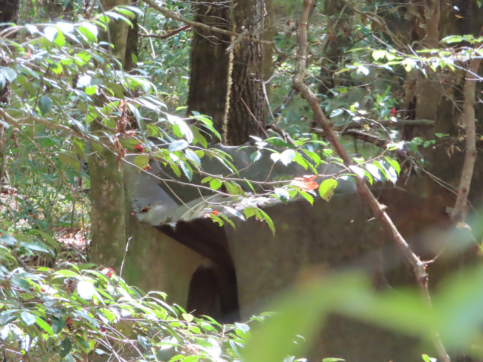
Water and corn squeezings were used to make sour mash. The mash was heated and distilled through copper tubing to produce moonshine. The Congaree floodplain’s difficult terrain and tall trees made it a perfect place for moonshiners to hide stills and produce their illegal liquor.

On September 21, 1989 Hurricane Hugo left its mark in this part of the forest. Accompanying tornados likely touched down here, leaving large open gaps in the tall trees and canopy. Many large trees did not survive, but seedlings and vines sprouted with abundance of sunlight reaching the forest floor. Natural disturbances like this, play an active role in the forest renewal.

As a repoter and editor for the State newspaper, Harry Hampton began a campaign in the 1950’s to save the Congaree River floodplain. An avid outdoorsman and hunter, he spent time exploring the old-growth forest. The Sims trail, is a former road. Roads historically used by hunters, fishermen and loggers are scattered throughout the park. They serve as a reminder of the long human history and use of the land.

His efforts, with the help of many others, led to the establishment of Congaree Swamp National Monument in 1976, predesignated Congaree National Park in 2003.

We found wildlife too …. A snake

Wooley caterpillars

and Spiders

lots of spiders

and unique webs that were almost yellow and very visible!


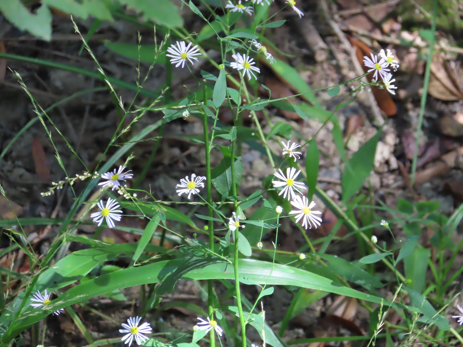
There were other colors besides brown and green in this forest too!


We only found a few reminders that man has been here, besides footprints.


Sunday, October 6, 2019

2019 Rally Route - Sunday September 22nd, 2019 – Day 14


Today, we said “See You Later” to Big Hart COE campground. It is only see you later, because we will be back! We lined up on the main road and hooked up the tow vehicles after we all dumped.

Naturally, Charlie found someone to talk to. Those ladies that are the hosts for this park do an amazing job! I wish I could remember all three names, but Nanette is the only one that stuck in my head! Charlie was chatting with Nanette and the park ranger.

     
We took our friends on another Two Lane Adventure today! We traveled on US 78 to GA 43. You know it is country … with horse and hay bales in the fields!

Along GA 43, you enter Raysville Georgia, but don’t blink or you might miss it. A post office called Raysville was established in 1894, and remained in operation until 1908. Now, there is a convenient store or restaurant, I am not sure which it was now. There is a campground and a marina with a campground. That is it, don’t blink. The community was named after Joseph Ray, a pioneer settler.

We crossed over Little River. They say the scenery along the river is all wild as it winds through the Clarks Hill Wildlife Management Area. The river harbors numerous native fish species. There are also rocky granite outcrops, native wildlife like white tail deer, wild turkey, fox, squirrel, wood ducks, turtle, beaver, river otter and bald Eagle. There is also rich history along the river from gold mines, Quaker settlements and Native American Indians.

After Raysville, we turned onto GA 220 and headed toward Lincolnton. GA Route 220 is unique, it runs southwest-to-northeast in a semicircle completely within Lincoln County.

Lincolnton, the seat of Lincoln County, is located in northeast Georgia, is situated at the intersection of US highway 378 and Georgia highways 43 and 47. The settlement of Lincolnton, located near a water source then called Founders Spring, was named the seat of the county about 1800. It was incorporated in 1817. Like the county, the town was named for General Benjamin Lincoln, a Massachusetts officer of the Revolutionary War (1775-83) who commanded American forces in the southern states. General Lincoln also served as U.S. secretary of war during the latter years of the American Revolution.

In the fall of 1917 downtown Lincolnton, which consisted primarily of wooden structures, was largely destroyed by fire. Rebuilding began in 1918. The current county courthouse in Lincolnton dates from 1915 and is listed on the National Register of Historic Places. Also on the register is the Lamar-Blanchard House (1823), built by Peter Lamar, the "king of Lincoln," and now home to the Lincoln County Chamber of Commerce, Welcome Center, and Development Authority. Until it closed in 1996, Price's Store was one of the oldest authentic general stores still in operation in Georgia. Located off Double Branches Road in Lincolnton, the store opened in 1897.

In Lincolnton, we turned onto US 378, we will be on this route most of our trip today.

We crossed Soap Creek. Strange name for a creek. I can imagine the settlers on the edge of the creek, washing clothes and sending the soap downstream. The Soap Creek Wildlife Management Area is located near here. This 1,000-acre property offers hunting opportunities for deer, turkey, and small game along the creeks edge.

US 378 and SR 43 meet the eastern end of SR 220 just west of Elijah Clark State Park. Elijah Clark State Park is named for a frontiersman and Georgia war hero who led pioneers during the Revolutionary War. A log cabin replica of the Clark home displays furniture, utensils and tools circa 1780. Visitors to the park can also view the graves of Clark and his wife, Hannah.

SR 43 ends at the Georgia – South Carolina state line at the center line of the Savannah River.

Welcome to South Carolina!

US 378 enters Sumter National Forest and passes the Baker Creek State Park. Baker Creek is operated seasonally and caters to those looking for fun on Lake Thurmond, a wild ride on South Carolina mountain bike trails or a quick camping trip. Some of South Carolina’s best mountain bike trails are located here. The park is home to 10 miles of rolling, loop trails that take bikers through oak and pine woodlands.

The highway continues to the town of McCormick, SC. The town of McCormick is named for inventor Cyrus McCormick. With help from an SCAC grant, the McCormick Chamber of Commerce, Willington on the Way, and McCormick Arts Council (MACK) debuted a mural (above) celebrating the history of the area. This mural consists of a series of panels created by McCormick artist Jeffery Callaham and included the support and enthusiasm of more than 120 local elementary, middle, and high school students. The mural work is untitled. The building mural depicts images of animals and people, so Jeffery gave a project to the kids to make up a story about things in the mural and they would make a graphic novel about it.  The town wanted a work that embodied a railroad theme, since McCormick was a railroad stop town, though the Modoc Native American tribe put up a fierce resistance to the train invasion of the area and delayed McCormick’s rail stop.  The trains still run through McCormick, but they are now freight versus passenger trains. After the project was finished, Jeffery painted four panels to go with the novel. They are mounted on the McCormick library’s walls for viewing with information about the kids’ stories.

US 378 leaves McCormick South Carolina and forms the forms the southern border of Sumter National Forest. I found an old barn with lots of old signs. I love old barns and old signs too. I find it interesting that the Coca-Cola sign is still so vibrant!

Who is Candler Grady Matthews, Sr? And why is a Road named after him? He was born in Saluda County in 1906, and graduated in 1929 from The Citadel. He taught school for 5 years and owned and operated Matthews Chevrolet for 35 years. Mr. Matthews helped organize the Saluda Finance and Insurance Corp. and served on the first Beautification Committee in Saluda County. He served as Trustee of Saluda District 1 Schools for many years and he and Mooney Player organized the first Little League Baseball team in Saluda County and was one of 3 charter members of the Saluda Lions Club. Mr. Matthews was an original member of the Saluda County Chamber of Commerce. Mr. Matthews served 2 consecutive terms on the State Highway Commission and was instrumental in the building of many sidewalks in Saluda County as well as the paving of many roads. He also served on the State Highway Department Acquisition Board for many years. In 1995, Mr. Matthews was honored for his service to his community by the naming of 15 miles of Highway 378 after him.

The highway enters the town of Saluda along Church Street and intersects Main Street. There are at least 10 other markers are within walking distance of this marker. The Saluda Old Town is a small, oval, earthen mound about eight feet in height. Historic records refer to this as the site of a town of the Saluda Indians of the late 17th and early 18th century and as having been abandoned by 1712 when the Saludas moved north, eventually going as far as Pennsylvania. The historic records also indicate this to be the site at which, on July 2, 1755, the Cherokee Chief Conocartee (Old Hop) signed a treaty with South Carolina Governor [James] Glen. The treaty recognized the sovereignty of the King of England over all Cherokee lands in South Carolina, 360,000 square miles. This later became Ninety Six District comprising ten counties. This recognition was in exchange for some $365.00 worth of presents from Governor Glen. This site, just off the Cherokee Trail, was chosen for the treaty because it was halfway between the principal Cherokee town of Keowee and Charleston. The meeting was held partially because the English were afraid the Cherokees would make a treaty with France. Governor Glen believed that this treaty would keep the Cherokees from abandoning the English after Braddock's defeat in the French and Indian War.

Saluda County Courthouse is home to several monuments celebrating this area’s history. Originally called Butler County, the county was renamed Saluda two days after its incorporation in honor of the river which forms its northern border. The word “saluda” comes from the Cherokee Indians and means “river of corn.” The Saluda town clock stands in front of the courthouse, along with the Bonham and Travis memorial which honors heroes of the Alamo (and Saluda County natives!) William Barret Travis and James Butler Bonham.

In Leesville South Carolina, we came upon a traffic circle. It is the first traffic circle we have come across in SC. It was interesting, once we got around the traffic circle, we came upon a Volunteer Fire Department, called “Circle” Vol FD. There is also an EMS station and the Circle Diner on this traffic circle.

We crossed over a portion of Lake Murray. The road is under construction, looks like a widening and raising the bridge levels. The lake was named after William S Murray, who was an engineer involved in the design and creation of the dam. South Carolina Electric and Gas built the dam in order to generate electricity. The lake and dam were under construction from 1927 through 1930. Approximately 100,000 acres of land was purchased for the building of the dam and lake. Land was purchased from more than 5000 families. The land sold between $15 and $45 an acre. To make room for the lake, nearly a dozen communities had to abandoned, including Derrick, Pine Ridge, Selwood, Wessinger, Cantsville, Leaphart, Savilla, Boyleston, Lorena, Holly’s Ferry and Lorick’s Ferry. Six schools, three churches and about 193 graveyards containing 2,323 graves had to be moved.

On August 31, 1929, the reservoir began filling with water. Lake Murray covers approximately 50,000 acres of land and 650 miles of shoreline. It is 41 miles long and 14 miles wide at its widest point. On Dec 1, 1930, at 7 a.m. the first electric power-- -10,000 kilowatts---was delivered and Lake Murray was celebrated as the world’s largest power reservoir. The official name of the dam is Dreher Shoals, although most people refer to it as Lake Murray Dam. In the early 1940s, the U. S. military use the lake to train bomber pilots on the B-25 bomber airplanes. Seven of the lake’s islands, Bomb, Shull, Wessinger, Dreher, Spence Mistey, and Holley Key were used as practice.

Along the edge of Highway 378 in Lexington SC, there is the Lexington County 9/11 Memorial. I tried to find out more information about it, but no luck ... just lots of pictures on flicker!

US 378 crosses the Saluda River as you enter Columbia SC.

Arrived at Sesquicentennial State Park, our home for the next five nights. Sesquicentennial State Park, affectionately known to locals as "Sesqui," is a spacious, green getaway in the heart of the Sandhills region. Inside of the 1,400 acres of pines, you forget just how close you are to bustling, downtown of Columbia, South Carolina.

Sandy and I took a walk around the park to the lake. There are 1.5 miles of walking trails and 6 miles of biking trails.

The water level on the lake is really down. This area of South Carolina has had no rain in months.