Wednesday, August 30, 2017

Tuesday July 11th - Canadian Maritimes to New York 2017

We got up today, had a leisurely breakfast and left Farmington ME. We enjoyed our visit with Phyllis & Wayne and thank them for their hospitality!


Wilton, Maine is home to the annual Wilton Blueberry Festival. It is always held the first Friday and Saturday of August. It began in 1982 with a simple ‘Blueberry Church Bazaar.’ As the years have passed, it has grown into a two-day signature event, and a time for people from town and around to gather, socialize, and celebrate the heritage of this great region. 35 years running and averaging more than 60 unique events throughout the weekend, the festival has something new to offer year after year. We were three weeks too early to enjoy it this year!

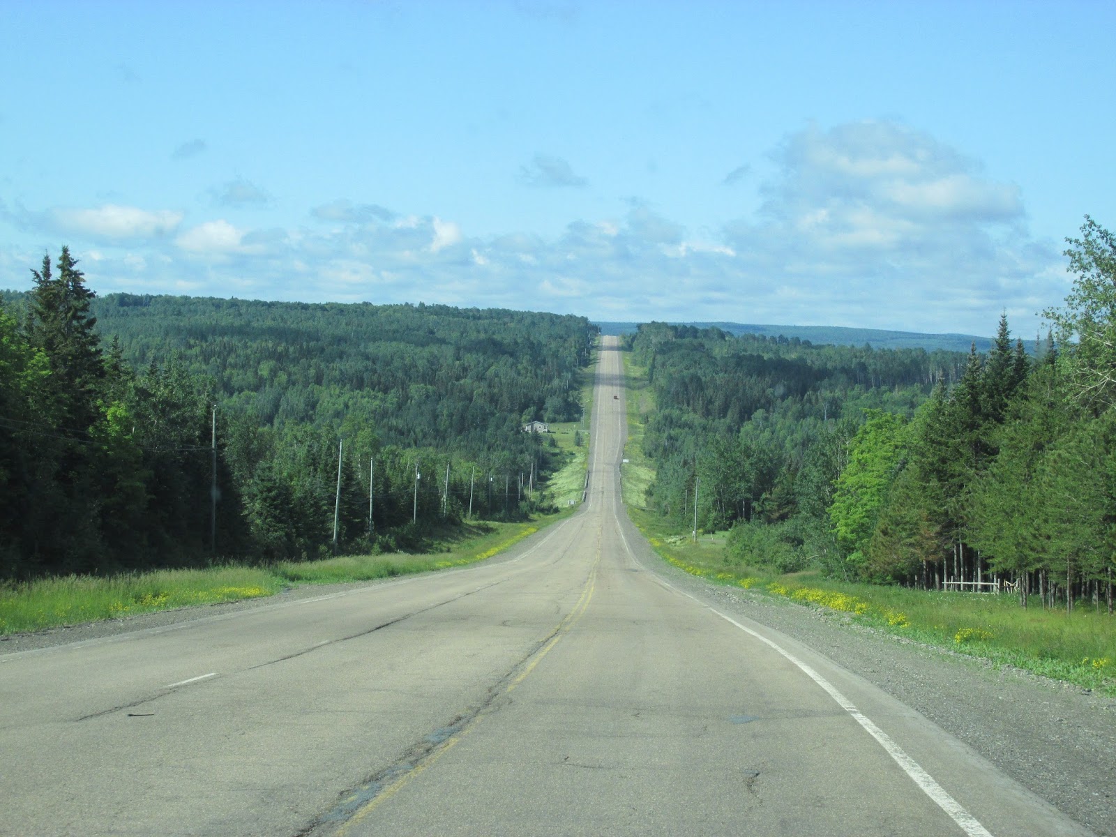
There certainly are many mountains in Maine. The shadows they create are awesome, even on an overcast morning!

We entered the town of Dixfield Maine on Route 2. The town motto of Dixfield is "The Only One" because it is the only town in the world to claim that name. Where did a name like that come from? In 1795, the first six permanent settlers arrived with their families Gould. It was called Holmantown Plantation until part of it was incorporated on June 21, 1803 as Dixfield, the remainder of the plantation would be incorporated in 1818 as Mexico. Dr. Elijah Dix of Boston, a substantial landowner in the area, promised to donate a library for the town if the citizens changed its name from Holmantown to Dixfield. The citizens complied, after which the town received dusty old boxes of medical books printed in German. Dr. Dix also left his name on Dixmont, where he died while visiting in 1809 and was buried. With several streams for water power, Dixfield developed into a small mill town. It had sawmills and gristmills. It also produced cheese, carriages, shingles, toothpicks, rakes, wooden boxes, flies and leaders, boots and shoes. Dixfield once had a marble works.

Next we came into the town of Mexico, known as the gateway to Western Mountains. The Holmantown Plantation's remaining portion, which had been first settled by Isaac Gleason, was incorporated on February 13, 1818 as the town of Mexico. The name was inspired by local sympathy for Mexico's 1810–1821 fight for independence from Spain. Then known as Mexico Corner, it developed as a farming community with mills at the streams. Mexico is located on several hills overlooking the Androscoggin River. Across the river is the town of Rumford, which has a large paper mill. The Swift River empties into the Androscoggin at Mexico's southwest corner, its historic business center positioned in the 19th-century near the source of water power. While the large Androscoggin forms Mexico's southern boundary with Rumford, the smaller Swift River more or less follows its western boundary with that town. Mexico's downtown is located on land formed by the northeast corner of the right-angle junction of the two rivers. These low lying riverbanks in Mexico have flooded many times, including 1936, 1953 and 1987.

Speaking of the Town of Rumford, it was originally called New Pennacook Plantation. The township was granted in 1779 to Timothy Walker, Jr. and associates of Concord, New Hampshire. Both Pennacook and Rumford are former names of Concord, from which many early settlers arrived. Incorporated in 1800, the town would later annex land from Peru and Franklin Plantation. Located in the foothills of the White Mountains, Rumford has a mighty fiberglass woodsman (and Babe the Blue Ox) welcoming visitors. Rumford is also home of the Tallest Falls east of the Niagara, which are, in fact, just up the street.

The Pennacook Falls, called by historian George J. Varney "the grandest cataract in New England," where the Androscoggin River drops 177 feet over solid granite. Bands of St. Francis Indians once hunted and fished here, where salmon spawn in the 13-acre pool below Upper Falls, a barrier that fish cannot pass. The river is home to a large population of the finless brown variety of trout. Indians also came here to trade furs brought from the lakes region. Sawmills and gristmills were built to harness water power from the falls.

We passed Grafton Notch State Park. It has waterfalls, a cave and a couple of big mountains. Old Speck Mountain topping out at 4,170 feet and Baldpate Mountain East Peak is 3,780 feet and West Peak at 3,662 feet. A trip to this state park does not need to include a climb to the summit to experience great views. There are great views of the notch from some notable spots that don’t require much effort. And you can still hike part of the historic Appalachian Trail. If you are not a hiker, but a waterfall lover, like me, the highlight of the park is Screw Auger Falls.

In the community of Bethel, Maine you can see the imposing views of Grafton Notch State Park, Bethel's tree-lined historic downtown village common and the White Mountain National Forest. Bethel is situated on the banks of the beautiful Androscoggin River and the Appalachian Mountains surrounds the community. For over two hundred years, Bethel has been a favorite tourist destination. We found this Norsmen Motel, which reminded us of our time in the Canadian Maritimes.

In Gilend Maine, we found the Maine National Guard Bog Brook Training Area. The Army Guard’s Bog Brook training area plays host to a pair of week-long youth camps, where around 200 Maine youngsters, ages 5 to 18, come together for camaraderie and campfires. It is also home to many training exercises for the National Guard troops of western Maine and New Hampshire. We crossed from Maine into New Hampshire.

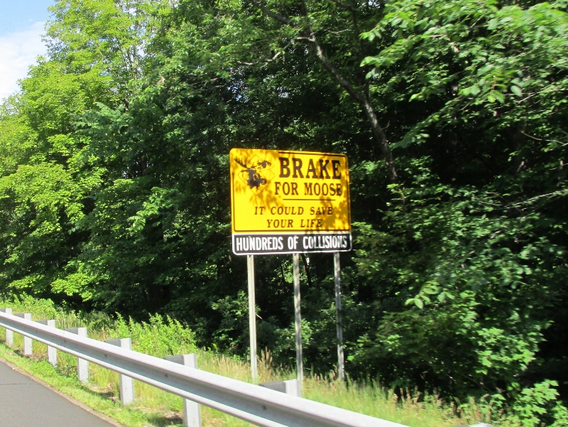
The first signs we saw after the welcome signs … were Moose crossings …. This is a heavily wooded area, so I believe these signs! We were traveling along the edge of the White Mountain National Forest.

The 800,000-acre White Mountain National Forest is a powerful presence in the White Mountains. Adjacent to or part of every village and town, the National Forest ensures that this region will remain largely undeveloped. The WMNF is the only National Forest located in either New Hampshire or Maine. Most of the major peaks over 4,000 feet high and there are over 100 miles of the Appalachian Trail traversing the White Mountain National Forest. The town of Gorham, New Hampshire is called the Great Woods North Region. Woods and water dominate the landscape in the Great North Woods. Sporting adventures are a way of life, from hunting to fishing, camping, hiking, boating, wild life watching and snowmobiling.

Don’t you just love it when you’re driving along and you look up and somebody has built something that makes you just go Hmmmm? Well we found one of those things outside of Jefferson, New Hampshire. It is a stone tower on the side of Route 2. Internet research tells me it is Carter’s Stone Tower. James Richard Carter, a paper company mogul from the late 1800, built a vacation estate in Jefferson. The 1800’s was when the rich started to build vacation homes and venues like the Bretton Woods and Mt. Washington hotels for the well-to-do to get away from the city during the hot summer’s. After finishing the house and grounds he is reported to have built this rock tower which he may have called “Carter’s Tower of Foolishness”. The building that is still standing today has a series of inside stairs to the top of the tower where panoramic view of the surrounding country can be seen. Apparently there may have been a practical application for this tower. A railroad line was nearby and since in those days trains were fired by coal sparks and fires were a common occurrence along train lines. So the tower may have been for a fire watch to protect the nearby estate, but it is all conjecture.


We turned onto Route 116, heading toward Littleton, New Hampshire. It was called Chiswick (Saxon for "Cheese Farm") in 1764. The town was part of Lisbon until 1770, when it was granted as Apthorp in honor of George Apthorp, head of one of the wealthiest mercantile establishments in Boston, Massachusetts. The land was later passed to the Apthorp family's associates from Newburyport, Massachusetts, headed by Colonel Moses Little. 

Colonel Little held the post of Surveyor of the King's Woods, and the town was named in his honor when it was incorporated in 1784, the same year New Hampshire became a state. Located along the banks of the Ammonoosuc River is the Littleton Grist Mill. The historic mill first opened in 1798, and has been fully restored to its original appearance. Between 1867 and 1909, the local Kilburn Brothers factory published photographs, stereoviews, and sold stereoscopes, double-picture viewers popular in the Victorian age.

Pollyanna of Littleton is the centerpiece of historic downtown as an ambassador of cheer and community spirit for residents and visitors alike. With her arms flung wide open, giving everyone a welcoming wave! Littleton's jubilant bronze sculpture tributes hometown author, Eleanor H. Porter, who is best remembered as the creator of the world's most optimistic character, Pollyanna. Pollyanna Whittier is an orphan who goes to live with her mean aunt in the dispirited New England town of Beldingsville, Vermont. 

Community Piano, notice Pollyanna on the crosswalk!
Influenced by her father’s unending optimism, she simply “plays the glad game” whenever things get bleak—when she’s sentenced to eat bread and milk in the kitchen with the servant, Nancy, for being late to dinner, she profusely thanks her aunt because she loves milk and bread and Nancy. Porter’s book sold over a million copies the first year, 1913, and by 1920 had already gone through 47 printings, a Broadway play, and the first of many films. Porter penned the book’s sequel, Pollyanna Grows Up, in 1915, and several other writers have written at least 13 more since.

The Pollyanna Gateway to the covered bridge & river
Pollyanna’s influence reaches much further than New England. Allan Moore’s comic The League of Extraordinary Gentlemen features a character, Polly Whittier, who maintains an optimistic outlook despite attacks from the Invisible Man. Merriam-Webster defines a “Pollyanna” as “a person characterized by irrepressible optimism and a tendency to find good in everything,” and Ray Bradbury once described himself to William Plummer (in a scrapped interview for the Paris Review in 1976) as being “too much Pollyanna… But I don’t think I’m too over optimistic.” Porter left Littleton for the New England Conservatory of Music and never came back, but her forever optimistic character left an impression on the people of the town, and they commemorated her gracious spirit in bronze in 2002.


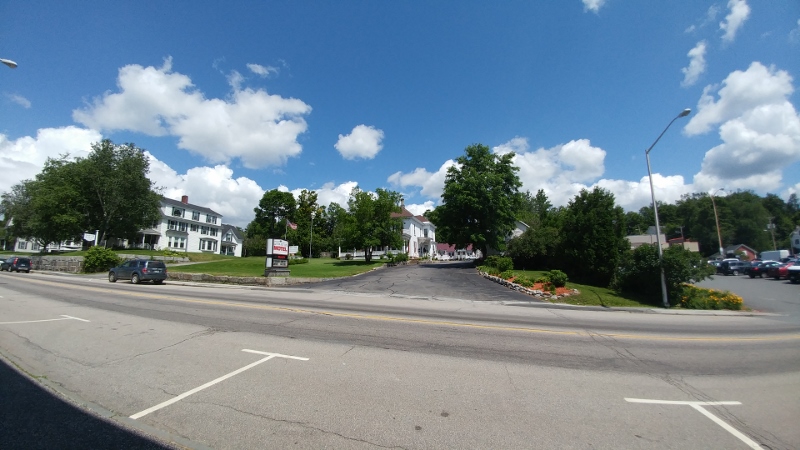
We visited Gail at the hotel she works at, Larry stopped in to say hi too! 

Ron and Patty opened their home and driveway for our overnight stop. We had dinner at The Little Grill at the Depot and toured the town and took a trip to Larry & Gail’s house. 

It was great to see them all! 

Tuesday, August 29, 2017

Monday July 10th - Canadian Maritimes to New York 2017

We departed Houghton Maine and ended our stay My Brother’s Place campground with Walter and Betty this morning. Since we are traveling with another couple, we headed down Interstate 95, toward Bangor.

We crossed the Captain Ambrose Bear Stream and I made the assumption that it was named after a military man. Well, it was … but, not for any of the branches of service I thought! It used to be known as B Stream in Houlton. Bear, who grew up in Lewiston, is the nonvoting tribal member of the Houlton Band of Maliseet Indians in the Maine House of Representatives. Captain Ambrose Bear Stream was named in recognition of the role one of his ancestors played in the American Revolution. Ambrose Bear was a Maliseet chief in 1777, and historical records show he served under Col. Jonathan Eddy, an officer in George Washington’s Continental Army. Bear is credited for his efforts during the Second Battle of Machias, in which he and other members of the tribe were among the soldiers who fended off an attack of British war ships on the town in what is thought to be one of the first naval engagements of the war. According to the historic records, Bear led a party of 100 canoes and was instrumental in beating back the British as they sought to attack Machias with war ships. Bear also was credited with serving in a raid on British-held Nova Scotia a year earlier. With State lawmakers making requests to rename bridges for other Mainers who played significant roles in the state’s military history, it is fitting to have the stream in Houlton renamed for an American Indian.

We are back in the US … into another season in the states … the Construction season!

Mount Katahdin is the highest mountain in the U.S. state of Maine at 5,267 feet. Named Katahdin by the Penobscot Indians, which means "The Greatest Mountain", Katahdin is the centerpiece of Baxter State Park. Percival P. Baxter was governor of Maine during the years of 1921-1924. He enjoyed fishing and vacationing in the Maine woods throughout childhood and his affection for the land and Maine’s wildlife were instrumental in his creation of a park for people of the State of Maine. He began with the purchase of almost 6,000 acres of land, including Katahdin, Maine’s highest peak. In 1931, Baxter formally donated the parcel to the State of Maine with the condition that it be kept forever wild. 

Over the years, Governor Baxter purchased additional lands and pieced his park together, transaction by transaction. He made his final purchase in 1962. Since then, additional purchases and land gifts have increased the Park’s total size to 204,733 acres. Demonstrating not only enormous generosity, but admirable foresight, Baxter left a trust of nearly 7 million dollars to ensure that Park managers would have sufficient funds to maintain the Park without ever having to compete for Maine taxpayers’ dollars from the general fund account.


The Penobscot River, including its branches, is the longest river entirely in Maine. Its branches originate along the Canadian border in northwestern Maine and then flows 70 miles south to the head of tide in Bangor. The watersheds associated with the Penobscot’s four branches are forested and only sparsely settled and developed. The variety of habitats found throughout the Penobscot drainage support many game fish species, including brook trout, landlocked salmon, smallmouth bass, white perch, and chain pickerel. Anglers can select sections of river to fish based on their preferences for species they desire to catch. The West Branch is noted for both wild brook trout and landlocked salmon. Unlike most Maine landlocked salmon populations, West Branch salmon are unique for spending their entire lives in the river environment. The East Branch of the Penobscot boasts wild brook trout and landlocked salmon fisheries. The Main Stem of the Penobscot offers good fishing for small mouth bass. In addition to the resident smallmouth bass, anadromous game fish species such as Atlantic salmon and striped bass have access to the free flowing section of river.

The Penobscot Tribe (Panawahpskek) are an indigenous people in North America with members who reside in the United States and Canada. They are organized as a federally recognized tribe in Maine and as a First Nations band government in the Atlantic Provinces. They are part of the Wabanaki Confederacy, along with the Abenaki, Passamaquoddy, Maliseet, and Mi'kmaq nations, all of whom historically spoke Algonquian languages. Their main settlement is now the Penobscot Indian Island Reservation, located along the Penobscot River. The word "Penobscot" originates from a mispronunciation of their name for themselves: Penawapskewi. The word means "rocky part" or "descending ledges," and originally referred to their territory on the portion of the Penobscot River between present-day Old Town and Bangor. They had a hunting-gathering society, with the men hunting beaver, otters, moose, bears, caribou, fish, seafood (clams, mussels, fish), birds, and possibly marine mammals such as seals. The women gathered and processed bird eggs, berries, nuts, and roots, all of which were found throughout their native lands.

At Exit 185, on I-95 in Bangor, Betty and Walter continued south … and then there was one! We started as one RV on the 26th of May, we became a three vehicle convoy on the 29th of May, when we met up with Jack & Jackie and Walter & Betty. On the 4th of June, we joined the Yankee RV Caravan and traveled as a group of 20 rigs for the next thirty days. As we all went our separate ways, the three rigs we started with stayed together for a while … we lost Jack & Jackie at the New Brunswick / Quebec border yesterday. And today we lost Walter & Betty and we became one again ….

In Bangor, we had a late breakfast or an early lunch …. Depending on what you ate … with Don & Donna London at Dysart's Truck Stop. 

It was great to visit with them! We have heard about the hard work that they have completed on their home and it was great to see it! They should be very proud of the end result! It was a short visit, but so glad we did it!

We are back into Moose Country! We never saw any Moose, just the signs!

The Kennebec River flows through the heart of Maine, from its origin at Moosehead Lake for more than 100 miles downstream to the head of tide in Augusta. You'll find a variety of environments in which to fish for stocked and wild brook trout, rainbow trout, brown trout, stocked and wild landlocked salmon, smallmouth bass, striped bass and anadromous shad, which return to freshwater to spawn. The uppermost portion reaches flow through a deep gorge noted more for its whitewater rafting than its fishing. Access to the gorge is limited. Below the gorge the gradient moderates, and although access to the river is still limited, you'll find more opportunity to fish this forested, undeveloped stretch. Although you'll be traveling through a very populated area of Maine, you'll be isolated while you're on the Kennebec River in a canoe or kayak.

We transitioned onto 104W. There is a 104 in NY too … have we traveled that far that fast? I doubt it … but it is a nice thought!

According to state records, the entire area now known as Fairfield was originally the Fairfield Plantation.  Settlement in the plantation may date back to 1771 when Jonathan Emery built a house on Emery Hill near the banks of the Kennebec River. Other settlers established themselves nearby and a small community began to develop.  In 1780, William Kendall purchased the mill of an earlier settler (Jonas Dutton) as well as much of the land in the area. The entire village area came to be known as Kendall's Mills. While the Kendall's Mills settlement was developing, a second population center was established.  Nearby, a group of Quakers under the Bowerman brothers established another settlement in North Fairfield in 1782. With one area of the town being primarily industrial and the other primarily agricultural, it is not surprising that differing priorities led to debates and arguments. The dispute came to a head in 1856 and the towns separated. Through the years, the boundaries and size of the town have changed. Land has been offset to Norridgewock and to Bloomfield and land has been added from Benton. Today the town covers nearly 55 square miles and includes the geographic areas of Fairfield Center, Nye's Corner, Hinckley, Larone, North Fairfield, Shawmut, and the downtown area (formerly called Kendall's Mills).

We turned onto Route 139 W and into the town of Norridgewock. It was situated on the New England and Acadia border. The area was once territory of the Norridgewock Indians, a band of the Abenaki nation. English colonists suspected Father Sebastien Rale, the French missionary at the village since 1694, of abetting tribal hostilities against British settlements during the French and Indian Wars. During Father Rale's War, soldiers left Fort Richmond in whaleboats until they reached Taconic Falls, then marched quietly to Norridgewock Village, arriving on August 23, 1724. Battle of Norridgewock was "sharp, short and decisive," leaving 26 warriors slain, 14 wounded and 150 survivors fleeing to Quebec, Canada. Father Rale was among the dead. The British settled the area in 1773, then called Norridgewock Plantation. In 1775, Benedict Arnold and his troops marched through on their way to the Battle of Quebec.

A sawmill was built to manufacture the region's abundant hardwoods, used in local factories to make carriages and furniture. Norridgewock also had a gristmill and granite works. Built in 1849 and replaced in 1929, the 600-foot Norridgewock Covered Bridge across the Kennebec River was the second longest covered bridge in Maine after the 792-foot Bangor Covered Bridge, which was built in 1846 across the Penobscot River to Brewer.


We moved onto Route 2, which will carry us through Maine, New Hampshire and Vermont! 

We saw a jeep with a GR8Top … It offered coverage of the two people in the cab, but leaves the back end open like a pick-up truck … very interesting concept!

We arrived in Farmington, Maine our destination for today. This area was once territory of the Canibas tribe of Abenaki Indians. They had two camps located near Farmington Falls, with fields cleared for cultivation of maize and potatoes. Their fort's stockade enclosed about an acre at the center of what is today Farmington Falls village. A group from Topsham arrived in 1776 to explore the area and lay out a town, called Plantation No. 1 or Sandy River Plantation, but permanent settlement was delayed by the Revolutionary War. In 1781, the first settlers arrived, the same year a sawmill was established. On February 1, 1794, Sandy River Plantation was incorporated as Farmington, named for its unusually fertile soil. Beginning with a cluster of log houses at Farmington Falls, the town grew quickly and prospered. Agriculture was an important early occupation, with hay a principal product. Orchards yielded apples and other fruit. Farmington became one of the largest wool producing towns in New England, with many herds of sheep grazing the hills.

Photo credit: Farmington Community Library
The town's water power attracted industry, including five lumber mills, two sash, blind and door factories, two brickyards, a foundry, a rake factory, three gristmills, nearly a dozen carriage factories, a cheese factory, two corn canning factories, two reaper machine factories, a spool factory and a tannery. In 1879, the town became the southern terminus for the narrow gauge Sandy River Railroad, making it a gateway to the Rangeley Lake and Sugarloaf Mountain areas. Farmington suffered a devastating fire on October 22, 1886, when thirty-three houses, nineteen stores, three churches, the county jail and the post office were destroyed. Today Farmington is a college town, home to University of Maine.


We camped at Wayne & Phyllis Nickerson’s house for the night. We had our own private campground in the woods at their log home! 

We were treated to a homemade chicken dinner, a driving tour through town and some ice cream at Gifford’s Homemade Ice Cream stand. Wayne even had a Facebook lesson! It was great to spend the afternoon and evening with them. We hear so much about our friends lives and homes in the north, it is nice to see them all!

Saturday, August 26, 2017

Sunday July 9th - Canadian Maritimes to New York 2017


We departed Andy & Rejeanne’s house and stopped at the Tim Horton’s Café in Petir-Rocher for a quick breakfast. We left the town and headed out on Route 134 until we reached Route 11N.

We passed through Belledune and Charlo. We followed the curve of the River Charlo into the town of Dalhousie. The Town of Dalhousie has been through some very distinct periods between its founding in 1825 and today. Prior to 1825, few showed much interest in the northern part of the province, but then the Great Miramichi Fire raged through central New Brunswick and into Maine, destroying the forests that were the mainstay of the province's economy. Lumbermen looked north to the great pine stands of this region. Soon it was a booming town with lumber and fishing as the main interests, although agriculture was more important in the early days than it is today.

The hilly town site was first laid out in 1826 with the first settlement established by Scottish settlers in 1827. It was named after the 9th Earl of Dalhousie, who was then the governor of both Upper Canada and Lower Canada. Some Acadians displaced in the Great Upheaval also settled in Dalhousie, and to this day there is a very close balance between the English and French speakers. Many of the present residents can trace ancestry back to the original European settlers in the region. The Eel River Bar First Nation, adjacent to Dalhousie, is home to many Micmac natives, who were the original residents of the region. It has been referred to as a Papertown. It was the leading town of the area until the arrival of the railway following confederation. With steep hills at its back, the Intercolonial Railway bypassed Dalhousie for its nearby rival, Campbellton.

The area around the present city of Campbellton was settled by French people circa 1700 with a trading post based upon fishing and fur trading with the Mi'gmaq. It was here that the Battle of the Restigouche, the final naval battle between the English and French for the possession of North America during the Seven Years' War, was waged. It marked a turning point for the settlement. In 1769, only nine years after the Battle of Restigouche, Scotsman Hugh Baillie and a partner set up a fur and salted salmon business on the site that would become Campbellton. Its present day name, Campbellton, is in honor of Lieutenant-Governor Sir Archibald Campbell.

In 1875, the advent of the intercolonial railway had a strong impact on Campbellton. Its population increased rapidly and development of the settlement shifted westward. In July of 1910 a disastrous fire, sparked by a sawmill, on the waterfront destroyed a large portion of the town. The fire was spread throughout the town by flaming shingles. Prior to the fire its population was approaching 4,000 citizens and help came from near and far to provide food and supplies in order to come to their aid. Most of the people had to live in tents while plans to rebuild were being prepared. Campbellton was subsequently rebuilt. In the months and years following the fire, many of the new (now historic) buildings were constructed of brick as Water Street had been designated a "Fire District" where all new buildings had to be built with fireproof exterior walls.

photo credit: Backroad Mapbooks
The history of the City of Campbellton is not complete without the infamous Phantom Ship known as "Fireship of Baie des Chaleurs". Stories of its appearance include seeing a burning sailing vessel, sometimes a vessel with all its sails set scudding along the water or sometimes a ball of fire or burning vessel on the water's surface or fading out of sight. This is not frequently seen. Some believe it is a ghost ship from the Battle of the Restigouche whereas others believe it is merely caused by heat waves, reflections or hallucinations.


We turned off 11N onto Route 17 and started to head more west, along the border of Quebec and New Brunswick. Route 17 is hilly and rough. This hilly region, is part of the Appalachian mountain range. We have been in this mountain range several times since we first got on them in North Carolina!

We went from Glenwood, at the top of the mountain down into Adam’s Gulch and back-up again! Traveling along Route 17, we kept seeing these brown signs marking the Appalachian Mountain Trail. It is a hiking and biking trail which is actually International! It runs from the northern end of the Appalachian Trail at Mount Katahdin, Maine, through New Brunswick, to the Gaspé Peninsula of Quebec, after which it follows a ferry route to Newfoundland, and then continues to the northern-easternmost point of the Appalachian Mountains at Belle Isle, Newfoundland and Labrador.


We are definitely back into farm country!


As we arrived in Saint-Quentin, we thought we might be part of the parade! We must have been just ahead of the big event, because the streets were lined with spectators! We waved like we were, as we drove through town! If we did not have Walter & Betty behind us, I am sure we would have pulled off and enjoyed the festival for a while!

The Western Festival of Saint-Quentin is the only Western Festival throughout New Brunswick. How did the Western Festival come to Saint-Quentin? It was the “brain child” of Paul Lamarre, a local businessman. It began in 1984. Mr. Lamarre, wanted a festival for Saint-Quentin and assisted by several volunteers, he created the Western Festival. It runs annually in early July. This year, we were traveling through on the last day of the festival.

What can be said of the infamous Western Festival? Saint-Quentin has succeeded in preserving its warm and rustic ‘Far West’ character, which helps explain the Festival’s well-established reputation! The whole town decorates for it! The renowned Super Rodeo, which welcomes cowboys (and cowgirls) from across the country, always entertains! You will be impressed by the strength of the Horse Pulling Contest. You won’t want to miss the Miss Atlantic Cowgirl contest, Coe Plop Bingo, the Pow-Pow, professional country music shows and more. They have Festival Queens and they even have a Festival Mascot, Youdly, a cowboy hat & vest wearing horse!

We passed by acres and acres of forests owned by the Irving empire. JD Irving, believes that his companies are stewards of the land and it is one of the most important roles they play. Our business begins with the forest. Irving Woodlands is a division dedicated to overseeing sustainable forest management, research and conservation of their land holdings. It is focused on rigorous land management and responsible stewardship, Irving Woodlands is guided by a 100-year Management Plan that preserves the environmental and ecological integrity of our land, air, water and wildlife.

We drove back onto a Trans-Canada Highway, 2E from Route 17 in St Leonard, NB. We traveled through St Andre, NB. This stretch of the Trans-Canada Highway follows the wide and majestic Saint John River. The river has eroded its path through gravel banks left behind by the glaciers of the last Ice Age. At spots you can see the terraces of gravel left behind alongside the river, and on the flatter areas large deposits of sand and silt have made the upper Saint John River valley ideal for growing potatoes. International potato (and frozen vegetable) giant McCain Foods is headquartered at Florenceville. The firm started with one farm in 1957 and today processes nearly one-third of the world's French fries, with 22,000 employees at 55 facilities on six continents.

photo credit: Michael K Robb at www.robbphotos.com
The river also has a number of power dams, to provide power for the province's residents and large industries. The dams also make water levels more stable after rain storms, and during the spring floods. These dams are at Grand Falls, Tobique (on the Pokiok River tributary), Beechwood (south of Grand Falls), with the largest being the Mactaquac Dam, west of Fredericton, with a provincial park using the waters behind the dam, a marina, a campground, golf course, and a craft village.

In Hartland, New Brunswick, you can visit the World’s Longest Covered Bridge. It was declared a National Historic Site in 1980, and a Provincial Historic Site in 1999. The Longest Covered Bridge in the World is, like all covered bridges in New Brunswick, a “kissing bridge.” Kissing bridges date back to the years of horse and wagon traffic, when young men “trained” their horses to stop about half way across the bridge, wait while the couple shared a couple of kisses, and then continue to the other side of the bridge. The bridge was covered in 1921-22, to considerable opposition and concern, and sermons were even preached in the area, cautioning how a “covered” bridge would destroy the morals of the young people. However, the bridge was covered anyway. For some years after, snow had to be hauled each winter and placed on the bridge floor to allow horses and sleds to travel across it. 

This 1,282-foot bridge officially opened on July 4, 1901 and was purchased by the government of New Brunswick in 1906. Lighting was installed in 1924 and a side walkway was added to the bridge in 1945. It has suffered some incidents over the years, but it continues on, roadworthy and dependable. When constructed, it was an engineering wonder, much as the Confederation Bridge across the Westmorland Strait is today. In 1987 the Olympic Torch for the 1988 Winter Olympics made its way across this bridge and in 1995 a Canadian postage stamp was issued honoring the bridge.

Shortly before we got to the US border, we came to Woodstock, New Brunswick. This is the third time we have been through a town named Woodstock, on this trip. This Woodstock, was New Brunswick’s first town. It is rich with more than 160 years of history and heritage and is home to some of New Brunswick’s first pioneers. Settled on the banks of the Meduxnekeag and Saint John rivers. Woodstock boasts some of the finest 19th-century homes, churches and civic buildings in the Maritimes. They boast a Heritage Walking Tour to view the architecture of these Victorian-era homes.


We crossed the border back into the US at Houlton Maine. We had no issues crossing the border. 


It is great to travel, but Charlie and I always breathe a bit better when we are back on US soil!


We checked into My Brother’s Place and took a tour around the town with Walter and Betty. We later learned several of our friends had stayed here before as the departed for or returned from a Canadian Adventure!

We toured Market Square Historic District and headed out into the outskirts of town, sometimes that is where you see the most interesting things!


We found “7 Wonders of God Warriors” compound ….. 


not sure what else to call it! 


It stretches several hundred yards along US 2, a piled mass of boards, stumps, signs, and artwork, which includes everything from fake palm trees to a giant Indian head with tires for eyes to a portrait of Jesus.

I had to do some research to learn more! It is a seven-acre property with likenesses of Bigfoot and Santa, as well as flying saucers, totem poles, and dinosaurs.

The owner, Jerry Cardone, claims he is an average, middle-aged guy when he moved to Houghton, Maine in 1984. Jerry's cluttered acreage is what is known as "visionary art" and it's in situ, not the deloused examples you'd find in urbane museums and art galleries. No Sundance filmmakers or latte-drinking art-rockers hang out with Jerry. In fact, no one does; he won't let anyone onto the property. The neighbors are just waiting for the day when they can bring in the bulldozers.


After we toured the town, we made a quick trip into Walmart and then enjoyed a quiet dinner with Walter & Betty at a local pub. I took this picture for my sister-in-law, Donna. It seems every time we go out ... I get a Kevin Harvick glass!