
We departed Andy & Rejeanne’s house and stopped at the
Tim Horton’s Café in Petir-Rocher for a quick breakfast. We left the town and headed out on Route 134 until we
reached Route 11N.

We passed through Belledune and Charlo. We followed the
curve of the River Charlo into the town of Dalhousie. The Town of Dalhousie has
been through some very distinct periods between its founding in 1825 and today.
Prior to 1825, few showed much interest in the northern part of the province,
but then the Great Miramichi Fire raged through central New Brunswick and into
Maine, destroying the forests that were the mainstay of the province's economy.
Lumbermen looked north to the great pine stands of this region. Soon it was a
booming town with lumber and fishing as the main interests, although
agriculture was more important in the early days than it is today.

The hilly town site was first laid out in 1826 with the
first settlement established by Scottish settlers in 1827. It was named after
the 9th Earl of Dalhousie, who was then the governor of both Upper Canada and
Lower Canada. Some Acadians displaced in the Great Upheaval also settled in
Dalhousie, and to this day there is a very close balance between the English
and French speakers. Many of the present residents can trace ancestry back to
the original European settlers in the region. The Eel River Bar First Nation,
adjacent to Dalhousie, is home to many Micmac natives, who were the original
residents of the region. It has been referred to as a Papertown. It was the
leading town of the area until the arrival of the railway following
confederation. With steep hills at its back, the Intercolonial Railway bypassed
Dalhousie for its nearby rival, Campbellton.

The area around the present city of Campbellton was settled
by French people circa 1700 with a trading post based upon fishing and fur
trading with the Mi'gmaq. It was here that the Battle of the Restigouche, the
final naval battle between the English and French for the possession of North
America during the Seven Years' War, was waged. It marked a turning point for
the settlement. In 1769, only nine years after the Battle of Restigouche,
Scotsman Hugh Baillie and a partner set up a fur and salted salmon business on
the site that would become Campbellton. Its present day name, Campbellton, is in
honor of Lieutenant-Governor Sir Archibald Campbell.

In 1875, the advent of the intercolonial railway had a
strong impact on Campbellton. Its population increased rapidly and development
of the settlement shifted westward. In July of 1910 a disastrous fire, sparked
by a sawmill, on the waterfront destroyed a large portion of the town. The fire
was spread throughout the town by flaming shingles. Prior to the fire its
population was approaching 4,000 citizens and help came from near and far to
provide food and supplies in order to come to their aid. Most of the people had
to live in tents while plans to rebuild were being prepared. Campbellton was
subsequently rebuilt. In the months and years following the fire, many of the
new (now historic) buildings were constructed of brick as Water Street had been
designated a "Fire District" where all new buildings had to be built
with fireproof exterior walls.
 |
| photo credit: Backroad Mapbooks |
The history of the City of Campbellton is not complete
without the infamous Phantom Ship known as "Fireship of Baie des
Chaleurs". Stories of its appearance include seeing a burning sailing
vessel, sometimes a vessel with all its sails set scudding along the water or
sometimes a ball of fire or burning vessel on the water's surface or fading out
of sight. This is not frequently seen. Some believe it is a ghost ship from the
Battle of the Restigouche whereas others believe it is merely caused by heat
waves, reflections or hallucinations.

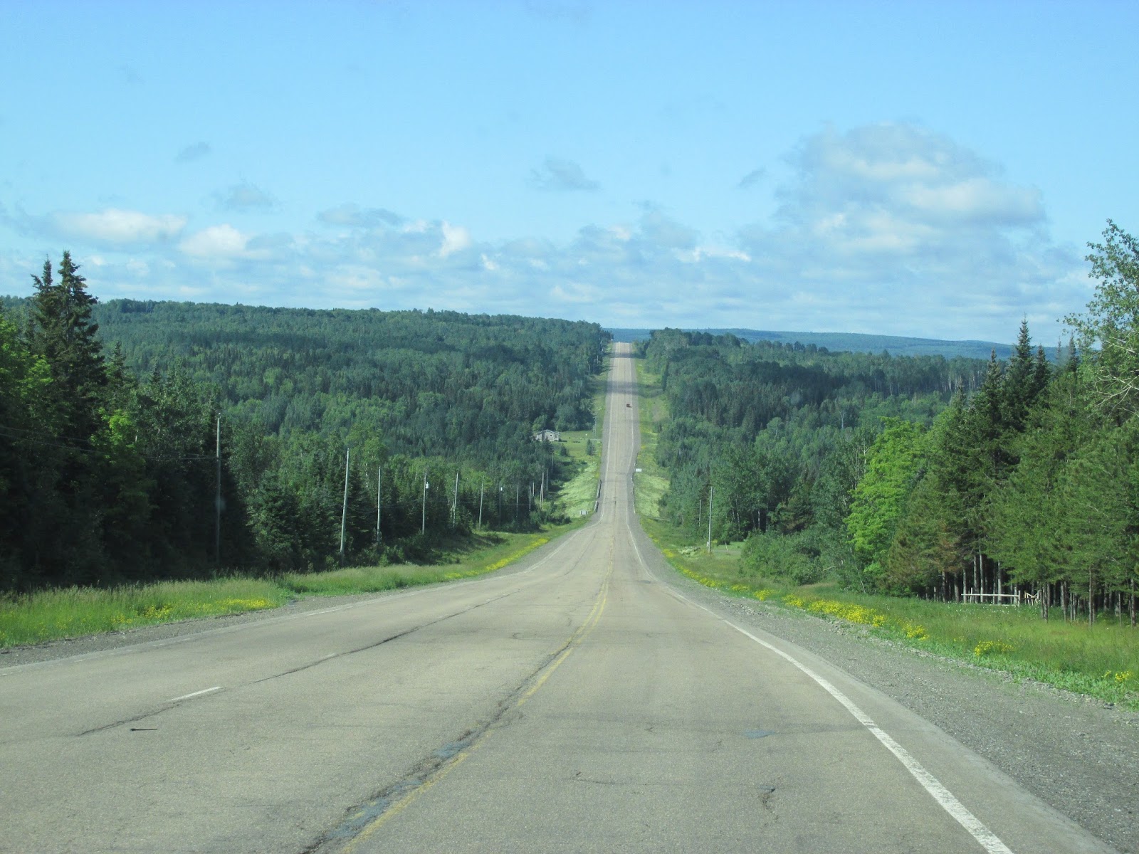
We turned off 11N onto Route 17 and started to head more
west, along the border of Quebec and New Brunswick. Route 17 is hilly and rough. This hilly region, is
part of the Appalachian mountain range. We have been in this mountain range
several times since we first got on them in North Carolina!
We went from Glenwood, at the top of the mountain
down into Adam’s Gulch and back-up again! Traveling along Route 17, we kept seeing these brown signs
marking the Appalachian Mountain Trail. It is a hiking and biking trail which
is actually International! It runs from the northern end of the Appalachian
Trail at Mount Katahdin, Maine, through New Brunswick, to the Gaspé Peninsula
of Quebec, after which it follows a ferry route to Newfoundland, and then
continues to the northern-easternmost point of the Appalachian Mountains at
Belle Isle, Newfoundland and Labrador.

We are definitely back into farm country!

As we arrived in Saint-Quentin, we thought we might be part
of the parade! We must have been just ahead of the big event, because the streets were lined with spectators! We waved like we were, as we drove through town! If we did not
have Walter & Betty behind us, I am sure we would have pulled off and
enjoyed the festival for a while!

The Western Festival of Saint-Quentin is the only Western
Festival throughout New Brunswick. How did the Western Festival come to
Saint-Quentin? It was the “brain child” of Paul Lamarre, a local businessman. It
began in 1984. Mr. Lamarre, wanted a festival for Saint-Quentin and assisted by
several volunteers, he created the Western Festival. It runs annually in early
July. This year, we were traveling through on the last day of the festival.

What can be said of the infamous Western Festival? Saint-Quentin
has succeeded in preserving its warm and rustic ‘Far West’ character, which
helps explain the Festival’s well-established reputation! The whole town decorates for it! The renowned Super
Rodeo, which welcomes cowboys (and cowgirls) from across the country, always
entertains! You will be impressed by the strength of the Horse Pulling Contest.
You won’t want to miss the Miss Atlantic Cowgirl contest, Coe Plop Bingo, the
Pow-Pow, professional country music shows and more. They have Festival Queens
and they even have a Festival Mascot, Youdly, a cowboy hat & vest wearing
horse!

We passed by acres and acres of forests owned by the Irving empire.
JD Irving, believes that his companies are stewards of the land and it is one
of the most important roles they play. Our business begins with the forest. Irving
Woodlands is a division dedicated to overseeing sustainable forest management, research
and conservation of their land holdings. It is focused on rigorous land
management and responsible stewardship, Irving Woodlands is guided by a
100-year Management Plan that preserves the environmental and ecological
integrity of our land, air, water and wildlife.

We drove back onto a Trans-Canada Highway, 2E from Route 17
in St Leonard, NB. We traveled through St Andre, NB. This stretch of the
Trans-Canada Highway follows the wide and majestic Saint John River. The river
has eroded its path through gravel banks left behind by the glaciers of the
last Ice Age. At spots you can see the terraces of gravel left behind alongside
the river, and on the flatter areas large deposits of sand and silt have made
the upper Saint John River valley ideal for growing potatoes. International
potato (and frozen vegetable) giant McCain Foods is headquartered at
Florenceville. The firm started with one farm in 1957 and today processes
nearly one-third of the world's French fries, with 22,000 employees at 55
facilities on six continents.
 |
| photo credit: Michael K Robb at www.robbphotos.com |
The river also has a number of power dams, to provide power
for the province's residents and large industries. The dams also make water
levels more stable after rain storms, and during the spring floods. These dams
are at Grand Falls, Tobique (on the Pokiok River tributary), Beechwood (south
of Grand Falls), with the largest being the Mactaquac Dam, west of Fredericton,
with a provincial park using the waters behind the dam, a marina, a campground,
golf course, and a craft village.

In Hartland, New Brunswick, you can visit the World’s Longest
Covered Bridge. It was declared a National Historic Site in 1980, and a
Provincial Historic Site in 1999. The Longest Covered Bridge in the World is,
like all covered bridges in New Brunswick, a “kissing bridge.” Kissing bridges
date back to the years of horse and wagon traffic, when young men “trained”
their horses to stop about half way across the bridge, wait while the couple
shared a couple of kisses, and then continue to the other side of the bridge. The
bridge was covered in 1921-22, to considerable opposition and concern, and sermons
were even preached in the area, cautioning how a “covered” bridge would destroy
the morals of the young people. However, the bridge was covered anyway. For
some years after, snow had to be hauled each winter and placed on the bridge
floor to allow horses and sleds to travel across it.

This 1,282-foot bridge
officially opened on July 4, 1901 and was purchased by the government of New
Brunswick in 1906. Lighting was installed in 1924 and a side walkway was added
to the bridge in 1945. It has suffered some incidents over the years, but it
continues on, roadworthy and dependable. When constructed, it was an
engineering wonder, much as the Confederation Bridge across the Westmorland
Strait is today. In 1987 the Olympic Torch for the 1988 Winter Olympics made
its way across this bridge and in 1995 a Canadian postage stamp was issued honoring
the bridge.

Shortly before we got to the US border, we came to Woodstock,
New Brunswick. This is the third time we have been through a town named Woodstock,
on this trip. This Woodstock, was New Brunswick’s first town. It is rich with
more than 160 years of history and heritage and is home to some of New
Brunswick’s first pioneers. Settled on the banks of the Meduxnekeag and Saint
John rivers. Woodstock boasts some of the finest 19th-century homes, churches
and civic buildings in the Maritimes. They boast a Heritage Walking Tour to view
the architecture of these Victorian-era homes.

We crossed the border back into the US at Houlton Maine. We had
no issues crossing the border.

It is great to travel, but Charlie and I always breathe
a bit better when we are back on US soil!

We checked into My Brother’s Place and took a tour around
the town with Walter and Betty. We later learned several of our friends had stayed here before as the departed for or returned from a Canadian Adventure!

We toured Market Square Historic District and
headed out into the outskirts of town, sometimes that is where you see the most
interesting things!


We found “7 Wonders of God Warriors” compound …..


It stretches several hundred yards along US 2, a piled
mass of boards, stumps, signs, and artwork, which includes everything from fake
palm trees to a giant Indian head with tires for eyes to a portrait of Jesus.


The owner, Jerry Cardone, claims he is an average,
middle-aged guy when he moved to Houghton, Maine in 1984. Jerry's cluttered
acreage is what is known as "visionary art" and it's in situ, not the
deloused examples you'd find in urbane museums and art galleries. No Sundance
filmmakers or latte-drinking art-rockers hang out with Jerry. In fact, no one
does; he won't let anyone onto the property. The neighbors are just waiting for
the day when they can bring in the bulldozers.

After we toured the town, we made a quick trip into Walmart
and then enjoyed a quiet dinner with Walter & Betty at a local pub. I took this picture for my sister-in-law, Donna. It seems every time we go out ... I get a Kevin Harvick glass!
No comments:
Post a Comment