
We departed Squaw Rock RV Park. We had a great site
next to the river. Across the river was “Squaw rock” and a top of the rock was
a totem pole. I hunted and hunted for information on how and why it was there,
no luck.

We back tracked a bit on WA 410, toward Naches. We
passed through the community of Nile Valley. It is a small community that was
established in the mid-1890s by families of James Beck, William Markle and
Henry Sedge. They named the small valley and community Nile because of the
area's fertility thought to resemble that of the Nile River Valley in Egypt.

We traveled on US 12 and got back on I-82, heading
east into Yakima. I spotted an infamous "Welcome to Yakima, The Palm
Springs of Washington" sign. It captures your eye as you drive Interstate
82, it is known to many as a reminder of how great Yakima is. But others in the
valley consider it an embarrassment. Although many assume the sign was erected
by the city, it, in fact, was erected by a local man named Gary Lukehart in
1987. Lukehart put up the sign to celebrate Yakima's centennial. After the
centennial, Lukehart modified it to say "The Palm Springs of
Washington." Lukehart also owned Trail Wagons/Chinook, which manufactured
upscale Class C RVs/motorhomes. Sadly, Trail Wagons/Chinook went under in 2006
and the land and buildings were foreclosed on. Lukehart was able to keep the
sign, though. In the past, local government officials and citizens have
attempted to reason with Lukehart to remove the sign, but Lukehart continues to
ignore the requests -- much to the dismay of the sign's opponents. Lukehart's
reasoning for the sign? "Because we have a lot of sunshine... That's what
we have in common with Palm Springs."
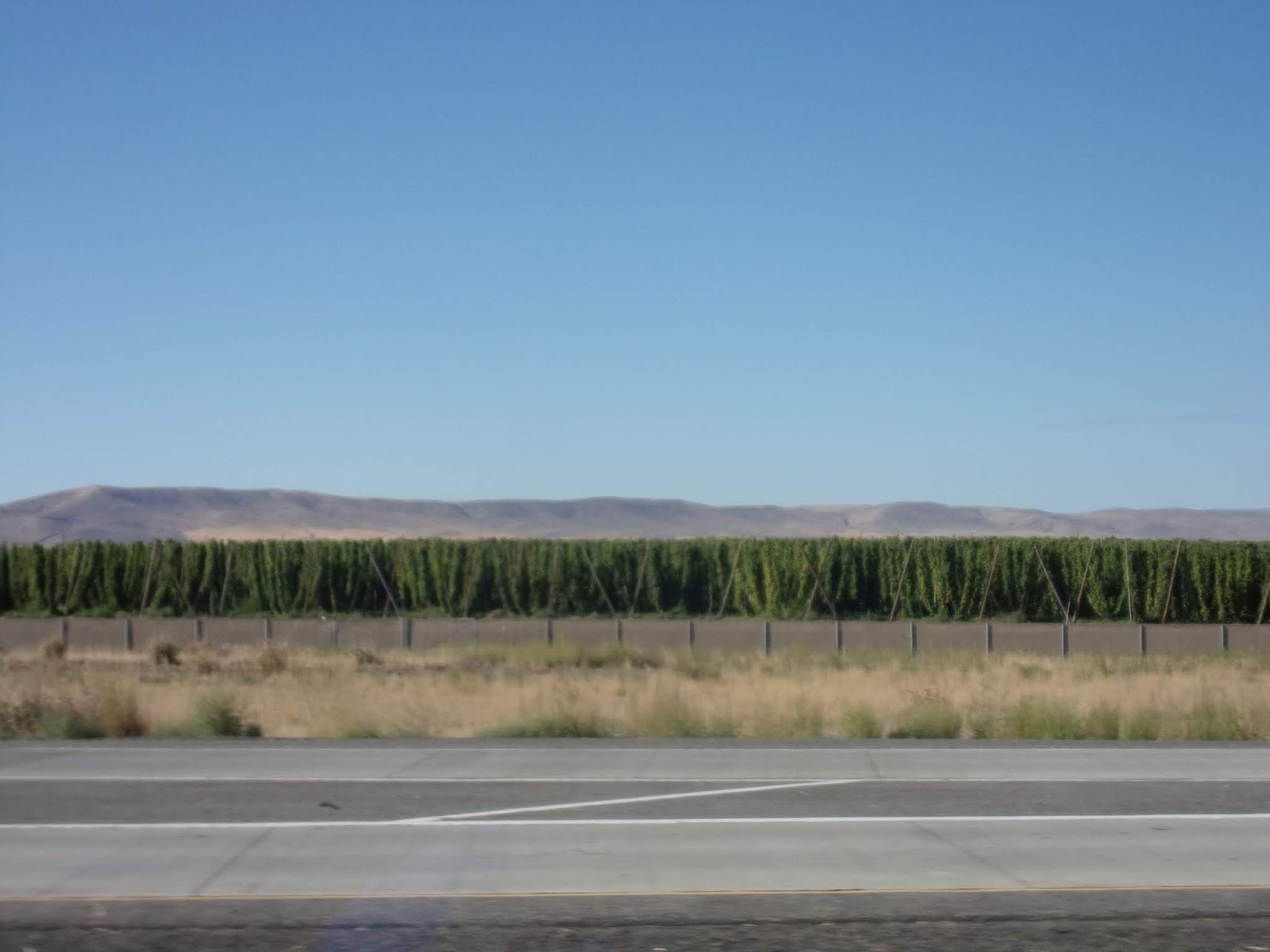
We were going to cut off of I-82 onto WA 97, but bad
accident found by the dawn patrol made us change route. We did get to see large
farms of hops growing along the interstate.

Everyone pulled off for gas and to regroup in Prosser.
Prosser was long home to Native Americans who lived and fished along the river.
They called the area "Tap tut", meaning rapids. Colonel William
Farrand Prosser first surveyed the area in 1879, then claimed homestead in
1882. The Northern Pacific Railroad laid tracks through the area two years
later. A town plat was filed by Colonel Prosser in 1885, and in 1886 he was
elected Yakima County Auditor. He moved to North Yakima to attend to these
duties, and never returned to the town that he founded. In more recent years,
Prosser's location on the Yakima River and access from I-82 has encouraged a
growing wine business and associated tourist industry. Several Prosser wineries
are located within the Yakima Valley hillsides.
We have had contact with the dawn patrol and the accident
will be keeping the road blocked for 5 to 6 hours. So the State Patrol, had
them unhook and turn around and follow WA 22, to WA221, to WA 14 and then that
would put them back on US 97. We were on WA 22 in Prosser … so we will be
following that route too! It was a quick turn onto WA 221, and a few coaches
missed it. So they headed further down WA 22 looking for a turn around. As they
were heading in the wrong direction, the dawn patrol passed them heading to WA
221 … All our rigs are reunited again!

Washington State Route 221 is a 26 mile highway
located entirely within Benton County. The highway connects the county seat of
Prosser and the unincorporated community of Paterson. The highway has existed
since at least 1926. The starts out in a southerly course it descends into the
Horse Heaven Hills. I finally understand the phrase “Amber Waves of Grain.”

We passed the Columbia Crest Winery on WA 221. Our
resident shopper and wine connoisseur, Judy, tells us we have to buy some of
this wine. It is nestled alongside the Columbia River in eastern Washington,
Columbia Crest winery opened its doors in the heart of the acclaimed Horse
Heaven Hills in 1983. Year after year, the winery maintains its commitment to
quality, heritage and innovation in grape growing and winemaking to craft
exceptional wines. Washington state and the Columbia Valley represent the
perfect grape-growing climate, from the weather to the soil to the vineyard
sites. These growing conditions, along with outstanding viticulture and
winemaking practices, allow Columbia Crest to create high-quality wines that
are true to their varietal character and represent the unique terroir of the
region. Their history begins in 1982, when Doug Gore named Columbia Crest's
head winemaker. In 1983 the Winery and visitor center was dedicated and opened
in June. By 1987 they released their first release of white wine varieties and
in 1988 their reds. Eight years after their inception, they are named 1 of the
24 “Best Value Wineries” in the world, by the Wine Advocates. Ten years after
the release of their first wines, Columbia Crest makes its first appearance on
Wine Spectator’s list of Top 100 wines for the year with two wines: 1994
Cabernet Sauvignon; 1995 Estate Series Chardonnay.
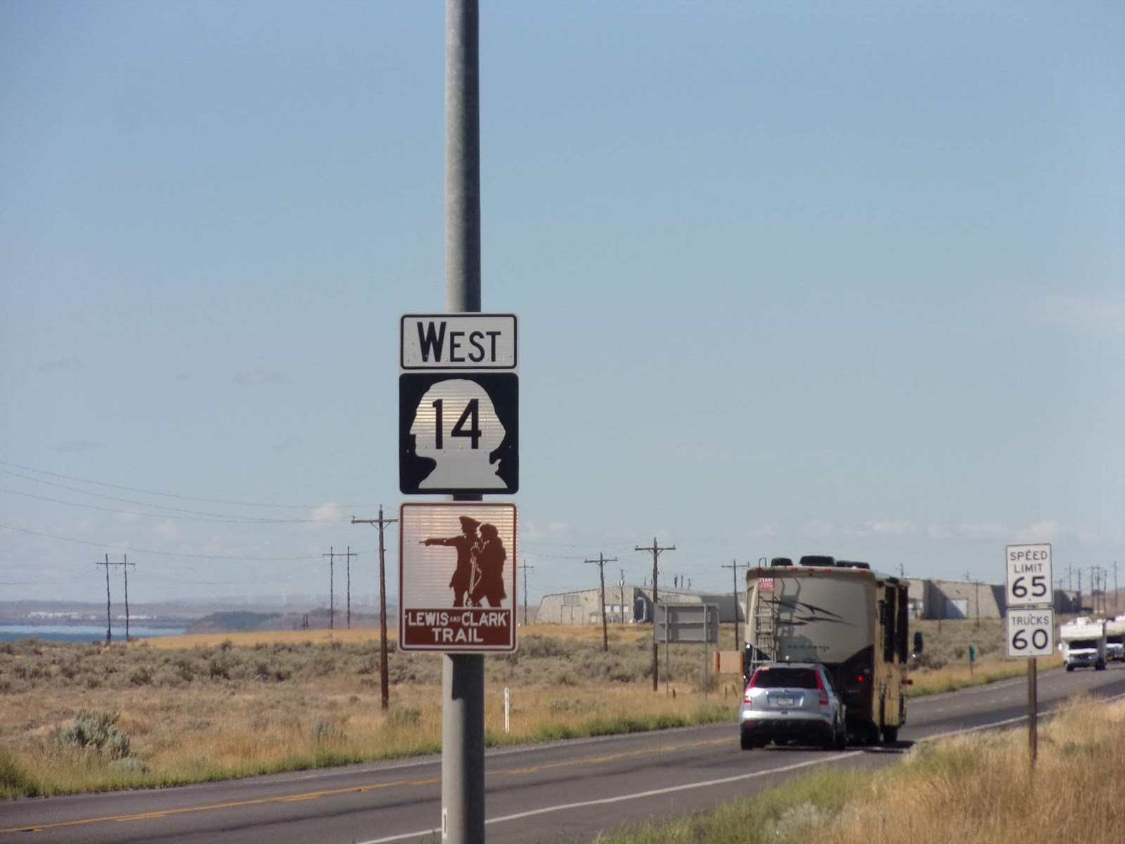
In Paterson, we turned onto Washington State Route
14. The highway travels east-west on the north side of the Columbia River,
opposite Interstate 84 (I-84) to the south in Oregon. WA 14 is a section of the
Lewis and Clark Trail Scenic Byway.

We traveled on WA 14 in a southwesterly direction along
the Columbia Hills and the Columbia River. The Columbia River Basin covers
258,000 square miles and includes parts of seven states and one Canadian
province. In its 1,200 mile course to the ocean, the river flows through four
mountain ranges and drains more water to the Pacific Ocean than any other river
in North or South America. It once produced the largest salmon runs on earth,
with returns often exceeding 30 million salmon per year.

The Columbia River also provides drinking water to
numerous communities along its course, and irrigates 600,000 acres of farmland.
Between the US and Canada, the river’s 19 hydroelectric dams provide about half
the region’s supply of electricity, in addition to providing flood control
benefits. However, the dams have also played a major role in the decline and
extirpation of numerous salmon and steelhead populations, including 13 stocks
currently listed under the Endangered Species Act.

We found a “castle” on top of the hill and there were
questions on our hand held radios about what it might be … I had to research
it. Here is what I learned. Samuel Hill was a Quaker and used his money to
organize and fund a Quaker utopian community on the banks of the Columbia River
in the early 1900s. Unfortunately no Quakers besides Hill ever moved there and
his utopian vision failed after a few short years. Nonetheless Hill continued
with the construction of a French Mansion—in steel and concrete—on a cliff overlooking
the Columbia River. Hill was friends with various socialites and celebrities,
including Queen Marie of Romania, who was living in exile at the time. Parisian
modern dancer Loïe Fuller convinced Hill to turn his mansion into a museum. The
Maryhill Museum of Art is a small museum with an eclectic collection, located
near what is now the community of Maryhill. The museum is situated on a bluff
overlooking the eastern end of the Columbia River Gorge. It was named Maryhill
for Hill's wife, daughter of James J. Hill, a Great Northern Railroad baron,
and was intended to be used as a home at which they could entertain Samuel
Hill's school friend King Albert I of Belgium. Construction was halted upon
America's entry into World War I. The unfinished museum building was dedicated
on November 3, 1926 by Queen Marie of Romania, and was opened to the public on
Hill's birthday (May 13) in 1940.

Maryhill Museum owes a profound debt to its fourth
great patron, Alma de Bretteville Spreckels. Following the deaths of Hill
(1931), Fuller (1928) and Queen Marie (1938), she worked tirelessly to turn Sam
Hill’s unfinished mansion into an art museum. Over the years, Spreckels had
acquired many objects from Queen Marie that were intended for a "Romanian
Room" in San Francisco's California Palace of the Legion of Honor. She
instead donated this material to Maryhill Museum in 1938. It included Queen
Marie’s gold throne and other unique pieces of Byzantine-inspired furniture, a
replica of her coronation crown, and other objects. Spreckels also gave
Maryhill a collection of art glass by artists such as Émile Gallé and René
Lalique, some Art Deco ceramics by Seraphine Soudbinine, European paintings,
and ecclesiastical textiles from the Armenian Apostolic Church. Others also
contributed to the early growth of Maryhill’s art collection. Clifford Dolph,
who served as the museum’s first director (1938–1972), had a passion for chess.
With the encouragement of the museum's Board of Trustees, he began collecting
chess sets in 1957. The museum's first physical expansion was completed when
the Mary and Bruce Stevenson Wing opened to the public in May 2012. Until
recently this was all set miles from civilization in the bleak basalt and cheat
grass of Eastern Washington. In the past few years, vineyards and fruit
orchards have sprung up nearby, making Hill’s original dream of a utopian
community easier to envision.

I saw a sign for Stonehenge War Memorials. We all
have heard about the ancient structure situated in England. It is massive
stones, broken and fallen from age, have stirred the imagination for centuries.
There is nothing quite like this famous prehistoric monument anywhere else in
the world. We have even seen a likeness of the original, but made of foam, in the
Natural Bridge area of Virginia. Erected as the nation’s first WWI memorial and
dedicated in 1918 to the servicemen of Klickitat County, Washington, who died
in the service of their country during the Great War, Hill’s Stonehenge
Memorial is a monument to heroism and peace. The men honored at Stonehenge are
James Henry Allyn, Charles Auer, Dewey V. Bromley, John W. Cheshier, William O.
Clary, Evan Childs, James D. Duncan, Harry Gotfredson, Robert F. Graham, Louis
Leidl, Carl A. Lester, Edward Lindblad, Henry O. Piendl and Robert F. Venable. These
men, all members of the American Expeditionary Force, represented the US Army
(Calvary, Artillery, Engineers and Infantry), US Marines and the US Navy.

Hill erroneously believed that the original Stonehenge was
constructed as a place of human sacrifice. Concluding there was a parallel
between the loss of life in WWI and the sacrifices at ancient Stonehenge, he
set out to build a replica on the cliffs of the Columbia as a reminder of those
sacrifices and the “incredible folly” of the war. Guided by leading authorities
on archaeology, astronomy, and engineering, Hill combined their knowledge to
duplicate, as nearly as possible, the original size and design of the ancient
Neolithic ruin in England. When Samuel Hill died in 1931, his body was cremated
and the ashes placed in a crypt just below the Stonehenge Memorial. The
original crypt deteriorated in the next 25 years and was replaced in 1955 by a
granite monument bearing his epitaph: “Samuel Hill: Amid nature’s great unrest,
he sought rest.” It is a short walk southwest of Stonehenge on a bluff
overlooking the river.

We got back onto Route 97 and crossed the Columbia
River from Washington to Oregon. We could still see Mt Hood on the horizon!

Entering into Oregon, we were driving on the Oregon
Scenic Byway – Journey Through Time. The Journey Through Time Scenic Byway
stretches 286 miles through north central to eastern Oregon. Beginning in the
community of Biggs and ending in Baker City, this Byway meanders through ghost
towns and small farming communities that bring the Old West to life. The Wild and
Scenic John Day River - North America's second longest undammed river, parallels
much of the route. Geology buffs will take great pleasure in the interpretive trails
at the John Day Fossil Beds. Historic commemorations of more recent times, such
as the Sherman County Museum in Moro and the Oregon Trail Auto Tour in Wasco offer
telling windows into Oregon pioneer life.

The City of Wasco, Oregon is situated in the gently
rolling hills of the Mid-Columbia Plateau, eight miles south of the Columbia
River and centered between the Deschutes River and the John Day River. Just a stone's throw from the Oregon Trail,
Wasco was settled by ranchers, wheat farmers and merchants. Wasco prospered with the railroad and is now
at the center of Oregon's growing wind energy industry.

If you are traveling this way, it is suggested that
you visit the Sherman County Historical Museum in Moro. The museum includes
over 15,000 artifacts and exhibits on Native American life, Oregon Trail, migration,
rural living, and wheat farming.

In front of the Grass Valley City Hall was a
non-voting member of the community a large buck, maybe a 4 or 6-point buck.
Yes, right there as we passed through downtown on Main Street!

With Mount Hood and Mount Jefferson looming to the
west, you'll reach the town of Shaniko.

Back in the 1880’s, it was the Wool Shipping Center
of the World, and now a "living" ghost town. The recently renovated
Shaniko Hotel is open for business, and listed on the National Register of
Historic places.

A recent road side fire was still smoldering. Park
Rangers have told us most fires are caused by lightning strikes, but this close
to the road … I tend to think this was caused by a careless smoker.

With smoke rising on the ridge, your mind
automatically thinks “another fire.” We never got close enough to make any kind
of real assessment.

Love to see the green fields, even if they have to
water like crazy to get them to stay green and grow!

Also love to see a farmers “pride in America”
displayed for all those passing by to see!

The Willow Creek basin that cradles Madras held four
homesteads in 1902 when John Palmehn platted the town. It was initially called
Palmain, an Americanized version of Palmehn, but the US Postal Department
denied that moniker, noting it too closely resembled Palmer, a community that
has long since vanished. Debate continues how Madras was chosen as the second
option, but it stuck. A commercial district rapidly formed in Madras, fueled by
the promise of a railroad through town. The town incorporated in 1910, and the
Oregon Trunk Railroad and Deschutes Railroad Co. both arrived in 1911.
Jefferson County was forged out of Crook County in 1914, with Culver as the
county seat. In 1916, however, a countywide vote gave the seat to Madras; and
in the early morning hours of January 1, 1917, Madras area residents went to
Culver and secured—stole, according to Culver versions—the county records.

In 1946, irrigation water finally reached the
district, and the dry-land wheat country soon turned green. The irrigation
project created a land rush and a population boom in Madras and the surrounding
area, and the farmland around the town would eventually produce some of the
world’s finest mint and seed crops. Farming and ranching continue to be an
important part of the local economy. Bright Wood Corporation, a
wood-remanufacturing plant owned by the Stovall family, employs approximately
650 people at its Madras plant.

Crooked River Ranch is a private resort community. It
is located between the Deschutes River and the Crooked River near the south end
of Lake Billy Chinook. It is west of US Route 97 between Culver and Terrebonne.
Amenities in the community include a golf course, swimming pool, saloon, disc
golf course, horse riding arena and general store. The 12,000-acre ranch has a
population of approximately 5,500. It is the largest homeowner association in
Oregon. Crooked River Ranch has a Terrebonne mailing address, but the postal
service also allows mail addressed to Crooked River, Oregon or Crooked River
Ranch, Oregon. In 1910, Hillsboro politician Harry V Gates bought the Crooked
River Ranch property from local homesteaders and named it "Gates
Ranch". The main ranch house was built in 1916 and is currently in use as
a senior center. The property was named "Crooked River Ranch" as
early as 1934. In 1961 the ranch was sold to the Thomas Bell family, who
operated it as the Z-Z Cattle Company for the next 10 years. In 1972 Crooked
River Ranch was sold and developed as a recreational site. In 1980, the ranch's
zoning changed from recreational to rural/residential, then 12 years later, it was
rezoned as a residential subdivision. We arrived at Crooked River Ranch RV Park, our home for 2 nights.
No comments:
Post a Comment