
We got to sleep in, since it is only a 147 mile trip to
Arnold AFB FamCamp. We departed Yogi Bear’s Jellystone campground around 10 am
and headed for a Walmart for gas and biscuits … I am going to try to use my
convection oven tomorrow morning. Wish me luck!

All of US 27 in Georgia runs concurrently with SR 1 and is
also designated as the Martha Berry Highway. Martha Berry was the founder of
the Berry Schools for academically able but economically poor children of the
rural South—those who usually could not afford to go to other schools. These
schools of the early 1900s grew within three decades into Berry College, a
comprehensive liberal arts college. As a result of her work of forty years with
the schools and college, Berry is among Georgia's most prominent women of the
first half of the twentieth century. Berry continued to be honored after her
death on February 27, 1942. Her grave site near the Berry College Chapel is
marked by the Atlanta Gas Light Company's first posthumous Shining Light Award.
 The Georgia segment of U.S. Highway 27 was designated as the Martha Berry
Highway, her portrait was hung in the state capitol's Gallery of Distinguished
Georgians, she was included among the inaugural inductees into Georgia Women of
Achievement, and she was selected for induction into the Agricultural Hall of
Fame at the University of Georgia.
The Georgia segment of U.S. Highway 27 was designated as the Martha Berry
Highway, her portrait was hung in the state capitol's Gallery of Distinguished
Georgians, she was included among the inaugural inductees into Georgia Women of
Achievement, and she was selected for induction into the Agricultural Hall of
Fame at the University of Georgia.
Route 27 is also known as the Hometown Scenic Highway. I am
not sure how it got its name, but it is a fitting moniker because of the towns,
but also the scenery. Traveling highways like US 27 rather than on interstates offers
you a variety of mom-and-pop restaurants rather than the
"cookie-cutter" chains.
Foley GA offered us a “top of the mountain view.”
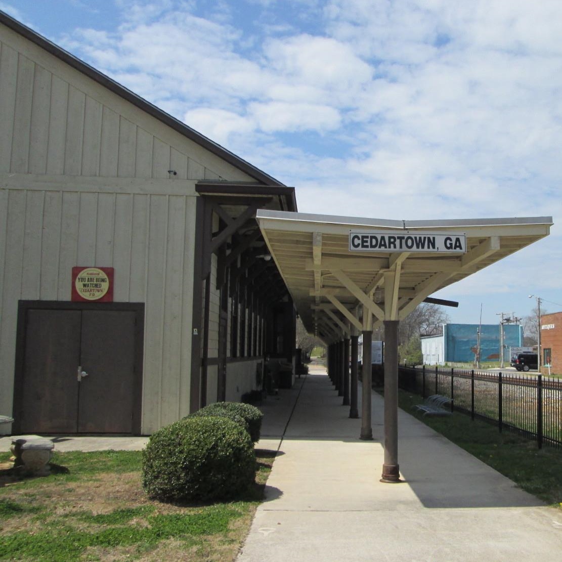
In Cedartown you can hit the Silver Comet Trail. The Silver
Comet Trail is 61-miles long, and starts at the Mavell Road Trailhead in
Smyrna, Georgia. It ends at the Georgia/Alabama state line, near Cedartown and
The Esom Hill Trailhead. At the Georgia/Alabama state line, the Silver Comet
connects to the 33-mile long Chief Ladiga Trail. Both the Silver Comet Trail
and Chief Ladiga are fully paved rail-trails built on abandoned railroad lines.
The combined Silver Comet and Chief Ladiga trail length is estimated to be 94-paved
miles. Our friend, Jack, could ride this trail on his bike and we could pick
him up at the other end!

Rome Georgia is home to Copper Creek Farm Annual Sunflower
festival. It is held weekends in June and early July. This festival offers
bluegrass music, tours of the sunflower fields, hayrides, cow trains, and many
other children’s activities.

There are a full six acres of beautiful sunflowers
to walk through and you can purchase a bucket and pick a whole bucket of
flowers to take home in celebration of the summer. The warm weather has produced
some awesome blooms this year, but no picking for us!

I saw these stone arches at the interchange of US 27, GA 53,
GA 422 and I-20. But could not find any information about them … I have not
given up, yet … because I am tenacious like that. Anyone know anything about
them?

It also has been a long time since I have seen a Mary Kay
Pink Cadillac. Times have changed, they get a Cadillac MTS now!

We turned onto GA 20 W and quickly crossed the GA / AL State Line.

Turned onto AL 35 N original Trail of Tears, John Benge
Route. John Benge led one detachment of approximately 1100 Cherokee with 60
wagons and 600 horses that left from Alabama on about September 28, 1838 from
camp in Wills Valley, approximately eight mile south of Fort Payne, Of all the
routes of the Trail of Tears, Benge’s route is the most obscure. It is known
that the group traveled through Huntsville and Gunter’s Landing in Alabama and
Reynoldsburg on the Tennessee River in Tennessee. Evidence also suggests that
they crossed the Mississippi River at Columbus, Kentucky. Although the specific
route of the Benge detachment is not known, a likely route has been determined
through an examination of period maps.

Little River Canyon National Preserve was established in
1992. The preserve currently contains 15,288 acres. The sculptor of this canyon
is the Little River, which is notable for flowing for most of its length atop a
mountain. Yes, we climbed to the top plateau of the mountain in Alabama. Forested
uplands, waterfalls, canyon rims and bluffs, pools, boulders, and sandstone
cliffs offer settings for a variety of recreational activities.

As we headed down the mountain, we got a view of Fort Payne
from above.

In the vibrant downtown of Fort Payne, you can find the
Dekalb Theater. The DeKalb Theatre was built in 1941. It is still in use and
has been gracefully restored as a multi-purpose venue. I love all the neon, I
wish we had been here are dark, to see it a glow.
Fort Payne, Alabama is home to the musical group, Alabama. It's
been 40 years since a trio of young cousins left Fort Payne, Alabama, to spend
the summer playing in a Myrtle Beach bar called The Bowery. It took Randy Owen,
Teddy Gentry and Jeff Cook six long years of tip jars and word of mouth to earn
the major label deal they'd been dreaming of. But then in no time at all, they changed
the face of country music. ALABAMA is the band that changed everything.

They
reeled off 21 straight #1 singles, a record that will probably never be equaled
in any genre. They brought youthful energy, sex appeal and a rocking edge that
broadened country's audience and opened the door to self-contained bands from
then on, and they undertook a journey that led, 73 million albums later, to the
Country Music Hall of Fame and the Hollywood Walk of Fame.

We came into Rainsville Alabama is a city of 5,000 residents
resting atop the large plateau known as Sand Mountain in scenic northeast
Alabama. I loved the look of their welcome sign.

Going down Sand Mountain, we could see the Bellefonte
Nuclear Plant, through the trees.

We crossed the Tennessee River into Scottsboro, Alabama. The
Tennessee River is approximately 650-miles long. The river was once popularly
known as the Cherokee River, among other names, as many of the Cherokee had
their territory along its banks, especially in northern Alabama.

 We turned onto 72N and traveled along the banks of the Crow Creek. There is a historical
marker for Crow Town. It was one of the Five Lower Towns established by the
Chickamauga Cherokees in 1782 under the leadership of Dragging Canoe. “Crow
Town lies on the north side of the Tennessee, half a mile from the river, up
Crow Creek, 30 miles below the Suck. It is the lowest town in the Cherokee
Nation and contained 30 huts in 1790. The Creeks and Northward tribes cross
here.” All of the Five Lower Towns were on the extreme Cherokee frontier. Crow Creek looks more like a lake.
We turned onto 72N and traveled along the banks of the Crow Creek. There is a historical
marker for Crow Town. It was one of the Five Lower Towns established by the
Chickamauga Cherokees in 1782 under the leadership of Dragging Canoe. “Crow
Town lies on the north side of the Tennessee, half a mile from the river, up
Crow Creek, 30 miles below the Suck. It is the lowest town in the Cherokee
Nation and contained 30 huts in 1790. The Creeks and Northward tribes cross
here.” All of the Five Lower Towns were on the extreme Cherokee frontier. Crow Creek looks more like a lake.
We crossed from Alabama into Tennessee. Shortly after we
that, we hopped onto I-24, because those are the driving directions that we
provided to us by the Recreation Department at Arnold Air Force Base.
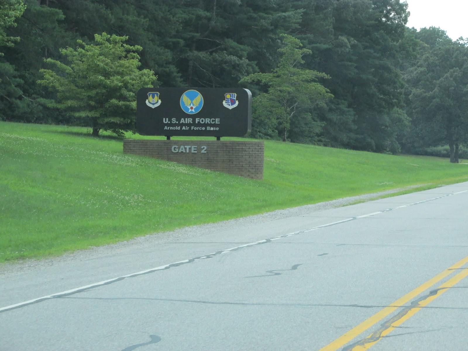
We actually only had to go through the housing gate, to
check in at the Rec Dept. Getting into the FamCamp required no gate access.
Very easy, much better than some FamCamp on military installations.

This is our home for the next 2 nights. Time to do some
exploring and see our niece and great nephew!
No comments:
Post a Comment