Today
we caravanned from Grand Canyon Railway RV Resort in Williams to a Harvest
Host, Stetson Winery, in Kingman. Today we drove mostly on Route 66. From I-40
exit 139, just west of Ash Fork, a nice section of the old Route 66 two-lane
runs along the railroad tracks just north of, and parallel to, I-40 all the way
to the sleepy little town of Seligman. One of best places to stop and get a
feel for the spirit of old Route 66. Seligman is a perfect place to take a
break after following the interstate hordes. The town retains a lot of its
historic character—old sidewalk awnings and even a few hitching rails—and
offers lots of reasons to stop. Coming into Seligman on this stretch of Route
66, you’ll be greeted by The Rusty Bolt, a fantastic junk shop and oddball
emporium that’s impossible to miss along the north side of the old highway.


Though
most people of today’s generation have never even heard of Burma-Shave, ask
anyone who lived from the 1920s to the early 1960s, and you will mostly likely
bring up a few memories and tales from that vintage era. Burma-Shave was a
brand of brushless shaving cream that was sold from 1925 to 1966. The company was notable for its innovative
advertising campaign. To
market Burma-Shave, Allan Odell devised the concept of sequential signboards to
sell the product. Allan Odell recalled one time when he noticed signs saying
Gas, Oil, Restrooms, and finally a sign pointing to a roadside gas station. The
signs compelled people to read each one in the series and would hold the
driver’s attention much longer than a conventional billboard. Though Allan’s father, Clinton, wasn’t crazy
about the idea he eventually gave Allan $200 to give it a try.
In
the fall of 1925, the first sets of Burma-Shave signs were erected on two
highways leading out of Minneapolis. Sales rose dramatically in the area, and
the signs soon appeared nationwide. The
next year, Allan and his brother Leonard set up more signs, spreading across
Minnesota and into Wisconsin, spending $25,000 that year on signs. Orders
poured in, and sales for the year hit $68,000. Burma-Shave
sign series appeared from 1925 to 1963 in all of the lower 48 states except for
New Mexico, Arizona, Massachusetts, and Nevada. Four or five consecutive
billboards would line highways, so they could be read sequentially by motorists
driving by. So, it’s funny that we see the Burma Shave signs in Arizona today!
Coming
into Peach Springs, we went down an incline and I captured a perfect shot of
the caravanner in front of us.
We passed through Peach Springs. It’s this town that inspired the town of
Radiator Springs in the Pixar Film “Cars”. We did not see anything related to
the Cars movie there. In fact, aside from the Grand Canyon Caverns, we did not
see much of anything else.
The town of Truxton had 3 gas stations, too bad only one of them looked like
you may be able to get gas! Good thing, we filled up in Williams! Like the rest
of the town the Truxton Station dates to the early 1950's. Over the years it
has been a Whiting Brothers Station, an Enco station and in 1983 it was a Mobil
station. In 1983 the large garage building had not yet been added and the
canopy still had the traditional red and yellow stripes banding it.


We arrived at
our Harvest Host location for our home for the next two nights, Stetson Winery.
We have stayed at many Harvest Host locations before, but for some … dry
camping will be a new and different experience! The Winery is nestled in a
beautiful, high-desert valley and surrounded by the Peacock, Long and Music Mountain
ranges. We had full run of the place, we could stretch our legs out on their veranda
and watch beautiful hues of fuchsia, salmon, violet, gold and copper light up
the sky as the evening sun sets over the mountains and you sip your glass of
wine.
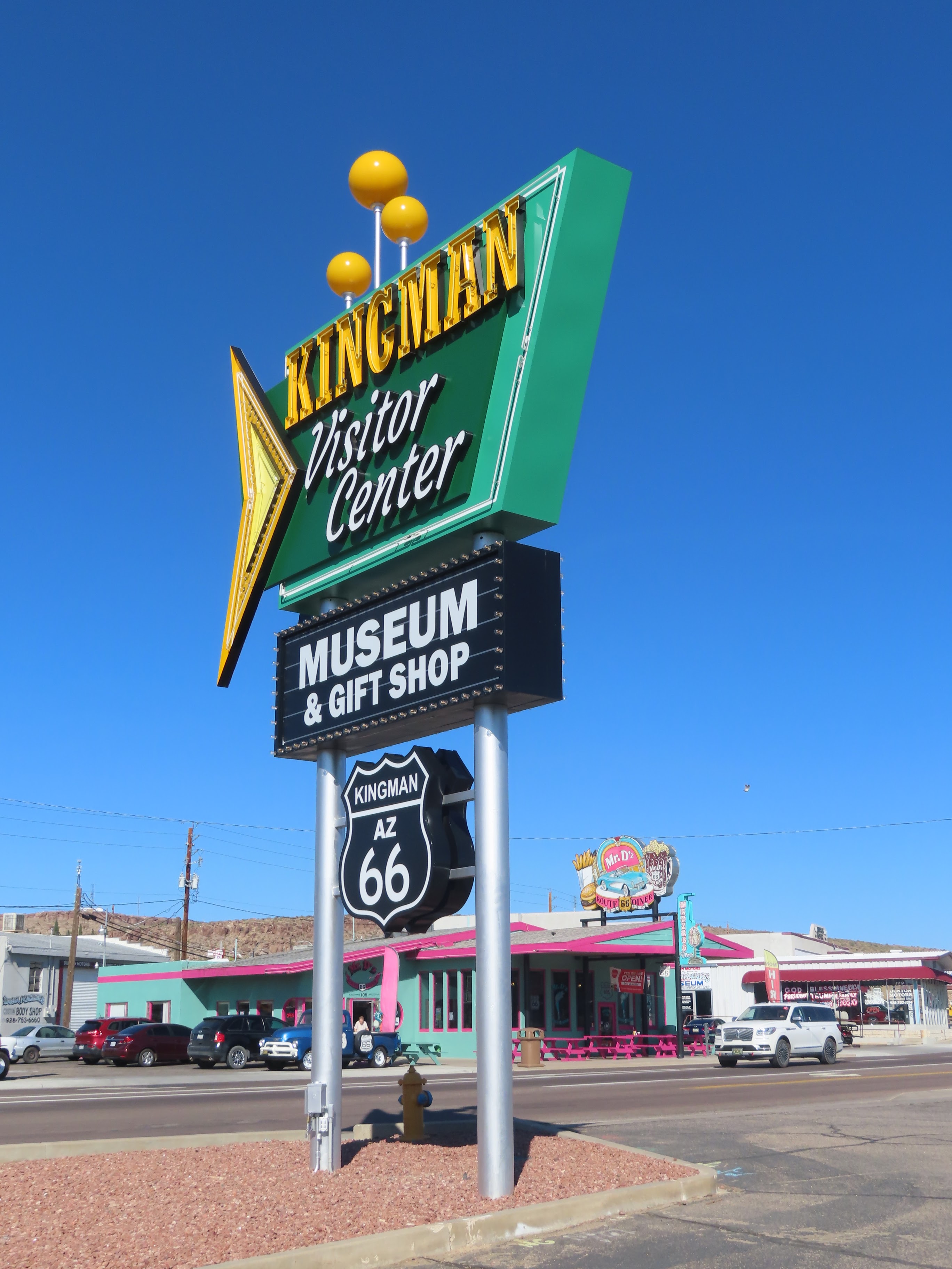
We settled in
and drove into Kingman for our guided tour of the Powerhouse Museum, aka the Arizona
Route 66 Museum.
The museum shows the progress made in travel. Settlers who
migrated west over the first wagon roads and the dust bowl refugees who dealt
with despair and hardship while traveling down the Mother Road are featured throughout
the museum. Bright murals, pictures, and life-size dioramas feature each of the
groups.
Even the
building has historical relevance to the highway, as it is situated within a
historical building that once lit the way for Route 66 travelers. Built in two
phases, the building came to be in 1907 and 1991 and was operated by the Desert
Power & Light Company. It gave power to the early sections of Kingman along
with the early mines around the middle of 1909. Restored 60 years later, the
building was transformed into a visitor center in 1997 and remains open today.
We enjoyed a
catered BBQ Dinner at the Stetson Winery and a perfect sunset!


No comments:
Post a Comment