Today
we left Modoc SC to travel to the SC Good Sam Rally in Cleveland SC. We
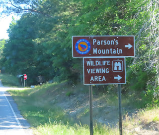
traveled on US 221 and SC 28, which bears the SC Heritage Corridor Nature Route
markers. These signs populate the Scenic Byway, helping travelers to navigate
the intricate highway system. The nature route is one of two parallel
corridor-wide routes that run the length of the Heritage corridor to act as
entrances to the corridors regions. The routes will connect and tie the 14
countries into one tourism destination. The nature route is a gateway to a wide
variety of South Carolina’s natural resources. Beginning in the waterfalls and
mountains of Table Rock and the Mountain Bridge Wilderness Area, the nature
route winds along Russell and Thurmond Lakes and on to the Savannah River. The
route follows the Edisto River, the longest free flowing black water river in
America, until it reaches the ACE Basin and coastal plain of the Low country.

It's
what is painted on the side of the building that brings the chills up your
spine. "This building may fall, but the quality of our merchandise will
never." Although, from outward appearances, the building is in good shape
for the age! Oddly enough, the name painted on the building is E.C. Rice, while
the building has large letters affixed to the roof indicating Bracknell’s.
There
was also a freshly painted mural on an outbuilding of the railroad in this lonely
town of Plumb Branch. I tried to find any info


As
we departed McCormick, we spotted cheap gas! Too bad the station has been
closed for years, especially with those prices!

In Anderson
SC on SC 28, we passed Anderson's one & only Bison Farm. There was no name
on it, but those big guys are definitely buffalo or bison!


We
passed through downtown of Historic Pickens, SC. The town of Pickens was
founded in 1868 and named for the Revolutionary War hero General Andrew
Pickens. Scottish-Irish settlers were the original inhabitants of the Pickens
area, with a few traders who lived among the Cherokees. When the new Pickens
was being created, Elihu Griffin offered 40 acres of his land for the courthouse;
it was this land being offered for sale in the 1869 handbill. On June 15, 1869,
a handbill distributed in South Carolina’s Upcountry advertised the “Last Sale
of Town Lots” for the new county of Pickens. The ad stated, “The location is
most desirable, one situated on a beautiful plateau and surrounded by a fertile
region, with thrifty inhabitants and the village rapidly growing.”

Just outside
of the town center of Pickens is the Hagood Mill Historic Site. It is home to over
50 acres to explore. It is also on the National Registry of Historic Sites. It
features an 1845 gristmill, restored log cabins, blacksmith shop, cotton gin,
moonshine still, nature trails, and a gift shop featuring local crafters,
musicians and authors. They host musical performances, private events and other
community events. During musical and community events, you can see the grist
mill in operation, a variety of living history demonstrators and an artisan
market. Located on the same grounds is the South Carolina Petroglyph Site, the
state's only protected and most accessible collection of rock art.
We
saw our first brown bear as we neared the RV Park. I hope this is the only one
we see!
Arrived at Palmetto
Cove RV Park, our home for the next 3 night and 4 days. We will enjoy the SC Good
Sam Rally, we always do!
Sandy and I dipped our toes into the cold, cold stream that runs behind the campground. We sat on a big, big rock and enjoyed the cool refreshing water!
Stay tuned
for more Two Lane Adventures!


No comments:
Post a Comment