
Depart Ponderosa Campground in Cody and are taking the scenic
drive to the east entrance of Yellowstone, on the road that Teddy Roosevelt
once called the "most scenic 50 miles in America."

It was the perfect day for a drive, the sunrise was
spectacular!

In the winter of 1807 John Colter passed through the
canyon of the North Fork of the Shoshone River. His description of the area
with a “boiling tar spring,” fumaroles and sulphur-smelling hot springs near
the confluence of the North and South Forks of the Shoshone River (originally
named the Stinkingwater River for good reason) was not believed. Other reports of the area attributed the
observed thermal activity to “subterranean fires.” The “imagined” thermal place
reported by the mountain man and others was jeeringly called “Colter’s Hell.”

But Colter’s story was true.
The features he described are the surface expression of the Cody
hydrothermal system. The thermal
features have nothing to do with Yellowstone or the nearby Absaroka volcanic
activity which ended over 45 million years ago.
Rather it is groundwater being heated by the earth’s geothermal gradient
as it circulates eastward from a basin beneath the Absaroka Mountains to rise
along the outcrops at Rattlesnake anticline.
Geothermal gradient is the rate of temperature increase as depth
increases. The Bighorn basin average
geothermal gradient is 16 degrees Fahrenheit per thousand feet.

Since traffic was light, I was able to capture the
two tunnels we traveled through perfectly!

With the early morning light waning and the haze
still in the air, the unique color of the Buffalo Bill Reservoir still shows
through!

Just before Wapiti, Wyoming we found a lonely Big
Boy Statue, along a sparsely inhabited stretch of highway that connects Cody to
Yellowstone National Park. The fiberglass Big Boy statue appeared atop a
concrete pedestal on Wyoming rangeland about 5 years ago. Strangely, it's some
distance from the road, out in a fenced field, and can be seen from the highway
shoulder. He started his life as a mascot for a mid-20th century fast food
chain, this figure (perhaps a JB's Big Boy) balances a double cheeseburger on a
platter and clutches his left suspender. He could be an original from
International Fiberglass from the 1960s, 2nd generation from FAST constructed
in the 1980s, or a later replication.

Just past Wapiti, we saw a new 1 – 3 acre home
sites development at Copperleaf. Copperleaf is nestled right in the middle
between Cody and Yellowstone. Copperleaf is a Western community, situated
alongside the Shoshone River in a jaw dropping setting in the Wapiti Valley,
giving each property owner a panoramic Rocky Mountain views and over a mile of
blue ribbon trout stream fishing.

We thought we found an old mine on a hilltop, in
the Wapiti Valley, but quickly learned it is the former home of builder and
engineer Lee Smith. It rises out of the landscape in a seemingly random
collection of wooden terraces and staircases. Smith began building the home for
his wife and children from locally harvested logs and wood, and in the
beginning the house had a fairly ordinary form. However, after completing the
basic home, Smith continued to build, adding extra floors and seemingly
tacked-on balconies, all from logs he would collect in his small pick-up. The
5-story, 77-ft. tall rustic structure was built, without blueprints. Even after
his devotion to the building project led to a divorce, Smith simply redoubled
his efforts, building winding organic staircases and scenic terraces on the
upper floors. Tragically, Smith fell to his death while working (untethered, as
was his way) on one of the upper balconies. The “Smith Mansion” has been empty,
accumulating myths and legends about ghosts and madmen. However, Smith’s
daughter, Sunny Smith Larsen, has begun a preservation campaign for the site
and hopefully her efforts will keep her father’s astonishing house from being
destroyed by daring teenagers and superstitious tourists.

The Shoshone National Forest offered us amazing scenery!
The Shoshone National Forest was set aside in 1891 as part of the Yellowstone
Timberland Reserve, making the Shoshone the first national forest in the United
States. Yes, another first for Wyoming. It is about 2.4 million acres of varied
terrain ranging from sagebrush flats to rugged mountains. The higher mountains
are snow-covered most of the year. Immense areas of exposed rock are
interspersed with meadows and forests. With Yellowstone National Park on its
western border, the Shoshone encompasses the area from the Montana state line
south to Lander, Wyoming, and includes portions of the Absaroka, Wind River, and
Beartooth Mountains. All this providing us with white travertine cliffs along
the Shoshone River.

Speaking of the Shoshone River, it was named for
the Shoshone Indians. We have meandered along it for most of the morning.

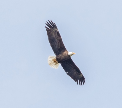
The Wapiti Valley (Wapiti, the Indian name for
elk) follows the North Fork of the Shoshone River as it cuts through the
Absaroka Range of the Rocky Mountains. Along this valley, I captured an eagle
soaring … no, no, yes … yes I did!


There was a bear too, you have to look close to
see him, or her!

We found this unique Firefighters Memorial. I
learned the fourth deadliest wildfire in the nation's history was the
Blackwater Creek fire. It was started by a lightning strike in the pine-filled
Shoshone National Forest on Aug. 18, 1937. On the second anniversary of the
Blackwater Creek fire, a 71-foot-long stone monument, which contains the names
of all the men who were killed or injured, was dedicated. It is located on US
Highway 14/16, near the junction of Blackwater Creek and the North Fork of the
Shoshone River. The fire smoldered and crept through the ground fuels for two
days before it was spotted by the owners of a local hunting camp. It covered
about 2 acres; by the time it was controlled four days later it had consumed
1,700 acres. Fifteen firefighters were killed by the forest fire when a dry
weather front caused the winds to suddenly increase and change direction.

The fire quickly spread into dense forest, creating
spot fires that trapped some of the firefighters in a firestorm. Nine
firefighters died during the fire and six more died shortly thereafter from
severe burns and respiratory complications and another 38 firefighters were
injured. It killed more professional wildland firefighters in the US than any
other in the 103 years between 1910 and 2013. Most of the firefighters
consisted of Civilian Conservation Corps (CCC) employees, they were led by more
experienced United States Forest Service (USFS) fire managers. Firefighters in
the first half of the 20th century used mostly hand tools to suppress
wildfires, and all gear was carried by the firefighters or by pack animals. Weather
forecasting and radio communication were generally poor or nonexistent.
Investigations and analysis of the event led the USFS to develop better ways to
provide a more immediate response to combat fires; one of them was the
development of the smokejumper program in 1939. Additionally, the Ten Standard
Firefighting Orders, a standardized set of wildland firefighting principles,
were developed in 1957. On our caravan adventure, we are going to the Smoke
Jumpers School in Missoula, Montana.

We entered Yellowstone, via the East Entrance and
started our slow long climb up the pass. The Sylvan Pass, elevation of 8,524
feet, is in the Absaroka Range and provides access to the park from the east
entrance. The pass was named after nearby Sylvan Lake (derived from Latin
Silvānus, god of the woods), and was formed by frost action breaking the rocks.
The park road through the pass used to be closed during winter but is now open
to visitors throughout winter, but only if you are on a snowmobile or
cross-country skis.

Yellowstone Lake is a natural lake that has 136
square miles of surface area and 110 miles of shoreline. Its deepest spot is in
excess of 400 feet. Yellowstone Lake is largest lake at high elevation in North
America (above 7,000 feet). Lake Tahoe is larger, though it is at lower
elevation. Yellowstone cutthroat trout, longnose dace, redside shiners,
longnose suckers, and lake chubs. In the summer of 1994, illegally introduced
lake trout were discovered in Yellowstone Lake. Cutthroat trout and longnose
suckers are often seen from Fishing Bridge. The longnose dace, redside shiners,
and lake chubs are all small minnows and are, therefore, harder to detect from
the bridge.

The Indian Pond is where quiet water disguises the
site of a hydrothermal blowout. Imagine the scene: tons of rock, steam, and
boiling water exploding into the air, leaving the crater that became Indian
Pond. Hardly a typical pond, this hollow is deeper than expected, evidence of
the force of the blast. Most of Yellowstone’s thermal systems release steam
gradually, bubbling and hissing through geyser vents.

We got into some construction in the “Fishing
Bridge” area. Why is there no fishing on the fishing bridge? Because the gravelly
bottom of the Yellowstone River at the outlet of the lake is a major spawning
area for the cutthroat trout. Overfishing from this once popular fishing spot
contributed to the decline of the cutthroat trout in the lake, which is home to
the largest inland population of cutthroat trout in the world. Fishing was
prohibited from the bridge in 1973.

When you least expect it, the wildlife appears!
This cow Elk came right out in front of us on the main road!

Bay Bridge Marina. If you think Yellowstone Lake is
beautiful from the shoreline, you should check it our from the water … you can
rent a boat in Yellowstone!

Acres of dead trees … Forest Fire or invasive bugs?

Lewis Lake offers boating, canoeing, sea kayaking,
hiking and fishing. Lewis Lake is the third largest lake in Yellowstone and is
the jump off point for canoe trips to Shoshone Lake, a backcountry lake. Lewis
Lake is 7,779 feet above sea level and is 108 feet deep. A popular fishery,
Lewis Lake offers plenty of action, with ice-off occurring around Memorial Day.
Mostly brown trout are found in Lewis Lake with a few lake and brook trout. The
best times to fish Lewis Lake are at ice-out in mid-June, warm summer evenings,
and late October, when the spawning brown trout become aggressive.

Lewis Falls was a wide 30ft tall waterfall on the
Lewis River, where we chanced upon it as we were driving south on the South
Entrance Road as it was one of the easier waterfalls to see. The falls was
named after Meriwether Lewis from the famous Lewis and Clark Expedition,
despite the fact that their explorations were 50 miles to the north of this
spot. That said, a Hayden surveyor by the name of Frank Bradley honored Lewis
by naming the falls as such because he wanted at least one landmark to be named
after one of the guys who first surveyed the region. Finally, the Lewis and
Clark expedition was significant because it was the first government-sanctioned
effort to explore and map the Western Frontiers (including parts of what would
become Yellowstone National Park) shortly after the Louisiana Purchase in 1803.
Apparently with some assistance from Sacagawea (a Native American woman from
the Shoshone Tribe), they ultimately reached the Pacific Ocean. For better or
for worse (especially for Native Americans), this set the state for settlers to
come west, but it also set the stage for the eventual establishment of National
Parks.

We arrived at Headwaters Campground at Flagg
Ranch. It is an awesome location to camp while visiting two fantastic National
Parks. The Headwaters Campground is located in the John D. Rockefeller Jr.
Memorial Parkway, right in between Grand Teton and Yellowstone National Parks
and only a few miles from each. Here we set up the sites for the arrival of the
rest of the caravan. The partners we have for this adventure are awesome!

After everyone arrived and had a chance to settle
in, some of us took a car caravan to the Lower & Upper Falls. We ran into a
Buffalo traffic jam, not as bad as the one in Custer State Park. But
Yellowstone has a larger bison population. It fluctuates from 2,300 to 5,500
animals in two subpopulations, defined by where they gather for breeding. The
northern herd breeds in the Lamar Valley and on the high plateaus around it.
The central herd breeds in Hayden Valley.

Yellowstone is the only place in the US where
bison have lived continuously since prehistoric times. A number of Native
American tribes especially revere Yellowstone’s bison as pure descendants of
the vast herds that once roamed the grasslands of the United States. The
largest bison population in the country on public land resides in Yellowstone.
It is one of the few herds free of cattle genes.

The bison is the largest land mammal in North
America. Males or bulls weigh up to 2,000 pounds and females or cows weigh
about 1,000 pounds. Don’t let their size fool you, a bison is agile and quick,
and can run up to 35 miles per hour. A bison can also pivot quickly, an
advantage they use when fighting predators that aim for hindquarters.

Male or Female Bison? A bull’s head is wider and
shaped more like a triangle than the female bison; its “forehead” fur is much
thicker, as is the fur on its forelegs; and its beard is thicker. A cow’s horns
are slightly more curved and slender than a bull’s. In addition, a cow’s
shoulders are narrower than its hips while a male’s shoulders are broader than
its hips.

When the bison are rolling in the dirt, it is also
called wallowing. It deters biting flies and removes tufts of molted fur. Bison
also leave their scent in the wallow. And during the rut, bull bison wallow to
display their strength and vigor. The rut lasts each year from June to
September, with most of the activity occurring between July and August.
Breeding is strongly seasonal and very promiscuous. Bison are not monogamous,
but rather polygynous, meaning bulls are will mate with more than one female,
but females will only mate with one bull.

Not sure why, but the bison really seem to like
the thermal area of the park in Hayden Valley. I can understand why they would
like the area in the winter, but when it is 90 degrees outside. Hhmmmm?

We arrived at Artist Point. This canyon area
features the colorful Grand Canyon of the Yellowstone River, as well as the
lower and upper falls. The Lower Falls, is the biggest waterfall in Yellowstone.
Hands down, it is the most famous in the Park.
In fact, the 308-foot tall waterfall it is most likely the second most
photographed spot in Yellowstone, with Old Faithful Geyser being the first. In
terms of height alone, it’s more than twice the size of Niagara Falls. The
amount of water flowing over the falls varies greatly depending on the season.
At peak runoff times in the spring, 63,500 gal/sec flow over the falls, whereas
at lower runoff times in the fall, the flow diminishes to 5,000 gal/sec.

There are numerous views of the Lower Falls from Inspiration
Point, Grandview Point, Lookout Point and Artists Point. The canyon’s colors were
created by hot water acting on volcanic rock. It was not these colors, but the
river’s yellow banks at its distant confluence with the Missouri River, that
occasioned the Minnetaree Indian name which French trappers translated as roche
jaune, yellow stone. The canyon has been rapidly downcut more than once,
perhaps by great glacial outburst floods. Little deepening takes place today.

Although the Upper Falls of the Grand Canyon of
Yellowstone is significantly smaller than their lower counterpart, it’s just as
breathtaking. When you are standing on the platform at the Brink of the Upper
Falls, this 109-foot cascade of surging water will look every bit as powerful
as it is.

It is tended to be overshadowed by the Lower Falls
further downstream because it wasn't plunging within the depths of the Grand
Canyon of the Yellowstone River. Nonetheless, this impressive waterfall held
its own in terms of scenic allure, especially when we considered its power.

Yes, there was another bison jam, on the road back
to the campground.

We also had an Elk cow and her calf, the calf did
not come out of the wood line, but her mama did.

We crossed the Continental Divide on our way back
to the campground. A great first day in Yellowstone, with 3 more full days to
go!
No comments:
Post a Comment