
Departed The Virginian before daylight and we had a big buck
cross in front of us, while we were still in town! I tried to catch him, but I think it was too dark! Oh well, we were going slow, because Lyle & Judy, our dawn patrol partners, caught a light and were behind us.

Snake River, Others gave the river names including Shoshone
River (after the tribe) and Saptin River. Eventually, the name Snake River was
derived from an S-shaped gesture the Shoshone tribe made with their hands to
represent swimming salmon. Explorers misinterpreted it to represent a snake,
giving the river its present-day name.
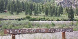
Teton High Adventure Base is a nationally accredited Boy
Scout high adventure camp located near Jackson, WY. Owned and operated by the
Great Salt Lake Council. Nested on the banks of the Snake River are the
headquarters of Teton High Adventure Base. The Snake River has been the home
for Boy Scout high adventure for over 60 years. It offers scouts a mind-blowing
explosion of adrenaline by traversing river rapids, mountain bike highland trails,
and more … that’s just the first day! This area provides some of the most
beautiful and remote backcountry in the world. The scouts can backpack on the
same rivers and trails that the Shoshone, Blackfoot, and Crow Indians utilized
as their sacred hunting grounds for hundreds of years. Seeing this place made
me think of my nephew, Bobby, the Boy Scout and my brother, he was a Boy Scout
too!

We entered the Targhee National Forest, which is full of rugged
mountains, fertile valleys, rivers, varied wildlife, campgrounds, wilderness,
adventure, solitude and scenery enough to dowse your senses. Part of this
forest is hugging the Snake River. We are traveling on a portion of Wyoming’s newest scenic
byway, the Star Valley Scenic Byway. The south end of the byway is where US 89 crosses
the Idaho state line a few miles north of Geneva Junction, Idaho. It continues
from there north east as it climbs Salt Canyon to the 7, 610 foot summit of
Salt River Pass. From the summit, US 89
continues generally north as it descends into Star Valley, continuing until reaching
Alpine. There, the byway continues to
the east as US 26-89 into Snake River Canyon to its northernmost point at the
Lincoln-Teton County line about nine miles south of Hoback Junction.

We crossed from Wyoming into Idaho.

Palisades Dam is located on the Snake River, it is a large earth-fill
structure 270 feet high. At the time of construction, this was the largest
volume of material placed in a dam by the Bureau of Reclamation. Palisades Reservoirs covers about 16,000 acres of the Grand
Valley, the northern portion of Lower Star Valley. The right wall of the valley
rises as a very steep slope from the dam upstream for about 500 feet, then as a
cliff for several hundred feet to the rim of the valley.

Since we left early for the dawn patrol, we got enjoy the sunrise
over the mountains.
We saw barley fields as far as we could see! You could
actually smell the grain!

The barley and wheat industries play an important role in
Idaho's economy. Production of these grains creates jobs and income, not only
in the production process, but also in transportation, storage, and input
supply industries. Further positive economic impacts are generated by malt
processing and flour milling that occur in the state. More than 85% of acreage
was planted to a malting type. Idaho crop represented 34% of total US
production. Our rafting guide, told us about the importance of
Anheuser-Busch and Idaho, but who knew! Barley gives beer its soul, and this
year, Anheuser-Busch is celebrating 50 years of partnership and collaboration
with Idaho Falls barley growers, who carefully cultivate this essential
ingredient.

Anheuser-Busch’s Smart Agriculture goal targets the first
step in the beer-making process - growing and harvesting barley and hops. As the center of any great beer, barley serves not only as
the starting point for creating a high-quality beer, but also the initial point for improved sustainability efforts. At Anheuser-Busch, they have a saying, ‘barley today,
Budweiser tomorrow,’ which rings true, as barley is one of the four key
ingredients critical in making high-quality beer. Anheuser-Busch has a state-of-the-art malt plant in Idaho Falls.The technology used to process
the Idaho barley that makes its way into almost three beers in every six-pack
of Budweiser sold in America.

We skirted around Idaho Falls, on US 15. We want to avoid
the parade of big rigs through any downtown, if we can. Until the 1860’s, when Fort Hall Reservation was established
as their permanent home, the Shoshone and Bannock tribe lived, fished and
hunted throughout the West. The Shoshone-Bannock Tribal Museum has excellent
displays on their stories, life and legends. If you are in town at the right
time, you must attend the Annual Shoshone-Bannock Indian Festival in August to
experience one of North America’s most popular tribal gatherings. You can enjoy
traditional dancing, Indian relay races, a rodeo, and arts and crafts. If you
are a gambling man, you can try your luck, anytime, at the Fort Hall Casino.

We turned off US 15 and onto I-86 W. We will remain in this
road, until we reach our destination later today. On this leg of our journey, we passed through Pocatello,
also known as the “Gateway to the Northwest.” As pioneers, gold miners and
settlers traveled the Oregon Trail, they passed through the Portneuf Gap south
of town. Stage and freight lines and the railroad soon followed, turning our
community into a trade center and transportation junction. The name
"Pocatello" comes from an Indian chief of the Shoshone tribe who
granted the railroad a right-of-way through their land. Nathaniel Wyeth of
Massachusetts established one of the first permanent settlements at Fort Hall
in 1834, which is only a few miles northeast of Pocatello. When over-trapping
and a shift in fashion to silk hats put an end to the fur trade, Fort Hall became
a supply point for immigrants traveling the Oregon Trail.

We passed through American Falls, which has an interesting
history. First of all, American Falls has no falls. If that is not interesting
enough, in 1925, the whole town was moved to make room for the American Falls
Dam on the Snake River. Nearly 350 residents and their homes were moved, along
with 60 businesses, churches, schools, and the entire railroad was moved 22
feet to prepare for the increased water levels. The American Falls Dam was
supposed to help the city who was in a drought but instead it put the city
right in the middle of a reservoir and flooded the entire city. There was one
exception to the move, the Oneida Milling grain elevator was too large and its
foundation too deep to go anywhere. You can get a glimpse of the city every
once in a while though as the water recedes and remnants become visible. You
can see foundations of homes and stone landscaping peaking up through the
water.

This is the first time we have seen wind turbines in a
northwestern state, since Iowa. But, it is a great thing to see. Using
renewable sources of energy, is great for our future generations.

Massacre Rocks State Park is located along the Snake River
west of American Falls, Idaho. It contains a configuration of boulders along
the south bank of the Snake, known alternatively as Massacre Rocks, "Gate
of Death," or "Devil's Gate." Massacre Rocks was a well-known
site on the Oregon Trail and California Trail during the mid-19th century.
Immigrants gave the name Massacre Rocks to the trail's narrow passage through
the rocks. The name stemmed from the fear of a possible ambush by Indians. The pages of some immigrants' diaries indicate that the
travelers feared an ambush at the narrow passage that is all that’s left of an
extinct volcano. But on August 9 and 10,
1862 it was an area east of Devils Gate, and even east of the park, which saw a
series of skirmishes involving four wagon trains. When it was over 10 pioneers and an unknown
number of natives were dead and the area acquired it’s undeserved name. Actually settlers and the natives made use of
the area for generations because the Snake River is accessible and relatively
gentle in this part of its run, and the violent episodes were the exception,
not the rule.

We arrived at Anderson Camp in Eden ID our home for the next
few days. Now we must get ready for the arrival of the main body of the
caravan.
All in a days work! Another excellent Yankee RV Caravan.
No comments:
Post a Comment