
On the morning of Wednesday June 14, 2017 we departed
Prince Edward Campground, which is located on the Humber River. About half a
mile from the campground is a bridge over the river, on that bridge was a fire
department incident commander. Looking south on the river, we could see a
rubber boat in the river with several rescuers in the boat. We tried to find
information about the incident later on line, but were not successful.

The Humber River is approximately 75 miles long,
flowing through the Long Range Mountains, southeast then southwest, through
Deer Lake, to the Bay of Islands at Corner Brook. It begins near Hampden,
Newfoundland. James Cook first charted the Humber in the summer of 1767. It was
named, as so many of eastern North America for its English counterpart the
Humber. The Humber is rich in Atlantic Salmon, and was used as a waterway for
European trappers and loggers. It continues to be considered one of the world's
best recreational salmon fishing rivers.

We continued northeast on TCH #1. Into the community
of Deer Lake. Western Newfoundland was an upland area in which vertical
movements of crustal blocks along major fault zones led to the formation of two
major basins in which accumulations of sediments occurred between 345 million
and 280 million years ago. One of these basins extended from Deer Lake to
Conche (the Deer Lake Basin) and the other extended from Stephenville to the
Codroy Valley (the St. George's Bay Basin). These basins probably resembled the
present-day Death Valley of California, surrounded by mountains and with great silty
fans extending from the mountain scarps across a lowland with shallow lakes.
Sedimentary rocks deposited in both basins are conglomerate, sandstone,
siltstone and shale, commonly containing fossils of fish, plants and trees.
Thin coal seams and oil shales occur in the Deer Lake Basin, and evaporates,
like gypsum, potash and salt, as well as coal and oil, occur in the St.
George's Bay Basin.

Rod told us about them and we saw evidence of fields
that are prepared for them … but we did not see any … Newfoundland Strawberries!
Yes, we are told that they can grow in this climate and soil depth. Strawberry
plants are a truly fascinating marvel of nature. They are amazingly adaptable to surviving and
thriving in sub-zero temperatures, and, consequently, can be grown from the
warmer temperate regions to all the way north, in this frigid region.

We are
told that the Newfoundland Strawberries are oversized, sweet and delicious.
There is an annual Deer Lake Strawberry Festival near the end of July … so, we
are about a month early! The Strawberry festival is promoted as Western
Newfoundland and Labrador's largest 3-day festival, with activities for all
ages. A great variety of music, dancing, children's rides, slides, games of
chance, kiddies parade, market place, concession stands, a beer tent,
demonstrations, challenges, a spectacular fireworks display, and of course strawberries.

Off TCH 1 onto Highway 430, the Viking Trail. The
Viking Trail is the largest themed highway in Newfoundland and Labrador.
Stretching all the way from the province's west coast to Southern Labrador, the
Viking Trail is the only route to the popular UNESCO World Heritage sites at
Gros Morne National Park of Canada and L'Anse aux Meadows National Historic
Site of Canada.

Newfoundland Insectarium and Butterfly
Pavilion. I can honestly say, I have never seen an Insectarium! It is 20 acres
of land and nearly 8,000 square feet of indoor space. The attraction features
thousands of live and mounted insects, arachnids and arthropods from around the
world. There is a special section dedicated to the insects of Newfoundland and
Labrador. I am not sure, if I want to see that many creepy crawling things!

We passed through the Town of Cormack. It was named
after the famous Newfoundland explorer William Epps Cormack, the first European
to walk across the island's interior. This area was settled in the late 1940s
by veterans of World War II. Families with previous farming experience who were
willing to relocate were given 20 acres of land, a six-room bungalow, and money
for the construction of a barn, purchase of livestock and equipment, and to buy
supplies for the first winter. I wish our Governments would do this today, to
help our returning war veterans.

We drove through, Gros Morne National Park, we will
visit the park on our way back down.

I am a waterfall fanatic, and finding an unexpected
waterfall is such a bonus to me! We hit some construction through the National
Park, so it was slow going. Which is good, because I might have missed the two unexpected
waterfalls!

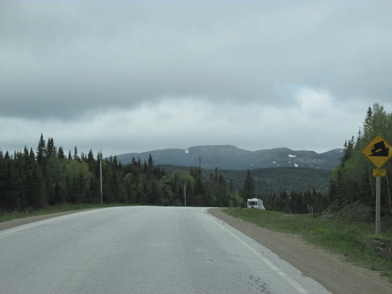
There was a lot of up and down and up and down today, but the sights were amazing!


The further north we got, the more snow we
saw ... and not just on the mountain tops anymore!

Skirting along the Bonnie Bay as we headed toward
Port au Choix. The bay separates the Great Northern Peninsula from the rest of
the island. It is a part of Gros Morne National Park. There are two sections:
Inner Bonne Bay and Outer Bonne Bay. Inner Bonne Bay consists of two arms, one
is south which has wooded coves and beach landings. Outer Bonne Bay consists of
the entrance to the fjord of Bonne Bay. Bonne Bay was carved out approximately
10,000 years ago by two large glaciers in each one of the arms. The glaciers
then came together in the middle part of the Bay and continued to push on out
to the Ocean.

There are benefits to drive on overcast days, you
miss the sun shining into your windows and windshield, but your pictures are
muted colors, but you see some unique low hanging clouds.

We had a rest stop in Rocky Harbor, next to the
campground we will be staying at on our way back down to the Ferry. As we continued
to drive on Route 430, Viking Trail, you can visit the Dr. Henry N. Payne
Community Museum and Craft Shop at Cow Head. It is said that Jacques Cartier,
the French explorer and navigator, anchored at nearby Cow Cove in 1534. At
Shallow Bay you can roam the sandy beaches in search of a prized piece of
gnarled driftwood, just one of the treasures from the sea that wash up along
this coast. The beach's back shore dunes have been planted with dune grasses to
help prevent erosion. Just behind the dunes you can explore the Old Mail Road
Trail, where dappled sunlight, the soft chirps of birds and the nearly muffled
sound of waves breaking on the other side of the dunes will entice you to
linger.

Cow Head is home base for the Gros Morne Theater Festival. Being a Theater major in college, I would enjoy a repertory theater festival of comedy, drama, dinner theater and evenings of Newfoundland music and recitations. Just north of the national
park and past Parson's Pond is Arches Provincial Park. This pebble beach
features two large arches, which were cut through a bed of dolomite by the
action of the sea – when the arches were under water. A subsequent uplift of the
land raised them above sea level where they remain as a distinctive geology
lesson.

Continue to the next stretch of coast, which includes
the Portland Creek River. Portland Creek River was made famous by the late Lee
Wulff, one of the foremost anglers of the mid-20th century. This part of the
highway takes you through Portland Creek, Daniel's Harbour, Bellburns, River of
Ponds, and Hawke's Bay. The Portland Creek area is filled with lakes, rivers
and ponds that teem with salmon and trout. Fishermen from all over the world
come to try their luck in these waterways. Keep an eye out for the herd of
caribou in this area.

Just north of Bellburns is Table Point Ecological
Reserve, which protects rare marine fossils that date to the era 458 million
years ago when the Appalachian Mountains began to form. River of Ponds has a
scheduled salmon river and is one of the province's most delightful camping and
picnic areas. It is ideal for a meal stop or an overnight stay. River of Ponds
has a number of upstream pools carrying a run of trout that have been known to
grow up to 3 pounds. River of Ponds is also an excellent base from which to
tour the surrounding area.

We completed our caravan, for today, and arrived in Port au Choix.

Staying at Oceanside RV Park, where the sun meets the
sea every evening and rocks you to sleep through the sounds of the waves
hugging the shores. It is owned and operated by the United Towns Lion Club.

In Port au Choix, in 1967 while excavating a basement for a
theater, workers found what is now Port au Choix National Historic Site by
accident. They found a mass of bones, tools and weapons. The following year,
archaeologists discovered three ancient cemeteries and scores of skeletons. By
studying the artifacts and human remains, archaeologists have been able to
determine the Maritime Archaic People, a group of hunters and gatherers who
lived along the eastern seaboard from Maine to Labrador, occupied the site
3,200 to 3,700 years ago. Over thousands of years, many groups have moved into
the Port au Choix area because of its marine resources. Cultural habits and
technologies have come and gone, but dependence on the sea remains a way of
life, and a bond that connects half a dozen cultures over more than 50
centuries.
 |
| Photo Credit: Jack-n-Jackie Laubach |
Port au Choix is a tri-town area, which is comprised of
Hawkes Bay, Port Saunders and Port au Choix. The name of Port au Choix is
translated as Port of Choice because the fishermen had the choice of ports to
land their fish. Port au Choix is known as “the Capital of the Shrimp
fisheries.”
 |
| Photo Credit: Jack-n-Jackie Laubach |
Some went to an optional dinner, others enjoyed a quiet
dinner at the campground. Whichever the caravaneers enjoyed, we all enjoyed the
awesome views of the Atlantic Ocean. We had an evening road log review and little known facts about the caravaneers.
 |
| Photo Credit: Jack-n-Jackie Laubach |
 |
| Photo Credit: Jack-n-Jackie Laubach |
Some went Moose watching in a local neighborhood, based on the recommendations of a member of the Lions Club.
 |
| Photo Credit: Jack-n-Jackie Laubach |
They were successful, just
did not capture them in their natural habitat … but then talking to the locals …
they are in their yards all the time … so, maybe it is the Moose’s natural
habitat!?
No comments:
Post a Comment