
On Tuesday June 20, 2017 we began our day with a carpool through Norris Point to the docks for a boat tour. Norris Point is located on the northern side of Bonne
Bay and is named after one of its first settlers, Neddy Norris, who came to the
area with his wife and children between 1789 and 1790. The Norris’s apparently
disappeared or left the area and consequently there is no official account of
their residency. William and Charlotte Humber from Dorset, England are listed
as the first permanent settlers of Norris Point, arriving in 1833. No other
families resided in Norris Point until the spring of 1858. At this time, George
and Susannah Harding, Matthew and Frances Smith (Harding’s brother and
sister-in-law) and other extended family members left Burnt Island and sailed
to the coast of Labrador for the summer fishery. Their ship was caught in a
heavy gale and they sought shelter at Whales Cove, currently called Wild Cove.
Rather than continue to Codroy when the storm subsided two days later, the
Hardings and Smiths continued to Norris Point, where they erected temporary
living quarters. In the fall they returned to build permanent houses. Future
residents of Norris Point originated from England, Ireland and Scotland and
came mainly because of the fall herring fishery and, like the others, found
Bonne Bay to be a convenient location from which to access the coastal waters
of Labrador. Their primary sources of employment included the lobster fishery;
five local lobster factories and a herring fishery had been established in Norris
Point. Although fishing was the dominant industry, fur trapping also provided a
supplemental source of income.

A trading post was erected around 1800 by Joseph Bird, an
English merchant. Later, fur trading gained popularity at the post. The local families
would exchange fish and fur for supplies, foodstuffs and clothing. The trading
post became so popular that laborers, servants and apprentices were brought
from southwestern England during the summer to support it. In the early 1900s a
ferry service was established and the population in 1921 had risen to 372,
including 241 Church of England residents, 58 Methodist residents and 78 Roman
Catholics. Around this time, residents had also begun to engage in the cod and
salmon fishery. The construction and opening of Highway 430 connecting north
and south Bonne Bay in 1968 made travel to other areas much easier. Before this
highway was completed residents of the north of Bonne Bay had to travel to
Norris Point, cross by ferry to Woody Point, then get a bus to Deer Lake for
the train to St. John’s or bus to Corner Brook for medical attention or even
work. In winter the north side of Bonne Bay was pretty much isolated.

We hopped on a BonTour Bonne Bay Boat Tour. We
enjoyed climbing aboard the Catamaran and let the skipper and crew of the MV
Emm-Cat take us on a guided tour of the Bay and area. In their opening pitch,
they said they would fascinate us with the many breathtaking view and visual
treasures hidden in their back yard. I have to admit, they did not disappoint!
The live commentary throughout the tour highlights the geological wonders, the
rich cultural history, the diversity of this fascinating bay, and was non-stop!
When one guide needed a break, another crew member or the Captain, stepped
right in!

During the Tour, we had the opportunity to view and
photograph eagles, whales and many incredible landscapes. An awesome tour with
views of Gros Morne Mountain, the small villages that were nestled within the coves
and lots of lobster traps buoys in the water and traps along the shores. The
first item pointed out to us, was Burnt Hill. The hill is surrounded by water
on three sides and the town on the other. It provides a spectacular view of
Norris Point, the Tablelands and Main Arm of Bonne Bay. It is named Burnt Hill,
due to a fire that cleared the hill of all vegetation.

There were two fisherman at the base of Burnt Hill on
the shoreline. The guide told us they were catching sea trout.

Shag Cliff is a cliff within Newfoundland and is
nearby to the South Arm of Bonne Bay. Shag Cliff is also close to Little Bay
Head, Morris Cove and Wells Cove.

This 600 foot cliff is a great place to
explore some of the unique geology of Gros Morne National Park.

We were lucky enough to see a bald eagle on Shag
Cliff. Bald eagles are not actually bald; the name derives from an older
meaning of the word, "white headed". The adult is mainly brown with a
white head and tail. The sexes are identical in plumage, but females are about
25 percent larger than males. The bald eagle is an opportunistic feeder which
subsists mainly on fish, which it swoops down and snatches from the water with
its talons.

Gadd’s Point was once inhabited by fisherman and
features beaches on both sides of the small peninsula. The cove situated on the
backside of the point in Gadd’s Harbor is very sheltered from the prevailing
south-west wind and the water here often warms up to 15 degrees by late summer. From Gadd’s Harbor you can follow the shore along the East
Arm of Bonne Bay to Shag Cliff.

As we passed this small waterfalls, our guide made a
few jokes about this is the Newfoundland version of Niagara Falls … it has the
American side and a Canadian side!

From Gadd’s Point, we crossed “the tickle.” The
Tickle – the shallow area between two deep areas, can be rough

St Patrick’s Church was not always located in Woody
Point. In the late 1880s there was a shift in population and a change in the
parish center. St. Patrick's was moved, in sections, nearly two miles over the frozen
bay from Bailey's Cove to Woody Point where it currently stands. The church was
forced to close in 1984 because of its deterioration.

Woody Point, Wharf burned John Roberts and his wife,
Emma, together with their four children are considered to be the first settlers
of Woody Point. They came in 1849. By 1872, there were 129 families residing in
the Bonne Bay area. In 1873, the Bonne Bay Post Office was established in the
home of J.R. Roberts, John Roberts' nephew. This house was one of the first
built in the area and is still standing today. It is a blue clapboarded
structure on the Shore Road left of the downtown. Plans are being made to
restore this house. Solomon Wilton was the second settler to Woody Point. It
was Wilton who donated the land on which the present day Church of the Epiphany
was built. A school and parsonage once stood on this sport. These early
founding families are laid to rest in the Anglican cemetery on Shore Road.

In 1922, when Woody Point was experiencing the height
of its population and commercial success, a devastating fire ripped through the
downtown. The wind quickly carried the flames which shot all the way across the
Bay to Norris Point. In all, 58 buildings were destroyed. The degree of
commerce in the town never returned to the pre-fire level. Most of the
buildings currently on the waterfront date from after 1922, but there are some
exceptions.

The lighthouse was built in 1919. Also, the large
grey and green house to the right of the Lighthouse Restaurant was built in the
1890s. This house was the scene of a riot in 1938.

The crew, minus one guy driving the boat, entertained
us with some live music. What a great experience.

On our way back to the campground, we passed a water slide at an abandoned park near Rocky Harbour hints at better days.

We departed Gros Morne campground and began driving
south on 430 in the overcast and rainy afternoon.

We have seen these Red Adirondack chairs (or Muskoka
chairs, for my Ontario friends) at some of Canada’s National Parks. What is it
all about? It is called “The Red Chair Experience.” The concept is simple … place
these sets of red chairs throughout Canada’s beautiful parks, capturing some of
the most stunning views in this great land. And then what … visitors take a
nap? Enjoy your lunch? Nope, you share. You Facebook, Tweet, and Instragram the
hell out of those red chair pictures. In the words of Parks Canada, “Visitors are
encourage to seek out the ‘Red Chairs’ to enjoy these special places and to
share their experience through social media and other communication channels.”

We got a quick glimpse at another unexpected
waterfalls thru the trees. It was our only chance to see this waterfalls. I
would love to figure out where it comes from!

There is a road widening project being worked in the
Gros Morne National Park. We got caught up in some of the road closures. This
is a picture of the workers setting dynamite charges to blast out more rock.

Weather is a funny thing … by the time we got near
Cormack and our turn back onto TCH #1, the roads were bone dry. Not a drop of
rain all day!

Rod told us all about the roadside Lupines we would
see. I say my first lupins, along the edge of the highway. He tells us they
will be in full bloom once we get back to Nova Scotia.
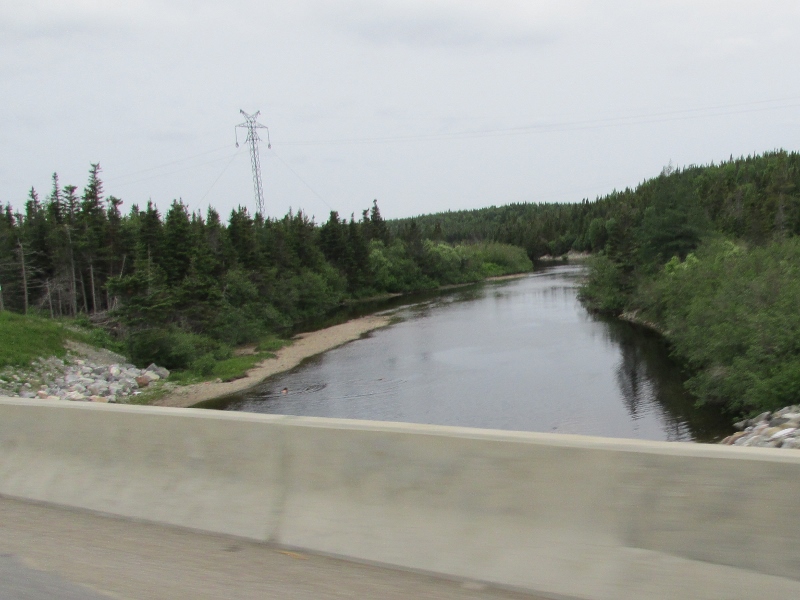
Look closely and you can see people swimming in Flat
Bay Brook. We think the water is still a bit chilly to be swimming, but not the
native Newfoundlanders!

We passed through the Cordroy Valley again. The signs
warned us of high winds … you could feel the winds, but they were not strong
enough to stop us from crossing tonight!

We are spending our night at the port. There was a
big back-up getting there. I am not sure why Sue got out of her vehicle while
we waited on the highway!

Our evening ended with our agricultural inspection
and parking in a lane in the marshaling area, in preparation for our ferry ride tomorrow!
No comments:
Post a Comment