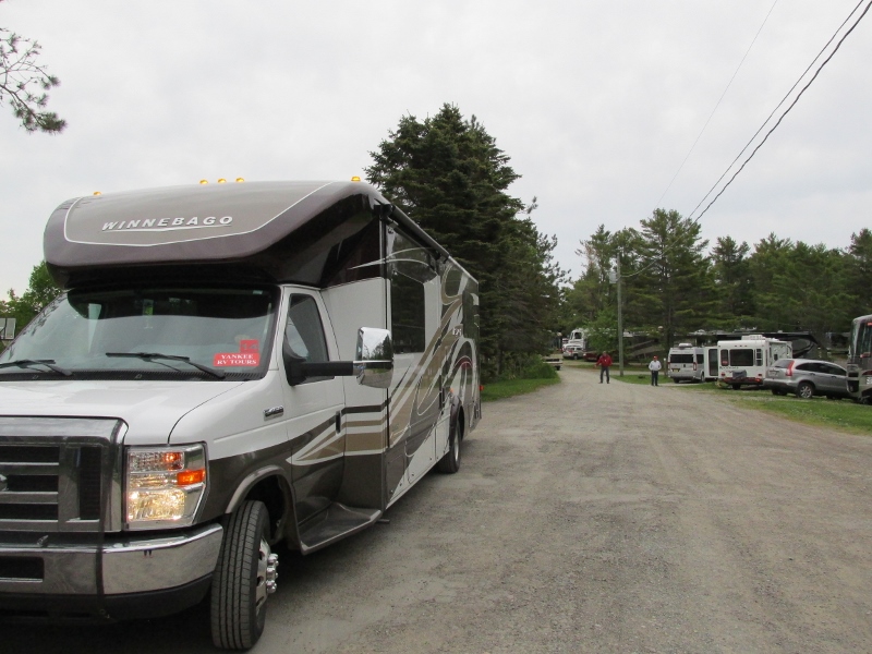
On Friday June 9th, 2017, we departed Ponderosa
Pines Campground. It was an excellent park with views of the Bay of Fundy!

We continued to skirt the Bay of Fundy as we headed to our
next destination. We are traveling on Route 114, which is a major tourist route
to the Hopewell Rocks Park, Fundy National Park and the Fundy Scenic
Drive.
We came upon the town of Hillsborough, New Brunswick. It
made me think of our kids in Florida, they live in Hillsborough County. The village
of Hillsborough is located on the banks of the Petitcodiac River. The village promotes
itself as the “Eastern Gateway to the Fundy Tidal Zone”. Hillsborough boasts many historic sites, the Steeves House,
the New Brunswick Railway Museum and a historic post office.

Set in the historic birthplace of the Honorable William
Henry Steeves, the Steeves House Museum is a charming Colonial mansion filled
with light from massive windows. The original cottage was finished in 1812, and
William Henry Steeves was born here in 1814 as the oldest of eleven children.
He became a Father of Confederation and, later, Senator Steeves. The larger
house was added around 1840 when the economy of the Village expanded. The house
is now comprised of 6000 square foot of period rooms and antique furnishings.
The museum is only open for the summer season.

The leading railway museum in New Brunswick! The New
Brunswick Railway Museum and houses an extensive collection of railway
artefacts. The museum is a project of the Canadian Railroad Historical
Association, which is a charitable organization of volunteers dedicated to
educating the public about New Brunswick's railway history. They offer an
online exhibit entitled Riding the Rails exhibit, it is a community-oriented
project that showcases the railway stations of New Brunswick. The museum is refurbishing
a CN baggage car to provide more museum space. The New Brunswick Division of
the Canadian Railway Historical Association is working to add a model railway
for young visitors, as well as using the other half of the car to promote the
local history on Albertite; Gypsum & Petroleum.

The Old Hillsborough Post Office is a two-story brick and
sandstone Beaux Arts style institutional building that stands proudly on Main
Street in Hillsborough. Just inside the double front doors, the original wall of mail boxes still scrutinizes the public
area. For ninety-seven years the joys and sorrows of the villagers waited
behind each brass and glass door to be revealed by the box owner’s key. The old
Hillsborough Post Office has local historic significance as the symbol of a
turning point in the development of the village.
 The stunning contrast of red
brick highlighted by local sandstone door and window surrounds, string courses,
keystones, entablature and foundations. The unflinching angles and plans of the
building’s masonry exterior are unmistakably a class apart from the softer
contours of the frame buildings cascading toward it down Main Street. Completed
in 1913, the Old Post Office is more recent in design, material and construction
techniques than its neighbors, setting it apart along the streetscape.
The stunning contrast of red
brick highlighted by local sandstone door and window surrounds, string courses,
keystones, entablature and foundations. The unflinching angles and plans of the
building’s masonry exterior are unmistakably a class apart from the softer
contours of the frame buildings cascading toward it down Main Street. Completed
in 1913, the Old Post Office is more recent in design, material and construction
techniques than its neighbors, setting it apart along the streetscape.
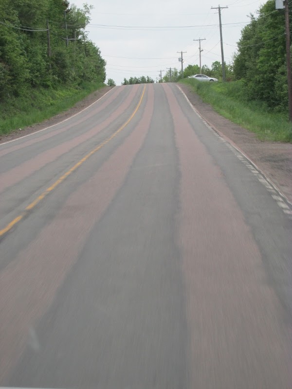
The stunning contract from the rocks in this area can be seen in the red tones in the roads it creates when they pave them. It is a color I have never seen, except in the red dirt roads of Georgia!

The Town of Riverview prides itself on the quantity and
quality of its outdoor recreation offerings. Our community has more than 20
parks and playgrounds to accommodate a range of year-round activities for all
ages and abilities.

Some parks provide a peaceful, relaxing setting where you
can enjoy passive leisure activities, while others are venues that encourage
high activity and sports play. Riverview's trail networks connect neighborhoods,
using the 15 miles of walking, running, skiing, and snowshoe trails along with
more than 25 miles of bicycling trails. Some of the trails are even plowed during
the winter. We passed the Riverfront Trail that winds alongside the spectacular
Petitcodiac River. If you you’re your travel right, you can catch the tidal
bore when it arrives twice daily.
We crossed the causeway and had to navigate several traffic circles.
Have I mentioned lately how much I hate traffic circles? I do … if you don’t
believe me, check out a blog from a few weeks back … and the mishap we had when
I was leading the three of us to Maine. Using the traffic circles, we
transitioned from route 114 as it became Route 15 and at the next traffic
circle, we moved onto Highway 2.

We came upon the town of Memramcook, New Brunswick. It is where most Acadians rallied after the deportation and the loss of their
lands, it is quite natural to refer to this area as the “Cradle of New Acadia”.
It was here where dispersed
Acadians re-established their homes. Bit by bit, the Acadian spirit slowly
rekindled itself and began breathing life into the newly settled Acadian
communities hugging the three Maritime Provinces’ coastline. Memramcouke really is the foundation that re-energized Acadians to rebuild their
lives and their villages. Dating back to 1700, the Parish of Memramcook’s first
settlers were aboriginal peoples from the Mi’kmaq tribe who made their home
along the river. Did you know that “Memramcook” is a Mi’kmaq name that,
according to some, means “crooked river”? Many controversies marked the final
spelling choice of the parish’s name. At the beginning, it was written
“Memeramcouque”, and then it became “Mamramkook”. Finally, after many years,
the spelling “Memramcook” was universally adopted. Memramcook, like many other
Acadian villages, was built around salt marshes.

Charlie is ready to hold the wheel tight, as we get ready to
enter Nova Scotia. There are large signs indicating “High Winds.” It must be
winding, because we can see several wind turbines here. There are also a series
of bridges we must traverse to enter Nova Scotia.
As we entered Nova Scotia, Highway 2 becomes Highway 104.
This is where the wind turbines are located that we saw before we crossed the
bridge.

 As the dawn patrol, we had to stop at the Information Center for Nova Scotia and pick up the books and maps for all the caravaneers.
We were lucky that a tour bus came at the same time and we got to hear the bag piper play!

Amherst, is the first town we came to in Nova Scotia. Fort
Beauséjour – Fort Cumberland National Historic Site are located here. They are
situated at the head of the Bay of Fundy on the border between New Brunswick
and Nova Scotia. Fort Beauséjour – Fort Cumberland stands at a crossroads of
natural and cultural history. The site is an excellent place to learn more
about its great importance to Canadian history. Amherst is also home to Five
Islands Provincial Park. It rises majestically from the shores of the Bay of
Fundy, and is one of Nova Scotia's premiere outdoor destinations. The park
features 300 feet of sea cliffs overlooking the world's highest tides.

Highway 104 in Nova Scotia is also known as Miners Memorial
Highway. It runs from Fort Lawrence at the New Brunswick border near Amherst to
River Tillard near St. Peter's. Except for the portion on Cape Breton Island
between Port Hawkesbury and St. Peter's, it is part of the Trans-Canada
Highway. The provincial government named the highway the Miners
Memorial Highway in 2008, one month before the 50th anniversary of the Springhill
Mining Disaster of 1958. The 1958 bump, an underground earthquake, occurred on
October 23, was the most severe "bump" in North American mining
history. The 1958 bump injured Springhill residents and devastated the town's
economy. It is not exactly known what causes a "bump". It could be
the result of coal being totally removed from a bedrock unit. The resulting
geological stresses upon overlying strata may cause the pillars to suddenly and
catastrophically disintegrate, so that the galleries themselves collapse. No. 2 colliery was one of the deepest coal mines in the
world. Sloping shafts 14,200 feet in length led to a vast labyrinth of galleries
more than 4,000 feet below the surface. Mining techniques there had been
changed 20 years before the 1958 bump, from "room and pillar" to
"long wall retreating" after reports had shown the increased danger
of "bump" phenomena resulting from the former technique. A small bump occurred at 7:00 pm during the
evening shift; it was ignored, as this was a somewhat common occurrence.
However, just over an hour later, at 8:06 pm, an enormous bump "severely
impacted the middle of the three walls that were being mined and the ends of
the four levels nearest the walls". The bump spread as three distinct
shock waves, resembling a small earthquake throughout the region, alerting
residents on the surface over a wide area to the disaster. "Dräger"
teams and teams of barefaced miners entered No. 2 colliery to begin the rescue
effort. They encountered survivors at the 13,400-foot level walking or limping
toward the surface. Gas released by the bump was encountered in increasing
concentrations at the 13,800-foot level where the ceiling had collapsed, and
rescuers were forced to work down shafts that were in a partial state of
collapse or were blocked completely by debris. Miners not saved by being either
in side galleries or some other shelter were immediately crushed during the
bump, the coal galleries and faces being completely destroyed. 75 survivors
were on the surface by 4:00 am on October 24, 1958. Rescue teams continued
working, but the number of rockfalls and the amount of debris slowed progress. Meanwhile,
the Canadian and international news media had made their way to Springhill. The
disaster became famous for being the first major international event to appear
in live television broadcasts. As the world waited and those on the surface
kept their vigil, rescuers continued to toil below ground trying to reach
trapped survivors. Teams began to arrive from other coal mines in Cumberland
County, on Cape Breton Island and in Pictou County. After five and a half days,
contact was established with a group of 12 survivors on the other side of a
160-foot rockfall. A rescue tunnel was dug; it broke through to the trapped
miners on Thursday, October 30, 1958. On Saturday, November 1, 1958,
another group of survivors was found. None were found after those. Instead,
bodies of the dead were hauled out in airtight aluminum coffins, on account of
the advanced stage of decomposition. Decomposition was accelerated by the earth's heat in the
depths of 14,000 feet below the mine entrance. Of the 174
miners in # 2 mine at the time of the bump: 75 died, and 99 were trapped
but rescued.
Oxford, Nova Scotia, is known for being the Wild Blueberry
Capital of Canada. Oxford is a central location for distribution and processing
of fresh wild blueberries that are grown in Cumberland County. You can purchase
fresh blueberries in season at various locations around Oxford from August to
early September. Oxford is considered the wild blueberry capital of Canada as it
is centered in a large blueberry growing region. Oxford Frozen Foods Ltd., a
wild blueberry processor, is the largest employer in the town, processing up to
three million pounds of berries a day during peak season.[3] The plant and over
12,000 acres blueberry land are owned by local businessman, John Bragg, who
added in 2014 another 15,700 acres in the Acadian region of northern New
Brunswick. Historically, the town was home to a vibrant manufacturing industry
with a woollen mill and foundry being key employers.

The town of Truro has a sign that indicates it is “the hub
of Nova Scotia.” Truro is located on the Salmon River east of the head of
Cobequid Bay. No one knows for sure where the name "Truro"
originated. Before Europeans came to Nova Scotia the Mi'kmaq had been in the
province for thousands of years. In this area they camped along the shores of
the Salmon River. In 1689, Mathieu
Martin "the first born Frenchman in Acadia" secured land along the
Wecobequitk River at the site of present-day Truro. He founded the Acadian
settlement of Cobequit. By 1748 there were 142 families in the Cobequit
district. In 1755, at the time of the expulsion of the Acadians by the English,
the Acadians left their homes at Cobequit to avoid deportation and the villages
were eventually burned by the English, discouraging the Acadians' return. In
1758, the Governor of Nova Scotia, issued a proclamation which was circulated
in the New England colonies offering free land to settlers who would come to
Nova Scotia. Captain Alexander McNutt applied for land for himself and others
from New Hampshire. These people were of Scotish-Irish descent. In 1761, about
60 families came to settle Truro Township on the south side of the bay. The
year 1858 can be considered the turning point in the history of Truro, the railroad
opened between Truro and Halifax. No other single factor in Truro’s history had
such a profound effect on the life and growth of the community. The railway
line, with its potential to expand in several directions, gave rise to Truro’s
nickname, “The Hub of Nova Scotia”. After the coming of the railway to Truro, the
dangers of fire were even more possible from the sparks of wood-burning train
engines. George Jones, Truro’s first barber and an early African Nova Scotian
resident of the town, suggested that a public meeting be held to discuss the
situation. From this meeting, it was decided to form a “Bucket and Ladder
Company”. World War II brought the development of Camp Debert as a training
center for the Canadian Army. This camp was designed to hold 15,000 men. Over 4,000
men were employed in the construction and operation of the camp and many
carpenters, electricians, drivers, painters and laborers earned from 35 cents
to 65 cents an hour, better than many places in Truro were offering.


 Many of the signs along the highway marking the towns are
very brightly painted and vibrant.
Many of the signs along the highway marking the towns are
very brightly painted and vibrant.
Along Highway 104, we came across a one legged man walking
down a hill, north of New Glascow. There was a small class C camper at the bottom
of the hill, maybe that is his vehicle. Maybe he is walking for a cause?
Antigonish, is the highland heart of Nova Scotia. It is a
small town with a rich in Gaelic history. Home of one of Canada`s most
prestigious universities, St. Francis Xavier University. Antigonish is a
Mi'kmaq name and, depending upon whom you ask, has two quite distinct meanings.
One is ‘The place where the branches are torn off by bears gathering beechnuts’
or ‘Meeting place of five forked rivers, West River, South River, Brierly
Brook, Wright's River, and east Wright's River’.

The French arrived in the 1650’s,
but were driven off by the Mi'kmaq. The Mi'kmaq, a branch of the wandering
Algonquin race, once were scattered over New England and much of Atlantic
Canada. In 1755, the Acadian French began to settle the east end of Antigonish
County. The largest centers of Acadian population in the county became Pomquet,
Tracadie, and Havre Boucher. After the American Revolution, 3000 free black
citizens enter Nova Scotia. Some of them settle in Antigonish. The first Highland
Games, celebrating their Gaelic heritage, was held in 1861. The railroad service
opened between New Glasgow and Antigonish in 1880. During World War I, a fund
drive was launched to raise money to equip a hospital ship for the wounded
soldiers. A plea for volunteers went out from every pulpit, platform and
classroom. Many university students enlisted in the Canadian Officers Training
Corps and in other units as well. During World War II, everyone from soldiers
to the women of the area did their part for the war effort. Lloyd MacDonald was
the first Antigonish soldier to give his life in the war. Antigonish was the
first town in Nova Scotia to have all of its streets paved. In 1989, the Town
of Antigonish celebrated its centennial.

We arrived at our home for the night, Whidden’s Travel Park.
It was overcast, as we started to park the rigs. It started to rain heavier as
we parked the last few rigs.


My dinner was stir-fry vegetables in a spicy sauce. Dessert was a wild berry cobbler with ice cream! It was very good food and conversation.

A quiet night was enjoyed by all.
No comments:
Post a Comment