
We departed St Barbe, Newfoundland on Saturday June
17, 2017 and headed north on Highway 430, to our destination, for today, St
Anthony. Our stay at the St Barbe RV Park was exceptional. I loved the all gravel sites and the convenient location to the port was perfect!

Just after we turned back onto Highway 430, there is a
fishing weir. A fish weir is an obstruction placed, wholly or partially, across
a river, to direct the passage of fish. A weir may be used to trap fish.
Alternatively, fish weirs can be used to channel fish to a particular location.
Weirs are traditionally built from wood and stone. This weir is used to count
Salmon in the river. After the fish are counted and measured, they are
released.

The use of fishing weirs as fish traps dates back
prior to the emergence of modern humans, and have since been used by many
societies across the world. The word weir comes from the Anglo-Saxon wer, one
meaning of which is a device to trap fish. In Ireland, fish traps in
association with weirs have been found that date from 8,000 years ago. In medieval
Europe, large fishing weir structures were constructed from wood posts and
wattle fences. Such weirs were frequently the cause of disputes between various
classes of river users and tenants of neighboring land.

We went
through the town of Bear Cove. It got its name from a man who thought he saw a
man out in the cove but it turned out to be a bear. The village is near Anchor
Point on the Strait of Belle Isle. People settled here for two reasons, fishing
and hunting. One of the first settlers of Bear Cove was James Chambers. He was
a splendid type of Scotsman. He married Jane Buckle, daughter of William
Buckle. In the summer, he went out to Seal Island, which was also called French
Island because it was a favorite resort of the French fishermen. There are
mostly Gould families residing in Bear Cove today. The Gould's ancestors were
Duncan's. Alexander Duncan Gould decided to carry on his mother's maiden name
many years ago and this is how the Gould name was carried on. It is here that I
found another unexpected waterfalls, it was not tall, but it was wide!

Nameless Cove is a small community just off the main
highway between Flower's Cove and Savage Cove. It is situated on a point of
land in the Strait of Belle Isle that is close to mainland Labrador. The area
was mapped by James Cook in 1764. During the early 19th century English
fishermen began to settle in the area. By 1857 there were eleven families in
Flower's Cove and Nameless Cove while most communities in the Strait of Belle
Isle had only one family. Dempster, Walsh and Diamond were the surnames
familiar to Nameless Cove in the late 1800's. These families continue to live
in Nameless Cove today.
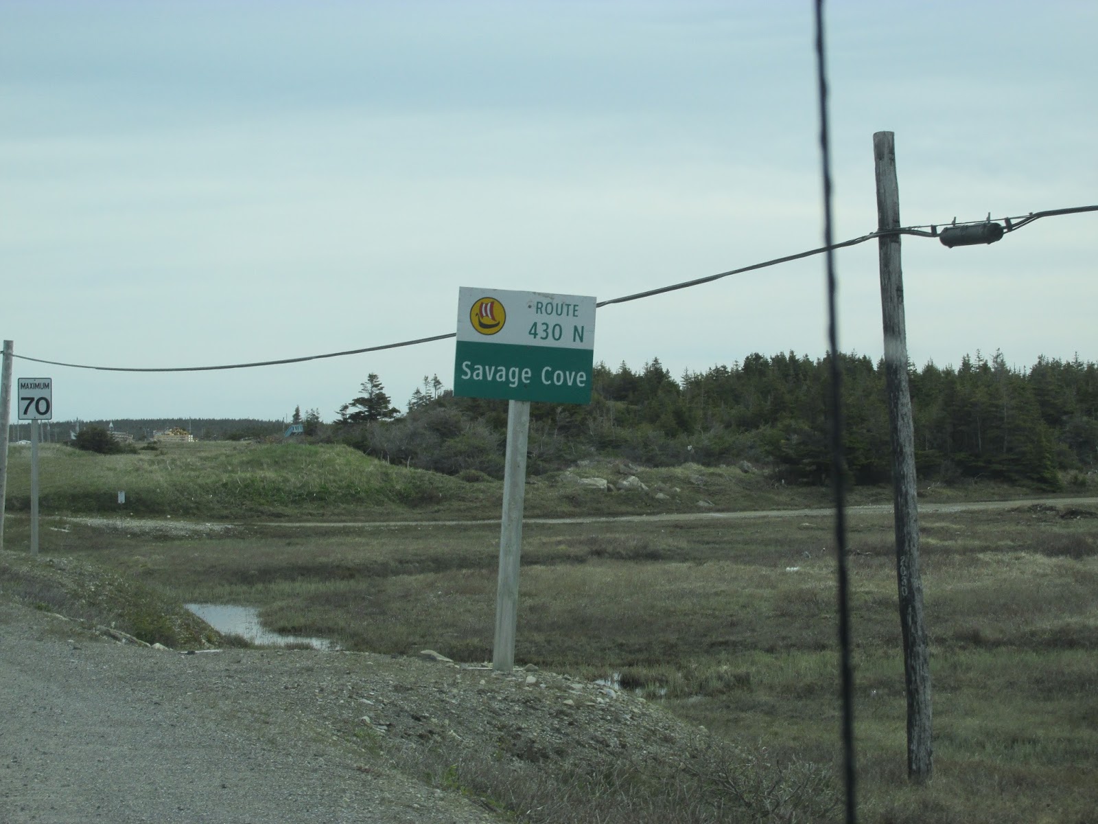
Savage Cove is the most northerly sheltered harbor on
the Newfoundland side of the Strait of Belle Isle. Its entrance is protected by
Cooper Island, locally known as Gaulton's. Savage Cove received its name from
having been frequented by aboriginal people at the time when the French were
fishing in the area. The cove appears on early French maps as "Anse aux
Savages". The first English settler was George Gaulton, who settled after
his marriage to Susan Gould of Anchor Point in the 1830s.

Gaulton's Island and the south side of the cove were
gradually abandoned in favor of settlement on a ridge to the northeast, along
the new highway. Since that time, the majority of new home construction has
taken place along the road, where most services are located. In 1993, a new St.
Mark's Anglican Church was nearing completion on the highway, replacing the old
church on the north side.

Sandy Cove was once named Poverty Cove; however, the
name was changed due to its sandy shoreline. The first settler and founder of
Sandy Cove was Thomas White. People settled in Sandy Cove because of the
fishery. In the early 1900's, the Whites' and Coles' made much of their living
from netting seals in the Straits, fishing for cod on the Labrador Coast, and
fur trapping in the country. In the mid 1800's, Sandy Cove had a reliable cod
fishery for the first time.

The limestone barrens in the Sandy Cove Provisional
Ecological Reserve support a species of plant found nowhere else in the world.
Long's Braya is a small plant that grows only on a 5 mile stretch near the
community of Sandy Cove. The reserve protects two small parcels of land and limestone
barrens along the Strait of Belle Isle. Long’s Braya is a member of the mustard
family. It is very small, only growing to a height of 1 – 4 inches.

A fishing settlement situated along a wide bay on the
southeast shore of the Strait of Belle Isle, Green Island Cove, also known as
Green Island Harbor, takes its name from the small grassy island located
offshore from the cove. This island, which provides shelter and a fair
anchorage between the island and the mainland, was so named because it was
agreeable in color to the name it bears. Captain James cook labeled both Green
Island Brook to the north and Green Island Cove in 1764. Green Island Cove was
first settled by Englishmen who came to the coast in the 1870s by way of
fishing rooms and mercantile premises at Forteau and Anchor Point. Green Island
Cove was originally established as a sealing and furring post, one of a string
of such posts established along the Newfoundland shore of the Strait of Belle
Isle by the Genge family based at Anchor Point.

Eddies Cove East is an unincorporated fishing community
located northeast of Anchor Point in the Strait of Belle Isle. The settlement
is situated on a shallow inlet with good shelter for small boats. Eddies Cove
East was first settled by Phillip Coates, a Somerset fisherman, and his wife
Sarah Duncan. The first official census in 1869, records one family with ten
children in 1871. Because of a relatively high incidence of tuberculosis in the
community from 1884 to 1911 the population grew slowly but reached 100 by 1935.
The fishing season is relatively short because of severe ice and fog
conditions. Herring and cod have been the main species fished. The shrimp and
scallop fishery, with its longer season, has been pursued since 1970. Logging
and saw milling have provided supplementary income, and the community produces a
good quantity of vegetables for local use. In 1981 a post office and government
wharf was constructed in Eddies Cove East. Much of their lineage can be found in the East Anglican Cemetery.

In Newfoundland there are a couple of unique
activities. One is wood cutting. Each family can get a wood cutting permit for
up to 18 cords of wood. The wood is cut in the winter when the bogs are frozen.
They ride out on their snowmobiles with a sled attached, the wood hauling sled.

The wood is cut and stacked by the roadside to dry. As
I have said before, everyone leaves each other's wood alone, no problem with
stealing there.

On the drive to St Anthony, we passed the Straits of
Labrador, a mere 28 miles wide, which connects the Sea of Labrador with the
Gulf of St Lawrence. This stretch is part of what is called Iceberg Alley. One
of the features of the Newfoundland landscape that we wanted to see close up
was an iceberg. It was where we saw plenty of icebergs but at a distance.

Highway 430 starts to turn away from the coast and
started back into the wooded areas on either side of the highway.

Some of the evergreens had a yellowish tint and I have
no idea why! The good thing about turning away from the coast, is the skies lightened up a little!
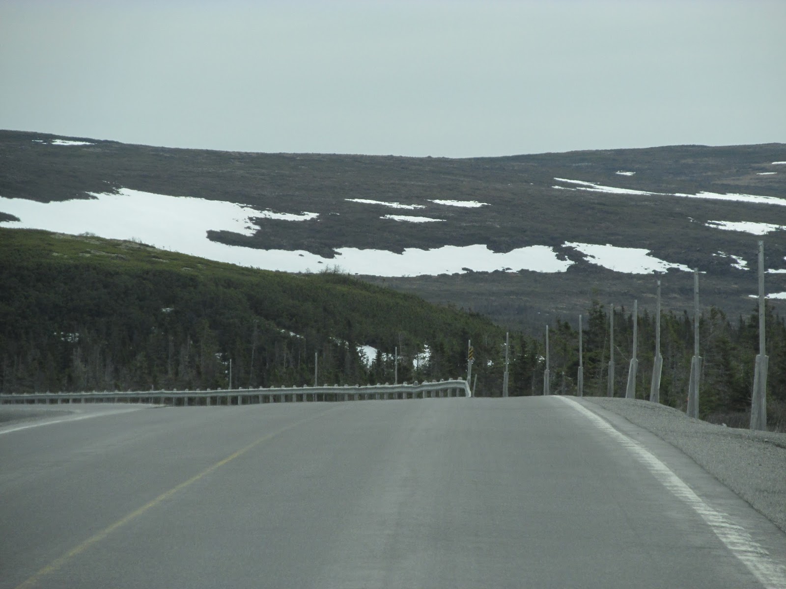
Along the side of the road, you can see the wooden extensions they placed on the concrete markers on the side of the road. This is a required so when the snow gets
too high for the standard markers, which happens quite often in the winter!

We passed this sign today, we are going to the Norse
settlement in a few days and we will learn more about the Vikings arrival to
this area.

We arrived at Triple Falls RV Park. It has 130 sites
with electric and water. The park has campsites secluded by trees and open areas
that accommodate groups. We all had back-in sites in the open area.

After we got set-up, we caravaned in cars to St Anthony
for our afternoon meeting with St Anthony’s Mayor, Earnest Simms.

On a Saturday, the Mayor met us at the town offices and told us all about St Anthony’s rich and vibrant
history. Named in 1534 by French explorer Jacques Cartier it has held a
strategic location to rich fishing grounds and a haven to fishing fleets. It
was later named St Anthony Haven. In 1892 a British doctor named Wilfred
Grenfell arrived in St. Anthony and commenced building a medical system that
has grown to serve the entire region of Northern Newfoundland and Labrador.

The Mayor also shared the history of the 10 foot tall
polar bear in the town offices, don’t worry, he is stuffed. This big fella was
wondering around the town and hanging near the elementary school. Wildlife
rescuers were called in to aid in the relocation of the polar bear. He was
tranquilized and complications arose and the bear had to be euthanized. He
would have been sent to a facility for research, but the town asked to keep the
animal. The request was granted and he now stands watch over all the activities
of the town offices and the public library.

After our visit with the Mayor, we headed to see the
history of Grenfell. St. Anthony is the home of the Grenfell Mission,
established by the International Grenfell Association to provide medical
services to the scattered and isolated population of northern Newfoundland and
Labrador.

The Grenfell Interpretation Center and Grenfell
Handicrafts. This center gives you a glimpse into the life and times of Dr
Wilfred Grenfell through a gallery of interpretive panels and displays. We
started our tour with a film about his life and accomplishments. Dr Grenfell single-handedly
tackled the medical plights of people in coastal Labrador during the late 1800s
and early 1900s. Dr Grenfell also established co-operative stores in several
communities, encouraged women to produce handicrafts for sale, started a
sawmill which eventually failed, and established orphanages, schools,
agricultural stations and other invaluable social and economic endeavors.
Today, the center houses Grenfell Handicrafts, which provides training and a
marketing service for beautiful, hand-embroidered parkas and other unique
products that can be purchased.


There are two mammoth icebergs out there, then the captain tells us we are heading out there! They were over 100 ft tall and the brightest white. The iceberg has only one eighth of its height above the water line, quick math told us that this monster was almost 800 feet top to bottom. Where the bottom of the berg meets the sea water, its color changed from white to a bluer color. We circled the icebergs, always keeping our distance as these icebergs are constantly melting and changing shape.


 And of course Iceberg Beer, Iceberg Water and Iceberg Vodka,
all Island exclusives, are only made from the water of melted icebergs. We saw
icebergs and whales all in the same day. It is the sheer size of them that
overwhelms you. You will never forget them.
And of course Iceberg Beer, Iceberg Water and Iceberg Vodka,
all Island exclusives, are only made from the water of melted icebergs. We saw
icebergs and whales all in the same day. It is the sheer size of them that
overwhelms you. You will never forget them. 
Coming back into the harbor, you had a glimpse of the St Anthony lighthouse and the restaurant we will be eating at tonight.

Dinner at Lightkeepers Seafood Restaurant, one of the top rated restaurants in Newfoundland. It affords you beautiful views of the harbor, whales and icebergs. It sits atop St Anthony Fishing Point and near the lighthouse.

About dusk, we headed out for our Moose sighting expedition. Several of us have not seen a Moose yet … Rod says that he has a couple roads to drive on and we have a good chance to see a Moose. He said, if you see one, say right or left and a clock position ... he saw the first one and all we heard was moose, moose, moose ... I guess he forgot to follow his own advise! LOL

He was right, we did not get pictures of all of them, but our count was either 7 or 9 … we kind of lost count!

No comments:
Post a Comment